| Home | City Bus | Maps | Villages | Cities | Rail | Tourist Places | School | College | Pin Codes | Corona Cases Count |
| Distance Calculator Bus Services IFSC Codes Trace Mobile Number Weather Search Place Trace IP Available Cash ATM/Banks Locate Polling Booth Report an Error contact People |
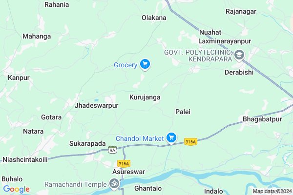
Kurujanga Map
EDIT Map
Add Your House
 ..
..
Current Corona Virus Infected Patients Count in Cuttack District
| City Name | District Name | Total Covid cases |
|---|---|---|
| Cuttack District | Cuttack | 1 |
Locality Name :
Kurujanga
( କୁରୁଜଙ୍ଗା )
Tehsil Name : Mahanga
District : Cuttack
State : Odisha
Language : Oriya and Hindi
Current Time 01:24 PM
Date: Sunday , Apr 27,2025 (IST)
Time zone: IST (UTC+5:30)
Elevation / Altitude: 30 meters. Above Seal level
Telephone Code / Std Code: 06725
Assembly constituency : Mahanga assembly constituency
Assembly MLA : pratap jena
Lok Sabha constituency : Kendrapara parliamentary constituency
Parliament MP : Anubhav Mohanty
Serpanch Name :
Pin Code : 754208
Post Office Name : Chandol
Commodities Prices : Kendupatna Market / Mandi
Kurujanga Live Weather
Temperature: 41.2 °C
overcast clouds
Humidity: 16%
Wind : 5.01 mt/sec towards NW
StationName : "KendrÄ\u0081parha"
observed on Now
Temperature: 41.2 °C
overcast clouds
Humidity: 16%
Wind : 5.01 mt/sec towards NW
StationName : "KendrÄ\u0081parha"
observed on Now
Kurujanga Weather Forecast for Next 5 days
28-04-2025
28.1°C to 41.1°C
broken clouds, overcast clouds
28.1°C to 41.1°C
broken clouds, overcast clouds
29-04-2025
25.6°C to 40.0°C
broken clouds, scattered clouds, light rain, few clouds
25.6°C to 40.0°C
broken clouds, scattered clouds, light rain, few clouds
30-04-2025
24.7°C to 39.1°C
few clouds, clear sky, moderate rain, light rain, scattered clouds
24.7°C to 39.1°C
few clouds, clear sky, moderate rain, light rain, scattered clouds
01-05-2025
24.9°C to 36.6°C
light rain, clear sky, few clouds, scattered clouds
24.9°C to 36.6°C
light rain, clear sky, few clouds, scattered clouds
02-05-2025
23.8°C to 37.2°C
clear sky, few clouds, light rain, moderate rain, overcast clouds
23.8°C to 37.2°C
clear sky, few clouds, light rain, moderate rain, overcast clouds
National Highways Reachable To Kurujanga
Nationa High Way :NH53
Nationa High Way :NH55
Nationa High Way :NH53
Nationa High Way :NH55
Rivers Near Kurujanga
Brahmani :Брагмані
Rana
Brahmani :Брагмані
Rana
About Kurujanga
Correct below Info and add more info about KurujangaKurujanga is a Village in Mahanga Tehsil in Cuttack District of Odisha State, India. It is located 47 KM towards East from District head quarters Cuttack. 10 KM from Mahanga. 61 KM from State capital Bhubaneswar
Kurujanga Pin code is 754208 and postal head office is Chandol .
Haladia ( 3 KM ) , Bhadreswar ( 4 KM ) , Jhadeswarpur ( 4 KM ) , Umar ( 6 KM ) , Sukarpada ( 6 KM ) are the nearby Villages to Kurujanga. Kurujanga is surrounded by Mahanga Tehsil towards west , Nischinta Koili Tehsil towards South , Garadapur Tehsil towards South , Kendrapada Tehsil towards East .
Kendrapara , Jagatsinghapur , Pattamundai , Jajapur are the near by Cities to Kurujanga.
This Place is in the border of the Cuttack District and Kendrapara District. Kendrapara District Derabish is East towards this place . Also it is in the Border of other district Jajapur .
Kurujanga 2011 Census Details
Kurujanga Local Language is Oriya. Kurujanga Village Total population is 2008 and number of houses are 470. Female Population is 46.5%. Village literacy rate is 88.3% and the Female Literacy rate is 40.7%.
Population
| Census Parameter | Census Data |
| Total Population | 2008 |
| Total No of Houses | 470 |
| Female Population % | 46.5 % ( 934) |
| Total Literacy rate % | 88.3 % ( 1773) |
| Female Literacy rate | 40.7 % ( 817) |
| Scheduled Tribes Population % | 0.0 % ( 0) |
| Scheduled Caste Population % | 10.3 % ( 207) |
| Working Population % | 42.1 % |
| Child(0 -6) Population by 2011 | 186 |
| Girl Child(0 -6) Population % by 2011 | 44.1 % ( 82) |
Kurujanga Census More Deatils.
Politics in Kurujanga
BJD is the major political party in this area.Polling Stations /Booths near Kurujanga
1)Parasailo Urdu Pry. School2)Praharajapur Pry. School
3)Mallipura Pry. School
4)Sadhak Nagar Pry. School
5)Riso Pry. School
HOW TO REACH Kurujanga
By Rail
There is no railway station near to Kurujanga in less than 10 km.Colleges near Kurujanga
Jwahar Lal Nehru College ,kuanpal ,cuttack
Address :
Mahanga Puspagiri Mahavidyalaya
Address :
Barabati Institute Of Management Studies
Address : Plot No: 242, Biswalpada,po : Khandeitavia: Gopalp
Schools in Kurujanga
Dimiri Ps
Address : kurujanga , mahanga , cuttack , Sikkim . PIN- 754208 , Post - Chandol
Govt Health Centers near Kurujanga
1) ORTI , , , Orti PHC (New)2) NAGASPUR , , , Nagaspur Chhak
3) Gardapur PHC(N) , , Patkura , Near Patkura Block Office
Petrol Bunks in Kurujanga,Mahanga
Maa Rudrani Filling Station Bharat Petroleum
Kendrapara; SH-9A; Aul Kendrapada Jagatpur Road; Dhuhuria; Dhuhuria; Odisha 754211; India
5.3 KM distance Detail
more ..
Colleges in Kurujanga,Mahanga
Dularpur Project Primary School
Katikata - Mahanga Rd; Gopalpur; Naiguan; Odisha 754208; India
2.9 KM distance Detail
more ..
Schools in Kurujanga,Mahanga
Sabalkana High School
Baliapada - Derabishi Rd; Sabalkana; Odisha 754208; India
1.7 KM distance Detail
Super Markets in Kurujanga,Mahanga
Bhuyan Cycle Store Erakana
Katikata - Mahanga Rd; Erakana; Odisha 754206; India
6.4 KM distance Detail
Police Stations near Kurujanga,Mahanga
Bhadreswara out post
Katikata - Mahanga Rd; Gopalpur; Pandia; Odisha 754208; India
4.2 KM distance Detail
Derabish Police Station
derabish;; ;india;pin-; Kendrapara; Odisha 754289; India
5.4 KM distance Detail
Governement Offices near Kurujanga,Mahanga
Gopalpur Grama Panchayat Office
Katikata - Mahanga Rd; Gopalpur; Naiguan; Odisha 754208; India
3.0 KM distance Detail
About Kurujanga &
History
How to reach Kurujanga
Tourist Places Near By Kurujanga
Schools in Kurujanga
Colleges in Kurujanga
Temperature & weather of Kurujanga
places in Kurujanga
Kurujanga photos
More Information
How to reach Kurujanga
Tourist Places Near By Kurujanga
Schools in Kurujanga
Colleges in Kurujanga
Temperature & weather of Kurujanga
places in Kurujanga
Kurujanga photos
More Information
Village Talk
Post News or Events about this Village
Near Cities
Kendrapara 17 KM near
Jagatsinghapur 33 KM near
Pattamundai 34 KM near
Jajapur 41 KM near
Kendrapara 17 KM near
Jagatsinghapur 33 KM near
Pattamundai 34 KM near
Jajapur 41 KM near
Near By Taluks
Derabish 5 KM near
Mahanga 10 KM near
Nischinta Koili 12 KM near
Garadapur 17 KM near
Derabish 5 KM near
Mahanga 10 KM near
Nischinta Koili 12 KM near
Garadapur 17 KM near
Near By Air Ports
Bhubaneswar Airport 62 KM near
Netaji Subhas Chandra Bose Airport 364 KM near
Ranchi Airport 365 KM near
Vishakhapatnam Airport 499 KM near
Bhubaneswar Airport 62 KM near
Netaji Subhas Chandra Bose Airport 364 KM near
Ranchi Airport 365 KM near
Vishakhapatnam Airport 499 KM near
Near By Tourist Places
Cuttack 46 KM near
Paradeep Beach 47 KM near
Nandan Kanan National Park 55 KM near
Bhubaneswar 58 KM near
Konark 80 KM near
Cuttack 46 KM near
Paradeep Beach 47 KM near
Nandan Kanan National Park 55 KM near
Bhubaneswar 58 KM near
Konark 80 KM near
Near By Districts
Kendrapara 17 KM near
Jagatsinghapur 34 KM near
Jajapur 42 KM near
Cuttack 45 KM near
Kendrapara 17 KM near
Jagatsinghapur 34 KM near
Jajapur 42 KM near
Cuttack 45 KM near
Near By RailWay Station
Cuttack Junction Rail Way Station 43 KM near
Jajpur Keonjhar Road Rail Way Station 55 KM near
Cuttack Junction Rail Way Station 43 KM near
Jajpur Keonjhar Road Rail Way Station 55 KM near