| Home | City Bus | Maps | Villages | Cities | Rail | Tourist Places | School | College | Pin Codes | Corona Cases Count |
| Distance Calculator Bus Services IFSC Codes Trace Mobile Number Weather Search Place Trace IP Available Cash ATM/Banks Locate Polling Booth Report an Error contact People |
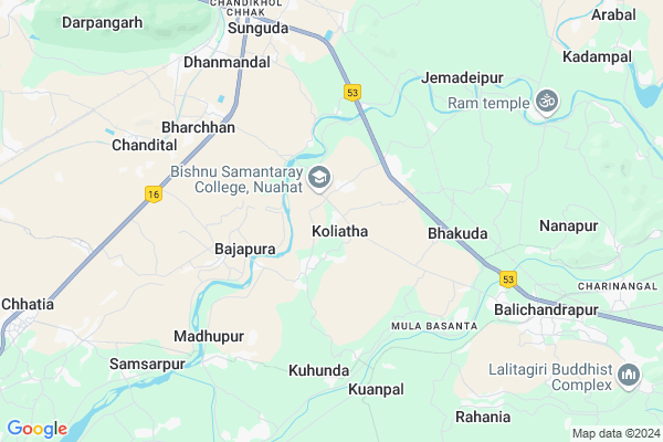
Koliatha Map
EDIT Map
Add Your House
 ..
..
Current Corona Virus Infected Patients Count in Cuttack District
| City Name | District Name | Total Covid cases |
|---|---|---|
| Cuttack District | Cuttack | 1 |
Locality Name :
Koliatha
( କୋଳିଅଠା )
Tehsil Name : Mahanga
District : Cuttack
State : Odisha
Language : Oriya and Hindi
Current Time 07:35 PM
Date: Wednesday , Feb 05,2025 (IST)
Time zone: IST (UTC+5:30)
Elevation / Altitude: 30 meters. Above Seal level
Telephone Code / Std Code: 06725
Assembly constituency : Mahanga assembly constituency
Assembly MLA : pratap jena
Lok Sabha constituency : Kendrapara parliamentary constituency
Parliament MP : Anubhav Mohanty
Serpanch Name :
Pin Code : 754204
Post Office Name : Kuanpal
Commodities Prices : Kendupatna Market / Mandi
Koliatha Live Weather
Temperature: 31.7 °C
broken clouds
Humidity: 32%
Wind : 1.39 mt/sec towards SE
StationName : "KendrÄ\u0081parha"
observed on 1 Hours Back
Temperature: 31.7 °C
broken clouds
Humidity: 32%
Wind : 1.39 mt/sec towards SE
StationName : "KendrÄ\u0081parha"
observed on 1 Hours Back
Koliatha Weather Forecast for Next 5 days
06-02-2025
23.0°C to 29.5°C
scattered clouds, few clouds, broken clouds
23.0°C to 29.5°C
scattered clouds, few clouds, broken clouds
07-02-2025
22.4°C to 34.7°C
overcast clouds, few clouds, clear sky
22.4°C to 34.7°C
overcast clouds, few clouds, clear sky
08-02-2025
21.3°C to 32.7°C
clear sky
21.3°C to 32.7°C
clear sky
09-02-2025
20.6°C to 32.1°C
clear sky
20.6°C to 32.1°C
clear sky
10-02-2025
20.5°C to 33.1°C
clear sky, broken clouds, scattered clouds
20.5°C to 33.1°C
clear sky, broken clouds, scattered clouds
National Highways Reachable To Koliatha
Nationa High Way :NH53
Nationa High Way :NH55
Nationa High Way :NH53
Nationa High Way :NH55
Rivers Near Koliatha
Brahmani :Брагмані
Rana
Brahmani :Брагмані
Rana
About Koliatha
Correct below Info and add more info about KoliathaKoliatha is a Village in Mahanga Tehsil in Cuttack District of Odisha State, India. It is located 39 KM towards East from District head quarters Cuttack. 10 KM from Mahanga. 61 KM from State capital Bhubaneswar
Koliatha Pin code is 754204 and postal head office is Kuanpal .
Mulabasanta ( 5 KM ) , Kuhunda ( 5 KM ) , Kusupur ( 5 KM ) , Srikrushnapur ( 6 KM ) , Arilo ( 6 KM ) are the nearby Villages to Koliatha. Koliatha is surrounded by Mahanga Tehsil towards South , Dahrmasala Tehsil towards North , Salepur Tehsil towards South , Bari Tehsil towards East .
Jajapur , Kendrapara , Byasanagar , Cuttack are the near by Cities to Koliatha.
This Place is in the border of the Cuttack District and Kendrapara District. Kendrapara District Derabish is East towards this place . Also it is in the Border of other district Jajapur .
Koliatha 2011 Census Details
Koliatha Local Language is Oriya. Koliatha Village Total population is 3389 and number of houses are 785. Female Population is 48.2%. Village literacy rate is 75.3% and the Female Literacy rate is 33.1%.
Population
| Census Parameter | Census Data |
| Total Population | 3389 |
| Total No of Houses | 785 |
| Female Population % | 48.2 % ( 1635) |
| Total Literacy rate % | 75.3 % ( 2551) |
| Female Literacy rate | 33.1 % ( 1122) |
| Scheduled Tribes Population % | 0.1 % ( 5) |
| Scheduled Caste Population % | 29.4 % ( 995) |
| Working Population % | 31.6 % |
| Child(0 -6) Population by 2011 | 383 |
| Girl Child(0 -6) Population % by 2011 | 51.2 % ( 196) |
Koliatha Census More Deatils.
Politics in Koliatha
BJD is the major political party in this area.Polling Stations /Booths near Koliatha
1)Alijoda Pry. School Alijoda2)Mohanapur Pry. School
3)Kulasukarapada U.g.m.e. School
4)Sahid Indira Pry. School Panchasaranga Balaramapur
5)Kahnupur Up M.e. School
HOW TO REACH Koliatha
By Rail
Dhanmandal Rail Way Station is the very nearby railway stations to Koliatha.Colleges near Koliatha
Jwahar Lal Nehru College ,kuanpal ,cuttack
Address :
Mahanga Puspagiri Mahavidyalaya
Address :
Barabati Institute Of Management Studies
Address : Plot No: 242, Biswalpada,po : Khandeitavia: Gopalp
Schools in Koliatha
Basantee Jayadurga Hs
Address : koliatha , mahanga , cuttack , Sikkim . PIN- 754204 , Post - Kuanpal
Sudu Sailo Ps
Address : koliatha , mahanga , cuttack , Sikkim . PIN- 754204 , Post - Kuanpal
Govt Health Centers near Koliatha
1) Haripur SC , 38 , Balia , Nahan Nodal UP School2) ORTI , , , Orti PHC (New)
3) NAGASPUR , , , Nagaspur Chhak
Petrol Bunks in Koliatha,Mahanga
Bharat Petroleum
Buduchana; Jajapur; NH-5; Baharagora Chennai Highway; Badchana; Badchana; Odisha 754296; India
5.5 KM distance Detail
more ..
About Koliatha &
History
How to reach Koliatha
Tourist Places Near By Koliatha
Schools in Koliatha
Colleges in Koliatha
Temperature & weather of Koliatha
places in Koliatha
Koliatha photos
More Information
How to reach Koliatha
Tourist Places Near By Koliatha
Schools in Koliatha
Colleges in Koliatha
Temperature & weather of Koliatha
places in Koliatha
Koliatha photos
More Information
Village Talk
Post News or Events about this Village
Near Cities
Jajapur 32 KM near
Kendrapara 34 KM near
Byasanagar 38 KM near
Cuttack 39 KM near
Jajapur 32 KM near
Kendrapara 34 KM near
Byasanagar 38 KM near
Cuttack 39 KM near
Near By Taluks
Badchana 6 KM near
Mahanga 10 KM near
Dahrmasala 15 KM near
Salepur 20 KM near
Badchana 6 KM near
Mahanga 10 KM near
Dahrmasala 15 KM near
Salepur 20 KM near
Near By Air Ports
Bhubaneswar Airport 62 KM near
Ranchi Airport 347 KM near
Netaji Subhas Chandra Bose Airport 363 KM near
Vishakhapatnam Airport 500 KM near
Bhubaneswar Airport 62 KM near
Ranchi Airport 347 KM near
Netaji Subhas Chandra Bose Airport 363 KM near
Vishakhapatnam Airport 500 KM near
Near By Tourist Places
Cuttack 39 KM near
Nandan Kanan National Park 50 KM near
Bhubaneswar 58 KM near
Paradeep Beach 66 KM near
Konark 93 KM near
Cuttack 39 KM near
Nandan Kanan National Park 50 KM near
Bhubaneswar 58 KM near
Paradeep Beach 66 KM near
Konark 93 KM near
Near By Districts
Jajapur 33 KM near
Kendrapara 34 KM near
Cuttack 38 KM near
Jagatsinghapur 46 KM near
Jajapur 33 KM near
Kendrapara 34 KM near
Cuttack 38 KM near
Jagatsinghapur 46 KM near
Near By RailWay Station
Dhanmandal Rail Way Station 8.4 KM near
Cuttack Junction Rail Way Station 37 KM near
Jajpur Keonjhar Road Rail Way Station 37 KM near
Dhanmandal Rail Way Station 8.4 KM near
Cuttack Junction Rail Way Station 37 KM near
Jajpur Keonjhar Road Rail Way Station 37 KM near