| Home | City Bus | Maps | Villages | Cities | Rail | Tourist Places | School | College | Pin Codes | Corona Cases Count |
| Distance Calculator Bus Services IFSC Codes Trace Mobile Number Weather Search Place Trace IP Available Cash ATM/Banks Locate Polling Booth Report an Error contact People |
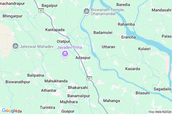
Adaspur Map
EDIT Map
Add Your House
 ..
..
Current Corona Virus Infected Patients Count in Cuttack District
| City Name | District Name | Total Covid cases |
|---|---|---|
| Cuttack District | Cuttack | 1 |
Locality Name :
Adaspur
( ଅଦାସପୁର )
Tehsil Name : Kantapada
District : Cuttack
State : Odisha
Language : Oriya and Hindi
Current Time 12:03 PM
Date: Monday , Apr 28,2025 (IST)
Time zone: IST (UTC+5:30)
Elevation / Altitude: 16 meters. Above Seal level
Telephone Code / Std Code: 06758
Assembly constituency : Niali assembly constituency
Assembly MLA : pramod kumar mallick
Lok Sabha constituency : Jagatsinghpur parliamentary constituency
Parliament MP : RAJASHREE MALLICK
Serpanch Name :
Pin Code : 754011
Post Office Name : Adaspur
Commodities Prices : Jagatsinghpur Market / Mandi
Adaspur Live Weather
Temperature: 32.2 °C
haze
Humidity: 62%
Wind : 2.06 mt/sec towards SW
StationName : "NimÄ\u0081parha"
observed on 2 Hours Back
Temperature: 32.2 °C
haze
Humidity: 62%
Wind : 2.06 mt/sec towards SW
StationName : "NimÄ\u0081parha"
observed on 2 Hours Back
Adaspur Weather Forecast for Next 5 days
29-04-2025
26.5°C to 37.8°C
broken clouds, scattered clouds, few clouds, light rain
26.5°C to 37.8°C
broken clouds, scattered clouds, few clouds, light rain
30-04-2025
25.6°C to 37.3°C
broken clouds, clear sky, scattered clouds, light rain
25.6°C to 37.3°C
broken clouds, clear sky, scattered clouds, light rain
01-05-2025
24.1°C to 36.3°C
clear sky, few clouds, light rain, broken clouds
24.1°C to 36.3°C
clear sky, few clouds, light rain, broken clouds
02-05-2025
20.7°C to 37.0°C
clear sky, light rain, moderate rain, scattered clouds
20.7°C to 37.0°C
clear sky, light rain, moderate rain, scattered clouds
03-05-2025
23.5°C to 37.6°C
scattered clouds, clear sky, moderate rain, light rain
23.5°C to 37.6°C
scattered clouds, clear sky, moderate rain, light rain
Edit below overview about Adaspur
Edit below overview about Adaspur
OverView of Adaspur
Adaspur is a settled village of the Ganga period named after Attahas Dev, a powerful Ganga official. It is a big village of more than 7000 people. It is historically important as many Hindu, Buddhist and Jain temples and images are found. The beautiful and rare images of Tirthankaras of Jain sect and the image of Durga, locally worshipped as Narayani Durga are found in this village. Baraha Nrusingha temple is another attraction. At different places of the village some Buddhist images are discovered.Adaspur has UP School, Baraha Nrusimgha Secondary School, Prachi Academy high school and the much celebrated U.N Autonomous College of Sc. & Tech. It has a big daily market from which every day large quantities of milk, cheese, vegetables etc. are carried to Bhubaneswar and Cuttcak. The market is also famous for river fishes. Since 1956 the villagers have been organising a Pala competition without any interruption till date for which almost all the renowned Pala Gayakas have been invited. Adaspur has the branches of Canara Bank, SBI, Cooperative Bank etc. Once upon a time it was famous for its Laxmipuja. For a lone period from 1950 to 2000 Adaspur Rasgolas and Chhenapoda were very famous. Adaspur must be declared as a NAC by the government.
Edit below overview about Adaspur
National Highways Reachable To Adaspur
Nationa High Way :NH53
Nationa High Way :NH316
Nationa High Way :NH53
Nationa High Way :NH316
Rivers Near Adaspur
Rana
Mahanadi
Rana
Mahanadi
About Adaspur
Adaspur is a Village in Kantapada Tehsil in Cuttack District of Odisha State, India. It is located 36 KM towards South from District head quarters Cuttack. 5 KM from Kantapara. 22 KM from State capital Bhubaneswar
Adaspur Pin code is 754011 and postal head office is Adaspur.
Dimiri ( 3 KM ) , Uttaran ( 4 KM ) , Anlo ( 4 KM ) , Kantapara ( 6 KM ) , Erancha ( 6 KM ) are the nearby Villages to Adaspur. Adaspur is surrounded by Balipatna Tehsil towards South , Balianta Tehsil towards west , Niali Tehsil towards East , Biridi Tehsil towards North .
Jagatsinghapur , Bhubaneswar , Cuttack , Jatani are the near by Cities to Adaspur.
This Place is in the border of the Cuttack District and Khordha District. Khordha District Balipatna is South towards this place .
Adaspur 2011 Census Details
Adaspur Local Language is Oriya. Adaspur Village Total population is 4320 and number of houses are 878. Female Population is 48.1%. Village literacy rate is 80.4% and the Female Literacy rate is 36.3%.
Population
| Census Parameter | Census Data |
| Total Population | 4320 |
| Total No of Houses | 878 |
| Female Population % | 48.1 % ( 2078) |
| Total Literacy rate % | 80.4 % ( 3475) |
| Female Literacy rate | 36.3 % ( 1570) |
| Scheduled Tribes Population % | 0.3 % ( 13) |
| Scheduled Caste Population % | 20.7 % ( 896) |
| Working Population % | 36.3 % |
| Child(0 -6) Population by 2011 | 453 |
| Girl Child(0 -6) Population % by 2011 | 49.2 % ( 223) |
Adaspur Census More Deatils.
Politics in Adaspur
BJD is the major political party in this area.Polling Stations /Booths near Adaspur
1)Adaspur Pry. School2)Usuma Pry. School
3)Paikapada Pry School
4)Ular U.p. School
5)Balipada Pry. School
HOW TO REACH Adaspur
By Rail
There is no railway station near to Adaspur in less than 10 km.Colleges near Adaspur
Govindpur College
Address :
Schools in Adaspur
Prachi Academy Hs
Address : adaspur , kantapara , cuttack , Sikkim . PIN- 754011
Saraswati Shishumandir Adaspur
Address : adaspur , kantapara , cuttack , Sikkim . PIN- 754011
Tulasipur Ugme Scl
Address : adaspur , kantapara , cuttack , Sikkim . PIN- 754011
Govt Health Centers near Adaspur
1) Gada-Charipada , Gadacharipada Sc , Banamalipur , Gada-Charipada2) Mahukhanda , MAHUKHANDA , MAHUKHANDA , MAHUKHANDA
3) Sekhpatna , Sekhpatna Sc , Banamalipur , Sekhpatna
Hospitals in Adaspur,Kantapada
Community Health Center
Adaspur; Cuttack; SH-60; Konark Cuttack Road; Cuttack; Cuttack; Odisha 754002; India
1.1 KM distance Detail
more ..
Colleges in Adaspur,Kantapada
Udayanath Autonomous College of Science and Technology
Adaspur; Cuttack; SH-60; Konarak Cuttack Road; Cuttack; Cuttack; Odisha 754001; India
1.2 KM distance Detail
Udayanath College Of Science & Technology
SH 60; Adaspur; Odisha 754011; India
1.2 KM distance Detail
more ..
Electronic Shops in Adaspur,Kantapada
Shree Krishna Agency airtel Digital Tv Service Centre
Adaspur-Jagatsinghpur Rd; Adaspur; Odisha 754011; India
0.8 KM distance Detail
HI-MARK ELECTROWIRE
Panchayat office; Near; Adaspur; Barahipur; Odisha 754011; India
1.5 KM distance Detail
Super Markets in Adaspur,Kantapada
Patasundarpur hata by anirudh mohanty
Bhagalpur - Badapatasundarpur Rd; Bagalpur; Odisha 754002; India
9.2 KM distance Detail
Local Parks in Adaspur,Kantapada
Aditya Bike Point
Selada Rd; Biswanath Bazar; Baragudikuda; Odisha 754004; India
11.0 KM distance Detail
Police Stations near Adaspur,Kantapada
SDPO Sadar Office
Adaspur; Cuttack; SH-60; Konarak Cuttack Road; Cuttack; Cuttack; Odisha 754002; India
1.0 KM distance Detail
About Adaspur &
History
How to reach Adaspur
Tourist Places Near By Adaspur
Schools in Adaspur
Colleges in Adaspur
Temperature & weather of Adaspur
places in Adaspur
Adaspur photos
More Information
How to reach Adaspur
Tourist Places Near By Adaspur
Schools in Adaspur
Colleges in Adaspur
Temperature & weather of Adaspur
places in Adaspur
Adaspur photos
More Information
Village Talk
Post News or Events about this Village
Near Cities
Jagatsinghapur 18 KM near
Bhubaneswar 25 KM near
Cuttack 33 KM near
Jatani 37 KM near
Jagatsinghapur 18 KM near
Bhubaneswar 25 KM near
Cuttack 33 KM near
Jatani 37 KM near
Near By Taluks
Kantapada 5 KM near
Balipatna 11 KM near
Balianta 12 KM near
Niali 14 KM near
Kantapada 5 KM near
Balipatna 11 KM near
Balianta 12 KM near
Niali 14 KM near
Near By Air Ports
Bhubaneswar Airport 24 KM near
Ranchi Airport 394 KM near
Netaji Subhas Chandra Bose Airport 412 KM near
Vishakhapatnam Airport 452 KM near
Bhubaneswar Airport 24 KM near
Ranchi Airport 394 KM near
Netaji Subhas Chandra Bose Airport 412 KM near
Vishakhapatnam Airport 452 KM near
Near By Tourist Places
Bhubaneswar 24 KM near
Nandan Kanan National Park 32 KM near
Cuttack 34 KM near
Konark 41 KM near
Puri 55 KM near
Bhubaneswar 24 KM near
Nandan Kanan National Park 32 KM near
Cuttack 34 KM near
Konark 41 KM near
Puri 55 KM near
Near By Districts
Jagatsinghapur 18 KM near
Khordha 25 KM near
Cuttack 35 KM near
Puri 55 KM near
Jagatsinghapur 18 KM near
Khordha 25 KM near
Cuttack 35 KM near
Puri 55 KM near
Near By RailWay Station
Bhubaneswar Rail Way Station 21 KM near
Mancheswar Rail Way Station 24 KM near
Bhubaneswar Rail Way Station 21 KM near
Mancheswar Rail Way Station 24 KM near