| Home | City Bus | Maps | Villages | Cities | Rail | Tourist Places | School | College | Pin Codes | Corona Cases Count |
| Distance Calculator Bus Services IFSC Codes Trace Mobile Number Weather Search Place Trace IP Available Cash ATM/Banks Locate Polling Booth Report an Error contact People |
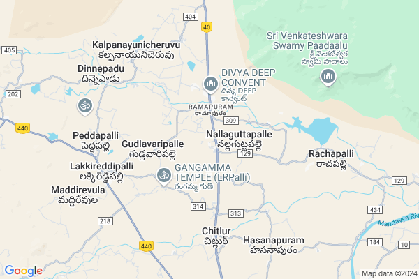
Rachapalle
Rachapalle Map
EDIT Map
Add Your House
 ..
..
Current Corona Virus Infected Patients Count in Cuddapah District
| City Name | District Name | Total Covid cases |
|---|
Locality Name :
Rachapalle
( రాచపల్లె )
Mandal Name : Ramapuram
District : Cuddapah
State : Andhra Pradesh
Region : Rayalaseema
Language : Telugu and Urdu
Current Time 06:05 PM
Date: Saturday , Apr 26,2025 (IST)
Time zone: IST (UTC+5:30)
Elevation / Altitude: 146 meters. Above Seal level
Telephone Code / Std Code: 08567
Assembly constituency : assembly constituency
Assembly MLA : GADIKOTA. SRIKANTH REDDY.
Lok Sabha constituency : parliamentary constituency
Parliament MP : P.V.MIDHUN REDDY
Serpanch Name :
Pin Code : 516504
Post Office Name : Neelakantaraopet
Main Village Name : Bandlapalle
Commodities Prices : Cuddapah Market / Mandi
Rachapalle Live Weather
Temperature: 38.2 °C
broken clouds
Humidity: 19%
Wind : 6.14 mt/sec towards E
StationName : "Rayachoti"
observed on 10 Mins Back
Temperature: 38.2 °C
broken clouds
Humidity: 19%
Wind : 6.14 mt/sec towards E
StationName : "Rayachoti"
observed on 10 Mins Back
Rachapalle Weather Forecast for Next 5 days
27-04-2025
26.0°C to 36.2°C
overcast clouds
26.0°C to 36.2°C
overcast clouds
28-04-2025
24.4°C to 39.3°C
overcast clouds, broken clouds, scattered clouds
24.4°C to 39.3°C
overcast clouds, broken clouds, scattered clouds
29-04-2025
25.2°C to 39.3°C
scattered clouds, few clouds
25.2°C to 39.3°C
scattered clouds, few clouds
30-04-2025
25.8°C to 40.9°C
scattered clouds, few clouds, clear sky, overcast clouds
25.8°C to 40.9°C
scattered clouds, few clouds, clear sky, overcast clouds
01-05-2025
27.7°C to 40.6°C
overcast clouds, broken clouds, scattered clouds, clear sky, few clouds
27.7°C to 40.6°C
overcast clouds, broken clouds, scattered clouds, clear sky, few clouds
National Highways Reachable To Rachapalle
Nationa High Way :NH716
Nationa High Way :NH716
Rivers Near Rachapalle
Madduleru River
Cheyyeru
Madduleru River
Cheyyeru
About Rachapalle
Correct below Info and add more info about RachapalleRachapalle is a small Village/hamlet in Ramapuram Mandal in Cuddapah District of Andhra Pradesh State, India. It comes under Bandlapalle Panchayath. It belongs to Rayalaseema region . It is located 34 KM towards South from District head quarters Kadapa. 415 KM from State capital Hyderabad
Rachapalle Pin code is 516504 and postal head office is Neelakantaraopet .
Rachapalle is surrounded by Lakkireddipalle Mandal towards west , Veeraballi Mandal towards East , Rayachoty Mandal towards South , Chintakomma Dinne Mandal towards North .
Rayachoti , Kadapa , Cuddapah , Yerraguntla are the near by Cities to Rachapalle.
Rachapalle 2011 Census Details
Rachapalle Local Language is Telugu. Rachapalle Village Total population is 4251 and number of houses are 1101. Female Population is 48.7%. Village literacy rate is 51.0% and the Female Literacy rate is 19.5%.
Population
| Census Parameter | Census Data |
| Total Population | 4251 |
| Total No of Houses | 1101 |
| Female Population % | 48.7 % ( 2072) |
| Total Literacy rate % | 51.0 % ( 2170) |
| Female Literacy rate | 19.5 % ( 828) |
| Scheduled Tribes Population % | 0.8 % ( 33) |
| Scheduled Caste Population % | 15.4 % ( 654) |
| Working Population % | 53.2 % |
| Child(0 -6) Population by 2011 | 537 |
| Girl Child(0 -6) Population % by 2011 | 46.6 % ( 250) |
Rachapalle Census More Deatils.
HOW TO REACH Rachapalle
By Road
Cuddapah is the Nearest Town to Rachapalle. Road connectivity is there from Cuddapah to Rachapalle.By Rail
There is no railway station near to Rachapalle in less than 10 km. How ever there are railway Stations from Near By town Cuddapah. are the railway Stations near to Cuddapah. You can reach from Cuddapah to Rachapalle by road after .By Bus
Chakrayapeta APSRTC Bus Station , Rayachoti APSRTC Bus Station , Ramapuram APSRTC Bus Station are the nearby by Bus Stations to Rachapalle .APSRTC runs Number of busses from major cities to here.Colleges near Rachapalle
A P S W R Jr Collfor(boys),ramapuram
Address : Ramapuram
Schools in Rachapalle
Mpups Rachapalle
Address : rachapalle , ramapuram , cuddapah , Andhra Pradesh . PIN- 516504 , Post - Neelakantaraopet
Govt Health Centers near Rachapalle
1) SC NGPalli , Nallaguttapalli , Ramapuram , Rayachoty Road2) Ramapuram , Primary Health Centre , Ramapuram , Ramapuram
3) SC NK Rao peta , Sub Health Center , NK Rao peta , Near AWW Center
Sub Villages in Rachapalle
Hospitals in Rachapalle,Ramapuram
Government Hospital
Nagulagutta Palli; Lakkireddipalli; Andhra Pradesh 516257; India
5.8 KM distance Detail
more ..
Petrol Bunks in Rachapalle,Ramapuram
HP PETROL PUMP - SRI DARGA MATHAJI AGENCIES
Hpcl Dealers; SY. NO.270; Nallaguttapalli Village & Panchayat Mandal; Ramapuram; Kadapa; Andhra Pradesh 516504; India
1.3 KM distance Detail
HP Filling Station
Rayachoti - Vempalli Rd; Lakkireddipalli; Andhra Pradesh 516257; India
7.0 KM distance Detail
more ..
Colleges in Rachapalle,Ramapuram
Vasavi Institute of Management & Computer Science
Vasavi Nagar; Peddapalli; Madhavaram-1; Kadapa; Andhra Pradesh 516247; India
7.0 KM distance Detail
more ..
Schools in Rachapalle,Ramapuram
MPP School ;Kothapalli; Nallaguttapalli
Nallaguttapalle; Andhra Pradesh 516504; India
0.1 KM distance Detail
APSWRS Residential School; Ramapuram
Nallaguttapalle; Andhra Pradesh 516504; India
1.4 KM distance Detail
Electronic Shops in Rachapalle,Ramapuram
Friends mobiles;idea service point
Ramapuram - L R Palli Rd; Ramapuram; Nallaguttapalle; Andhra Pradesh 516504; India
2.0 KM distance Detail
Friends Mobiles & ATM SEVA POINT
Ramapuram; నల్లగుట్టపల్లె; ఆంధ్ర ప్రదేశ్ 516504; India
2.0 KM distance Detail
Super Markets in Rachapalle,Ramapuram
Ismail Traders
Ramapuram - L R Palli Rd; Lakkireddipalli; Andhra Pradesh 516257; India
6.9 KM distance Detail
Police Stations near Rachapalle,Ramapuram
Ramapuram Police Station
Kadapa Rd; Ramapuram; Nallaguttapalle; Andhra Pradesh 516504; India
2.1 KM distance Detail
Lakkireddypalli Police Station & Circle Office
Ramapuram - L R Palli Rd; Lakkireddipalli; Andhra Pradesh 516257; India
6.6 KM distance Detail
Police Station
Nagulagutta Palli; Lakkireddipalli; Andhra Pradesh 516257; India
6.6 KM distance Detail
Governement Offices near Rachapalle,Ramapuram
MeeSeva Center
02-8; Bommisetty Online Service; Ramapuram; Near Tahasildar Office; Nallaguttapalli(V); Ramapuram(M); Dr.YSR Kadapa(D);516504; Andhra Pradesh 516504; India
2.1 KM distance Detail
About Rachapalle &
History
How to reach Rachapalle
Tourist Places Near By Rachapalle
Schools in Rachapalle
Colleges in Rachapalle
Temperature & weather of Rachapalle
places in Rachapalle
Rachapalle photos
More Information
How to reach Rachapalle
Tourist Places Near By Rachapalle
Schools in Rachapalle
Colleges in Rachapalle
Temperature & weather of Rachapalle
places in Rachapalle
Rachapalle photos
More Information
Village Talk
Post News or Events about this Village
Near Cities
Rayachoti 17 KM near
Kadapa 34 KM near
Cuddapah 34 KM near
Yerraguntla 60 KM near
Rayachoti 17 KM near
Kadapa 34 KM near
Cuddapah 34 KM near
Yerraguntla 60 KM near
Near By Taluks
Ramapuram 0 KM near
Lakkireddipalle 7 KM near
Veeraballi 13 KM near
Rayachoty 17 KM near
Ramapuram 0 KM near
Lakkireddipalle 7 KM near
Veeraballi 13 KM near
Rayachoty 17 KM near
Near By Air Ports
Tirupati Airport 118 KM near
Bengaluru International Airport 177 KM near
Chennai Airport 228 KM near
Salem Airport 325 KM near
Tirupati Airport 118 KM near
Bengaluru International Airport 177 KM near
Chennai Airport 228 KM near
Salem Airport 325 KM near
Near By Tourist Places
Kadapa 34 KM near
Horsley Hills 80 KM near
Tirupati 107 KM near
Puttaparthi 115 KM near
Srikalahasti 127 KM near
Kadapa 34 KM near
Horsley Hills 80 KM near
Tirupati 107 KM near
Puttaparthi 115 KM near
Srikalahasti 127 KM near
Near By Districts
Cuddapah 34 KM near
Chittoor 130 KM near
Spsr Nellore 150 KM near
Anantapur 151 KM near
Cuddapah 34 KM near
Chittoor 130 KM near
Spsr Nellore 150 KM near
Anantapur 151 KM near
Near By RailWay Station
Kadapa Rail Way Station 32 KM near
Nandalur Rail Way Station 43 KM near
Kadapa Rail Way Station 32 KM near
Nandalur Rail Way Station 43 KM near