| Home | City Bus | Maps | Villages | Cities | Rail | Tourist Places | School | College | Pin Codes | Corona Cases Count |
| Distance Calculator Bus Services IFSC Codes Trace Mobile Number Weather Search Place Trace IP Available Cash ATM/Banks Locate Polling Booth Report an Error contact People |
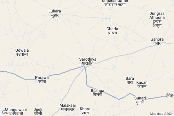
Sarothiya Map
EDIT Map
Add Your House
 ..
..
Current Corona Virus Infected Patients Count in Churu District
| City Name | District Name | Total Covid cases |
|---|---|---|
| Churu District | Churu | 14 |
Locality Name :
Sarothiya
( सारोठिया )
Tehsil Name : Sujangarh
District : Churu
State : Rajasthan
Division : Bikaner
Language : Hindi and Rajasthani
Current Time 01:37 PM
Date: Monday , Apr 28,2025 (IST)
Time zone: IST (UTC+5:30)
Elevation / Altitude: 318 meters. Above Seal level
Telephone Code / Std Code: 01569
Assembly constituency : Sujangarh assembly constituency
Assembly MLA : Manoj Kumar
Lok Sabha constituency : Churu parliamentary constituency
Parliament MP : RAHUL KASWAN
Serpanch Name :
Pin Code : 331518
Post Office Name : Lalgarh (Churu)
Commodities Prices : Sridungargarh Market / Mandi
Sarothiya Live Weather
Temperature: 39.9 °C
clear sky
Humidity: 6%
Wind : 3.38 mt/sec towards W
StationName : "LÄ\u0081dnÅ«n"
observed on 1 Hours Back
Temperature: 39.9 °C
clear sky
Humidity: 6%
Wind : 3.38 mt/sec towards W
StationName : "LÄ\u0081dnÅ«n"
observed on 1 Hours Back
Sarothiya Weather Forecast for Next 5 days
29-04-2025
29.4°C to 42.1°C
clear sky
29.4°C to 42.1°C
clear sky
30-04-2025
25.1°C to 43.0°C
clear sky
25.1°C to 43.0°C
clear sky
01-05-2025
27.9°C to 44.2°C
clear sky, scattered clouds, broken clouds
27.9°C to 44.2°C
clear sky, scattered clouds, broken clouds
02-05-2025
29.4°C to 43.8°C
broken clouds, scattered clouds, few clouds, clear sky, light rain, overcast clouds
29.4°C to 43.8°C
broken clouds, scattered clouds, few clouds, clear sky, light rain, overcast clouds
03-05-2025
28.4°C to 41.4°C
overcast clouds, broken clouds, clear sky
28.4°C to 41.4°C
overcast clouds, broken clouds, clear sky
Edit below overview about Sarothiya
Edit below overview about Sarothiya
OverView of Sarothiya
Sarothiya is directly connected to Bikaner, Jaipur, Nagaur cities serially distance from Sarothiya, 113 Km, 180 and 84 all around not exactly by Road lines, near railway station is Ladnun and Sujangarh, the distance is 12km from Ladnun and 21 km from Sujangarh, and geographically it was surrounded by sand dunes, farming is depends on raining only, there is no any other sources of water, and for Drinking people making their own water tank in their houses and these are fill ups by the water when the raining starts, some water is supplied from other village its name is marothia but it is supplied sometimes not regularly otherwise conditions is very poor. and population wise is around 4000 and 800 houses around in this village as many casts are living here as Rajputâs, Brahmins, Jats, Prajapats, Meghwal, Nayak, Bavari, Sunar etc.Edit below overview about Sarothiya
National Highways Reachable To Sarothiya
Nationa High Way :NH52
Nationa High Way :NH52
About Sarothiya
Sarothiya is a Village in Sujangarh Tehsil in Churu District of Rajasthan State, India. It belongs to Bikaner Division . It is located 114 KM towards South from District head quarters Churu. 26 KM from Sujangarh. 204 KM from State capital Jaipur
Sarothiya Pin code is 331518 and postal head office is Lalgarh (Churu).
Luhara ( 7 KM ) , Udwala ( 9 KM ) , Parewada ( 13 KM ) , Balera ( 14 KM ) , Sandwa ( 15 KM ) are the nearby Villages to Sarothiya. Sarothiya is surrounded by Sujangarh Tehsil towards East , Didwana Tehsil towards South , Jayal Tehsil towards South , Sri Dungargarh Tehsil towards North .
Ladnu , Sujangarh , Rajaldesar , Ratangarh are the near by Cities to Sarothiya.
This Place is in the border of the Churu District and Nagaur District. Nagaur District Ladnu is East towards this place .
Sarothiya 2011 Census Details
Sarothiya Local Language is Hindi. Sarothiya Village Total population is 3286 and number of houses are 561. Female Population is 50.1%. Village literacy rate is 46.3% and the Female Literacy rate is 17.4%.
Population
| Census Parameter | Census Data |
| Total Population | 3286 |
| Total No of Houses | 561 |
| Female Population % | 50.1 % ( 1645) |
| Total Literacy rate % | 46.3 % ( 1521) |
| Female Literacy rate | 17.4 % ( 572) |
| Scheduled Tribes Population % | 0.1 % ( 2) |
| Scheduled Caste Population % | 39.4 % ( 1296) |
| Working Population % | 56.1 % |
| Child(0 -6) Population by 2011 | 581 |
| Girl Child(0 -6) Population % by 2011 | 49.1 % ( 285) |
Sarothiya Census More Deatils.
Politics in Sarothiya
BJP , INC are the major political parties in this area.Polling Stations /Booths near Sarothiya
1)Govt. Adrash Sen. Sec. School Building (left Side) Sarangsar2)Govt. Adrash Sen. Sec. School Building (right Side) Sarangsar
3)Govt. Upper Primary School Building Bhompura
4)Govt. Adrash Sen. Sec. School Building (left Side) Chariyan
5)Govt. Adrash Sen. Sec. School Building (right Side) Chariyan
HOW TO REACH Sarothiya
By Rail
There is no railway station near to Sarothiya in less than 10 km.Colleges near Sarothiya
Sujala Colleage
Address :
Jasveer Memorial P.g. College
Address :
Dr,rajendra Prasad College Of Galobal Exelence Parewada
Address :
Jyani Boys College Daniankhlai Bhasina
Address :
Itct College
Address :
Schools in Sarothiya
Goutam Ss Ps Sarothia
Address : sarothiya , sujangarh , churu , Rajasthan . PIN- 331518 , Post - Lalgarh (Churu)
Gps Navin Sarothia
Address : sarothiya , sujangarh , churu , Rajasthan . PIN- 331518 , Post - Lalgarh (Churu)
Sarsavati Bal Niketan
Address : sarothiya , sujangarh , churu , Rajasthan . PIN- 331518 , Post - Lalgarh (Churu)
Gups Sanskrit Sarothia
Address : sarothiya , sujangarh , churu , Rajasthan . PIN- 331518 , Post - Lalgarh (Churu)
Gss Sarothia
Address : sarothiya , sujangarh , churu , Rajasthan . PIN- 331518 , Post - Lalgarh (Churu)
Govt Health Centers near Sarothiya
1) Sarothiya , , ,2) Charla , , ,
3) Marotheya , , ,
Colleges in Sarothiya,Sujangarh
Acharya Kalu Kanya Mahavidyalaya
Jain Vishva Bharati Institute; Ladnun; Rajasthan 341306; India
14.4 KM distance Detail
Jasveer Memorial College
Bidasar-Nokha Road; Sandwa; Rajasthan 331517; India
14.8 KM distance Detail
more ..
Schools in Sarothiya,Sujangarh
Swami Vivekanand Vidhya Aashram Senior Secondary School Sarothiya ; Churu
Sujangarh Rd; Vishwanathpura; Rajasthan 341306; India
1.1 KM distance Detail
Government Senior Secondary School Sarothia
Sarothiya; Rajasthan 331517; India
1.4 KM distance Detail
Electronic Shops in Sarothiya,Sujangarh
लक्की लक्की सारोठिया मोबाईल रिपरिग सेन्टर
Charla Rd; Sarothiya; Rajasthan 331517; India
1.0 KM distance Detail
श्री बालाजी मोटर पार्ट्स एंड साउंड सिस्टम उडवाला प्रो हरदेव जाट
Udwala; Rajasthan 331517; India
8.9 KM distance Detail
Local Parks in Sarothiya,Sujangarh
Nehru Park
Gandhi Chowk Road; Gandhi Chowk; Bagreche Bass; Sujangarh; Rajasthan 331507; India
22.9 KM distance Detail
Governement Offices near Sarothiya,Sujangarh
P.h.e.d. Ladnun
Border jawabass-shaheriabass; Jawa Bass; Shaheria Bass; Ladnun; Rajasthan 341306; India
14.4 KM distance Detail
About Sarothiya &
History
How to reach Sarothiya
Tourist Places Near By Sarothiya
Schools in Sarothiya
Colleges in Sarothiya
Temperature & weather of Sarothiya
places in Sarothiya
Sarothiya photos
More Information
How to reach Sarothiya
Tourist Places Near By Sarothiya
Schools in Sarothiya
Colleges in Sarothiya
Temperature & weather of Sarothiya
places in Sarothiya
Sarothiya photos
More Information
Village Talk
Post News or Events about this Village
Near Cities
Ladnu 13 KM near
Sujangarh 22 KM near
Rajaldesar 48 KM near
Ratangarh 61 KM near
Ladnu 13 KM near
Sujangarh 22 KM near
Rajaldesar 48 KM near
Ratangarh 61 KM near
Near By Taluks
Ladnu 23 KM near
Sujangarh 25 KM near
Didwana 56 KM near
Sri Dungargarh 61 KM near
Ladnu 23 KM near
Sujangarh 25 KM near
Didwana 56 KM near
Sri Dungargarh 61 KM near
Near By Air Ports
Sanganeer Airport 200 KM near
Surat Gujarat Airport 205 KM near
Jodhpur Airport 222 KM near
Indira Gandhi International Airport 329 KM near
Sanganeer Airport 200 KM near
Surat Gujarat Airport 205 KM near
Jodhpur Airport 222 KM near
Indira Gandhi International Airport 329 KM near
Near By Tourist Places
Tal Chhapar Sanctuary 23 KM near
Kuchaman 92 KM near
Sikar 97 KM near
Mandawa 107 KM near
Churu 108 KM near
Tal Chhapar Sanctuary 23 KM near
Kuchaman 92 KM near
Sikar 97 KM near
Mandawa 107 KM near
Churu 108 KM near
Near By Districts
Nagaur 84 KM near
Sikar 98 KM near
Churu 109 KM near
Bikaner 111 KM near
Nagaur 84 KM near
Sikar 98 KM near
Churu 109 KM near
Bikaner 111 KM near
Near By RailWay Station
Ladnun Rail Way Station 15 KM near
Sujangarh Rail Way Station 21 KM near
Ladnun Rail Way Station 15 KM near
Sujangarh Rail Way Station 21 KM near