| Home | City Bus | Maps | Villages | Cities | Rail | Tourist Places | School | College | Pin Codes | Corona Cases Count |
| Distance Calculator Bus Services IFSC Codes Trace Mobile Number Weather Search Place Trace IP Available Cash ATM/Banks Locate Polling Booth Report an Error contact People |
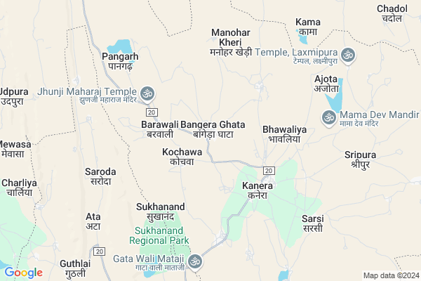
Bangera Ghata
Bangera Ghata Map
EDIT Map
Add Your House
 ..
..
Current Corona Virus Infected Patients Count in Chittorgarh District
| City Name | District Name | Total Covid cases |
|---|
Locality Name :
Bangera Ghata
( बंगरा घटा )
Tehsil Name : Nimbahera
District : Chittorgarh
State : Rajasthan
Division : Udaipur
Language : Hindi and Rajasthani
Current Time 06:45 AM
Date: Saturday , Apr 26,2025 (IST)
Time zone: IST (UTC+5:30)
Elevation / Altitude: 441 meters. Above Seal level
Telephone Code / Std Code: 01477
Assembly constituency : Nimbahera assembly constituency
Assembly MLA :
Lok Sabha constituency : Chittorgarh parliamentary constituency
Parliament MP :
Serpanch Name :
Pin Code : 312606
Post Office Name : Kanera
Commodities Prices : Javad Market / Mandi
Bangera Ghata Live Weather
Temperature: 25.1 °C
clear sky
Humidity: 22%
Wind : 3.37 mt/sec towards W
StationName : "JÄ\u0081wad"
observed on Now
Temperature: 25.1 °C
clear sky
Humidity: 22%
Wind : 3.37 mt/sec towards W
StationName : "JÄ\u0081wad"
observed on Now
Bangera Ghata Weather Forecast for Next 5 days
27-04-2025
26.8°C to 40.0°C
clear sky, few clouds, scattered clouds
26.8°C to 40.0°C
clear sky, few clouds, scattered clouds
28-04-2025
25.2°C to 40.4°C
clear sky
25.2°C to 40.4°C
clear sky
29-04-2025
26.1°C to 42.6°C
clear sky, few clouds, scattered clouds
26.1°C to 42.6°C
clear sky, few clouds, scattered clouds
30-04-2025
26.8°C to 43.1°C
scattered clouds, clear sky
26.8°C to 43.1°C
scattered clouds, clear sky
01-05-2025
25.8°C to 43.3°C
few clouds, clear sky, broken clouds, scattered clouds
25.8°C to 43.3°C
few clouds, clear sky, broken clouds, scattered clouds
Edit below overview about Bangera Ghata
Edit below overview about Bangera Ghata
OverView of Bangera Ghata
To reach bangera ghata by road from chittorgarh is via bassi.Catch a bus from chittorgarh to bassi.From bassi bus goes every 2 hrly to bangera ghata,last bus at 1900 h.it takes 2 hr to reach bangeraEdit below overview about Bangera Ghata
National Highways Reachable To Bangera Ghata
Nationa High Way :NH56
Nationa High Way :NH156
Nationa High Way :NH56
Nationa High Way :NH156
Rivers Near Bangera Ghata
Gambhiri
Wagli Nadi
Gambhiri
Wagli Nadi
About Bangera Ghata
Bangera Ghata is a Village in Nimbahera Tehsil in Chittorgarh District of Rajasthan State, India. It belongs to Udaipur Division . It is located 34 KM towards East from District head quarters Chittorgarh. 26 KM from Nimboda. 304 KM from State capital Jaipur
Bangera Ghata Pin code is 312606 and postal head office is Kanera .
Bhawaliya ( 4 KM ) , Kanera ( 4 KM ) , Sarsi ( 7 KM ) , Mailana ( 9 KM ) , Arnoda ( 14 KM ) are the nearby Villages to Bangera Ghata. Bangera Ghata is surrounded by Nimbahera Tehsil towards west , Chittaurgarh Tehsil towards west , Neemuch Tehsil towards South , Begun Tehsil towards North .
Nimbahera , Neemuch , Manasa , Mandalgarh are the near by Cities to Bangera Ghata.
This Place is in the border of the Chittorgarh District and Neemuch District. Neemuch District Jawad is South towards this place . It is near to the Madhya Pradesh State Border.
Bangera Ghata 2011 Census Details
Bangera Ghata Local Language is Hindi. Bangera Ghata Village Total population is 1729 and number of houses are 376. Female Population is 51.7%. Village literacy rate is 55.4% and the Female Literacy rate is 20.1%.
Population
| Census Parameter | Census Data |
| Total Population | 1729 |
| Total No of Houses | 376 |
| Female Population % | 51.7 % ( 894) |
| Total Literacy rate % | 55.4 % ( 958) |
| Female Literacy rate | 20.1 % ( 347) |
| Scheduled Tribes Population % | 12.1 % ( 209) |
| Scheduled Caste Population % | 33.4 % ( 578) |
| Working Population % | 60.2 % |
| Child(0 -6) Population by 2011 | 234 |
| Girl Child(0 -6) Population % by 2011 | 58.1 % ( 136) |
Bangera Ghata Census More Deatils.
Politics in Bangera Ghata
Bharatiya Janata Party , BJP , INC are the major political parties in this area.Polling Stations /Booths near Bangera Ghata
1)Govt. Secondry School Badoli Madhosingh2)Govt.secondry School Davta
3)Govt. Upper Primary School Khermaliya
4)Govt. Secondry School Arniya Mali
5)Govt. Upper Primary School Mandavli
HOW TO REACH Bangera Ghata
By Rail
There is no railway station near to Bangera Ghata in less than 10 km.Colleges near Bangera Ghata
Bhagwati Mahila Shikshak Prashikshan Maha Vidyalaya Bassi
Address :
Om Shiv Ayurved Nurse / Compounder College
Address : Om Shiv Ayurved Nurse / Compounder College , Chitt
Maharana Pratap Government Post Graduate College
Address : Dist.:chittaurgarh Rajasthan - 312 001
Sanwarjit Govt. Girls College
Address : Dist. Chittorgarh Rajasthan
Government Girls College Of Chittorgarh
Address : Gandhi Nagar, , Chittorgarh - 312001
Schools near Bangera Ghata
K.g.b.v. Barda
Address : barda , nimbahera , chittaurgarh , Rajasthan . PIN- 312601 , Post - Nimbahera
New Springdals Pup School
Address : np nimbahera_ward no.6 , nimbahera , chittaurgarh , Rajasthan . PIN- 312601 , Post - Nimbahera
G.g.u.p.s. Lasdawan
Address : lasdavan , nimbahera , chittaurgarh , Rajasthan . PIN- 312601 , Post - Nimbahera
G.g.u P.s. Keli
Address : keli , nimbahera , chittaurgarh , Rajasthan . PIN- 312601 , Post - Nimbahera
Govt Health Centers near Bangera Ghata
1) Sonagar , SC Sonagar , , Near Secondary School2) Udpura , SC Udpura , ,
3) Barodiya , SC Barodiya , ,
Hospitals in Bangera Ghata,Nimbahera
CHC Kanera Hospital
COMMUNITY HEALTH CENTER KANERA; MDR20; Kanera; Rajasthan 312606; India
4.0 KM distance Detail
Govt Hospital; Rajasthan Medicare Relief Society
MDR20; Benipuriya; Rajasthan 312606; India
4.1 KM distance Detail
more ..
Petrol Bunks in Bangera Ghata,Nimbahera
Athana Indane
ATHANA; BEHIND KRISHNA PALACE; ATHANA; MDR20; Jawad; Madhya Pradesh 458330; India
12.6 KM distance Detail
more ..
Colleges in Bangera Ghata,Nimbahera
Government Polytechnic College Jawad
Village Morka; Suwakheda; Jawad Tehsil; Neemuch; Madhya Pradesh 458330; India
22.3 KM distance Detail
more ..
Schools in Bangera Ghata,Nimbahera
Govt. Sen. Sec. School Bangera Ghata;Rajasthan
Bangera Ghata; Rajasthan 312606; India
0.4 KM distance Detail
Police Stations near Bangera Ghata,Nimbahera
Police Choki Sarwaniya Maharaj
Sarwaniya Maharaj; Madhya Pradesh 458220; India
23.2 KM distance Detail
About Bangera Ghata &
History
How to reach Bangera Ghata
Tourist Places Near By Bangera Ghata
Schools in Bangera Ghata
Colleges in Bangera Ghata
Temperature & weather of Bangera Ghata
places in Bangera Ghata
Bangera Ghata photos
More Information
How to reach Bangera Ghata
Tourist Places Near By Bangera Ghata
Schools in Bangera Ghata
Colleges in Bangera Ghata
Temperature & weather of Bangera Ghata
places in Bangera Ghata
Bangera Ghata photos
More Information
Village Talk
Post News or Events about this Village
Near Cities
Nimbahera 24 KM near
Neemuch 32 KM near
Manasa 44 KM near
Mandalgarh 63 KM near
Nimbahera 24 KM near
Neemuch 32 KM near
Manasa 44 KM near
Mandalgarh 63 KM near
Near By Taluks
Jawad 16 KM near
Nimbahera 25 KM near
Chittaurgarh 27 KM near
Neemuch 33 KM near
Jawad 16 KM near
Nimbahera 25 KM near
Chittaurgarh 27 KM near
Neemuch 33 KM near
Near By Air Ports
Dabok Airport 111 KM near
Indore Airport 271 KM near
Jodhpur Airport 279 KM near
Sanganeer Airport 280 KM near
Dabok Airport 111 KM near
Indore Airport 271 KM near
Jodhpur Airport 279 KM near
Sanganeer Airport 280 KM near
Near By Tourist Places
Neemuch 33 KM near
Bijolia 74 KM near
Bhilwara 81 KM near
Nathdwara 121 KM near
Jhalawar 121 KM near
Neemuch 33 KM near
Bijolia 74 KM near
Bhilwara 81 KM near
Nathdwara 121 KM near
Jhalawar 121 KM near
Near By Districts
Neemuch 33 KM near
Chittorgarh 33 KM near
Bhilwara 81 KM near
Mandsaur 85 KM near
Neemuch 33 KM near
Chittorgarh 33 KM near
Bhilwara 81 KM near
Mandsaur 85 KM near
Near By RailWay Station
Nimbahera Rail Way Station 23 KM near
Chittaurgarh Junction Rail Way Station 33 KM near
Nimbahera Rail Way Station 23 KM near
Chittaurgarh Junction Rail Way Station 33 KM near