| Home | City Bus | Maps | Villages | Cities | Rail | Tourist Places | School | College | Pin Codes | Corona Cases Count |
| Distance Calculator Bus Services IFSC Codes Trace Mobile Number Weather Search Place Trace IP Available Cash ATM/Banks Locate Polling Booth Report an Error contact People |
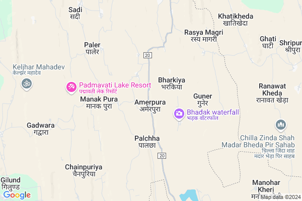
Amarpura
Amarpura Map
EDIT Map
Add Your House
 ..
..
Current Corona Virus Infected Patients Count in Chittorgarh District
| City Name | District Name | Total Covid cases |
|---|
Locality Name :
Amarpura
( अमरपुरा )
Tehsil Name : Chittaurgarh
District : Chittorgarh
State : Rajasthan
Division : Udaipur
Language : Hindi and Rajasthani
Current Time 11:34 AM
Date: Sunday , Apr 27,2025 (IST)
Time zone: IST (UTC+5:30)
Elevation / Altitude: 403 meters. Above Seal level
Telephone Code / Std Code: 01472
Assembly constituency : Chittorgarh assembly constituency
Assembly MLA : Chandrabhan Singh Chouhan
Lok Sabha constituency : Chittorgarh parliamentary constituency
Parliament MP : Chandra Prakash Joshi
Serpanch Name :
Pin Code : 312022
Post Office Name : Bassi (Chittorgarh)
Alternate Village Name : Amar Pura
Commodities Prices : Pratapgarh Market / Mandi
Amarpura Live Weather
Temperature: 38.7 °C
clear sky
Humidity: 9%
Wind : 5.99 mt/sec towards W
StationName : "Chittaurgarh"
observed on Now
Temperature: 38.7 °C
clear sky
Humidity: 9%
Wind : 5.99 mt/sec towards W
StationName : "Chittaurgarh"
observed on Now
Amarpura Weather Forecast for Next 5 days
28-04-2025
27.5°C to 40.7°C
clear sky
27.5°C to 40.7°C
clear sky
29-04-2025
26.1°C to 42.5°C
clear sky, scattered clouds
26.1°C to 42.5°C
clear sky, scattered clouds
30-04-2025
26.6°C to 43.3°C
scattered clouds, clear sky, few clouds
26.6°C to 43.3°C
scattered clouds, clear sky, few clouds
01-05-2025
26.3°C to 43.8°C
few clouds, clear sky
26.3°C to 43.8°C
few clouds, clear sky
02-05-2025
26.7°C to 43.9°C
clear sky, scattered clouds, broken clouds, few clouds
26.7°C to 43.9°C
clear sky, scattered clouds, broken clouds, few clouds
National Highways Reachable To Amarpura
Nationa High Way :NH48
Nationa High Way :NH48
Rivers Near Amarpura
Berach
Wagli Nadi
Berach
Wagli Nadi
About Amarpura
Correct below Info and add more info about AmarpuraAmarpura is a Village in Chittaurgarh Tehsil in Chittorgarh District of Rajasthan State, India. It belongs to Udaipur Division . It is located 22 KM towards East from District head quarters Chittorgarh. 15 KM from Chittaurgarh. 296 KM from State capital Jaipur
Amarpura Pin code is 312022 and postal head office is Bassi (Chittorgarh).
Abhaypura ( 12 KM ) , Barawali ( 12 KM ) , Gilund ( 12 KM ) , Ghatiyawali ( 13 KM ) , Bangera Ghata ( 14 KM ) are the nearby Villages to Amarpura. Amarpura is surrounded by Nimbahera Tehsil towards South , Jawad Tehsil towards South , Begun Tehsil towards North , Gangrar Tehsil towards North .
Nimbahera , Neemuch , Mandalgarh , Manasa are the near by Cities to Amarpura.
Amar Pura 2011 Census Details
Amarpura Local Language is Hindi. Amar Pura Village Total population is 549 and number of houses are 116. Female Population is 49.0%. Village literacy rate is 59.2% and the Female Literacy rate is 20.4%.
Population
| Census Parameter | Census Data |
| Total Population | 549 |
| Total No of Houses | 116 |
| Female Population % | 49.0 % ( 269) |
| Total Literacy rate % | 59.2 % ( 325) |
| Female Literacy rate | 20.4 % ( 112) |
| Scheduled Tribes Population % | 3.1 % ( 17) |
| Scheduled Caste Population % | 3.6 % ( 20) |
| Working Population % | 64.8 % |
| Child(0 -6) Population by 2011 | 65 |
| Girl Child(0 -6) Population % by 2011 | 40.0 % ( 26) |
Amar Pura Census More Deatils.
Politics in Amarpura
Bharatiya Janata Party , BJP , INC are the major political parties in this area.Polling Stations /Booths near Amarpura
1)Govt. Secondary School Agoriya2)Govt.upper Primary School Rasiamangari
3)Govt. Secondary School Pal
4)Govt. Upper Primary School Medi Ka Amrana
5)Govt. Upper Primary School Chogavdi
HOW TO REACH Amarpura
By Rail
There is no railway station near to Amarpura in less than 10 km.Colleges near Amarpura
Bhagwati Mahila Shikshak Prashikshan Maha Vidyalaya Bassi
Address :
Om Shiv Ayurved Nurse / Compounder College
Address : Om Shiv Ayurved Nurse / Compounder College , Chitt
Schools near Amarpura
Inani Public School
Address : np chittorgarh_ward no.17 , chittorgarh , chittaurgarh , Rajasthan . PIN- 312001 , Post - Chittorgarh
Gups Dhanatkala Sanskrit
Address : danatkala , chittorgarh , chittaurgarh , Rajasthan . PIN- 312001 , Post - Chittorgarh
K.g..b.v. Vijaipur
Address : vijaypur3 , chittorgarh , chittaurgarh , Rajasthan . PIN- 312605 , Post - Pratap garh (Chittorgarh)
Kalyani Akadmi School Senthi
Address : np chittorgarh_ward no.17 , chittorgarh , chittaurgarh , Rajasthan . PIN- 312001 , Post - Chittorgarh
Govt Health Centers near Amarpura
1) Barodiya , SC Barodiya , ,2) Vijypur , CHC Vijaypur , , Near Secondary School
3) Udpura , SC Udpura , ,
Hospitals in Amarpura,Chittaurgarh
Dhaker Doctor
Chittaurgarh Road; Nimbahera; Chittaurgarh; Unkhaliya; Rajasthan 312001; India
16.4 KM distance Detail
more ..
Petrol Bunks in Amarpura,Chittaurgarh
HP PETROL PUMP - SHIVANI FILLING STATION
Hpcl Retail Outlet NH 79 Jalampura; Udaipur; Rajasthan 312608; India
20.0 KM distance Detail
more ..
Colleges in Amarpura,Chittaurgarh
Bhagwati College of IT & Management
Lal Math;; fort; Chittorgarh; Rajasthan 312001; India
19.7 KM distance Detail
RNT Law College
Sector 5; Gandhi Nagar; Chittorgarh; Rajasthan 312001; India
19.7 KM distance Detail
Samarth ITI chittorgarh
Ghatyavali Rd; Sector5; Gandhi Nagar; Chittorgarh; Rajasthan 312001; India
19.9 KM distance Detail
more ..
Schools in Amarpura,Chittaurgarh
Govt Sr Sec School Gilund Chittorgarh
b gilund road; Gatiyavali; Rajasthan 312022; India
13.6 KM distance Detail
Govt Girls Sr. School Gilund
b gilund road; Gatiyavali; Rajasthan 312022; India
13.6 KM distance Detail
Local Parks in Amarpura,Chittaurgarh
Jobs All Indian.in (My smart phone store) Shelendra singh Bhati
Gandhi nagar sector no.4; house no 80; Chittorgarh; Rajasthan 312001; India
20.0 KM distance Detail
Rampura Park
22/CA; Chittorgarh Fort Village; Chittorgarh; Rajasthan 312001; India
20.1 KM distance Detail
Police Stations near Amarpura,Chittaurgarh
Police Chowki
Ghantewala Rd; Sector 3; Gandhi Nagar; Chittorgarh; Rajasthan 312001; India
20.2 KM distance Detail
Governement Offices near Amarpura,Chittaurgarh
Achariya Technologies Chittorgarh
Shop No 11; Near PNB Fort Road;; LBS Market; Chittorgarh; Rajasthan 312001; India
19.8 KM distance Detail
Patwari Office
Nimbahera; Chittorgarh; NH-79; Chittorgarh Road; Chittorgarh; Chittorgarh; Rajasthan 312024; India
20.0 KM distance Detail
About Amarpura &
History
How to reach Amarpura
Tourist Places Near By Amarpura
Schools in Amarpura
Colleges in Amarpura
Temperature & weather of Amarpura
places in Amarpura
Amarpura photos
More Information
How to reach Amarpura
Tourist Places Near By Amarpura
Schools in Amarpura
Colleges in Amarpura
Temperature & weather of Amarpura
places in Amarpura
Amarpura photos
More Information
Village Talk
Post News or Events about this Village
Near Cities
Nimbahera 28 KM near
Neemuch 45 KM near
Mandalgarh 56 KM near
Manasa 58 KM near
Nimbahera 28 KM near
Neemuch 45 KM near
Mandalgarh 56 KM near
Manasa 58 KM near
Near By Taluks
Chittaurgarh 14 KM near
Nimbahera 28 KM near
Jawad 31 KM near
Begun 32 KM near
Chittaurgarh 14 KM near
Nimbahera 28 KM near
Jawad 31 KM near
Begun 32 KM near
Near By Air Ports
Dabok Airport 106 KM near
Jodhpur Airport 265 KM near
Sanganeer Airport 272 KM near
Indore Airport 285 KM near
Dabok Airport 106 KM near
Jodhpur Airport 265 KM near
Sanganeer Airport 272 KM near
Indore Airport 285 KM near
Near By Tourist Places
Neemuch 46 KM near
Bhilwara 66 KM near
Bijolia 72 KM near
Nathdwara 111 KM near
Bundi 121 KM near
Neemuch 46 KM near
Bhilwara 66 KM near
Bijolia 72 KM near
Nathdwara 111 KM near
Bundi 121 KM near
Near By Districts
Chittorgarh 21 KM near
Neemuch 46 KM near
Bhilwara 66 KM near
Pratapgarh 99 KM near
Chittorgarh 21 KM near
Neemuch 46 KM near
Bhilwara 66 KM near
Pratapgarh 99 KM near
Near By RailWay Station
Chittaurgarh Junction Rail Way Station 20 KM near
Chanderiya Rail Way Station 23 KM near
Chittaurgarh Junction Rail Way Station 20 KM near
Chanderiya Rail Way Station 23 KM near