| Home | City Bus | Maps | Villages | Cities | Rail | Tourist Places | School | College | Pin Codes | Corona Cases Count |
| Distance Calculator Bus Services IFSC Codes Trace Mobile Number Weather Search Place Trace IP Available Cash ATM/Banks Locate Polling Booth Report an Error contact People |
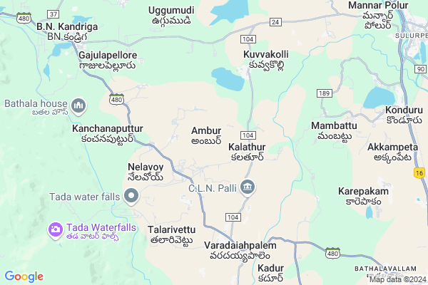
Ambur
Ambur Map
EDIT Map
Add Your House
 ..
..
Current Corona Virus Infected Patients Count in Chittoor District
| City Name | District Name | Total Covid cases |
|---|---|---|
| Chittoor District | Chittoor | 59 |
| Thyagaraja Nagar,Tirupathi | Chittoor | 3 |
| Srikalahasti | Chittoor | 3 |
| Nagiri | Chittoor | 2 |
| Chinna Masjid | Chittoor | 1 |
| Keelapattu nagari | Chittoor | 1 |
| Renigunta | Chittoor | 1 |
| Vadamalapeta | Chittoor | 1 |
| Tirupati | Chittoor | 1 |
| Nindra | Chittoor | 1 |
Locality Name :
Ambur
( అంబర్ )
Mandal Name : Varadaiahpalem
District : Chittoor
State : Andhra Pradesh
Region : Rayalaseema
Language : Telugu and Urdu
Current Time 10:58 AM
Date: Monday , Apr 28,2025 (IST)
Time zone: IST (UTC+5:30)
Elevation / Altitude: 11 meters. Above Seal level
Telephone Code / Std Code: 08623
Assembly constituency : assembly constituency
Assembly MLA :
Lok Sabha constituency : parliamentary constituency
Parliament MP :
Serpanch Name :
Pin Code : 517541
Post Office Name : Varadaiahpalem
Commodities Prices : Puttur Market / Mandi
Ambur Live Weather
Temperature: 33.2 °C
overcast clouds
Humidity: 44%
Wind : 3.6 mt/sec towards S
StationName : "Sūlūru"
observed on 1 Hours Back
Temperature: 33.2 °C
overcast clouds
Humidity: 44%
Wind : 3.6 mt/sec towards S
StationName : "Sūlūru"
observed on 1 Hours Back
Ambur Weather Forecast for Next 5 days
29-04-2025
26.6°C to 38.8°C
overcast clouds, scattered clouds, broken clouds
26.6°C to 38.8°C
overcast clouds, scattered clouds, broken clouds
30-04-2025
26.2°C to 40.5°C
overcast clouds, scattered clouds, broken clouds
26.2°C to 40.5°C
overcast clouds, scattered clouds, broken clouds
01-05-2025
26.6°C to 41.8°C
broken clouds, clear sky, few clouds, overcast clouds
26.6°C to 41.8°C
broken clouds, clear sky, few clouds, overcast clouds
02-05-2025
28.5°C to 41.9°C
overcast clouds, broken clouds, scattered clouds, clear sky, light rain
28.5°C to 41.9°C
overcast clouds, broken clouds, scattered clouds, clear sky, light rain
03-05-2025
27.9°C to 42.4°C
scattered clouds, clear sky
27.9°C to 42.4°C
scattered clouds, clear sky
National Highways Reachable To Ambur
Nationa High Way :NH16
Nationa High Way :NH716A
Nationa High Way :NH16
Nationa High Way :NH716A
Rivers Near Ambur
Nagari River
Ralla
Nagari River
Ralla
About Ambur
Correct below Info and add more info about AmburAmbur is a Village in Varadaiahpalem Mandal in Chittoor District of Andhra Pradesh State, India. It belongs to Rayalaseema region . It is located 119 KM towards East from District head quarters Chittoor. 7 KM from Varadaiahpalem. 517 KM from State capital Hyderabad
Ambur Pin code is 517541 and postal head office is Varadaiahpalem .
Maradawada ( 2 KM ) , West Warathur ( 2 KM ) , Santhavellore ( 5 KM ) , Kanchanaputtur ( 6 KM ) , Mavillapadu ( 6 KM ) are the nearby Villages to Ambur. Ambur is surrounded by Buchinadidu Khandriga Mandal towards west , Sullurpeta Mandal towards East , Doravarisatram Mandal towards North , Tada Mandal towards East .
Srikalahasti , Renigunta , Puttur , Ponneri are the near by Cities to Ambur.
This Place is in the border of the Chittoor District and Spsr Nellore District. Spsr Nellore District Sullurpeta is East towards this place .
Ambur 2011 Census Details
Ambur Local Language is Telugu. Ambur Village Total population is 677 and number of houses are 192. Female Population is 49.2%. Village literacy rate is 79.5% and the Female Literacy rate is 38.1%.
Population
| Census Parameter | Census Data |
| Total Population | 677 |
| Total No of Houses | 192 |
| Female Population % | 49.2 % ( 333) |
| Total Literacy rate % | 79.5 % ( 538) |
| Female Literacy rate | 38.1 % ( 258) |
| Scheduled Tribes Population % | 25.8 % ( 175) |
| Scheduled Caste Population % | 44.2 % ( 299) |
| Working Population % | 83.8 % |
| Child(0 -6) Population by 2011 | 72 |
| Girl Child(0 -6) Population % by 2011 | 43.1 % ( 31) |
Ambur Census More Deatils.
HOW TO REACH Ambur
By Road
Srikalahasti is the Nearest Town to Ambur. Srikalahasti is 39 km from Ambur. Road connectivity is there from Srikalahasti to Ambur.By Rail
There is no railway station near to Ambur in less than 10 km. How ever there are railway Stations from Near By town Srikalahasti. are the railway Stations near to Srikalahasti. You can reach from Srikalahasti to Ambur by road after .By Bus
Sullurupet Bypass APSRTC Bus Station , Sullurupet APSRTC Bus Station , Sri Kala Hasthi APSRTC Bus Station are the nearby by Bus Stations to Ambur .APSRTC runs Number of busses from major cities to here.Colleges near Ambur
Govt Junior College Varadaiahpalem
Address : Govt Junior College Varadaiahpalem
Sir Cv Raman Degree College Of Arts & Science
Address : Varadaiahpalem, Chittoor Dist.
Schools in Ambur
Anm Ps Ambur
Address : ambur , varadaiahpalem , chittoor , Andhra Pradesh . PIN- 517640 , Post - Panagal
Alternative School
Address : ambur , varadaiahpalem , chittoor , Andhra Pradesh . PIN- 517541 , Post - Varadaiahpalem
Govt Health Centers near Ambur
1) MARADAWADA , , CLN Palli , Beside Elementery school2) KANDADU , KANDADU , KANDADU , NEAR MPES
3) SANTHAVELLORE , , Santhavellore , Santhavellore
Hospitals in Ambur,Varadaiahpalem
PRIMARY HEALTH CENTER
Srikalahastri Road;; Varadaiahpalem; Andhra Pradesh; India
5.6 KM distance Detail
Sai Teja Hospital
varadaiahpalem Opp; sapthagiri bank; Varadaiahpalem; Andhra Pradesh; India
6.3 KM distance Detail
more ..
Petrol Bunks in Ambur,Varadaiahpalem
Indian Oil Petrol Pump
Tranku Rd; Varadaiahpalem; Andhra Pradesh 517541; India
6.3 KM distance Detail
more ..
Colleges in Ambur,Varadaiahpalem
O&O Academy Campus 4
waterfall road; Varadaiahpalem; Andhra Pradesh 517541; India
5.8 KM distance Detail
Krea University
Campus: 5655; Central Expy; Sri City; Andhra Pradesh 517646; India
16.7 KM distance Detail
more ..
Schools in Ambur,Varadaiahpalem
LAKSHMI PURAM C SCHOOL
Lakshmipuram C;C l n palli; Kalathur; Andhra Pradesh 517541; India
2.1 KM distance Detail
Electronic Shops in Ambur,Varadaiahpalem
TVS show room Varadaiah Palem Sai Hemanth Motors
Chittoor; Andhra Pradesh 517541; India
6.0 KM distance Detail
Sri Krishna Rewinding Shop
Tranku Rd; Varadaiahpalem; Andhra Pradesh 517541; India
6.4 KM distance Detail
Local Parks in Ambur,Varadaiahpalem
TransFarmer; Indranamma Nilayam; Varadaiahpalem.
Bazaar street;; Varadaiahpalem; India
6.9 KM distance Detail
Governement Offices near Ambur,Varadaiahpalem
Santhavelur
Santhavelur Village;; Varadaiah Palem mandal; Chittor Dist; PIN 517640; India
4.9 KM distance Detail
MeeSeva Center
5/55; Bazar Street; Near Police Station; Chittoor(D); Varadaiahpalem; Andhra Pradesh 517541; India
6.8 KM distance Detail
About Ambur &
History
How to reach Ambur
Tourist Places Near By Ambur
Schools in Ambur
Colleges in Ambur
Temperature & weather of Ambur
places in Ambur
Ambur photos
More Information
How to reach Ambur
Tourist Places Near By Ambur
Schools in Ambur
Colleges in Ambur
Temperature & weather of Ambur
places in Ambur
Ambur photos
More Information
Village Talk
Post News or Events about this Village
Near Cities
Srikalahasti 29 KM near
Renigunta 49 KM near
Puttur 51 KM near
Ponneri 53 KM near
Srikalahasti 29 KM near
Renigunta 49 KM near
Puttur 51 KM near
Ponneri 53 KM near
Near By Taluks
Varadaiahpalem 6 KM near
Buchinadidu Khandriga 13 KM near
Sullurpeta 17 KM near
Tada 17 KM near
Varadaiahpalem 6 KM near
Buchinadidu Khandriga 13 KM near
Sullurpeta 17 KM near
Tada 17 KM near
Near By Air Ports
Tirupati Airport 45 KM near
Chennai Airport 88 KM near
Bengaluru International Airport 274 KM near
Salem Airport 327 KM near
Tirupati Airport 45 KM near
Chennai Airport 88 KM near
Bengaluru International Airport 274 KM near
Salem Airport 327 KM near
Near By Tourist Places
Srikalahasti 29 KM near
Pulicat 56 KM near
Tirupati 60 KM near
Thiruthani 69 KM near
Chennai 83 KM near
Srikalahasti 29 KM near
Pulicat 56 KM near
Tirupati 60 KM near
Thiruthani 69 KM near
Chennai 83 KM near
Near By Districts
Thiruvallur 62 KM near
Chennai 82 KM near
Spsr Nellore 98 KM near
Kanchipuram 103 KM near
Thiruvallur 62 KM near
Chennai 82 KM near
Spsr Nellore 98 KM near
Kanchipuram 103 KM near
Near By RailWay Station
Sullurupeta Rail Way Station 13 KM near
Sri Kalahasti Rail Way Station 31 KM near
Sullurupeta Rail Way Station 13 KM near
Sri Kalahasti Rail Way Station 31 KM near