| Home | City Bus | Maps | Villages | Cities | Rail | Tourist Places | School | College | Pin Codes | Corona Cases Count |
| Distance Calculator Bus Services IFSC Codes Trace Mobile Number Weather Search Place Trace IP Available Cash ATM/Banks Locate Polling Booth Report an Error contact People |
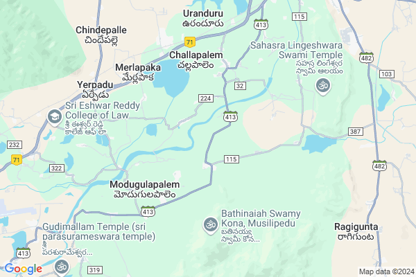
Ramalinga Puram
Ramalinga Puram Map
EDIT Map
Add Your House
 ..
..
Current Corona Virus Infected Patients Count in Chittoor District
| City Name | District Name | Total Covid cases |
|---|---|---|
| Chittoor District | Chittoor | 59 |
| Thyagaraja Nagar,Tirupathi | Chittoor | 3 |
| Srikalahasti | Chittoor | 3 |
| Nagiri | Chittoor | 2 |
| Chinna Masjid | Chittoor | 1 |
| Keelapattu nagari | Chittoor | 1 |
| Renigunta | Chittoor | 1 |
| Vadamalapeta | Chittoor | 1 |
| Tirupati | Chittoor | 1 |
| Nindra | Chittoor | 1 |
Locality Name :
Ramalinga Puram
( రామలింగ పురం )
Mandal Name : Srikalahasti
District : Chittoor
State : Andhra Pradesh
Region : Rayalaseema
Language : Telugu and Urdu
Current Time 04:31 PM
Date: Monday , Apr 28,2025 (IST)
Time zone: IST (UTC+5:30)
Elevation / Altitude: 68 meters. Above Seal level
Telephone Code / Std Code: 08578
Assembly constituency : assembly constituency
Assembly MLA : Madhusudhan Reddy Biyyapu
Lok Sabha constituency : parliamentary constituency
Parliament MP :
Serpanch Name :
Pin Code : 517641
Post Office Name : Thondamanadu
Alternate Village Name : Ramalingapuram HW, Ramalingapuram YC , Ramalingapu
Commodities Prices : Tirupati Market / Mandi
Edit below overview about Ramalinga Puram
Edit below overview about Ramalinga Puram
OverView of Ramalinga Puram
Yes it is right information,this village having good temple pettalamma temple.it is very near to swaranamuhi riverEdit below overview about Ramalinga Puram
National Highways Reachable To Ramalinga Puram
Nationa High Way :NH71
Nationa High Way :NH71;NH716
Nationa High Way :NH71
Nationa High Way :NH71;NH716
Rivers Near Ramalinga Puram
Swarnamukhi
Swarnamukhi
About Ramalinga Puram
Ramalinga Puram is a Village in Srikalahasti Mandal in Chittoor District of Andhra Pradesh State, India. It belongs to Rayalaseema region . It is located 92 KM towards East from District head quarters Chittoor. 15 KM from Srikalahasti. 505 KM from State capital Hyderabad
Ramalinga Puram Pin code is 517641 and postal head office is Thondamanadu .
Musalipedu ( 2 KM ) , Bokkasam Palem ( 3 KM ) , Kandadu ( 4 KM ) , Mannasamudram ( 4 KM ) , Modugulapalem ( 4 KM ) are the nearby Villages to Ramalinga Puram. Ramalinga Puram is surrounded by Srikalahasti Mandal towards North , K.V.B.Puram Mandal towards South , Renigunta Mandal towards west , Thottambedu Mandal towards North .
Srikalahasti , Renigunta , Tirupati , Puttur are the near by Cities to Ramalinga Puram.
This Place is in the border of the Chittoor District and Spsr Nellore District. Spsr Nellore District Pellakur is North towards this place .
Ramalinga Puram 2011 Census Details
Ramalinga Puram Local Language is Telugu. Ramalinga Puram Village Total population is 677 and number of houses are 212. Female Population is 47.7%. Village literacy rate is 60.9% and the Female Literacy rate is 27.0%.
Population
| Census Parameter | Census Data |
| Total Population | 677 |
| Total No of Houses | 212 |
| Female Population % | 47.7 % ( 323) |
| Total Literacy rate % | 60.9 % ( 412) |
| Female Literacy rate | 27.0 % ( 183) |
| Scheduled Tribes Population % | 17.7 % ( 120) |
| Scheduled Caste Population % | 29.7 % ( 201) |
| Working Population % | 45.1 % |
| Child(0 -6) Population by 2011 | 72 |
| Girl Child(0 -6) Population % by 2011 | 45.8 % ( 33) |
Ramalinga Puram Census More Deatils.
HOW TO REACH Ramalinga Puram
By Road
Srikalahasti is the Nearest Town to Ramalinga Puram. Srikalahasti is 10 km from Ramalinga Puram. Road connectivity is there from Srikalahasti to Ramalinga Puram.By Rail
Rachagunneri Rail Way Station , Yerpedu Rail Way Station are the very nearby railway stations to Ramalinga Puram. Also you can consider railway Stations from Near By town Srikalahasti. Sri Kalahasti Rail Way Station , Akkurti Rail Way Station are the railway Stations near to Srikalahasti. You can reach from Srikalahasti to Ramalinga Puram by road after .By Bus
Sri Kala Hasthi APSRTC Bus Station , Sri Kala Hasthi Bypass APSRTC Bus Station , Tirupathi APSRTC Bus Station are the nearby by Bus Stations to Ramalinga Puram .APSRTC runs Number of busses from major cities to here.Colleges near Ramalinga Puram
Sri Kalahastishwara Instute Of Technology
Address :
S V A Govt Jr College (b) Srikalahasti
Address : S V A Govt Jr College (b) Srikalahasti
Sri Siddartha Jr College Srikalahasti
Address : Sri Siddartha Jr College Srikalahasti
Apswr Jr Coll For Girls Srikalahasti
Address : Apswr Jr Coll For Girls Srikalahasti
Rayalaseema Junior College Srikalahasti
Address : Rayalaseema Junior College Srikalahasti
Schools in Ramalinga Puram
Mpps Ramalingapuram
Address : ramalinga puram , srikalahasti , chittoor , Andhra Pradesh . PIN- 517641 , Post - Thondamanadu
Govt Health Centers near Ramalinga Puram
1) BANDARUPALLI , , near railway gate , st colony2) S.N.KANDRIGA , SUBCENTER , SN KANDRIGA , Near--M.P.Ele. School, S.N.Kandriga,Grampanchayath
3) THONDAMANADU , SUBCENTER , THONDAMNADU , Near Jandamaanu & Post office Thondamnadu
Hospitals in Ramalinga Puram,Srikalahasti
Primary Health Center
Yerpadu; Chittoor; SH-59; Yerpadu Gudur Road; Chittoor; Chittoor; Andhra Pradesh 517619; India
8.2 KM distance Detail
more ..
Petrol Bunks in Ramalinga Puram,Srikalahasti
HP Petrol Pump
HPC Dealers; SNO-208-4 Cherelapalee Village Srikalahasti; Andhra Pradesh 517644; India
8.0 KM distance Detail
T.KANNIAPPA MUDALIAR&SONS
KALAHASTHI ON TIRUPATI ROA; CHITTOOR; Andhra Pradesh 517644; India
8.0 KM distance Detail
more ..
Schools in Ramalinga Puram,Srikalahasti
ZP HIGH SCHOOL; BANDARUPALLI
Srikrishna Asramam Road; Bandarupalli; Andhra Pradesh 517619; India
2.1 KM distance Detail
Electronic Shops in Ramalinga Puram,Srikalahasti
Sri Sai Maruthi Puncture Shop; SKHT Road; Yerpedu
SH 61; Yerpadu; Andhra Pradesh 517619; India
7.6 KM distance Detail
Super Markets in Ramalinga Puram,Srikalahasti
Agriculture Market Check Post
Harijanwada; Malavaram; Andhra Pradesh 517520; India
11.1 KM distance Detail
KM GREEN MART
3/371; Bazaar St; Bahadur Pet; Srikalahasti; Andhra Pradesh 517644; India
12.3 KM distance Detail
Police Stations near Ramalinga Puram,Srikalahasti
Srikalahasti Town Police Station
Nehru Street; Bahadur Pet; Srikalahasti; Andhra Pradesh 517644; India
12.6 KM distance Detail
Governement Offices near Ramalinga Puram,Srikalahasti
Mee Seva Center
1-85; Venkatagiri Road; Venkatagiri Road(V); Yerpedu(M); Chittoor(D);517619; Yerpadu; Andhra Pradesh 517619; India
7.8 KM distance Detail
About Ramalinga Puram &
History
How to reach Ramalinga Puram
Tourist Places Near By Ramalinga Puram
Schools in Ramalinga Puram
Colleges in Ramalinga Puram
Temperature & weather of Ramalinga Puram
places in Ramalinga Puram
Ramalinga Puram photos
More Information
How to reach Ramalinga Puram
Tourist Places Near By Ramalinga Puram
Schools in Ramalinga Puram
Colleges in Ramalinga Puram
Temperature & weather of Ramalinga Puram
places in Ramalinga Puram
Ramalinga Puram photos
More Information
Village Talk
Post News or Events about this Village
Near Cities
Srikalahasti 12 KM near
Renigunta 17 KM near
Tirupati 28 KM near
Puttur 29 KM near
Srikalahasti 12 KM near
Renigunta 17 KM near
Tirupati 28 KM near
Puttur 29 KM near
Near By Taluks
Yerpedu 7 KM near
Srikalahasti 13 KM near
K.V.B.Puram 15 KM near
Renigunta 17 KM near
Yerpedu 7 KM near
Srikalahasti 13 KM near
K.V.B.Puram 15 KM near
Renigunta 17 KM near
Near By Air Ports
Tirupati Airport 13 KM near
Chennai Airport 105 KM near
Bengaluru International Airport 242 KM near
Salem Airport 309 KM near
Tirupati Airport 13 KM near
Chennai Airport 105 KM near
Bengaluru International Airport 242 KM near
Salem Airport 309 KM near
Near By Tourist Places
Srikalahasti 11 KM near
Tirupati 28 KM near
Thiruthani 61 KM near
Pulicat 86 KM near
Chittoor 87 KM near
Srikalahasti 11 KM near
Tirupati 28 KM near
Thiruthani 61 KM near
Pulicat 86 KM near
Chittoor 87 KM near
Near By Districts
Thiruvallur 72 KM near
Chittoor 89 KM near
Spsr Nellore 103 KM near
Kanchipuram 103 KM near
Thiruvallur 72 KM near
Chittoor 89 KM near
Spsr Nellore 103 KM near
Kanchipuram 103 KM near
Near By RailWay Station
Rachagunneri Rail Way Station 6.3 KM near
Sri Kalahasti Rail Way Station 10 KM near
Renigunta Junction Rail Way Station 17 KM near
Rachagunneri Rail Way Station 6.3 KM near
Sri Kalahasti Rail Way Station 10 KM near
Renigunta Junction Rail Way Station 17 KM near