| Home | City Bus | Maps | Villages | Cities | Rail | Tourist Places | School | College | Pin Codes | Corona Cases Count |
| Distance Calculator Bus Services IFSC Codes Trace Mobile Number Weather Search Place Trace IP Available Cash ATM/Banks Locate Polling Booth Report an Error contact People |
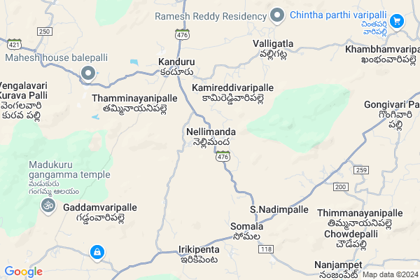
Nellimanda
Nellimanda Map
EDIT Map
Add Your House
 ..
..
Current Corona Virus Infected Patients Count in Chittoor District
| City Name | District Name | Total Covid cases |
|---|---|---|
| Chittoor District | Chittoor | 59 |
| Thyagaraja Nagar,Tirupathi | Chittoor | 3 |
| Srikalahasti | Chittoor | 3 |
| Nagiri | Chittoor | 2 |
| Keelapattu nagari | Chittoor | 1 |
| Renigunta | Chittoor | 1 |
| Vadamalapeta | Chittoor | 1 |
| Tirupati | Chittoor | 1 |
| Nindra | Chittoor | 1 |
| Chinna Masjid | Chittoor | 1 |
Locality Name :
Nellimanda
( నెల్లిమండ )
Mandal Name : Somala
District : Chittoor
State : Andhra Pradesh
Region : Rayalaseema
Language : Telugu and Urdu
Current Time 08:10 PM
Date: Wednesday , Feb 05,2025 (IST)
Time zone: IST (UTC+5:30)
Elevation / Altitude: 537 meters. Above Seal level
Telephone Code / Std Code: 08583
Assembly constituency : assembly constituency
Assembly MLA : PEDDIREDDI RAMACHANDRA REDDY
Lok Sabha constituency : parliamentary constituency
Parliament MP : P.V.MIDHUN REDDY
Serpanch Name :
Pin Code : 517257
Post Office Name : Chowdepalle
Commodities Prices : Kalikiri Market / Mandi
Edit below overview about Nellimanda
Edit below overview about Nellimanda
OverView of Nellimanda
Nellimanda was a one of the famous village in AP lot of villages commen name nellimandha .. one Eguvapalli is most education persons and talent peoples ..another paletamma jatara was woderfull estd 1952 big history in temple full rights goes to eguvapalli peoples .... more temples in hereEdit below overview about Nellimanda
National Highways Reachable To Nellimanda
Nationa High Way :NH140
Nationa High Way :NH71
Nationa High Way :NH140
Nationa High Way :NH71
Rivers Near Nellimanda
Swarnamukhi
Cheyyeru River
Swarnamukhi
Cheyyeru River
About Nellimanda
Nellimanda is a Village in Somala Mandal in Chittoor District of Andhra Pradesh State, India. It belongs to Rayalaseema region . It is located 55 KM towards North from District head quarters Chittoor. 3 KM from Somala. 504 KM from State capital Hyderabad
Nellimanda Pin code is 517257 and postal head office is Chowdepalle .
Kanduru ( 4 KM ) , Thamminayanipalle ( 5 KM ) , S. Nadimpalle ( 6 KM ) , Somala ( 6 KM ) , Valligatla ( 6 KM ) are the nearby Villages to Nellimanda. Nellimanda is surrounded by Sodam Mandal towards East , Nimmanapalle Mandal towards west , Chowdepalle Mandal towards South , Valmikipuram Mandal towards North .
Punganur , Madanapalle , Chittoor , Mulbagal are the near by Cities to Nellimanda.
Nellimanda 2011 Census Details
Nellimanda Local Language is Telugu. Nellimanda Village Total population is 2699 and number of houses are 731. Female Population is 49.2%. Village literacy rate is 57.4% and the Female Literacy rate is 23.9%.
Population
| Census Parameter | Census Data |
| Total Population | 2699 |
| Total No of Houses | 731 |
| Female Population % | 49.2 % ( 1329) |
| Total Literacy rate % | 57.4 % ( 1548) |
| Female Literacy rate | 23.9 % ( 645) |
| Scheduled Tribes Population % | 1.8 % ( 48) |
| Scheduled Caste Population % | 12.6 % ( 341) |
| Working Population % | 50.0 % |
| Child(0 -6) Population by 2011 | 281 |
| Girl Child(0 -6) Population % by 2011 | 40.6 % ( 114) |
Nellimanda Census More Deatils.
HOW TO REACH Nellimanda
By Road
Punganur is the Nearest Town to Nellimanda. Punganur is 38 km from Nellimanda. Road connectivity is there from Punganur to Nellimanda.By Rail
There is no railway station near to Nellimanda in less than 10 km.By Bus
Kanduru APSRTC Bus Station , Somala APSRTC Bus Station , Choudpally APSRTC Bus Station are the nearby by Bus Stations to Nellimanda .APSRTC runs Number of busses from major cities to here.Colleges near Nellimanda
S K V N Govt Junior Col Somala
Address : S K V N Govt Junior Col Somala
Schools in Nellimanda
Mpups Nellimanda
Address : nellimanda , somala , chittoor , Andhra Pradesh . PIN- 517257 , Post - Chowdepalle
Govt Health Centers near Nellimanda
1) NELLIMANDA , , , bus stop road2) Kanduru , , Suresh Rice Mill , Kandur
3) KANDURU , , Santhathopu , near high school
Sub Villages in Nellimanda
Schools in Nellimanda,Somala
Electronic Shops in Nellimanda,Somala
Super Markets in Nellimanda,Somala
Local Parks in Nellimanda,Somala
Police Stations near Nellimanda,Somala
Governement Offices near Nellimanda,Somala
About Nellimanda &
History
How to reach Nellimanda
Tourist Places Near By Nellimanda
Schools in Nellimanda
Colleges in Nellimanda
Temperature & weather of Nellimanda
places in Nellimanda
Nellimanda photos
More Information
How to reach Nellimanda
Tourist Places Near By Nellimanda
Schools in Nellimanda
Colleges in Nellimanda
Temperature & weather of Nellimanda
places in Nellimanda
Nellimanda photos
More Information
Village Talk
Post News or Events about this Village
Near Cities
Punganur 32 KM near
Madanapalle 35 KM near
Chittoor 51 KM near
Mulbagal 65 KM near
Punganur 32 KM near
Madanapalle 35 KM near
Chittoor 51 KM near
Mulbagal 65 KM near
Near By Taluks
Somala 3 KM near
Sodam 13 KM near
Nimmanapalle 15 KM near
Chowdepalle 17 KM near
Somala 3 KM near
Sodam 13 KM near
Nimmanapalle 15 KM near
Chowdepalle 17 KM near
Near By Air Ports
Tirupati Airport 92 KM near
Bengaluru International Airport 137 KM near
Chennai Airport 179 KM near
Salem Airport 244 KM near
Tirupati Airport 92 KM near
Bengaluru International Airport 137 KM near
Chennai Airport 179 KM near
Salem Airport 244 KM near
Near By Tourist Places
Horsley Hills 50 KM near
Chittoor 53 KM near
Tirupati 77 KM near
vellore 85 KM near
Thiruthani 109 KM near
Horsley Hills 50 KM near
Chittoor 53 KM near
Tirupati 77 KM near
vellore 85 KM near
Thiruthani 109 KM near
Near By Districts
Chittoor 53 KM near
Vellore 86 KM near
Kolar 92 KM near
Cuddapah 117 KM near
Chittoor 53 KM near
Vellore 86 KM near
Kolar 92 KM near
Cuddapah 117 KM near
Near By RailWay Station
Piler Rail Way Station 24 KM near
Madanapalle Road Rail Way Station 32 KM near
Piler Rail Way Station 24 KM near
Madanapalle Road Rail Way Station 32 KM near