| Home | City Bus | Maps | Villages | Cities | Rail | Tourist Places | School | College | Pin Codes | Corona Cases Count |
| Distance Calculator Bus Services IFSC Codes Trace Mobile Number Weather Search Place Trace IP Available Cash ATM/Banks Locate Polling Booth Report an Error contact People |
Sathram
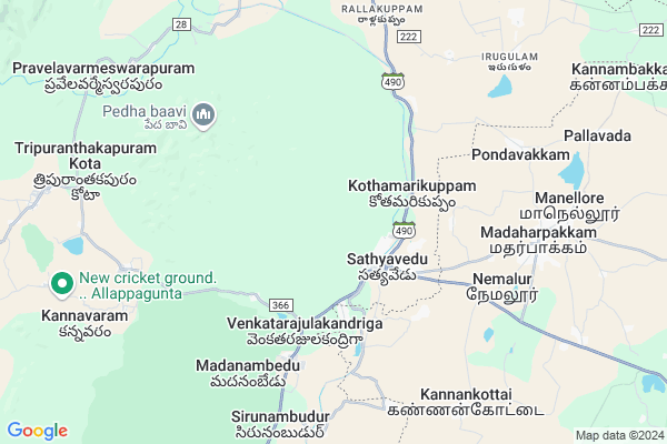
Sathram Map
EDIT Map
Add Your House
 ..
..
Current Corona Virus Infected Patients Count in Chittoor District
| City Name | District Name | Total Covid cases |
|---|---|---|
| Chittoor District | Chittoor | 59 |
| Thyagaraja Nagar,Tirupathi | Chittoor | 3 |
| Srikalahasti | Chittoor | 3 |
| Nagiri | Chittoor | 2 |
| Keelapattu nagari | Chittoor | 1 |
| Renigunta | Chittoor | 1 |
| Vadamalapeta | Chittoor | 1 |
| Tirupati | Chittoor | 1 |
| Nindra | Chittoor | 1 |
| Chinna Masjid | Chittoor | 1 |
Locality Name :
Sathram
( సత్రం )
Mandal Name : Satyavedu
District : Chittoor
State : Andhra Pradesh
Region : Rayalaseema
Language : Telugu and Urdu
Current Time 06:48 AM
Date: Saturday , Apr 26,2025 (IST)
Time zone: IST (UTC+5:30)
Elevation / Altitude: 11 meters. Above Seal level
Telephone Code / Std Code: 08576
Assembly constituency : assembly constituency
Assembly MLA :
Lok Sabha constituency : parliamentary constituency
Parliament MP :
Serpanch Name :
Main Village Name : Pedda etipakkam
Commodities Prices : Puttur Market / Mandi
Sathram Live Weather
Temperature: 25.5 °C
broken clouds
Humidity: 90%
Wind : 2.64 mt/sec towards SW
StationName : "Gummidipundi"
observed on 1 Hours Back
Temperature: 25.5 °C
broken clouds
Humidity: 90%
Wind : 2.64 mt/sec towards SW
StationName : "Gummidipundi"
observed on 1 Hours Back
Sathram Weather Forecast for Next 5 days
27-04-2025
25.4°C to 39.9°C
broken clouds, scattered clouds, overcast clouds
25.4°C to 39.9°C
broken clouds, scattered clouds, overcast clouds
28-04-2025
25.4°C to 38.4°C
overcast clouds, broken clouds, few clouds, scattered clouds
25.4°C to 38.4°C
overcast clouds, broken clouds, few clouds, scattered clouds
29-04-2025
25.9°C to 39.1°C
scattered clouds, few clouds, clear sky
25.9°C to 39.1°C
scattered clouds, few clouds, clear sky
30-04-2025
25.7°C to 41.7°C
few clouds, clear sky
25.7°C to 41.7°C
few clouds, clear sky
National Highways Reachable To Sathram
Nationa High Way :NH32
Nationa High Way :NH16
Nationa High Way :NH32
Nationa High Way :NH16
Rivers Near Sathram
Nagari River
Ralla
Nagari River
Ralla
About Sathram
Correct below Info and add more info about SathramSathram is a small Village/hamlet in Satyavedu Mandal in Chittoor District of Andhra Pradesh State, India. It comes under Pedda etipakkam Panchayath. It belongs to Rayalaseema region . It is located 112 KM towards East from District head quarters Chittoor. 543 KM from State capital Hyderabad
Sathram is surrounded by Nagalapuram Mandal towards west , Gummidipundi Mandal towards East , Varadaiahpalem Mandal towards North , Ellapuram Mandal towards South .
Ponneri , Thiruvallur , Thirunindravur , Nagari are the near by Cities to Sathram.
This Place is in the border of the Chittoor District and Thiruvallur District. Thiruvallur District Gummidipundi is East towards this place . It is near to the Tamil Nadu State Border.
Demographics of Sathram
Telugu is the Local Language here. Total population of Sathram is 1599 .Males are 794 and Females are 805 living in 383 Houses. Total area of Sathram is 420 hectares.HOW TO REACH Sathram
By Road
Srikalahasti is the Nearest Town to Sathram. Srikalahasti is 60 km from Sathram. Road connectivity is there from Srikalahasti to Sathram.By Rail
There is no railway station near to Sathram in less than 10 km. How ever there are railway Stations from Near By town Srikalahasti. are the railway Stations near to Srikalahasti. You can reach from Srikalahasti to Sathram by road after .By Bus
Sullurupet Bypass APSRTC Bus Station , Sullurupet APSRTC Bus Station , Srihari Kota APSRTC Bus Station are the nearby by Bus Stations to Sathram .APSRTC runs Number of busses from major cities to here.Pincodes near Sathram
517588 ( Satyavedu ) , 517541 ( Varadaiahpalem ) , 517589 ( Nagalapuram (Chittoor) )Colleges near Sathram
Govt Junior College, Satyavedu
Address : Satyavedu
Sri C.dass Arts & Science College
Address : Satyavedu, Chittoor Dist.
Schools near Sathram
Z.p.h.s Pudukuppam
Address : pedukuppam , sathyavedu , chittoor , Andhra Pradesh . PIN- 517588 , Post - Satyavedu
Z.p.h.s Madanambedu
Address : madamambedu , sathyavedu , chittoor , Andhra Pradesh . PIN- 517588 , Post - Satyavedu
Z.p.h.s Dasukuppam
Address : dasukuppam , sathyavedu , chittoor , Andhra Pradesh . PIN- 517588 , Post - Satyavedu
Z.p.h.s Madanapalem
Address : cherivi , sathyavedu , chittoor , Andhra Pradesh . PIN- 517588 , Post - Satyavedu
Govt Health Centers near Sathram
1) SATHYAVEDU - I , , Sathyavedu - I , NEAR ULAVACHENU2) SATHYAVEDU , o , Hospital Street , Satyavedu
3) SATHYAVEDU - I I , , Sathyavedu - II , NEAR NAVATHA TRANSPORT
Petrol Bunks in Sathram,Satyavedu
Hindustan Petrolium Station
Uthukottai - Satyavedu Rd; Sathyavedu; Andhra Pradesh 517588; India
2.3 KM distance Detail
HP PETROL PUMP - T.SHANMUGAM & T.SUBRAMANIAM
Hpcl Dealers Netaji Road Satyaveedu; Andhra Pradesh 517588; India
2.7 KM distance Detail
more ..
Colleges in Sathram,Satyavedu
Government Polytechnic Satyavedu
Dalavai Agraharam; Andhra Pradesh 517588; India
2.2 KM distance Detail
RVS Padhmavathy College of Engineering & Technology
SH 52; Chedilpakkam; Tamil Nadu 601202; India
5.2 KM distance Detail
RVS Padmavathy School of Architecture
SH 52; Chedilpakkam; Tamil Nadu 601202; India
5.2 KM distance Detail
more ..
Schools in Sathram,Satyavedu
Saint Joseph High School
Bus Depo Rd; Sathyavedu; Andhra Pradesh 517588; India
2.1 KM distance Detail
Government Girls Gurukula Paatashaala; Satyavedu
Sathyavedu; Andhra Pradesh 517588; India
2.2 KM distance Detail
Electronic Shops in Sathram,Satyavedu
G S RAVI AGENCIES
Uthukottai - Gummudipoondi Rd; Sathyavedu; Andhra Pradesh 517588; India
2.5 KM distance Detail
Police Stations near Sathram,Satyavedu
Padhirivedu - Madharpakkam Police Station
Madharpakkam; Tamil Nadu 601202; India
7.9 KM distance Detail
Governement Offices near Sathram,Satyavedu
Sathyavedu HFN Centre
Forest Bungalow St; Sathyavadu; Andhra Pradesh 517588; India
2.4 KM distance Detail
Gram Panchayat Office
Forest Bungalow St; Sathyavadu; Andhra Pradesh 517588; India
2.4 KM distance Detail
MeeSeva Center
Omsairam STD Center; Nethaji Road; Beside Subregister Office; Sathyavedu(V); Satyavedu(M);; 2/114; Sathyavedu Rd; Sathyavadu; Andhra Pradesh 517588; India
2.7 KM distance Detail
About Sathram &
History
How to reach Sathram
Tourist Places Near By Sathram
Schools in Sathram
Colleges in Sathram
Temperature & weather of Sathram
places in Sathram
Sathram photos
More Information
How to reach Sathram
Tourist Places Near By Sathram
Schools in Sathram
Colleges in Sathram
Temperature & weather of Sathram
places in Sathram
Sathram photos
More Information
Village Talk
Post News or Events about this Village
Near Cities
Ponneri 35 KM near
Thiruvallur 38 KM near
Thirunindravur 42 KM near
Nagari 46 KM near
Ponneri 35 KM near
Thiruvallur 38 KM near
Thirunindravur 42 KM near
Nagari 46 KM near
Near By Taluks
Satyavedu 0 KM near
Nagalapuram 15 KM near
Gummidipundi 18 KM near
Varadaiahpalem 19 KM near
Satyavedu 0 KM near
Nagalapuram 15 KM near
Gummidipundi 18 KM near
Varadaiahpalem 19 KM near
Near By Air Ports
Tirupati Airport 53 KM near
Chennai Airport 64 KM near
Bengaluru International Airport 272 KM near
Salem Airport 310 KM near
Tirupati Airport 53 KM near
Chennai Airport 64 KM near
Bengaluru International Airport 272 KM near
Salem Airport 310 KM near
Near By Tourist Places
Pulicat 45 KM near
Srikalahasti 47 KM near
Thiruthani 52 KM near
Sriperumbudur 59 KM near
Chennai 61 KM near
Pulicat 45 KM near
Srikalahasti 47 KM near
Thiruthani 52 KM near
Sriperumbudur 59 KM near
Chennai 61 KM near
Near By Districts
Thiruvallur 38 KM near
Chennai 60 KM near
Kanchipuram 80 KM near
Chittoor 107 KM near
Thiruvallur 38 KM near
Chennai 60 KM near
Kanchipuram 80 KM near
Chittoor 107 KM near
Near By RailWay Station
Sullurupeta Rail Way Station 32 KM near
Tiruvallur Rail Way Station 41 KM near
Sullurupeta Rail Way Station 32 KM near
Tiruvallur Rail Way Station 41 KM near