| Home | City Bus | Maps | Villages | Cities | Rail | Tourist Places | School | College | Pin Codes | Corona Cases Count |
| Distance Calculator Bus Services IFSC Codes Trace Mobile Number Weather Search Place Trace IP Available Cash ATM/Banks Locate Polling Booth Report an Error contact People |
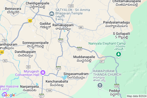
Avulakuppam
Avulakuppam Map
EDIT Map
Add Your House
 ..
..
Current Corona Virus Infected Patients Count in Chittoor District
| City Name | District Name | Total Covid cases |
|---|---|---|
| Chittoor District | Chittoor | 59 |
| Thyagaraja Nagar,Tirupathi | Chittoor | 3 |
| Srikalahasti | Chittoor | 3 |
| Nagiri | Chittoor | 2 |
| Keelapattu nagari | Chittoor | 1 |
| Renigunta | Chittoor | 1 |
| Vadamalapeta | Chittoor | 1 |
| Tirupati | Chittoor | 1 |
| Nindra | Chittoor | 1 |
| Chinna Masjid | Chittoor | 1 |
Locality Name :
Avulakuppam
( ఆవులకుప్పం )
Mandal Name : Ramakuppam
District : Chittoor
State : Andhra Pradesh
Region : Rayalaseema
Language : Telugu and Urdu
Current Time 12:34 AM
Date: Thursday , Feb 06,2025 (IST)
Time zone: IST (UTC+5:30)
Elevation / Altitude: 688 meters. Above Seal level
Telephone Code / Std Code: 08587
Assembly constituency : assembly constituency
Assembly MLA : Nara Chandra Babu Naidu
Lok Sabha constituency : parliamentary constituency
Parliament MP :
Serpanch Name :
Pin Code : 517401
Post Office Name : Ramakuppam
Main Village Name : Muddanapalle
Commodities Prices : Mulabagilu Market / Mandi
Avulakuppam Live Weather
Temperature: 17.6 °C
scattered clouds
Humidity: 73%
Wind : 2.55 mt/sec towards NE
StationName : "Kuppam"
observed on 54 Mins Back
Temperature: 17.6 °C
scattered clouds
Humidity: 73%
Wind : 2.55 mt/sec towards NE
StationName : "Kuppam"
observed on 54 Mins Back
Avulakuppam Weather Forecast for Next 5 days
06-02-2025
15.8°C to 17.1°C
scattered clouds
15.8°C to 17.1°C
scattered clouds
07-02-2025
14.9°C to 29.3°C
scattered clouds, clear sky, few clouds
14.9°C to 29.3°C
scattered clouds, clear sky, few clouds
08-02-2025
15.0°C to 29.4°C
clear sky, broken clouds, few clouds, scattered clouds
15.0°C to 29.4°C
clear sky, broken clouds, few clouds, scattered clouds
09-02-2025
15.8°C to 29.3°C
scattered clouds, clear sky, broken clouds
15.8°C to 29.3°C
scattered clouds, clear sky, broken clouds
10-02-2025
16.3°C to 29.3°C
scattered clouds, few clouds, clear sky
16.3°C to 29.3°C
scattered clouds, few clouds, clear sky
National Highways Reachable To Avulakuppam
Nationa High Way :NH42
Nationa High Way :NH648
Nationa High Way :NH42
Nationa High Way :NH648
Rivers Near Avulakuppam
Palar :ಪಾಲಾರ್ :பாலா
Then Pennai :ದಕ್ಷಿಣ ಪಿನಾಕಿನಿ
Palar :ಪಾಲಾರ್ :பாலா
Then Pennai :ದಕ್ಷಿಣ ಪಿನಾಕಿನಿ
About Avulakuppam
Correct below Info and add more info about AvulakuppamAvulakuppam is a small Village/hamlet in Ramakuppam Mandal in Chittoor District of Andhra Pradesh State, India. It comes under Muddanapalle Panchayath. It belongs to Rayalaseema region . It is located 86 KM towards west from District head quarters Chittoor. 2 KM from Ramakuppam. 587 KM from State capital Hyderabad
Avulakuppam Pin code is 517401 and postal head office is Ramakuppam .
Avulakuppam is surrounded by Venkatagirikota Mandal towards North , Santhipuram Ho Arimuthanapalle Mandal towards west , Kuppam Mandal towards South , Peranambattu Mandal towards East .
Vaniyambadi , Robertson Pet , Pernampattu , Mulbagal are the near by Cities to Avulakuppam.
Demographics of Avulakuppam
Telugu is the Local Language here. Total population of Avulakuppam is 2093 .Males are 1059 and Females are 1,034 living in 429 Houses. Total area of Avulakuppam is 506 hectares.HOW TO REACH Avulakuppam
By Road
Punganur is the Nearest Town to Avulakuppam. Punganur is 35 km from Avulakuppam. Road connectivity is there from Punganur to Avulakuppam.By Rail
There is no railway station near to Avulakuppam in less than 10 km.By Bus
Raju Peta X APSRTC Bus Station , Santhi Puram APSRTC Bus Station , V.Kota APSRTC Bus Station are the nearby by Bus Stations to Avulakuppam .APSRTC runs Number of busses from major cities to here.Colleges near Avulakuppam
Govt Junior College, Ramakuppam
Address : Ramakuppam
Ap Sw Resi Jrcoll Forboys Ramakuppam
Address : Ap Sw Resi Jrcoll Forboys Ramakuppam
Schools in Avulakuppam
Zphs Muddanapalle
Address : muddanapalle , ramakuppam , chittoor , Andhra Pradesh . PIN- 517401 , Post - Ramakuppam
Govt Health Centers near Avulakuppam
1) RAMAKUPPAM , , Bajar Street , OLD Phc2) SAGINEKUPPAM , , middel of the village , Near Primari school
3) BANDARLAPALLE , , Main ,
Electronic Shops in Avulakuppam,Ramakuppam
Super Markets in Avulakuppam,Ramakuppam
Local Parks in Avulakuppam,Ramakuppam
Police Stations near Avulakuppam,Ramakuppam
Governement Offices near Avulakuppam,Ramakuppam
About Avulakuppam &
History
How to reach Avulakuppam
Tourist Places Near By Avulakuppam
Schools in Avulakuppam
Colleges in Avulakuppam
Temperature & weather of Avulakuppam
places in Avulakuppam
Avulakuppam photos
More Information
How to reach Avulakuppam
Tourist Places Near By Avulakuppam
Schools in Avulakuppam
Colleges in Avulakuppam
Temperature & weather of Avulakuppam
places in Avulakuppam
Avulakuppam photos
More Information
Village Talk
Post News or Events about this Village
Near Cities
Vaniyambadi 27 KM near
Robertson Pet 29 KM near
Pernampattu 29 KM near
Mulbagal 39 KM near
Vaniyambadi 27 KM near
Robertson Pet 29 KM near
Pernampattu 29 KM near
Mulbagal 39 KM near
Near By Taluks
Ramakuppam 2 KM near
Venkatagirikota 11 KM near
Santhipuram Ho Arimuthanapalle 13 KM near
Kuppam 24 KM near
Ramakuppam 2 KM near
Venkatagirikota 11 KM near
Santhipuram Ho Arimuthanapalle 13 KM near
Kuppam 24 KM near
Near By Air Ports
Bengaluru International Airport 104 KM near
Salem Airport 157 KM near
Tirupati Airport 158 KM near
Chennai Airport 202 KM near
Bengaluru International Airport 104 KM near
Salem Airport 157 KM near
Tirupati Airport 158 KM near
Chennai Airport 202 KM near
Near By Tourist Places
Yelagiri 40 KM near
vellore 76 KM near
Chittoor 84 KM near
Horsley Hills 98 KM near
Thiruvannamalai 107 KM near
Yelagiri 40 KM near
vellore 76 KM near
Chittoor 84 KM near
Horsley Hills 98 KM near
Thiruvannamalai 107 KM near
Near By Districts
Krishnagiri 54 KM near
Kolar 55 KM near
Vellore 76 KM near
Chittoor 82 KM near
Krishnagiri 54 KM near
Kolar 55 KM near
Vellore 76 KM near
Chittoor 82 KM near
Near By RailWay Station
Kuppam Rail Way Station 24 KM near
Vaniyambadi Rail Way Station 28 KM near
Kuppam Rail Way Station 24 KM near
Vaniyambadi Rail Way Station 28 KM near