| Home | City Bus | Maps | Villages | Cities | Rail | Tourist Places | School | College | Pin Codes | Corona Cases Count |
| Distance Calculator Bus Services IFSC Codes Trace Mobile Number Weather Search Place Trace IP Available Cash ATM/Banks Locate Polling Booth Report an Error contact People |
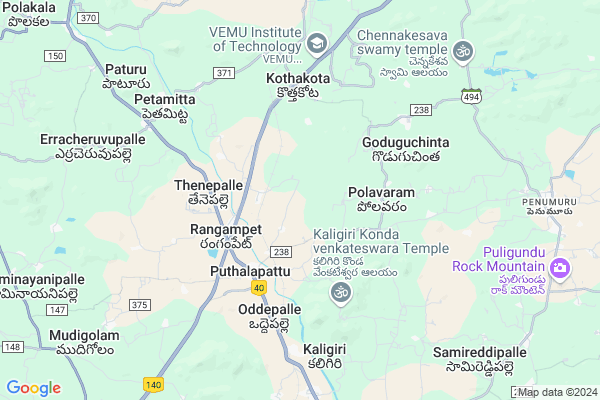
Rangapuram
Rangapuram Map
EDIT Map
Add Your House
 ..
..
Current Corona Virus Infected Patients Count in Chittoor District
| City Name | District Name | Total Covid cases |
|---|---|---|
| Chittoor District | Chittoor | 59 |
| Thyagaraja Nagar,Tirupathi | Chittoor | 3 |
| Srikalahasti | Chittoor | 3 |
| Nagiri | Chittoor | 2 |
| Chinna Masjid | Chittoor | 1 |
| Keelapattu nagari | Chittoor | 1 |
| Renigunta | Chittoor | 1 |
| Vadamalapeta | Chittoor | 1 |
| Tirupati | Chittoor | 1 |
| Nindra | Chittoor | 1 |
Locality Name :
Rangapuram
( రంగాపురం )
Mandal Name : Puthalapattu
District : Chittoor
State : Andhra Pradesh
Region : Rayalaseema
Language : Telugu and Urdu
Current Time 08:36 AM
Date: Wednesday , Apr 30,2025 (IST)
Time zone: IST (UTC+5:30)
Elevation / Altitude: 330 meters. Above Seal level
Telephone Code / Std Code: 08585
Assembly constituency : assembly constituency
Assembly MLA :
Lok Sabha constituency : parliamentary constituency
Parliament MP :
Serpanch Name :
Pin Code : 517124
Post Office Name : Puthalapattu
Main Village Name : Akanambattu
Commodities Prices : Chittoor Market / Mandi
Rangapuram Live Weather
Temperature: 24.8 °C
broken clouds
Humidity: 86%
Wind : 1.33 mt/sec towards S
StationName : "PÄ\u0081kÄ\u0081la"
observed on 1 Hours Back
Temperature: 24.8 °C
broken clouds
Humidity: 86%
Wind : 1.33 mt/sec towards S
StationName : "PÄ\u0081kÄ\u0081la"
observed on 1 Hours Back
Rangapuram Weather Forecast for Next 5 days
01-05-2025
25.8°C to 38.5°C
broken clouds, overcast clouds
25.8°C to 38.5°C
broken clouds, overcast clouds
02-05-2025
25.8°C to 38.8°C
overcast clouds, broken clouds, light rain
25.8°C to 38.8°C
overcast clouds, broken clouds, light rain
03-05-2025
26.7°C to 39.5°C
overcast clouds, broken clouds, light rain
26.7°C to 39.5°C
overcast clouds, broken clouds, light rain
04-05-2025
27.2°C to 39.7°C
overcast clouds, broken clouds, scattered clouds, light rain
27.2°C to 39.7°C
overcast clouds, broken clouds, scattered clouds, light rain
05-05-2025
26.0°C to 38.9°C
overcast clouds, scattered clouds, light rain, moderate rain
26.0°C to 38.9°C
overcast clouds, scattered clouds, light rain, moderate rain
National Highways Reachable To Rangapuram
Nationa High Way :NH716B
Nationa High Way :NH716
Nationa High Way :NH716B
Nationa High Way :NH716
Rivers Near Rangapuram
Pedda Vanka
Ponneri River
Pedda Vanka
Ponneri River
About Rangapuram
Correct below Info and add more info about RangapuramRangapuram is a small Village/hamlet in Puthalapattu Mandal in Chittoor District of Andhra Pradesh State, India. It comes under Akanambattu Panchayath. It belongs to Rayalaseema region . It is located 20 KM towards North from District head quarters Chittoor. 1 KM from Puthalapattu. 528 KM from State capital Hyderabad
Rangapuram Pin code is 517124 and postal head office is Puthalapattu .
Rangapuram is surrounded by Penumuru Mandal towards East , Pakala Mandal towards North , Irala Mandal towards west , Chittoor Mandal towards South .
Chittoor , Sholingur , Tirupati , Puttur are the near by Cities to Rangapuram.
Demographics of Rangapuram
Telugu is the Local Language here. Total population of Rangapuram is 1048 .Males are 509 and Females are 539 living in 268 Houses. Total area of Rangapuram is 412 hectares.HOW TO REACH Rangapuram
By Road
Chittoor is the Nearest Town to Rangapuram. Chittoor is 22 km from Rangapuram. Road connectivity is there from Chittoor to Rangapuram.By Rail
Putalapattu Rail Way Station , Pakala Junction Rail Way Station are the very nearby railway stations to Rangapuram. Also you can consider railway Stations from Near By town Chittoor. Chittoor Rail Way Station , Siddampalli Rail Way Station are the railway Stations near to Chittoor. You can reach from Chittoor to Rangapuram by road after .By Bus
Putalpattu APSRTC Bus Station , Patoor APSRTC Bus Station , Damalchervu APSRTC Bus Station are the nearby by Bus Stations to Rangapuram .APSRTC runs Number of busses from major cities to here.Colleges near Rangapuram
Bheemeshwar Educational Institutions
Address :
Vemu Institute Of Technology
Address : P.kothakota Post, Chittoor Dist - 517 112.
Schools in Rangapuram
Zphs Akanambattu
Address : akanambattu , puthalapattu , chittoor , Andhra Pradesh . PIN- 517124 , Post - Puthalapattu
Govt Health Centers near Rangapuram
1) Pantapalli , 01-33. , Main ,2) RANGAMPETA , Rangampeta S/C , Cross Road , Near MPP School
3) P.KOTHAKOTA , P.Kothakota S/C , Tirupathi Main Road , Beside ZP High School
Hospitals in Rangapuram,Puthalapattu
Government Hospital Thirumalaiah Palli
Chittoor Rd; Venugopalapuram; Andhra Pradesh 517569; India
21.5 KM distance Detail
more ..
Petrol Bunks in Rangapuram,Puthalapattu
HP PETROL PUMP - TIRUMALA PETRO HUB
HPC Dealer S.NO.797/1; Pakalavaripalli Village Panapakkam; Chandragiri Mandal; Andhra Pradesh 517502; India
21.6 KM distance Detail
more ..
Colleges in Rangapuram,Puthalapattu
S.V Junior College Kothapalli Mitta
Kotha Palli Mitta; Andhra Pradesh 517167; India
20.9 KM distance Detail
more ..
Super Markets in Rangapuram,Puthalapattu
Gurga Devi Temple G.V.kandriga
Vavilechanu Rd; Aggichenupalle; Andhra Pradesh 517126; India
20.7 KM distance Detail
Police Stations near Rangapuram,Puthalapattu
Governement Offices near Rangapuram,Puthalapattu
Mee Seva Center
C-26; Sriramcomplex; Gandla Street; Indian Bank Behaind; Devalampet(V); Veduru Kuppam(M); Chittoor(D);517167; Devalampeta; Andhra Pradesh 517167; India
18.1 KM distance Detail
Chenchugudi Village.
Chenchugudi Village; Thirumalayyapalli post; Vedurukuppam Mandal; Chittoor Dist. AP. India.; Andhra Pradesh; India
22.7 KM distance Detail
About Rangapuram &
History
How to reach Rangapuram
Tourist Places Near By Rangapuram
Schools in Rangapuram
Colleges in Rangapuram
Temperature & weather of Rangapuram
places in Rangapuram
Rangapuram photos
More Information
How to reach Rangapuram
Tourist Places Near By Rangapuram
Schools in Rangapuram
Colleges in Rangapuram
Temperature & weather of Rangapuram
places in Rangapuram
Rangapuram photos
More Information
Village Talk
Post News or Events about this Village
Near Cities
Chittoor 19 KM near
Sholingur 48 KM near
Tirupati 50 KM near
Puttur 54 KM near
Chittoor 19 KM near
Sholingur 48 KM near
Tirupati 50 KM near
Puttur 54 KM near
Near By Taluks
Puthalapattu 1 KM near
Penumuru 8 KM near
Pakala 10 KM near
Irala 11 KM near
Puthalapattu 1 KM near
Penumuru 8 KM near
Pakala 10 KM near
Irala 11 KM near
Near By Air Ports
Tirupati Airport 61 KM near
Chennai Airport 136 KM near
Bengaluru International Airport 171 KM near
Salem Airport 242 KM near
Tirupati Airport 61 KM near
Chennai Airport 136 KM near
Bengaluru International Airport 171 KM near
Salem Airport 242 KM near
Near By Tourist Places
Chittoor 19 KM near
Tirupati 49 KM near
vellore 56 KM near
Thiruthani 66 KM near
Srikalahasti 85 KM near
Chittoor 19 KM near
Tirupati 49 KM near
vellore 56 KM near
Thiruthani 66 KM near
Srikalahasti 85 KM near
Near By Districts
Chittoor 20 KM near
Vellore 57 KM near
Kanchipuram 97 KM near
Thiruvallur 100 KM near
Chittoor 20 KM near
Vellore 57 KM near
Kanchipuram 97 KM near
Thiruvallur 100 KM near
Near By RailWay Station
Putalapattu Rail Way Station 1.4 KM near
Pakala Junction Rail Way Station 10 KM near
Chittoor Rail Way Station 18 KM near
Putalapattu Rail Way Station 1.4 KM near
Pakala Junction Rail Way Station 10 KM near
Chittoor Rail Way Station 18 KM near