| Home | City Bus | Maps | Villages | Cities | Rail | Tourist Places | School | College | Pin Codes | Corona Cases Count |
| Distance Calculator Bus Services IFSC Codes Trace Mobile Number Weather Search Place Trace IP Available Cash ATM/Banks Locate Polling Booth Report an Error contact People |
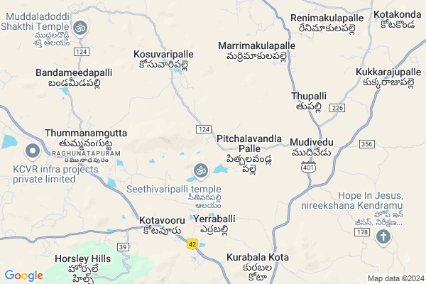
Enupothulapalle
Enupothulapalle Map
EDIT Map
Add Your House
 ..
..
Current Corona Virus Infected Patients Count in Chittoor District
| City Name | District Name | Total Covid cases |
|---|---|---|
| Chittoor District | Chittoor | 59 |
| Thyagaraja Nagar,Tirupathi | Chittoor | 3 |
| Srikalahasti | Chittoor | 3 |
| Nagiri | Chittoor | 2 |
| Chinna Masjid | Chittoor | 1 |
| Keelapattu nagari | Chittoor | 1 |
| Renigunta | Chittoor | 1 |
| Vadamalapeta | Chittoor | 1 |
| Tirupati | Chittoor | 1 |
| Nindra | Chittoor | 1 |
Locality Name :
Enupothulapalle
( ఎనుపోతులపల్లె )
Mandal Name : Kurabalakota
District : Chittoor
State : Andhra Pradesh
Region : Rayalaseema
Language : Telugu and Urdu
Current Time 12:29 PM
Date: Wednesday , Apr 30,2025 (IST)
Time zone: IST (UTC+5:30)
Elevation / Altitude: 686 meters. Above Seal level
Telephone Code / Std Code: 08571
Assembly constituency : assembly constituency
Assembly MLA : PEDDIREDDY DWARAKANATHA REDDY
Lok Sabha constituency : parliamentary constituency
Parliament MP : P.V.MIDHUN REDDY
Serpanch Name :
Pin Code : 517350
Post Office Name : Kurabalakota
Main Village Name : Pitchalavandlapalle
Commodities Prices : Vayalapadu Market / Mandi
Enupothulapalle Live Weather
Temperature: 35.9 °C
scattered clouds
Humidity: 20%
Wind : 3.57 mt/sec towards NE
StationName : "Madanapalle"
observed on 25 Mins Back
Temperature: 35.9 °C
scattered clouds
Humidity: 20%
Wind : 3.57 mt/sec towards NE
StationName : "Madanapalle"
observed on 25 Mins Back
Enupothulapalle Weather Forecast for Next 5 days
01-05-2025
25.9°C to 37.0°C
scattered clouds, overcast clouds
25.9°C to 37.0°C
scattered clouds, overcast clouds
02-05-2025
26.0°C to 38.4°C
overcast clouds, scattered clouds, broken clouds, light rain
26.0°C to 38.4°C
overcast clouds, scattered clouds, broken clouds, light rain
03-05-2025
26.7°C to 38.7°C
overcast clouds, broken clouds, scattered clouds, light rain
26.7°C to 38.7°C
overcast clouds, broken clouds, scattered clouds, light rain
04-05-2025
25.8°C to 38.5°C
overcast clouds, scattered clouds, broken clouds, light rain
25.8°C to 38.5°C
overcast clouds, scattered clouds, broken clouds, light rain
05-05-2025
24.5°C to 35.5°C
overcast clouds, broken clouds, light rain
24.5°C to 35.5°C
overcast clouds, broken clouds, light rain
National Highways Reachable To Enupothulapalle
Nationa High Way :NH42
Nationa High Way :NH340
Nationa High Way :NH42
Nationa High Way :NH340
Rivers Near Enupothulapalle
Papagni :ಪಾಪಾಗ್ನಿ :పాపాగ్ని
Cheyyeru River
Papagni :ಪಾಪಾಗ್ನಿ :పాపాగ్ని
Cheyyeru River
About Enupothulapalle
Correct below Info and add more info about EnupothulapalleEnupothulapalle is a small Village/hamlet in Kurabalakota Mandal in Chittoor District of Andhra Pradesh State, India. It comes under Pitchalavandlapalle Panchayath. It belongs to Rayalaseema region . It is located 103 KM towards west from District head quarters Chittoor. 5 KM from Kurabalakota. 478 KM from State capital Hyderabad
Enupothulapalle Pin code is 517350 and postal head office is Kurabalakota .
Enupothulapalle is surrounded by Thamballapalle Mandal towards North , B.Kothakota Mandal towards west , Mulakalacheruvu Mandal towards west , Gurramkonda Mandal towards East .
Madanapalle , Punganur , Srinivaspur , Rayachoti are the near by Cities to Enupothulapalle.
Demographics of Enupothulapalle
Telugu is the Local Language here. Total population of Enupothulapalle is 2524 .Males are 1269 and Females are 1,255 living in 595 Houses. Total area of Enupothulapalle is 2231 hectares.HOW TO REACH Enupothulapalle
By Road
Madanapalle is the Nearest Town to Enupothulapalle. Madanapalle is 25 km from Enupothulapalle. Road connectivity is there from Madanapalle to Enupothulapalle.By Rail
Kurabalakota Rail Way Station , Tummanamgutta Rail Way Station are the very nearby railway stations to Enupothulapalle.By Bus
Angallo APSRTC Bus Station , Burakayala Kota APSRTC Bus Station , Madanapally APSRTC Bus Station are the nearby by Bus Stations to Enupothulapalle .APSRTC runs Number of busses from major cities to here.Colleges near Enupothulapalle
Gvic
Address :
S V Junior College, Angallu
Address : Angallu
Sri Sai Siddhartha Jr College Madanapalle
Address : Sri Sai Siddhartha Jr College Madanapalle
Sri Ranganatha Jr College Kurabalakota
Address : Sri Ranganatha Jr College Kurabalakota
Viswam Degree College
Address : Angallu (p), Kurabalakota (m), Madanapally, Chitt
Schools in Enupothulapalle
Mpups Pitchalavandlapalle
Address : pitchalavandlapalle , kurabalakota , chittoor , Andhra Pradesh . PIN- 517350 , Post - Kurabalakota
Govt Health Centers near Enupothulapalle
1) PITCHULLAVARIPALLE , , Pitchalavaripalle , Near Post Office2) YERRABALLI , , YERRABALLI , RAMALAYAM
3) Kosuvaripalli , , THAMBALLAPALLI ROAD , BESIDE VETERINARY HOSPITAL
Hospitals in Enupothulapalle,Kurabalakota
Sri Venkateswara Clinic
Balasamudram-Pedaballe Rd; Andhra Pradesh 517350; India
6.5 KM distance Detail
Rural Government Health Centre.Kurabalakota
8/3; Chennai - Nagapattinam Highway; Neravy; 609602; India
8.9 KM distance Detail
more ..
Petrol Bunks in Enupothulapalle,Kurabalakota
Indian Oil Petrol Station
Sy no 378/1; Madanapalle - B Kothakota Road; Kotavooru; Andhra Pradesh 517325; India
6.5 KM distance Detail
Sri Mallikarjuna Traders
Kadapa Road;; Angallu; Andhra Pradesh 517325; India
10.4 KM distance Detail
more ..
Colleges in Enupothulapalle,Kurabalakota
Bharath Educational Society Group of Institutions
Angallu; Kurabalakota; Chittoor District; Madanapalle; Andhra Pradesh 517326; India
8.8 KM distance Detail
Madanapalle Institute of Technology & Science
Kadiri Road; Angallu Village; Chittoor District; Madanapalle; Andhra Pradesh 517325; India
10.7 KM distance Detail
more ..
Schools in Enupothulapalle,Kurabalakota
Mandal Parished Primary School;pitchalavandla Palli
Pitchalavandla Palle; Andhra Pradesh 517350; India
0.8 KM distance Detail
MOAHAMADIYA BED COLLEGE
Railway Station Approach Rd; BSNL Colony; Cowl Bazaar; Ballari; Karnataka 583101; India
0.9 KM distance Detail
Local Parks in Enupothulapalle,Kurabalakota
NRF MANGO GARDEN
Horsley Hills Rd; Horsley Hills; Andhra Pradesh 517352; India
8.2 KM distance Detail
Police Stations near Enupothulapalle,Kurabalakota
Traffic Controll Police Station
Patel Rd; Neerugattupalle; Madanapalle; Andhra Pradesh 517325; India
18.8 KM distance Detail
Governement Offices near Enupothulapalle,Kurabalakota
MeeSeva Center
42/2; Y Surendra;Suryatelelinks; Mudivedu; Mudivedu; Mudivedu(V); Kurabalakota(M); Chittoor(D);517350; Mudivedu; Andhra Pradesh 517350; India
6.2 KM distance Detail
About Enupothulapalle &
History
How to reach Enupothulapalle
Tourist Places Near By Enupothulapalle
Schools in Enupothulapalle
Colleges in Enupothulapalle
Temperature & weather of Enupothulapalle
places in Enupothulapalle
Enupothulapalle photos
More Information
How to reach Enupothulapalle
Tourist Places Near By Enupothulapalle
Schools in Enupothulapalle
Colleges in Enupothulapalle
Temperature & weather of Enupothulapalle
places in Enupothulapalle
Enupothulapalle photos
More Information
Village Talk
Post News or Events about this Village
Near Cities
Madanapalle 20 KM near
Punganur 44 KM near
Srinivaspur 54 KM near
Rayachoti 55 KM near
Madanapalle 20 KM near
Punganur 44 KM near
Srinivaspur 54 KM near
Rayachoti 55 KM near
Near By Taluks
Kurabalakota 5 KM near
Thamballapalle 11 KM near
Gurramkonda 18 KM near
B.Kothakota 18 KM near
Kurabalakota 5 KM near
Thamballapalle 11 KM near
Gurramkonda 18 KM near
B.Kothakota 18 KM near
Near By Air Ports
Bengaluru International Airport 111 KM near
Tirupati Airport 131 KM near
Chennai Airport 225 KM near
Salem Airport 259 KM near
Bengaluru International Airport 111 KM near
Tirupati Airport 131 KM near
Chennai Airport 225 KM near
Salem Airport 259 KM near
Near By Tourist Places
Horsley Hills 10 KM near
Chittoor 98 KM near
Puttaparthi 99 KM near
Lepakshi 103 KM near
Kadapa 104 KM near
Horsley Hills 10 KM near
Chittoor 98 KM near
Puttaparthi 99 KM near
Lepakshi 103 KM near
Kadapa 104 KM near
Near By Districts
Kolar 81 KM near
Chikballapur 95 KM near
Chittoor 98 KM near
Cuddapah 103 KM near
Kolar 81 KM near
Chikballapur 95 KM near
Chittoor 98 KM near
Cuddapah 103 KM near
Near By RailWay Station
Kurabalakota Rail Way Station 6.6 KM near
Tummanamgutta Rail Way Station 9.3 KM near
Madanapalle Road Rail Way Station 14 KM near
Piler Rail Way Station 56 KM near
Kurabalakota Rail Way Station 6.6 KM near
Tummanamgutta Rail Way Station 9.3 KM near
Madanapalle Road Rail Way Station 14 KM near
Piler Rail Way Station 56 KM near