| Home | City Bus | Maps | Villages | Cities | Rail | Tourist Places | School | College | Pin Codes | Corona Cases Count |
| Distance Calculator Bus Services IFSC Codes Trace Mobile Number Weather Search Place Trace IP Available Cash ATM/Banks Locate Polling Booth Report an Error contact People |
 ..
..
Current Corona Virus Infected Patients Count in Chittoor District
| City Name | District Name | Total Covid cases |
|---|---|---|
| Chittoor District | Chittoor | 59 |
| Thyagaraja Nagar,Tirupathi | Chittoor | 3 |
| Srikalahasti | Chittoor | 3 |
| Nagiri | Chittoor | 2 |
| Chinna Masjid | Chittoor | 1 |
| Keelapattu nagari | Chittoor | 1 |
| Renigunta | Chittoor | 1 |
| Vadamalapeta | Chittoor | 1 |
| Tirupati | Chittoor | 1 |
| Nindra | Chittoor | 1 |
Mandal Name : Kalakada
District : Chittoor
State : Andhra Pradesh
Region : Rayalaseema
Language : Telugu and Urdu
Current Time 08:42 AM
Date: Wednesday , Apr 30,2025 (IST)
Time zone: IST (UTC+5:30)
Elevation / Altitude: 537 meters. Above Seal level
Telephone Code / Std Code: 08586
Assembly constituency : assembly constituency
Assembly MLA : CHINTHALA RAMACHANDRA REDDY
Lok Sabha constituency : parliamentary constituency
Parliament MP : P.V.MIDHUN REDDY
Serpanch Name :
Pin Code : 517236
Post Office Name : Kalakada
Alternate Village Name : Kona Kaspa
Commodities Prices : Kalikiri Market / Mandi
Temperature: 29.1 °C
scattered clouds
Humidity: 51%
Wind : 1.94 mt/sec towards S
StationName : "Rayachoti"
observed on Now
26.1°C to 37.3°C
scattered clouds, broken clouds, overcast clouds
25.4°C to 38.6°C
overcast clouds, broken clouds, scattered clouds, light rain
26.5°C to 38.9°C
overcast clouds, broken clouds, few clouds, scattered clouds, light rain
26.1°C to 38.5°C
broken clouds, overcast clouds, scattered clouds, light rain
25.8°C to 36.8°C
overcast clouds, light rain
OverView of Kona
kona is a village head quarter in kalakada mandal and having around 900 houses consists of 3000 members
under kona there some villages that are included namey thippigaripalli,Gangireddygaripalli and other villages.
coming to the places in kona there is one ZPHS school is there for last 30 years and contains strength nearly
300 peoples are studied and every independence day school is giving the merit scholership for who scored
highest marks in 10th,7th classes there containing a Sarasvati devi temple which was established during the
year 2004-06.coming to the political issues all three party leaders took active participation in village ,but
Thogata,reddu,girijana voters are deciding the leaders.
Edit below overview about Kona
Nationa High Way :NH42
Cheyyeru River
Papagni :ಪಾಪಾಗ್ನಿ :పాపాగ్ని
About Kona
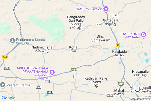
Kona is a Village in Kalakada Mandal in Chittoor District of Andhra Pradesh State, India. It belongs to Rayalaseema region . It is located 93 KM towards North from District head quarters Chittoor. 2 KM from Kalakada. 463 KM from State capital Hyderabad
Kona Pin code is 517236 and postal head office is Kalakada .
Devalapalle ( 1 KM ) , Nadimicherla ( 5 KM ) , Gangapuram ( 6 KM ) , Yerrakotapalle ( 6 KM ) , Kalakada ( 7 KM ) are the nearby Villages to Kona. Kona is surrounded by Chinnamandem Mandal towards North , Sambepalle Mandal towards North , Gurramkonda Mandal towards west , Kalikiri Mandal towards South .
Rayachoti , Madanapalle , Punganur , Kadiri are the near by Cities to Kona.
This Place is in the border of the Chittoor District and Cuddapah District. Cuddapah District Sambepalle is North towards this place .
Kona 2011 Census Details
Kona Local Language is Telugu. Kona Village Total population is 2972 and number of houses are 811. Female Population is 51.0%. Village literacy rate is 56.5% and the Female Literacy rate is 24.9%.
Population
| Census Parameter | Census Data |
| Total Population | 2972 |
| Total No of Houses | 811 |
| Female Population % | 51.0 % ( 1515) |
| Total Literacy rate % | 56.5 % ( 1678) |
| Female Literacy rate | 24.9 % ( 740) |
| Scheduled Tribes Population % | 1.2 % ( 35) |
| Scheduled Caste Population % | 11.1 % ( 329) |
| Working Population % | 65.5 % |
| Child(0 -6) Population by 2011 | 310 |
| Girl Child(0 -6) Population % by 2011 | 46.8 % ( 145) |
Kona Census More Deatils.
HOW TO REACH Kona
By Road
Tirupati is the Nearest Town to Kona. Tirupati is 100 km from Kona. Road connectivity is there from Tirupati to Kona.By Rail
There is no railway station near to Kona in less than 10 km. How ever there are railway Stations from Near By town Tirupati. are the railway Stations near to Tirupati. You can reach from Tirupati to Kona by road after .By Bus
Kalakada APSRTC Bus Station , Chinthaparthi APSRTC Bus Station , Kalikiri APSRTC Bus Station are the nearby by Bus Stations to Kona .APSRTC runs Number of busses from major cities to here.Colleges near Kona
Govt Junior College KalakadaSchools in Kona
Zphs KonaGovt Health Centers near Kona
1) K DODDIPALLI , 0 , K Doddipalli , Beside School2) NADIMICHERLA , 0 , Nadimicherla , Temple Street
3) Errakotapalli , 0 , Papireddygaripalli , PHC Road
Sub Villages in Kona
Petrol Bunks in Kona,Kalakada
HP PETROL PUMP - SRI SAI GANESH FILLING STATION
Hpcl Dealers Rayachoty-madanapalle Road Chinnamandem; Kadapa; Andhra Pradesh 516214; India
17.3 KM distance Detail
more ..
Colleges in Kona,Kalakada
Indira D.Ed & B.Ed College
NH 340; Vandati; Madanapalle; Andhra Pradesh 517325; India
23.4 KM distance Detail
more ..
Schools in Kona,Kalakada
reddyvari palli govt up school
devaptla; Reddy Vari Palli; Andhra Pradesh; India
10.2 KM distance Detail
Super Markets in Kona,Kalakada
Ameen Mango Farm
Devapatla mitta; Sambepalli mandal; Andhra Pradesh 516215; India
13.3 KM distance Detail
Governement Offices near Kona,Kalakada
MeeSeva Center
H No.4/74;Main Road; Devapatla;Sambepallil; Y S R Kadapa.; Devapatla; Andhra Pradesh 516215; India
11.3 KM distance Detail
MeeSeva Center
Sri Vinayaka Studio; Busstand; Beside SBI ATM; Chinnamandem; 6/106-1; Chinnamandem; Andhra Pradesh 516214; India
15.6 KM distance Detail
How to reach Kona
Tourist Places Near By Kona
Schools in Kona
Colleges in Kona
Temperature & weather of Kona
places in Kona
Kona photos
More Information
Village Talk
Post News or Events about this Village
Rayachoti 28 KM near
Madanapalle 44 KM near
Punganur 60 KM near
Kadiri 77 KM near
Kalakada 1 KM near
Chinnamandem 15 KM near
Sambepalle 15 KM near
Gurramkonda 17 KM near
Tirupati Airport 101 KM near
Bengaluru International Airport 146 KM near
Chennai Airport 203 KM near
Salem Airport 279 KM near
Horsley Hills 46 KM near
Kadapa 80 KM near
Tirupati 87 KM near
Chittoor 88 KM near
Srikalahasti 117 KM near
Cuddapah 79 KM near
Chittoor 88 KM near
Kolar 112 KM near
Vellore 124 KM near
Madanapalle Road Rail Way Station 31 KM near
Piler Rail Way Station 31 KM near