| Home | City Bus | Maps | Villages | Cities | Rail | Tourist Places | School | College | Pin Codes | Corona Cases Count |
| Distance Calculator Bus Services IFSC Codes Trace Mobile Number Weather Search Place Trace IP Available Cash ATM/Banks Locate Polling Booth Report an Error contact People |
Kothakota
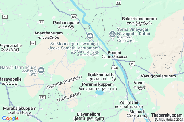
Kothakota Map
EDIT Map
Add Your House
 ..
..
Current Corona Virus Infected Patients Count in Chittoor District
| City Name | District Name | Total Covid cases |
|---|---|---|
| Chittoor District | Chittoor | 59 |
| Thyagaraja Nagar,Tirupathi | Chittoor | 3 |
| Srikalahasti | Chittoor | 3 |
| Nagiri | Chittoor | 2 |
| Chinna Masjid | Chittoor | 1 |
| Keelapattu nagari | Chittoor | 1 |
| Renigunta | Chittoor | 1 |
| Vadamalapeta | Chittoor | 1 |
| Tirupati | Chittoor | 1 |
| Nindra | Chittoor | 1 |
Locality Name :
Kothakota
( కొత్తకోట )
Mandal Name : Gudipala
District : Chittoor
State : Andhra Pradesh
Region : Rayalaseema
Language : Telugu and Urdu
Current Time 12:11 PM
Date: Tuesday , Apr 29,2025 (IST)
Time zone: IST (UTC+5:30)
Elevation / Altitude: 300 meters. Above Seal level
Telephone Code / Std Code: 08572
Assembly constituency : assembly constituency
Assembly MLA : Aranii Srenevasulu (Jangalapalli)
Lok Sabha constituency : parliamentary constituency
Parliament MP :
Serpanch Name :
Pin Code : 517403
Post Office Name : Ramapuram (Chittoor)
Main Village Name : Naragallu
Alternate Village Name : Kothakota Hw
Commodities Prices : Chittoor Market / Mandi
Kothakota Live Weather
Temperature: 34.9 °C
broken clouds
Humidity: 35%
Wind : 3.32 mt/sec towards SE
StationName : "RÄ\u0081mÄ\u0081puram"
observed on 50 Mins Back
Temperature: 34.9 °C
broken clouds
Humidity: 35%
Wind : 3.32 mt/sec towards SE
StationName : "RÄ\u0081mÄ\u0081puram"
observed on 50 Mins Back
Kothakota Weather Forecast for Next 5 days
30-04-2025
26.1°C to 38.2°C
broken clouds, overcast clouds
26.1°C to 38.2°C
broken clouds, overcast clouds
01-05-2025
25.1°C to 39.0°C
scattered clouds, broken clouds
25.1°C to 39.0°C
scattered clouds, broken clouds
02-05-2025
27.0°C to 41.1°C
light rain, broken clouds, overcast clouds, moderate rain
27.0°C to 41.1°C
light rain, broken clouds, overcast clouds, moderate rain
03-05-2025
26.8°C to 40.5°C
overcast clouds, broken clouds, scattered clouds, clear sky
26.8°C to 40.5°C
overcast clouds, broken clouds, scattered clouds, clear sky
04-05-2025
27.4°C to 41.3°C
scattered clouds, few clouds, clear sky, light rain, overcast clouds
27.4°C to 41.3°C
scattered clouds, few clouds, clear sky, light rain, overcast clouds
National Highways Reachable To Kothakota
Nationa High Way :NH69
Nationa High Way :NH42
Nationa High Way :NH69
Nationa High Way :NH42
Rivers Near Kothakota
Kortalaiyar :Kosasthalaiyar River
Kaundinya Mahanadhi :Koundinya :ಕೌಂಡಿನ್ಯ
Kortalaiyar :Kosasthalaiyar River
Kaundinya Mahanadhi :Koundinya :ಕೌಂಡಿನ್ಯ
About Kothakota
Correct below Info and add more info about KothakotaKothakota is a small Village/hamlet in Gudipala Mandal in Chittoor District of Andhra Pradesh State, India. It comes under Naragallu Panchayath. It belongs to Rayalaseema region . It is located 20 KM towards East from District head quarters Chittoor. 11 KM from Gudipala. 562 KM from State capital Hyderabad
Kothakota Pin code is 517403 and postal head office is Ramapuram (Chittoor).
Kothakota is surrounded by Gangadhara Nellore Mandal towards North , Chittoor Mandal towards west , Sholinghur Mandal towards East , Katpadi Mandal towards South .
Chittoor , Sholingur , Vellore , Arcot are the near by Cities to Kothakota.
This Place is in the border of the Chittoor District and Vellore District. Vellore District Katpadi is South towards this place . It is near to the Tamil Nadu State Border.
Demographics of Kothakota
Telugu is the Local Language here. Total population of Kothakota is 1624 .Males are 818 and Females are 806 living in 358 Houses. Total area of Kothakota is 1983 hectares.HOW TO REACH Kothakota
By Road
Chittoor is the Nearest Town to Kothakota. Chittoor is 14 km from Kothakota. Road connectivity is there from Chittoor to Kothakota.By Rail
Ramapuram Rail Way Station , Peyanapalli Rail Way Station are the very nearby railway stations to Kothakota. Also you can consider railway Stations from Near By town Chittoor. Chittoor Rail Way Station , Siddampalli Rail Way Station are the railway Stations near to Chittoor. You can reach from Chittoor to Kothakota by road after .By Bus
Chittoor APSRTC Bus Station , Vellore APSRTC Bus Station , Putalpattu APSRTC Bus Station are the nearby by Bus Stations to Kothakota .APSRTC runs Number of busses from major cities to here.Colleges near Kothakota
Govt Junior College Bommasamudram
Address : Govt Junior College Bommasamudram
Sri Lakshmi Narasimha College Of Pharmacy
Address : , Gudipala, Palluru, Chittoor Dist.,
Schools in Kothakota
Mpps Naragallu H.w
Address : naragallu , gudipala , chittoor , Andhra Pradesh . PIN- 517403 , Post - Ramapuram (Chittoor)
Mpps Kotha Kota H.w
Address : naragallu , gudipala , chittoor , Andhra Pradesh . PIN- 517403 , Post - Ramapuram (Chittoor)
Mpps Kotha Kota
Address : naragallu , gudipala , chittoor , Andhra Pradesh . PIN- 517403 , Post - Ramapuram (Chittoor)
Mpps Naragallu
Address : naragallu , gudipala , chittoor , Andhra Pradesh . PIN- 517403 , Post - Ramapuram (Chittoor)
Govt Health Centers near Kothakota
1) 197 RAMAPURAM , , 197 RAMAPURAM , NEAR TEMPLE2) A L PURAM , , A L PURAM , NEAR TEMPLE
3) N R PET , 3-Jan , TEMPLE STREET , NEAR ITI
Colleges in Kothakota,Gudipala
S.V Junior College Kothapalli Mitta
Kotha Palli Mitta; Andhra Pradesh 517167; India
22.9 KM distance Detail
more ..
Schools in Kothakota,Gudipala
MPP School; Gollakandiga
Gollakandiga(Vi); (PO); Palasamudram(Mandal); (Dist); 517421; Amudala; Andhra Pradesh; India
14.1 KM distance Detail
Tirumala Raju Puram High School
Thirumalarajupuram; Andhra Pradesh 631302; India
15.4 KM distance Detail
MPP Government School Varadaraja Puram
Varadaraja Puram; Gangadhara Nellore; Chittoor District; Varathur; Andhra Pradesh 517421; India
17.2 KM distance Detail
Electronic Shops in Kothakota,Gudipala
SRI ANJINEYA FASHION STUDIO
BAZZAR STREET; 49 KOTHAPALLI MITTA;S R PURAM MANDAL;CHITTOOR DIST; Andhra Pradesh 517167; India
22.7 KM distance Detail
Sri Lakshmi Ganapathi Mobile Shop
Kotha Palli Mitta; Andhra Pradesh 517167; India
22.8 KM distance Detail
Super Markets in Kothakota,Gudipala
Local Parks in Kothakota,Gudipala
Ss Konda Cricket Ground Thulasiram Reddy
Vinjam; Andhra Pradesh 517421; India
18.5 KM distance Detail
Police Stations near Kothakota,Gudipala
Governement Offices near Kothakota,Gudipala
About Kothakota &
History
How to reach Kothakota
Tourist Places Near By Kothakota
Schools in Kothakota
Colleges in Kothakota
Temperature & weather of Kothakota
places in Kothakota
Kothakota photos
More Information
How to reach Kothakota
Tourist Places Near By Kothakota
Schools in Kothakota
Colleges in Kothakota
Temperature & weather of Kothakota
places in Kothakota
Kothakota photos
More Information
Village Talk
Post News or Events about this Village
Near Cities
Chittoor 21 KM near
Sholingur 23 KM near
Vellore 28 KM near
Arcot 29 KM near
Chittoor 21 KM near
Sholingur 23 KM near
Vellore 28 KM near
Arcot 29 KM near
Near By Taluks
Gudipala 11 KM near
Gangadhara Nellore 12 KM near
Sholinghur 17 KM near
Chittoor 18 KM near
Gudipala 11 KM near
Gangadhara Nellore 12 KM near
Sholinghur 17 KM near
Chittoor 18 KM near
Near By Air Ports
Tirupati Airport 74 KM near
Chennai Airport 114 KM near
Bengaluru International Airport 185 KM near
Salem Airport 224 KM near
Tirupati Airport 74 KM near
Chennai Airport 114 KM near
Bengaluru International Airport 185 KM near
Salem Airport 224 KM near
Near By Tourist Places
Chittoor 19 KM near
vellore 27 KM near
Thiruthani 47 KM near
Kanchipuram 67 KM near
Tirupati 67 KM near
Chittoor 19 KM near
vellore 27 KM near
Thiruthani 47 KM near
Kanchipuram 67 KM near
Tirupati 67 KM near
Near By Districts
Chittoor 20 KM near
Vellore 28 KM near
Kanchipuram 66 KM near
Thiruvallur 82 KM near
Chittoor 20 KM near
Vellore 28 KM near
Kanchipuram 66 KM near
Thiruvallur 82 KM near
Near By RailWay Station
Ramapuram Rail Way Station 7.0 KM near
Mukundarayapuram Rail Way Station 19 KM near
Chittoor Rail Way Station 19 KM near
Ramapuram Rail Way Station 7.0 KM near
Mukundarayapuram Rail Way Station 19 KM near
Chittoor Rail Way Station 19 KM near