| Home | City Bus | Maps | Villages | Cities | Rail | Tourist Places | School | College | Pin Codes | Corona Cases Count |
| Distance Calculator Bus Services IFSC Codes Trace Mobile Number Weather Search Place Trace IP Available Cash ATM/Banks Locate Polling Booth Report an Error contact People |
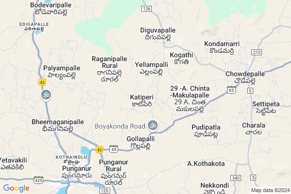
Girijapuram
Girijapuram Map
EDIT Map
Add Your House
 ..
..
Current Corona Virus Infected Patients Count in Chittoor District
| City Name | District Name | Total Covid cases |
|---|---|---|
| Chittoor District | Chittoor | 59 |
| Srikalahasti | Chittoor | 3 |
| Thyagaraja Nagar,Tirupathi | Chittoor | 3 |
| Nagiri | Chittoor | 2 |
| Renigunta | Chittoor | 1 |
| Vadamalapeta | Chittoor | 1 |
| Tirupati | Chittoor | 1 |
| Nindra | Chittoor | 1 |
| Chinna Masjid | Chittoor | 1 |
| Keelapattu nagari | Chittoor | 1 |
Locality Name :
Girijapuram
( గిరిజపురం )
Mandal Name : Chowdepalle
District : Chittoor
State : Andhra Pradesh
Region : Rayalaseema
Language : Telugu and Urdu
Current Time 12:28 PM
Date: Friday , Mar 14,2025 (IST)
Time zone: IST (UTC+5:30)
Elevation / Altitude: 596 meters. Above Seal level
Telephone Code / Std Code: 08581
Assembly constituency : assembly constituency
Assembly MLA : PEDDIREDDI RAMACHANDRA REDDY
Lok Sabha constituency : parliamentary constituency
Parliament MP : P.V.MIDHUN REDDY
Serpanch Name :
Pin Code : 517247
Post Office Name : Punganur
Main Village Name : Katiperi
Commodities Prices : Vayalapadu Market / Mandi
Girijapuram Live Weather
Temperature: 31.1 °C
broken clouds
Humidity: 22%
Wind : 4.36 mt/sec towards E
StationName : "Punganūru"
observed on 2 Hours Back
Temperature: 31.1 °C
broken clouds
Humidity: 22%
Wind : 4.36 mt/sec towards E
StationName : "Punganūru"
observed on 2 Hours Back
Girijapuram Weather Forecast for Next 5 days
15-03-2025
20.6°C to 34.0°C
broken clouds, scattered clouds, clear sky
20.6°C to 34.0°C
broken clouds, scattered clouds, clear sky
16-03-2025
20.1°C to 34.2°C
few clouds, clear sky, scattered clouds, overcast clouds, broken clouds
20.1°C to 34.2°C
few clouds, clear sky, scattered clouds, overcast clouds, broken clouds
17-03-2025
19.5°C to 34.8°C
clear sky, few clouds, scattered clouds
19.5°C to 34.8°C
clear sky, few clouds, scattered clouds
18-03-2025
19.7°C to 35.7°C
broken clouds, overcast clouds, clear sky
19.7°C to 35.7°C
broken clouds, overcast clouds, clear sky
19-03-2025
20.3°C to 36.0°C
few clouds, broken clouds, scattered clouds
20.3°C to 36.0°C
few clouds, broken clouds, scattered clouds
National Highways Reachable To Girijapuram
Nationa High Way :NH42
Nationa High Way :NH42
Rivers Near Girijapuram
Pedda Vanka
Kushalavati :ಕುಶಲಾವತಿ
Pedda Vanka
Kushalavati :ಕುಶಲಾವತಿ
About Girijapuram
Correct below Info and add more info about GirijapuramGirijapuram is a small Village/hamlet in Chowdepalle Mandal in Chittoor District of Andhra Pradesh State, India. It comes under Katiperi Panchayath. It belongs to Rayalaseema region . It is located 65 KM towards west from District head quarters Chittoor. 9 KM from Chowdepalle. 516 KM from State capital Hyderabad
Girijapuram Pin code is 517247 and postal head office is Punganur .
Girijapuram is surrounded by Punganur Mandal towards South , Peddapanjani Mandal towards South , Nimmanapalle Mandal towards North , Madanapalle Mandal towards North .
Punganur , Madanapalle , Mulbagal , Srinivaspur are the near by Cities to Girijapuram.
Demographics of Girijapuram
Telugu is the Local Language here. Total population of Girijapuram is 2083 .Males are 1020 and Females are 1,063 living in 460 Houses. Total area of Girijapuram is 1206 hectares.HOW TO REACH Girijapuram
By Road
Punganur is the Nearest Town to Girijapuram. Punganur is 10 km from Girijapuram. Road connectivity is there from Punganur to Girijapuram.By Rail
There is no railway station near to Girijapuram in less than 10 km.By Bus
Punganur APSRTC Bus Station , Choudpally APSRTC Bus Station , Madanapally APSRTC Bus Station are the nearby by Bus Stations to Girijapuram .APSRTC runs Number of busses from major cities to here.Colleges near Girijapuram
Vani Jr College V.kota Chittoor
Address : Behind Mpdo Office
durga Nagar V.kota
Sri Muninarayana Junior College
Address :
Sree Vidya Arts & Science Degree College.
Address :
Priyadarshini
Address :
Amaravathi Degree College. Ramasamudram
Address : Amaravathi Degree College Ramasamudram
Schools in Girijapuram
Zphs Katiperi
Address : katiperi , chowdepalle , chittoor , Andhra Pradesh . PIN- 517247 , Post - Punganur
Govt Health Centers near Girijapuram
1) KATIPERI , 01-46/A , , Beside Of Anganwadi centre2) CHADALLA , , ,
3) Mudipapanapalli , , , RAGANIPALLI PANCHAYAT
Schools in Girijapuram,Chowdepalle
Electronic Shops in Girijapuram,Chowdepalle
Super Markets in Girijapuram,Chowdepalle
Local Parks in Girijapuram,Chowdepalle
Police Stations near Girijapuram,Chowdepalle
Governement Offices near Girijapuram,Chowdepalle
About Girijapuram &
History
How to reach Girijapuram
Tourist Places Near By Girijapuram
Schools in Girijapuram
Colleges in Girijapuram
Temperature & weather of Girijapuram
places in Girijapuram
Girijapuram photos
More Information
How to reach Girijapuram
Tourist Places Near By Girijapuram
Schools in Girijapuram
Colleges in Girijapuram
Temperature & weather of Girijapuram
places in Girijapuram
Girijapuram photos
More Information
Village Talk
Post News or Events about this Village
Near Cities
Punganur 8 KM near
Madanapalle 22 KM near
Mulbagal 41 KM near
Srinivaspur 48 KM near
Punganur 8 KM near
Madanapalle 22 KM near
Mulbagal 41 KM near
Srinivaspur 48 KM near
Near By Taluks
Chowdepalle 8 KM near
Punganur 9 KM near
Nimmanapalle 16 KM near
Peddapanjani 16 KM near
Chowdepalle 8 KM near
Punganur 9 KM near
Nimmanapalle 16 KM near
Peddapanjani 16 KM near
Near By Air Ports
Bengaluru International Airport 114 KM near
Tirupati Airport 114 KM near
Chennai Airport 194 KM near
Salem Airport 227 KM near
Bengaluru International Airport 114 KM near
Tirupati Airport 114 KM near
Chennai Airport 194 KM near
Salem Airport 227 KM near
Near By Tourist Places
Horsley Hills 39 KM near
Chittoor 63 KM near
vellore 88 KM near
Tirupati 100 KM near
Yelagiri 105 KM near
Horsley Hills 39 KM near
Chittoor 63 KM near
vellore 88 KM near
Tirupati 100 KM near
Yelagiri 105 KM near
Near By Districts
Chittoor 62 KM near
Kolar 68 KM near
Vellore 88 KM near
Chikballapur 108 KM near
Chittoor 62 KM near
Kolar 68 KM near
Vellore 88 KM near
Chikballapur 108 KM near
Near By RailWay Station
Madanapalle Road Rail Way Station 28 KM near
Piler Rail Way Station 47 KM near
Madanapalle Road Rail Way Station 28 KM near
Piler Rail Way Station 47 KM near