| Home | City Bus | Maps | Villages | Cities | Rail | Tourist Places | School | College | Pin Codes | Corona Cases Count |
| Distance Calculator Bus Services IFSC Codes Trace Mobile Number Weather Search Place Trace IP Available Cash ATM/Banks Locate Polling Booth Report an Error contact People |
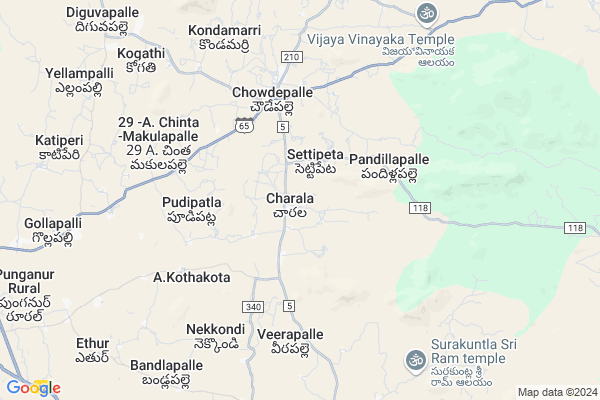
Charala
Charala Map
EDIT Map
Add Your House
 ..
..
Current Corona Virus Infected Patients Count in Chittoor District
| City Name | District Name | Total Covid cases |
|---|---|---|
| Chittoor District | Chittoor | 59 |
| Thyagaraja Nagar,Tirupathi | Chittoor | 3 |
| Srikalahasti | Chittoor | 3 |
| Nagiri | Chittoor | 2 |
| Keelapattu nagari | Chittoor | 1 |
| Renigunta | Chittoor | 1 |
| Vadamalapeta | Chittoor | 1 |
| Tirupati | Chittoor | 1 |
| Nindra | Chittoor | 1 |
| Chinna Masjid | Chittoor | 1 |
Locality Name :
Charala
( చారల )
Mandal Name : Chowdepalle
District : Chittoor
State : Andhra Pradesh
Region : Rayalaseema
Language : Telugu and Urdu
Current Time 11:36 AM
Date: Sunday , Apr 27,2025 (IST)
Time zone: IST (UTC+5:30)
Elevation / Altitude: 596 meters. Above Seal level
Telephone Code / Std Code: 08581
Assembly constituency : assembly constituency
Assembly MLA : PEDDIREDDI RAMACHANDRA REDDY
Lok Sabha constituency : parliamentary constituency
Parliament MP : P.V.MIDHUN REDDY
Serpanch Name :
Pin Code : 517257
Post Office Name : Chowdepalle
Alternate Village Name : Charala C J F SColony
Commodities Prices : Vayalapadu Market / Mandi
National Highways Reachable To Charala
Nationa High Way :NH42
Nationa High Way :NH42
Rivers Near Charala
Pedda Vanka
Kushalavati :ಕುಶಲಾವತಿ
Pedda Vanka
Kushalavati :ಕುಶಲಾವತಿ
About Charala
Correct below Info and add more info about CharalaCharala is a Village in Chowdepalle Mandal in Chittoor District of Andhra Pradesh State, India. It belongs to Rayalaseema region . It is located 55 KM towards west from District head quarters Chittoor. 2 KM from Chowdepalle. 519 KM from State capital Hyderabad
Charala Pin code is 517257 and postal head office is Chowdepalle .
Settipeta ( 2 KM ) , Pandillapalle ( 4 KM ) , Chowdepalle ( 5 KM ) , A. Kothakota ( 5 KM ) , Veerapalle ( 5 KM ) are the nearby Villages to Charala. Charala is surrounded by Peddapanjani Mandal towards South , Punganur Mandal towards west , Nimmanapalle Mandal towards North , Somala Mandal towards East .
Punganur , Madanapalle , Mulbagal , Chittoor are the near by Cities to Charala.
Charala 2011 Census Details
Charala Local Language is Telugu. Charala Village Total population is 2437 and number of houses are 640. Female Population is 50.0%. Village literacy rate is 63.6% and the Female Literacy rate is 27.5%.
Population
| Census Parameter | Census Data |
| Total Population | 2437 |
| Total No of Houses | 640 |
| Female Population % | 50.0 % ( 1219) |
| Total Literacy rate % | 63.6 % ( 1549) |
| Female Literacy rate | 27.5 % ( 669) |
| Scheduled Tribes Population % | 0.0 % ( 1) |
| Scheduled Caste Population % | 26.7 % ( 650) |
| Working Population % | 57.5 % |
| Child(0 -6) Population by 2011 | 258 |
| Girl Child(0 -6) Population % by 2011 | 45.3 % ( 117) |
Charala Census More Deatils.
HOW TO REACH Charala
By Road
Punganur is the Nearest Town to Charala. Punganur is 20 km from Charala. Road connectivity is there from Punganur to Charala.By Rail
There is no railway station near to Charala in less than 10 km.By Bus
Choudpally APSRTC Bus Station , Punganur APSRTC Bus Station , Somala APSRTC Bus Station are the nearby by Bus Stations to Charala .APSRTC runs Number of busses from major cities to here.Colleges near Charala
Vani Jr College V.kota Chittoor
Address : Behind Mpdo Office
durga Nagar V.kota
Sri Muninarayana Junior College
Address :
Sree Vidya Arts & Science Degree College.
Address :
Priyadarshini
Address :
Amaravathi Degree College. Ramasamudram
Address : Amaravathi Degree College Ramasamudram
Schools in Charala
Zphs Charala
Address : charala , chowdepalle , chittoor , Andhra Pradesh . PIN- 517257 , Post - Chowdepalle
Govt Health Centers near Charala
1) SETTYPETA , , Near Primary school , SETTIPETA2) CHOWDEPALLE , 2-125 , MAIN ROAD , bus stop
3) CHOWDEPALLI , 2-122 , MAIN ROAD , Tirupathi road
Sub Villages in Charala
Schools in Charala,Chowdepalle
Electronic Shops in Charala,Chowdepalle
Super Markets in Charala,Chowdepalle
Local Parks in Charala,Chowdepalle
Police Stations near Charala,Chowdepalle
Governement Offices near Charala,Chowdepalle
About Charala &
History
How to reach Charala
Tourist Places Near By Charala
Schools in Charala
Colleges in Charala
Temperature & weather of Charala
places in Charala
Charala photos
More Information
How to reach Charala
Tourist Places Near By Charala
Schools in Charala
Colleges in Charala
Temperature & weather of Charala
places in Charala
Charala photos
More Information
Village Talk
Post News or Events about this Village
Near Cities
Punganur 15 KM near
Madanapalle 30 KM near
Mulbagal 47 KM near
Chittoor 51 KM near
Punganur 15 KM near
Madanapalle 30 KM near
Mulbagal 47 KM near
Chittoor 51 KM near
Near By Taluks
Chowdepalle 1 KM near
Peddapanjani 13 KM near
Punganur 16 KM near
Somala 19 KM near
Chowdepalle 1 KM near
Peddapanjani 13 KM near
Punganur 16 KM near
Somala 19 KM near
Near By Air Ports
Tirupati Airport 106 KM near
Bengaluru International Airport 123 KM near
Chennai Airport 184 KM near
Salem Airport 227 KM near
Tirupati Airport 106 KM near
Bengaluru International Airport 123 KM near
Chennai Airport 184 KM near
Salem Airport 227 KM near
Near By Tourist Places
Horsley Hills 48 KM near
Chittoor 53 KM near
vellore 79 KM near
Tirupati 91 KM near
Yelagiri 103 KM near
Horsley Hills 48 KM near
Chittoor 53 KM near
vellore 79 KM near
Tirupati 91 KM near
Yelagiri 103 KM near
Near By Districts
Chittoor 52 KM near
Kolar 76 KM near
Vellore 80 KM near
Chikballapur 117 KM near
Chittoor 52 KM near
Kolar 76 KM near
Vellore 80 KM near
Chikballapur 117 KM near
Near By RailWay Station
Madanapalle Road Rail Way Station 35 KM near
Piler Rail Way Station 42 KM near
Madanapalle Road Rail Way Station 35 KM near
Piler Rail Way Station 42 KM near