| Home | City Bus | Maps | Villages | Cities | Rail | Tourist Places | School | College | Pin Codes | Corona Cases Count |
| Distance Calculator Bus Services IFSC Codes Trace Mobile Number Weather Search Place Trace IP Available Cash ATM/Banks Locate Polling Booth Report an Error contact People |
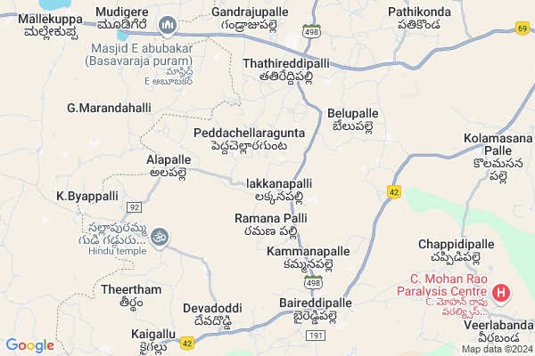
Ramanapalle
Ramanapalle Map
EDIT Map
Add Your House
 ..
..
Current Corona Virus Infected Patients Count in Chittoor District
| City Name | District Name | Total Covid cases |
|---|---|---|
| Chittoor District | Chittoor | 59 |
| Thyagaraja Nagar,Tirupathi | Chittoor | 3 |
| Srikalahasti | Chittoor | 3 |
| Nagiri | Chittoor | 2 |
| Chinna Masjid | Chittoor | 1 |
| Keelapattu nagari | Chittoor | 1 |
| Renigunta | Chittoor | 1 |
| Vadamalapeta | Chittoor | 1 |
| Tirupati | Chittoor | 1 |
| Nindra | Chittoor | 1 |
Locality Name :
Ramanapalle
( రామనాపల్లె )
Mandal Name : Baireddipalle
District : Chittoor
State : Andhra Pradesh
Region : Rayalaseema
Language : Telugu and Urdu
Current Time 04:41 PM
Date: Monday , Apr 28,2025 (IST)
Time zone: IST (UTC+5:30)
Elevation / Altitude: 769 meters. Above Seal level
Telephone Code / Std Code: 08587
Assembly constituency : assembly constituency
Assembly MLA : N VENKATE GOWDA
Lok Sabha constituency : parliamentary constituency
Parliament MP :
Serpanch Name :
Pin Code : 517415
Post Office Name : Baireddipalle
Main Village Name : Lakkanapalle
Commodities Prices : Mulabagilu Market / Mandi
Ramanapalle Live Weather
Temperature: 34.4 °C
broken clouds
Humidity: 31%
Wind : 6.07 mt/sec towards E
StationName : "Palmaner"
observed on 1 Hours Back
Temperature: 34.4 °C
broken clouds
Humidity: 31%
Wind : 6.07 mt/sec towards E
StationName : "Palmaner"
observed on 1 Hours Back
Ramanapalle Weather Forecast for Next 5 days
29-04-2025
23.7°C to 34.3°C
broken clouds, overcast clouds
23.7°C to 34.3°C
broken clouds, overcast clouds
30-04-2025
22.1°C to 36.8°C
overcast clouds, broken clouds
22.1°C to 36.8°C
overcast clouds, broken clouds
01-05-2025
23.3°C to 38.3°C
broken clouds, overcast clouds, scattered clouds, light rain
23.3°C to 38.3°C
broken clouds, overcast clouds, scattered clouds, light rain
02-05-2025
25.2°C to 37.2°C
overcast clouds, broken clouds, scattered clouds, light rain
25.2°C to 37.2°C
overcast clouds, broken clouds, scattered clouds, light rain
03-05-2025
24.5°C to 38.3°C
broken clouds, few clouds, clear sky, scattered clouds, light rain, overcast clouds
24.5°C to 38.3°C
broken clouds, few clouds, clear sky, scattered clouds, light rain, overcast clouds
National Highways Reachable To Ramanapalle
Nationa High Way :NH69
Nationa High Way :NH75
Nationa High Way :NH69
Nationa High Way :NH75
Rivers Near Ramanapalle
Palar :ಪಾಲಾರ್ :பாலா
Kaundinya Mahanadhi :Koundinya :ಕೌಂಡಿನ್ಯ
Palar :ಪಾಲಾರ್ :பாலா
Kaundinya Mahanadhi :Koundinya :ಕೌಂಡಿನ್ಯ
About Ramanapalle
Correct below Info and add more info about RamanapalleRamanapalle is a small Village/hamlet in Baireddipalle Mandal in Chittoor District of Andhra Pradesh State, India. It comes under Lakkanapalle Panchayath. It belongs to Rayalaseema region . It is located 63 KM towards west from District head quarters Chittoor. 5 KM from Baireddipalle. 552 KM from State capital Hyderabad
Ramanapalle Pin code is 517415 and postal head office is Baireddipalle .
Ramanapalle is surrounded by Palamaner Mandal towards East , Gangavaram Mandal towards North , Mulbagal Mandal towards west , Peddapanjani Mandal towards North .
Mulbagal , Punganur , Pernampattu , Robertson Pet are the near by Cities to Ramanapalle.
This Place is in the border of the Chittoor District and Kolar District. Kolar District Mulbagal is west towards this place . It is near to the Karnataka State Border.
Demographics of Ramanapalle
Telugu is the Local Language here. Total population of Ramanapalle is 2969 .Males are 1499 and Females are 1,470 living in 554 Houses. Total area of Ramanapalle is 566 hectares.HOW TO REACH Ramanapalle
By Road
Chittoor is the Nearest Town to Ramanapalle. Chittoor is 68 km from Ramanapalle. Road connectivity is there from Chittoor to Ramanapalle.By Rail
There is no railway station near to Ramanapalle in less than 10 km. How ever there are railway Stations from Near By town Chittoor. are the railway Stations near to Chittoor. You can reach from Chittoor to Ramanapalle by road after .By Bus
Bai Reddy Pally APSRTC Bus Station , Bireddypally APSRTC Bus Station , Palamaneru APSRTC Bus Station are the nearby by Bus Stations to Ramanapalle .APSRTC runs Number of busses from major cities to here.Colleges near Ramanapalle
Vani Jr College V.kota Chittoor
Address : Behind Mpdo Office
durga Nagar V.kota
Sri Muninarayana Junior College
Address :
Sree Vidya Arts & Science Degree College.
Address :
Priyadarshini
Address :
Amaravathi Degree College. Ramasamudram
Address : Amaravathi Degree College Ramasamudram
Schools in Ramanapalle
Zphs Lakkanapalle.
Address : lakkanapalle , baireddypalle , chittoor , Andhra Pradesh . PIN- 517415 , Post - Baireddipalle
Govt Health Centers near Ramanapalle
1) C C GUNTA , , C.C. GUNTA , C.C.GUNTA2) LAKKANAPALLI , , Main Road , LAKKANAPALLI
3) BELUPALLI , , mainroad , Near School
Petrol Bunks in Ramanapalle,Baireddipalle
AGASTI HP PETROL BUNK
Punganur-Baireddipalle Rd; Kammanapalle; Andhra Pradesh 517415; India
5.7 KM distance Detail
Sri Sesha Sai Traders; Ksk Indian Oil Petrol Bunk;
Kammanapalle; Andhra Pradesh 517415; India
5.8 KM distance Detail
HP PETROL PUMP - AGASTHI PETROL BUNK
HPC Dealers Sy.no.17.2a2;punganur-baireddypalli Road Baireddypalli(p); Andhra Pradesh 517415; India
6.3 KM distance Detail
more ..
Colleges in Ramanapalle,Baireddipalle
LRS Palamaner AH Polytechnic College
Krishnagiri-Palamaner Hwy; Andhra Pradesh 517432; India
15.4 KM distance Detail
LRS Palamaner AHP Girls Hostel
Krishnagiri-Palamaner Hwy; Andhra Pradesh 517432; India
15.4 KM distance Detail
more ..
Electronic Shops in Ramanapalle,Baireddipalle
rajeshcellpoint
main road;baireddipalle; Baireddipalle; Andhra Pradesh 517415; India
6.7 KM distance Detail
SNR tyres&service
Krishnagiri-Palamaner Hwy; Baireddipalle; Andhra Pradesh 517415; India
6.7 KM distance Detail
SNR service station
Krishnagiri-Palamaner Hwy; Baireddipalle; Andhra Pradesh 517415; India
6.8 KM distance Detail
Local Parks in Ramanapalle,Baireddipalle
sreenivasulureddy mango garden
Punganur-Baireddipalle Rd; Settipalle; Andhra Pradesh 517506; India
2.1 KM distance Detail
Governement Offices near Ramanapalle,Baireddipalle
Thathireddipalli
sandeep bredar forms; thathireddipalli(village); Gandrajupalli(post) Baireddipalli;; Chittoor; Andhra Pradesh; India
6.4 KM distance Detail
About Ramanapalle &
History
How to reach Ramanapalle
Tourist Places Near By Ramanapalle
Schools in Ramanapalle
Colleges in Ramanapalle
Temperature & weather of Ramanapalle
places in Ramanapalle
Ramanapalle photos
More Information
How to reach Ramanapalle
Tourist Places Near By Ramanapalle
Schools in Ramanapalle
Colleges in Ramanapalle
Temperature & weather of Ramanapalle
places in Ramanapalle
Ramanapalle photos
More Information
Village Talk
Post News or Events about this Village
Near Cities
Mulbagal 24 KM near
Punganur 28 KM near
Pernampattu 30 KM near
Robertson Pet 44 KM near
Mulbagal 24 KM near
Punganur 28 KM near
Pernampattu 30 KM near
Robertson Pet 44 KM near
Near By Taluks
Baireddipalle 5 KM near
Palamaner 17 KM near
Gangavaram 17 KM near
Mulbagal 18 KM near
Baireddipalle 5 KM near
Palamaner 17 KM near
Gangavaram 17 KM near
Mulbagal 18 KM near
Near By Air Ports
Bengaluru International Airport 107 KM near
Tirupati Airport 130 KM near
Chennai Airport 191 KM near
Salem Airport 192 KM near
Bengaluru International Airport 107 KM near
Tirupati Airport 130 KM near
Chennai Airport 191 KM near
Salem Airport 192 KM near
Near By Tourist Places
Chittoor 62 KM near
Horsley Hills 67 KM near
Yelagiri 70 KM near
vellore 71 KM near
Nandi Hills 114 KM near
Chittoor 62 KM near
Horsley Hills 67 KM near
Yelagiri 70 KM near
vellore 71 KM near
Nandi Hills 114 KM near
Near By Districts
Kolar 55 KM near
Chittoor 61 KM near
Vellore 71 KM near
Krishnagiri 88 KM near
Kolar 55 KM near
Chittoor 61 KM near
Vellore 71 KM near
Krishnagiri 88 KM near
Near By RailWay Station
Gudiyattam Rail Way Station 45 KM near
Ambur Rail Way Station 47 KM near
Gudiyattam Rail Way Station 45 KM near
Ambur Rail Way Station 47 KM near