| Home | City Bus | Maps | Villages | Cities | Rail | Tourist Places | School | College | Pin Codes | Corona Cases Count |
| Distance Calculator Bus Services IFSC Codes Trace Mobile Number Weather Search Place Trace IP Available Cash ATM/Banks Locate Polling Booth Report an Error contact People |
Patnapalle
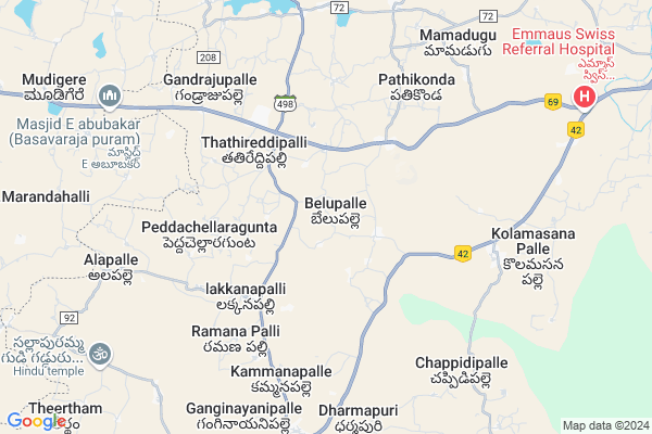
Patnapalle Map
EDIT Map
Add Your House
 ..
..
Current Corona Virus Infected Patients Count in Chittoor District
| City Name | District Name | Total Covid cases |
|---|---|---|
| Chittoor District | Chittoor | 59 |
| Thyagaraja Nagar,Tirupathi | Chittoor | 3 |
| Srikalahasti | Chittoor | 3 |
| Nagiri | Chittoor | 2 |
| Chinna Masjid | Chittoor | 1 |
| Keelapattu nagari | Chittoor | 1 |
| Renigunta | Chittoor | 1 |
| Vadamalapeta | Chittoor | 1 |
| Tirupati | Chittoor | 1 |
| Nindra | Chittoor | 1 |
Locality Name :
Patnapalle
( పట్నాపల్లె )
Mandal Name : Baireddipalle
District : Chittoor
State : Andhra Pradesh
Region : Rayalaseema
Language : Telugu and Urdu
Current Time 04:36 PM
Date: Monday , Apr 28,2025 (IST)
Time zone: IST (UTC+5:30)
Elevation / Altitude: 769 meters. Above Seal level
Telephone Code / Std Code: 08587
Assembly constituency : assembly constituency
Assembly MLA : N VENKATE GOWDA
Lok Sabha constituency : parliamentary constituency
Parliament MP :
Serpanch Name :
Pin Code : 517432
Post Office Name : Kolamasanapalle
Main Village Name : Belupalle
Commodities Prices : Mulabagilu Market / Mandi
Patnapalle Live Weather
Temperature: 34.6 °C
broken clouds
Humidity: 29%
Wind : 5.33 mt/sec towards E
StationName : "Palmaner"
observed on 2 Hours Back
Temperature: 34.6 °C
broken clouds
Humidity: 29%
Wind : 5.33 mt/sec towards E
StationName : "Palmaner"
observed on 2 Hours Back
Patnapalle Weather Forecast for Next 5 days
29-04-2025
23.7°C to 34.6°C
broken clouds, overcast clouds
23.7°C to 34.6°C
broken clouds, overcast clouds
30-04-2025
22.1°C to 36.8°C
overcast clouds, broken clouds
22.1°C to 36.8°C
overcast clouds, broken clouds
01-05-2025
23.5°C to 38.1°C
overcast clouds, broken clouds, few clouds, light rain
23.5°C to 38.1°C
overcast clouds, broken clouds, few clouds, light rain
02-05-2025
24.7°C to 37.0°C
overcast clouds, scattered clouds, broken clouds
24.7°C to 37.0°C
overcast clouds, scattered clouds, broken clouds
03-05-2025
24.5°C to 37.9°C
scattered clouds, few clouds, clear sky, light rain, overcast clouds, broken clouds
24.5°C to 37.9°C
scattered clouds, few clouds, clear sky, light rain, overcast clouds, broken clouds
Edit below overview about Patnapalle
Edit below overview about Patnapalle
OverView of Patnapalle
patnapalli in very famose tembule is sri hasthagiri kalyana venataramanaswami temple .somany devetis visiting every day and nitya sevas , architha sevas bramhosthavase pristagiosy ly doingEdit below overview about Patnapalle
National Highways Reachable To Patnapalle
Nationa High Way :NH69
Nationa High Way :NH75
Nationa High Way :NH69
Nationa High Way :NH75
Rivers Near Patnapalle
Palar :ಪಾಲಾರ್ :பாலா
Kaundinya Mahanadhi :Koundinya :ಕೌಂಡಿನ್ಯ
Palar :ಪಾಲಾರ್ :பாலா
Kaundinya Mahanadhi :Koundinya :ಕೌಂಡಿನ್ಯ
About Patnapalle
Patnapalle is a small Village/hamlet in Baireddipalle Mandal in Chittoor District of Andhra Pradesh State, India. It comes under Belupalle Panchayath. It belongs to Rayalaseema region . It is located 59 KM towards west from District head quarters Chittoor. 9 KM from Baireddipalle. 549 KM from State capital Hyderabad
Patnapalle Pin code is 517432 and postal head office is Kolamasanapalle .
Patnapalle is surrounded by Gangavaram Mandal towards North , Palamaner Mandal towards East , Peddapanjani Mandal towards North , Mulbagal Mandal towards west .
Punganur , Mulbagal , Pernampattu , Pallikonda are the near by Cities to Patnapalle.
This Place is in the border of the Chittoor District and Kolar District. Kolar District Mulbagal is west towards this place . It is near to the Karnataka State Border.
Demographics of Patnapalle
Telugu is the Local Language here. Total population of Patnapalle is 3779 .Males are 1902 and Females are 1,877 living in 749 Houses. Total area of Patnapalle is 1209 hectares.HOW TO REACH Patnapalle
By Road
Chittoor is the Nearest Town to Patnapalle. Chittoor is 55 km from Patnapalle. Road connectivity is there from Chittoor to Patnapalle.By Rail
There is no railway station near to Patnapalle in less than 10 km. How ever there are railway Stations from Near By town Chittoor. are the railway Stations near to Chittoor. You can reach from Chittoor to Patnapalle by road after .By Bus
Bireddypally APSRTC Bus Station , Bai Reddy Pally APSRTC Bus Station , Palamaneru APSRTC Bus Station are the nearby by Bus Stations to Patnapalle .APSRTC runs Number of busses from major cities to here.Colleges near Patnapalle
Vani Jr College V.kota Chittoor
Address : Behind Mpdo Office
durga Nagar V.kota
Sri Muninarayana Junior College
Address :
Sree Vidya Arts & Science Degree College.
Address :
Priyadarshini
Address :
Amaravathi Degree College. Ramasamudram
Address : Amaravathi Degree College Ramasamudram
Schools in Patnapalle
Zphs Belupalle
Address : belupalle , baireddypalle , chittoor , Andhra Pradesh . PIN- 517432 , Post - Kolamasanapalle
Mpups Bellamadugu
Address : belupalle , baireddypalle , chittoor , Andhra Pradesh . PIN- 517432 , Post - Kolamasanapalle
Govt Health Centers near Patnapalle
1) BELUPALLI , , mainroad , Near School2) C C GUNTA , , C.C. GUNTA , C.C.GUNTA
3) PATHIKONDA , , , Bangalore Road
Schools in Patnapalle,Baireddipalle
Electronic Shops in Patnapalle,Baireddipalle
Super Markets in Patnapalle,Baireddipalle
Local Parks in Patnapalle,Baireddipalle
Police Stations near Patnapalle,Baireddipalle
Governement Offices near Patnapalle,Baireddipalle
About Patnapalle &
History
How to reach Patnapalle
Tourist Places Near By Patnapalle
Schools in Patnapalle
Colleges in Patnapalle
Temperature & weather of Patnapalle
places in Patnapalle
Patnapalle photos
More Information
How to reach Patnapalle
Tourist Places Near By Patnapalle
Schools in Patnapalle
Colleges in Patnapalle
Temperature & weather of Patnapalle
places in Patnapalle
Patnapalle photos
More Information
Village Talk
Post News or Events about this Village
Near Cities
Punganur 26 KM near
Mulbagal 27 KM near
Pernampattu 30 KM near
Pallikonda 48 KM near
Punganur 26 KM near
Mulbagal 27 KM near
Pernampattu 30 KM near
Pallikonda 48 KM near
Near By Taluks
Baireddipalle 8 KM near
Gangavaram 13 KM near
Palamaner 13 KM near
Peddapanjani 18 KM near
Baireddipalle 8 KM near
Gangavaram 13 KM near
Palamaner 13 KM near
Peddapanjani 18 KM near
Near By Air Ports
Bengaluru International Airport 110 KM near
Tirupati Airport 126 KM near
Chennai Airport 188 KM near
Salem Airport 195 KM near
Bengaluru International Airport 110 KM near
Tirupati Airport 126 KM near
Chennai Airport 188 KM near
Salem Airport 195 KM near
Near By Tourist Places
Chittoor 58 KM near
Horsley Hills 66 KM near
vellore 69 KM near
Yelagiri 73 KM near
Tirupati 113 KM near
Chittoor 58 KM near
Horsley Hills 66 KM near
vellore 69 KM near
Yelagiri 73 KM near
Tirupati 113 KM near
Near By Districts
Chittoor 57 KM near
Kolar 59 KM near
Vellore 69 KM near
Krishnagiri 92 KM near
Chittoor 57 KM near
Kolar 59 KM near
Vellore 69 KM near
Krishnagiri 92 KM near
Near By RailWay Station
Gudiyattam Rail Way Station 43 KM near
Ambur Rail Way Station 48 KM near
Gudiyattam Rail Way Station 43 KM near
Ambur Rail Way Station 48 KM near