| Home | City Bus | Maps | Villages | Cities | Rail | Tourist Places | School | College | Pin Codes | Corona Cases Count |
| Distance Calculator Bus Services IFSC Codes Trace Mobile Number Weather Search Place Trace IP Available Cash ATM/Banks Locate Polling Booth Report an Error contact People |
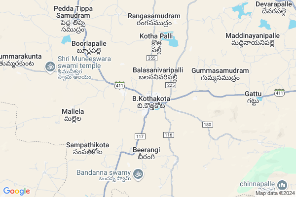
Nakkarajupalle
Nakkarajupalle Map
EDIT Map
Add Your House
 ..
..
Current Corona Virus Infected Patients Count in Chittoor District
| City Name | District Name | Total Covid cases |
|---|---|---|
| Chittoor District | Chittoor | 59 |
| Thyagaraja Nagar,Tirupathi | Chittoor | 3 |
| Srikalahasti | Chittoor | 3 |
| Nagiri | Chittoor | 2 |
| Keelapattu nagari | Chittoor | 1 |
| Renigunta | Chittoor | 1 |
| Vadamalapeta | Chittoor | 1 |
| Tirupati | Chittoor | 1 |
| Nindra | Chittoor | 1 |
| Chinna Masjid | Chittoor | 1 |
Locality Name :
Nakkarajupalle
( నక్కరాజుపల్లె )
Mandal Name : B.kothakota
District : Chittoor
State : Andhra Pradesh
Region : Rayalaseema
Language : Telugu and Urdu
Current Time 09:18 PM
Date: Friday , Apr 25,2025 (IST)
Time zone: IST (UTC+5:30)
Elevation / Altitude: 602 meters. Above Seal level
Telephone Code / Std Code: 08582
Assembly constituency : assembly constituency
Assembly MLA : PEDDIREDDY DWARAKANATHA REDDY
Lok Sabha constituency : parliamentary constituency
Parliament MP : P.V.MIDHUN REDDY
Serpanch Name :
Pin Code : 517370
Post Office Name : Beerangi Kothakota
Main Village Name : B Kothakota
Commodities Prices : Mulakalacheruvu Market / Mandi
Nakkarajupalle Live Weather
Temperature: 34.2 °C
broken clouds
Humidity: 27%
Wind : 5.65 mt/sec towards SE
StationName : "Madanapalle"
observed on 2 Hours Back
Temperature: 34.2 °C
broken clouds
Humidity: 27%
Wind : 5.65 mt/sec towards SE
StationName : "Madanapalle"
observed on 2 Hours Back
Nakkarajupalle Weather Forecast for Next 5 days
26-04-2025
26.2°C to 34.8°C
scattered clouds, broken clouds, overcast clouds
26.2°C to 34.8°C
scattered clouds, broken clouds, overcast clouds
27-04-2025
24.1°C to 37.7°C
overcast clouds, scattered clouds, few clouds, broken clouds
24.1°C to 37.7°C
overcast clouds, scattered clouds, few clouds, broken clouds
28-04-2025
23.7°C to 37.2°C
scattered clouds, broken clouds, overcast clouds
23.7°C to 37.2°C
scattered clouds, broken clouds, overcast clouds
29-04-2025
23.8°C to 37.6°C
scattered clouds, few clouds, clear sky
23.8°C to 37.6°C
scattered clouds, few clouds, clear sky
30-04-2025
25.4°C to 38.7°C
few clouds, clear sky, scattered clouds, broken clouds, overcast clouds
25.4°C to 38.7°C
few clouds, clear sky, scattered clouds, broken clouds, overcast clouds
National Highways Reachable To Nakkarajupalle
Nationa High Way :NH44
Nationa High Way :NH71
Nationa High Way :NH44
Nationa High Way :NH71
Rivers Near Nakkarajupalle
Kushavati :ಕುಶಾವತಿ
Papagni :ಪಾಪಾಗ್ನಿ :పాపాగ్ని
Kushavati :ಕುಶಾವತಿ
Papagni :ಪಾಪಾಗ್ನಿ :పాపాగ్ని
About Nakkarajupalle
Correct below Info and add more info about NakkarajupalleNakkarajupalle is a small Village/hamlet in B.kothakota Mandal in Chittoor District of Andhra Pradesh State, India. It comes under B Kothakota Panchayath. It belongs to Rayalaseema region . It is located 119 KM towards west from District head quarters Chittoor. 6 KM from B.Kothakota. 485 KM from State capital Hyderabad
Nakkarajupalle Pin code is 517370 and postal head office is Beerangi Kothakota .
Nakkarajupalle is surrounded by Peddathippasamudram Mandal towards North , Mulakalacheruvu Mandal towards North , Kurabalakota Mandal towards East , Tanakal Mandal towards North .
Madanapalle , Chintamani , Srinivaspur , Punganur are the near by Cities to Nakkarajupalle.
Demographics of Nakkarajupalle
Telugu is the Local Language here. Total population of Nakkarajupalle is 22262 .Males are 11541 and Females are 10,721 living in 4773 Houses. Total area of Nakkarajupalle is 3000 hectares.HOW TO REACH Nakkarajupalle
By Road
Madanapalle is the Nearest Town to Nakkarajupalle. Madanapalle is 38 km from Nakkarajupalle. Road connectivity is there from Madanapalle to Nakkarajupalle.By Rail
There is no railway station near to Nakkarajupalle in less than 10 km.By Bus
Burakayala Kota APSRTC Bus Station , Molakala Cheruvu APSRTC Bus Station , Angallo APSRTC Bus Station are the nearby by Bus Stations to Nakkarajupalle .APSRTC runs Number of busses from major cities to here.Colleges near Nakkarajupalle
Govt Junior College B.kothakota
Address : Govt Junior College B.kothakota
Schools in Nakkarajupalle
Apswrs B.kothakota
Address : b.kothakota , b.kothakota , chittoor , Andhra Pradesh . PIN- 517370 , Post - Beerangi Kothakota
Kgbv B.kothakota
Address : b.kothakota , b.kothakota , chittoor , Andhra Pradesh . PIN- 517370 , Post - Beerangi Kothakota
Saraswathi High School
Address : b.kothakota , b.kothakota , chittoor , Andhra Pradesh . PIN- 517370 , Post - Beerangi Kothakota
Sidhartha High Schol
Address : b.kothakota , b.kothakota , chittoor , Andhra Pradesh . PIN- 517370 , Post - Beerangi Kothakota
Chaithnya U.p.school
Address : b.kothakota , b.kothakota , chittoor , Andhra Pradesh . PIN- 517370 , Post - Beerangi Kothakota
Govt Health Centers near Nakkarajupalle
1) B Kothakota , , main road , B kothakota2) B.KOTHAKOTA I , , PTM.Road , Govt.ZPHS
3) B.KOTHAKOTA II , , BYPASS ROAD , Gg.p.office
Hospitals in Nakkarajupalle,B.kothakota
DR V V REDDY
Madanapalle - B Kothakota Rd; B.Kothakota; Andhra Pradesh 517370; India
0.4 KM distance Detail
Praja Dental Clinic
Rangasamudram Rd; B.Kothakota; Andhra Pradesh 517370; India
0.4 KM distance Detail
more ..
Petrol Bunks in Nakkarajupalle,B.kothakota
HP PETROL PUMP - SUMRAN FILLING STATION B.KOTHAKOT
Hpcl Dealers Banglore Road; B.c. B.kotha Kota; B.C.Colony; Nellore; Andhra Pradesh 517370; India
1.3 KM distance Detail
indian oil petrol pump
Chinthamani Road; Beerangi; Andhra Pradesh 517370; India
2.2 KM distance Detail
more ..
Schools in Nakkarajupalle,B.kothakota
Sri Bhagavan Sai Ram School
Bypass Rd; B.Kothakota; Andhra Pradesh 517370; India
0.1 KM distance Detail
Electronic Shops in Nakkarajupalle,B.kothakota
Bavajan Water Service
Chelur - B Kothakota Rd; B.Kothakota; Andhra Pradesh 517370; India
0.1 KM distance Detail
A-1engineering Works
Rangasamudram Rd; B.Kothakota; Andhra Pradesh 517370; India
0.3 KM distance Detail
Super Markets in Nakkarajupalle,B.kothakota
Sunku Prakash stores
No. 11/60; PTM Road; B Kothakota; B.Kothakota; Andhra Pradesh 517370; India
0.4 KM distance Detail
More Supermarket
No-2/C8 Kadiri Road; Opp To Ntr Citrcle; Madanaplli; Chittor; Andhra Pradesh 517325; India
0.4 KM distance Detail
Local Parks in Nakkarajupalle,B.kothakota
Gangotri seasonal Lake and Freak out point
Horsley Hills Rd; Horsley Hills; Andhra Pradesh 517352; India
18.6 KM distance Detail
NRF MANGO GARDEN
Horsley Hills Rd; Horsley Hills; Andhra Pradesh 517352; India
19.9 KM distance Detail
Police Stations near Nakkarajupalle,B.kothakota
Rayalpad Police Station
Rayalpad; Srinivaspur(t); SH 99; Rayalpadu; Karnataka 563134; India
19.9 KM distance Detail
Governement Offices near Nakkarajupalle,B.kothakota
MeeSeva Center
Gattu(V); B Kothakota(M); Chittoor(D);517370; Gattu village; Andhra Pradesh 517352; India
9.3 KM distance Detail
About Nakkarajupalle &
History
How to reach Nakkarajupalle
Tourist Places Near By Nakkarajupalle
Schools in Nakkarajupalle
Colleges in Nakkarajupalle
Temperature & weather of Nakkarajupalle
places in Nakkarajupalle
Nakkarajupalle photos
More Information
How to reach Nakkarajupalle
Tourist Places Near By Nakkarajupalle
Schools in Nakkarajupalle
Colleges in Nakkarajupalle
Temperature & weather of Nakkarajupalle
places in Nakkarajupalle
Nakkarajupalle photos
More Information
Village Talk
Post News or Events about this Village
Near Cities
Madanapalle 32 KM near
Chintamani 40 KM near
Srinivaspur 40 KM near
Punganur 52 KM near
Madanapalle 32 KM near
Chintamani 40 KM near
Srinivaspur 40 KM near
Punganur 52 KM near
Near By Taluks
B.Kothakota 6 KM near
Peddathippasamudram 8 KM near
Mulakalacheruvu 13 KM near
Kurabalakota 26 KM near
B.Kothakota 6 KM near
Peddathippasamudram 8 KM near
Mulakalacheruvu 13 KM near
Kurabalakota 26 KM near
Near By Air Ports
Bengaluru International Airport 88 KM near
Tirupati Airport 155 KM near
Chennai Airport 245 KM near
Salem Airport 250 KM near
Bengaluru International Airport 88 KM near
Tirupati Airport 155 KM near
Chennai Airport 245 KM near
Salem Airport 250 KM near
Near By Tourist Places
Horsley Hills 16 KM near
Nandi Hills 79 KM near
Lepakshi 80 KM near
Puttaparthi 85 KM near
Chittoor 115 KM near
Horsley Hills 16 KM near
Nandi Hills 79 KM near
Lepakshi 80 KM near
Puttaparthi 85 KM near
Chittoor 115 KM near
Near By Districts
Kolar 67 KM near
Chikballapur 70 KM near
Bangalore Rural 83 KM near
Chittoor 115 KM near
Kolar 67 KM near
Chikballapur 70 KM near
Bangalore Rural 83 KM near
Chittoor 115 KM near
Near By RailWay Station
Madanapalle Road Rail Way Station 35 KM near
Kadiri Rail Way Station 57 KM near
Madanapalle Road Rail Way Station 35 KM near
Kadiri Rail Way Station 57 KM near