| Home | City Bus | Maps | Villages | Cities | Rail | Tourist Places | School | College | Pin Codes | Corona Cases Count |
| Distance Calculator Bus Services IFSC Codes Trace Mobile Number Weather Search Place Trace IP Available Cash ATM/Banks Locate Polling Booth Report an Error contact People |
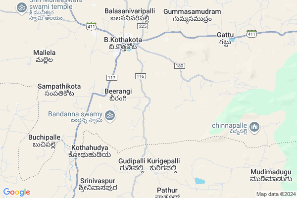
Kamathampalle
Kamathampalle Map
EDIT Map
Add Your House
 ..
..
Current Corona Virus Infected Patients Count in Chittoor District
| City Name | District Name | Total Covid cases |
|---|---|---|
| Chittoor District | Chittoor | 59 |
| Thyagaraja Nagar,Tirupathi | Chittoor | 3 |
| Srikalahasti | Chittoor | 3 |
| Nagiri | Chittoor | 2 |
| Keelapattu nagari | Chittoor | 1 |
| Renigunta | Chittoor | 1 |
| Vadamalapeta | Chittoor | 1 |
| Tirupati | Chittoor | 1 |
| Nindra | Chittoor | 1 |
| Chinna Masjid | Chittoor | 1 |
Locality Name :
Kamathampalle
( కమతంపల్లె )
Mandal Name : B.kothakota
District : Chittoor
State : Andhra Pradesh
Region : Rayalaseema
Language : Telugu and Urdu
Current Time 09:13 PM
Date: Friday , Apr 25,2025 (IST)
Time zone: IST (UTC+5:30)
Elevation / Altitude: 602 meters. Above Seal level
Telephone Code / Std Code: 08582
Assembly constituency : assembly constituency
Assembly MLA : PEDDIREDDY DWARAKANATHA REDDY
Lok Sabha constituency : parliamentary constituency
Parliament MP : P.V.MIDHUN REDDY
Serpanch Name :
Pin Code : 517370
Post Office Name : Beerangi Kothakota
Main Village Name : Badikayalapalle
Commodities Prices : Mulakalacheruvu Market / Mandi
National Highways Reachable To Kamathampalle
Nationa High Way :NH44
Nationa High Way :NH71
Nationa High Way :NH44
Nationa High Way :NH71
Rivers Near Kamathampalle
Kushavati :ಕುಶಾವತಿ
Papagni :ಪಾಪಾಗ್ನಿ :పాపాగ్ని
Kushavati :ಕುಶಾವತಿ
Papagni :ಪಾಪಾಗ್ನಿ :పాపాగ్ని
About Kamathampalle
Correct below Info and add more info about KamathampalleKamathampalle is a small Village/hamlet in B.kothakota Mandal in Chittoor District of Andhra Pradesh State, India. It comes under Badikayalapalle Panchayath. It belongs to Rayalaseema region . It is located 115 KM towards west from District head quarters Chittoor. 7 KM from B.Kothakota. 490 KM from State capital Hyderabad
Kamathampalle Pin code is 517370 and postal head office is Beerangi Kothakota .
Kamathampalle is surrounded by Peddathippasamudram Mandal towards North , Mulakalacheruvu Mandal towards North , Kurabalakota Mandal towards East , Srinivaspur Mandal towards South .
Madanapalle , Srinivaspur , Chintamani , Punganur are the near by Cities to Kamathampalle.
Demographics of Kamathampalle
Telugu is the Local Language here. Total population of Kamathampalle is 5311 .Males are 2645 and Females are 2,666 living in 1133 Houses. Total area of Kamathampalle is 3051 hectares.HOW TO REACH Kamathampalle
By Road
Madanapalle is the Nearest Town to Kamathampalle. Madanapalle is 43 km from Kamathampalle. Road connectivity is there from Madanapalle to Kamathampalle.By Rail
There is no railway station near to Kamathampalle in less than 10 km.By Bus
Burakayala Kota APSRTC Bus Station , Molakala Cheruvu APSRTC Bus Station , Angallo APSRTC Bus Station are the nearby by Bus Stations to Kamathampalle .APSRTC runs Number of busses from major cities to here.Colleges near Kamathampalle
Govt Junior College B.kothakota
Address : Govt Junior College B.kothakota
Schools in Kamathampalle
Zphs Badikayaklapalle
Address : badikayalapalle , b.kothakota , chittoor , Andhra Pradesh . PIN- 517370 , Post - Beerangi Kothakota
Mpups Surapavaipalle
Address : badikayalapalle , b.kothakota , chittoor , Andhra Pradesh . PIN- 517370 , Post - Beerangi Kothakota
Govt Health Centers near Kamathampalle
1) BADIKAYALA PALLE , , BADIKAYALAPALLI , AWC2) B Kothakota , , main road , B kothakota
3) B.KOTHAKOTA I , , PTM.Road , Govt.ZPHS
Petrol Bunks in Kamathampalle,B.kothakota
indian oil petrol pump
Chinthamani Road; Beerangi; Andhra Pradesh 517370; India
4.2 KM distance Detail
HP PETROL PUMP - SUMRAN FILLING STATION B.KOTHAKOT
Hpcl Dealers Banglore Road; B.c. B.kotha Kota; B.C.Colony; Nellore; Andhra Pradesh 517370; India
4.7 KM distance Detail
more ..
Colleges in Kamathampalle,B.kothakota
Sunku Usha Gowthami College
bangalor road;near; BC Colony; B.Kothakota; Andhra Pradesh; India
4.6 KM distance Detail
more ..
Schools in Kamathampalle,B.kothakota
M.P.P.School ;Yalagiripalli
yalagiripalli; Badikayalapalli; Andhra Pradesh 517370; India
2.7 KM distance Detail
Giri
# k r; 84; Cuddalore - Sankarapuram Rd; Thirupapuliyur; Cuddalore; Tamil Nadu 607002; India
3.8 KM distance Detail
Super Markets in Kamathampalle,B.kothakota
AGR Singapur big bazaar
Madanapalli Rd; B.Kothakota; Andhra Pradesh 517370; India
5.3 KM distance Detail
Cvv General Store
517370 near indian bank; Madanapalle - B Kothakota Rd; B.Kothakota; Andhra Pradesh 517370; India
5.3 KM distance Detail
Local Parks in Kamathampalle,B.kothakota
Gangotri seasonal Lake and Freak out point
Horsley Hills Rd; Horsley Hills; Andhra Pradesh 517352; India
16.3 KM distance Detail
NRF MANGO GARDEN
Horsley Hills Rd; Horsley Hills; Andhra Pradesh 517352; India
18.2 KM distance Detail
Police Stations near Kamathampalle,B.kothakota
Rayalpad Police Station
Rayalpad; Srinivaspur(t); SH 99; Rayalpadu; Karnataka 563134; India
14.2 KM distance Detail
Governement Offices near Kamathampalle,B.kothakota
MeeSeva Center
Gattu(V); B Kothakota(M); Chittoor(D);517370; Gattu village; Andhra Pradesh 517352; India
8.6 KM distance Detail
About Kamathampalle &
History
How to reach Kamathampalle
Tourist Places Near By Kamathampalle
Schools in Kamathampalle
Colleges in Kamathampalle
Temperature & weather of Kamathampalle
places in Kamathampalle
Kamathampalle photos
More Information
How to reach Kamathampalle
Tourist Places Near By Kamathampalle
Schools in Kamathampalle
Colleges in Kamathampalle
Temperature & weather of Kamathampalle
places in Kamathampalle
Kamathampalle photos
More Information
Village Talk
Post News or Events about this Village
Near Cities
Madanapalle 28 KM near
Srinivaspur 36 KM near
Chintamani 38 KM near
Punganur 47 KM near
Madanapalle 28 KM near
Srinivaspur 36 KM near
Chintamani 38 KM near
Punganur 47 KM near
Near By Taluks
B.Kothakota 7 KM near
Peddathippasamudram 13 KM near
Mulakalacheruvu 17 KM near
Kurabalakota 25 KM near
B.Kothakota 7 KM near
Peddathippasamudram 13 KM near
Mulakalacheruvu 17 KM near
Kurabalakota 25 KM near
Near By Air Ports
Bengaluru International Airport 87 KM near
Tirupati Airport 152 KM near
Chennai Airport 241 KM near
Salem Airport 245 KM near
Bengaluru International Airport 87 KM near
Tirupati Airport 152 KM near
Chennai Airport 241 KM near
Salem Airport 245 KM near
Near By Tourist Places
Horsley Hills 14 KM near
Nandi Hills 79 KM near
Lepakshi 84 KM near
Puttaparthi 90 KM near
Chittoor 111 KM near
Horsley Hills 14 KM near
Nandi Hills 79 KM near
Lepakshi 84 KM near
Puttaparthi 90 KM near
Chittoor 111 KM near
Near By Districts
Kolar 62 KM near
Chikballapur 71 KM near
Bangalore Rural 82 KM near
Chittoor 110 KM near
Kolar 62 KM near
Chikballapur 71 KM near
Bangalore Rural 82 KM near
Chittoor 110 KM near
Near By RailWay Station
Madanapalle Road Rail Way Station 33 KM near
Kadiri Rail Way Station 63 KM near
Madanapalle Road Rail Way Station 33 KM near
Kadiri Rail Way Station 63 KM near