| Home | City Bus | Maps | Villages | Cities | Rail | Tourist Places | School | College | Pin Codes | Corona Cases Count |
| Distance Calculator Bus Services IFSC Codes Trace Mobile Number Weather Search Place Trace IP Available Cash ATM/Banks Locate Polling Booth Report an Error contact People |
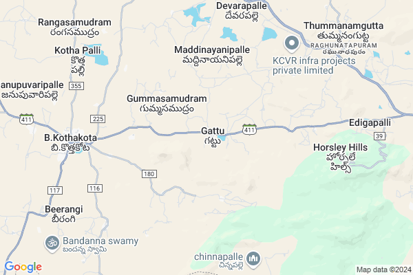
Akulavaripalle
Akulavaripalle Map
EDIT Map
Add Your House
 ..
..
Current Corona Virus Infected Patients Count in Chittoor District
| City Name | District Name | Total Covid cases |
|---|---|---|
| Chittoor District | Chittoor | 59 |
| Thyagaraja Nagar,Tirupathi | Chittoor | 3 |
| Srikalahasti | Chittoor | 3 |
| Nagiri | Chittoor | 2 |
| Keelapattu nagari | Chittoor | 1 |
| Renigunta | Chittoor | 1 |
| Vadamalapeta | Chittoor | 1 |
| Tirupati | Chittoor | 1 |
| Nindra | Chittoor | 1 |
| Chinna Masjid | Chittoor | 1 |
Locality Name :
Akulavaripalle
( ఆకులవారిపల్లె )
Mandal Name : B.kothakota
District : Chittoor
State : Andhra Pradesh
Region : Rayalaseema
Language : Telugu and Urdu
Current Time 02:43 PM
Date: Friday , Apr 25,2025 (IST)
Time zone: IST (UTC+5:30)
Elevation / Altitude: 602 meters. Above Seal level
Telephone Code / Std Code: 08582
Assembly constituency : assembly constituency
Assembly MLA : PEDDIREDDY DWARAKANATHA REDDY
Lok Sabha constituency : parliamentary constituency
Parliament MP : P.V.MIDHUN REDDY
Serpanch Name :
Pin Code : 517352
Post Office Name : Rishivalley
Main Village Name : Gattu
Commodities Prices : Mulakalacheruvu Market / Mandi
Akulavaripalle Live Weather
Temperature: 37.5 °C
few clouds
Humidity: 22%
Wind : 6.06 mt/sec towards E
StationName : "Madanapalle"
observed on 26 Mins Back
Temperature: 37.5 °C
few clouds
Humidity: 22%
Wind : 6.06 mt/sec towards E
StationName : "Madanapalle"
observed on 26 Mins Back
Akulavaripalle Weather Forecast for Next 5 days
26-04-2025
25.7°C to 37.5°C
few clouds, scattered clouds, broken clouds, overcast clouds
25.7°C to 37.5°C
few clouds, scattered clouds, broken clouds, overcast clouds
27-04-2025
23.4°C to 37.5°C
overcast clouds, broken clouds
23.4°C to 37.5°C
overcast clouds, broken clouds
28-04-2025
23.7°C to 37.3°C
broken clouds, overcast clouds, scattered clouds
23.7°C to 37.3°C
broken clouds, overcast clouds, scattered clouds
29-04-2025
23.7°C to 37.2°C
light rain, broken clouds, scattered clouds, clear sky, few clouds
23.7°C to 37.2°C
light rain, broken clouds, scattered clouds, clear sky, few clouds
30-04-2025
24.8°C to 38.6°C
scattered clouds, clear sky, few clouds, broken clouds, overcast clouds
24.8°C to 38.6°C
scattered clouds, clear sky, few clouds, broken clouds, overcast clouds
National Highways Reachable To Akulavaripalle
Nationa High Way :NH44
Nationa High Way :NH71
Nationa High Way :NH44
Nationa High Way :NH71
Rivers Near Akulavaripalle
Kushavati :ಕುಶಾವತಿ
Papagni :ಪಾಪಾಗ್ನಿ :పాపాగ్ని
Kushavati :ಕುಶಾವತಿ
Papagni :ಪಾಪಾಗ್ನಿ :పాపాగ్ని
About Akulavaripalle
Correct below Info and add more info about AkulavaripalleAkulavaripalle is a small Village/hamlet in B.kothakota Mandal in Chittoor District of Andhra Pradesh State, India. It comes under Gattu Panchayath. It belongs to Rayalaseema region . It is located 112 KM towards west from District head quarters Chittoor. 3 KM from B.Kothakota. 484 KM from State capital Hyderabad
Akulavaripalle Pin code is 517352 and postal head office is Rishivalley .
Akulavaripalle is surrounded by Mulakalacheruvu Mandal towards North , Peddathippasamudram Mandal towards west , Kurabalakota Mandal towards East , Thamballapalle Mandal towards North .
Madanapalle , Srinivaspur , Chintamani , Punganur are the near by Cities to Akulavaripalle.
Demographics of Akulavaripalle
Telugu is the Local Language here. Total population of Akulavaripalle is 8037 .Males are 4046 and Females are 3,991 living in 1816 Houses. Total area of Akulavaripalle is 7606 hectares.HOW TO REACH Akulavaripalle
By Road
Madanapalle is the Nearest Town to Akulavaripalle. Madanapalle is 30 km from Akulavaripalle. Road connectivity is there from Madanapalle to Akulavaripalle.By Rail
Tummanamgutta Rail Way Station is the very nearby railway stations to Akulavaripalle.By Bus
Burakayala Kota APSRTC Bus Station , Angallo APSRTC Bus Station , Molakala Cheruvu APSRTC Bus Station are the nearby by Bus Stations to Akulavaripalle .APSRTC runs Number of busses from major cities to here.Colleges near Akulavaripalle
Govt Junior College B.kothakota
Address : Govt Junior College B.kothakota
Schools in Akulavaripalle
Z.phs Gattu
Address : gattu , b.kothakota , chittoor , Andhra Pradesh . PIN- 517325 , Post - Madanapalle
Mpups Purusumanupaenta
Address : gattu , b.kothakota , chittoor , Andhra Pradesh . PIN- 517325 , Post - Madanapalle
Govt Health Centers near Akulavaripalle
1) REDDYVARI PALLE , , REDDYVARIPALLI , MPP.SCHOOL2) GATTU , , GATTU , RAMALAYAM
3) BUCHIREDDYGARI PALLE , , BUCHIREDDYGARIPALLI , MPP.SCHOOL
Hospitals in Akulavaripalle,B.kothakota
Praja Dental Clinic
Rangasamudram Rd; B.Kothakota; Andhra Pradesh 517370; India
8.5 KM distance Detail
Praja Dental Clinic R.S.M Road
Madanapalle - B Kothakota Rd; B.Kothakota; Andhra Pradesh 517370; India
8.5 KM distance Detail
more ..
Petrol Bunks in Akulavaripalle,B.kothakota
HP PETROL PUMP - SUMRAN FILLING STATION B.KOTHAKOT
Hpcl Dealers Banglore Road; B.c. B.kotha Kota; B.C.Colony; Nellore; Andhra Pradesh 517370; India
9.0 KM distance Detail
HP PETROL PUMP - SRI LAKSHMIVENKATESWARA F/S
HPC Dealer Sy.no.170; Nh-205;mbt Road Burrakayalakota; Andhra Pradesh 517351; India
9.3 KM distance Detail
indian oil petrol pump
Chinthamani Road; Beerangi; Andhra Pradesh 517370; India
9.4 KM distance Detail
more ..
Colleges in Akulavaripalle,B.kothakota
Sunku Usha Gowthami College
bangalor road;near; BC Colony; B.Kothakota; Andhra Pradesh; India
9.1 KM distance Detail
more ..
Schools in Akulavaripalle,B.kothakota
Gattu High School
Madanapalle - B Kothakota Rd; Gattu; Andhra Pradesh 517352; India
1.2 KM distance Detail
Ms Islamic English Medium Play School Kadiri
Madanapalli Rd; Gattu; Andhra Pradesh 517352; India
2.1 KM distance Detail
MS ISLAMIC ENGLISH PLY SCHOOL KADIRI
Madanapalli Rd; Gattu; Andhra Pradesh 517352; India
2.1 KM distance Detail
Super Markets in Akulavaripalle,B.kothakota
Cvv General Store
517370 near indian bank; Madanapalle - B Kothakota Rd; B.Kothakota; Andhra Pradesh 517370; India
8.2 KM distance Detail
AGR Singapur big bazaar
Madanapalli Rd; B.Kothakota; Andhra Pradesh 517370; India
8.3 KM distance Detail
Local Parks in Akulavaripalle,B.kothakota
Gangotri seasonal Lake and Freak out point
Horsley Hills Rd; Horsley Hills; Andhra Pradesh 517352; India
9.8 KM distance Detail
NRF MANGO GARDEN
Horsley Hills Rd; Horsley Hills; Andhra Pradesh 517352; India
11.0 KM distance Detail
Police Stations near Akulavaripalle,B.kothakota
Rayalpad Police Station
Rayalpad; Srinivaspur(t); SH 99; Rayalpadu; Karnataka 563134; India
16.9 KM distance Detail
Governement Offices near Akulavaripalle,B.kothakota
MeeSeva Center
Gattu(V); B Kothakota(M); Chittoor(D);517370; Gattu village; Andhra Pradesh 517352; India
0.4 KM distance Detail
About Akulavaripalle &
History
How to reach Akulavaripalle
Tourist Places Near By Akulavaripalle
Schools in Akulavaripalle
Colleges in Akulavaripalle
Temperature & weather of Akulavaripalle
places in Akulavaripalle
Akulavaripalle photos
More Information
How to reach Akulavaripalle
Tourist Places Near By Akulavaripalle
Schools in Akulavaripalle
Colleges in Akulavaripalle
Temperature & weather of Akulavaripalle
places in Akulavaripalle
Akulavaripalle photos
More Information
Village Talk
Post News or Events about this Village
Near Cities
Madanapalle 24 KM near
Srinivaspur 42 KM near
Chintamani 45 KM near
Punganur 46 KM near
Madanapalle 24 KM near
Srinivaspur 42 KM near
Chintamani 45 KM near
Punganur 46 KM near
Near By Taluks
B.Kothakota 2 KM near
Mulakalacheruvu 12 KM near
Peddathippasamudram 15 KM near
Kurabalakota 18 KM near
B.Kothakota 2 KM near
Mulakalacheruvu 12 KM near
Peddathippasamudram 15 KM near
Kurabalakota 18 KM near
Near By Air Ports
Bengaluru International Airport 94 KM near
Tirupati Airport 146 KM near
Chennai Airport 237 KM near
Salem Airport 251 KM near
Bengaluru International Airport 94 KM near
Tirupati Airport 146 KM near
Chennai Airport 237 KM near
Salem Airport 251 KM near
Near By Tourist Places
Horsley Hills 8 KM near
Nandi Hills 87 KM near
Lepakshi 88 KM near
Puttaparthi 91 KM near
Chittoor 108 KM near
Horsley Hills 8 KM near
Nandi Hills 87 KM near
Lepakshi 88 KM near
Puttaparthi 91 KM near
Chittoor 108 KM near
Near By Districts
Kolar 69 KM near
Chikballapur 78 KM near
Bangalore Rural 90 KM near
Chittoor 107 KM near
Kolar 69 KM near
Chikballapur 78 KM near
Bangalore Rural 90 KM near
Chittoor 107 KM near
Near By RailWay Station
Tummanamgutta Rail Way Station 9.2 KM near
Madanapalle Road Rail Way Station 27 KM near
Kadiri Rail Way Station 59 KM near
Tummanamgutta Rail Way Station 9.2 KM near
Madanapalle Road Rail Way Station 27 KM near
Kadiri Rail Way Station 59 KM near