| Home | City Bus | Maps | Villages | Cities | Rail | Tourist Places | School | College | Pin Codes | Corona Cases Count |
| Distance Calculator Bus Services IFSC Codes Trace Mobile Number Weather Search Place Trace IP Available Cash ATM/Banks Locate Polling Booth Report an Error contact People |
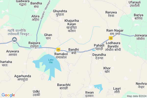
Bandhi
Bandhi Map
EDIT Map
Add Your House
 ..
..
Current Corona Virus Infected Patients Count in Chitrakoot District
| City Name | District Name | Total Covid cases |
|---|
Locality Name :
Bandhi
( बंधी )
Block Name : Ramnagar
District : Chitrakoot
State : Uttar Pradesh
Division : Chitrakoot
Language : Hindi and Urdu
Current Time 12:48 PM
Date: Sunday , Apr 27,2025 (IST)
Time zone: IST (UTC+5:30)
Elevation / Altitude: 201 meters. Above Seal level
Telephone Code / Std Code: 05198
Assembly constituency : Manikpur assembly constituency
Assembly MLA : Avinash Chandra Dwivedi
Lok Sabha constituency : Banda parliamentary constituency
Parliament MP : R.K. SINGH PATEL
Serpanch Name :
Pin Code : 210205
Post Office Name : Karwi
Commodities Prices : Karvi Market / Mandi
Bandhi Live Weather
Temperature: 40.8 °C
scattered clouds
Humidity: 7%
Wind : 7.02 mt/sec towards W
StationName : "Dabhaura"
observed on 1 Hours Back
Temperature: 40.8 °C
scattered clouds
Humidity: 7%
Wind : 7.02 mt/sec towards W
StationName : "Dabhaura"
observed on 1 Hours Back
Bandhi Weather Forecast for Next 5 days
28-04-2025
30.7°C to 42.3°C
scattered clouds, broken clouds
30.7°C to 42.3°C
scattered clouds, broken clouds
29-04-2025
27.9°C to 41.7°C
broken clouds, scattered clouds, clear sky
27.9°C to 41.7°C
broken clouds, scattered clouds, clear sky
30-04-2025
27.2°C to 43.3°C
few clouds, scattered clouds, clear sky
27.2°C to 43.3°C
few clouds, scattered clouds, clear sky
01-05-2025
28.0°C to 42.7°C
clear sky, few clouds, scattered clouds
28.0°C to 42.7°C
clear sky, few clouds, scattered clouds
02-05-2025
27.8°C to 41.1°C
broken clouds, few clouds, clear sky
27.8°C to 41.1°C
broken clouds, few clouds, clear sky
National Highways Reachable To Bandhi
Nationa High Way :NH731AG
Nationa High Way :NH30;NH35
Nationa High Way :NH731AG
Nationa High Way :NH30;NH35
Rivers Near Bandhi
Paisuni
Yamuna River :যমুনা :यमुना :ಯಮುನಾ :Ямуна :https://1drv.ms/b/s!Ar-WXIFaX7UdgQuO6WpVrTr6YYsQ
Paisuni
Yamuna River :যমুনা :यमुना :ಯಮುನಾ :Ямуна :https://1drv.ms/b/s!Ar-WXIFaX7UdgQuO6WpVrTr6YYsQ
About Bandhi
Correct below Info and add more info about BandhiBandhi is a Village in Ramnagar Block in Chitrakoot District of Uttar Pradesh State, India. It belongs to Chitrakoot Division . It is located 7 KM towards East from District head quarters Chitrakoot Dham. 9 KM from Ramnagar. 212 KM from State capital Lucknow
Bandhi Pin code is 210205 and postal head office is Karwi .
Rampur ( 2 KM ) , Bhakharwar ( 3 KM ) , Khajuriha Kalan ( 4 KM ) , Deundha ( 4 KM ) , Ghan ( 4 KM ) are the nearby Villages to Bandhi. Bandhi is surrounded by Manikpur Block towards South , Mau Block towards East , Pahari Block towards North , Sarsawan Block towards North .
Chitrakoot , Lal Gopalganj Nindaura , Allahabad , Satna are the near by Cities to Bandhi.
This Place is in the border of the Chitrakoot District and Kaushambi District. Kaushambi District Mooratganj is East towards this place .
Bandhi 2011 Census Details
Bandhi Local Language is Hindi. Bandhi Village Total population is 1716 and number of houses are 291. Female Population is 46.6%. Village literacy rate is 51.6% and the Female Literacy rate is 18.7%.
Population
| Census Parameter | Census Data |
| Total Population | 1716 |
| Total No of Houses | 291 |
| Female Population % | 46.6 % ( 799) |
| Total Literacy rate % | 51.6 % ( 885) |
| Female Literacy rate | 18.7 % ( 321) |
| Scheduled Tribes Population % | 0.0 % ( 0) |
| Scheduled Caste Population % | 26.5 % ( 455) |
| Working Population % | 47.7 % |
| Child(0 -6) Population by 2011 | 334 |
| Girl Child(0 -6) Population % by 2011 | 50.0 % ( 167) |
Bandhi Census More Deatils.
Politics in Bandhi
BJP , SP , BSP are the major political parties in this area.Polling Stations /Booths near Bandhi
1)Purva Madhyamik Vidyalay Tenduva Mafi2)Subhash Intar Collage Itvan Room No .1
3)Subhash Intar Collage Itvan Room No .2
4)Prathmik Vidyalay Banadi
5)Prathmik Vidyalay Dadri
HOW TO REACH Bandhi
By Rail
There is no railway station near to Bandhi in less than 10 km.Colleges near Bandhi
Lalsinghpgcollege Laxmepur Khandeha
Address :
Pandit Shree Vishnu Pandey Inter Collage Deora Mau Chitrakoot
Address :
Adarsh Inter College Manikpur Chitrakoot Up -210208
Address :
Schools in Bandhi
P.m.v. Bandhi
Address : bandhi , ramnagar , chitrakoot , Uttar Pradesh . PIN- 210209 , Post - Mauchhibu
Govt Health Centers near Bandhi
1) Raipura , SC Raipura , , Thana Raipura, Allahabad Road2) Chakwa , SC Chakawa , ,
3) Char , SC Char , Char ,
Sub Villages in Bandhi
Hospitals in Bandhi,Ramnagar
Up Health Center
Hatawa; Chitrakoot; NH-76; Allahabad Chitrakoot Road; Mau; Mau; Uttar Pradesh 208210; India
16.1 KM distance Detail
Pt. Kapil Dev Pandey Bhawan
Kapil Dev Pandey Puram; Uttar Pradesh 210209; India
20.0 KM distance Detail
more ..
Petrol Bunks in Bandhi,Ramnagar
Bharat Petroleum
Bodi Pokhari; Raipura; Ram Col; Chitrakoot; NH-76; Allahabad Chitrakoot Road; Manikpur; Uttar Pradesh 210209; India
7.3 KM distance Detail
Bp Petrol pump
bharat petroleum;. jokahai; raipura; 210245; Karwi; Uttar Pradesh; India
9.0 KM distance Detail
more ..
Colleges in Bandhi,Ramnagar
Angel Computer Institute & Common Service Center
Ram Col; Uttar Pradesh 210205; India
5.1 KM distance Detail
Chhatrapati Shahu Ji Maharaj Degree Collage
Naraina khera; Agarhunda; Chitrakoot; Uttar Pradesh; India
7.4 KM distance Detail
more ..
Schools in Bandhi,Ramnagar
C P Gautam Mahila Maha Vidyalaya
Deundha; Tenduwa Khurd; Chitrakoot; NH-76; Allahabad Chitrakoot Road; Ramnagar; Ram Nagar; Uttar Pradesh 210209; India
1.2 KM distance Detail
Government Primary School
Bandhi; Turka Viran; Chitrakoot; NH-76; Allahabad Chitrakoot Road; Ramnagar; Ramnagar; Uttar Pradesh 210209; India
1.7 KM distance Detail
Government Primary School
Deundha; Turka Viran; Chitrakoot; NH-76; Allahabad Chitrakoot Road; Ramnagar; Ram Nagar; Uttar Pradesh 210209; India
2.4 KM distance Detail
Electronic Shops in Bandhi,Ramnagar
Sksham Electonics
Rajapur - Manikpur Road; Raipura; Uttar Pradesh 210208; India
6.5 KM distance Detail
B.K. Electronic avam Repairing centre
Rajapur - Manikpur Road; Raipura; Uttar Pradesh 210205; India
6.6 KM distance Detail
Super Markets in Bandhi,Ramnagar
Balram General Store
Paikaura Devkali Road Paikaura; Karwi Mafi Road; Chitrakoot Dham; Uttar Pradesh 210205; India
11.7 KM distance Detail
Local Parks in Bandhi,Ramnagar
मुक्ति धाम;मदना
Bagiya Purwa Rd; Bagiya Purwa; Madana; Uttar Pradesh 210205; India
13.5 KM distance Detail
Governement Offices near Bandhi,Ramnagar
Range Forest Office
Raipura; Ram Col; Chitrakoot; NH-76; Allahabad Chitrakoot Road; Manikpur; Manikpur; Uttar Pradesh 210209; India
5.8 KM distance Detail
Upkendra Jorwara Block Office
Chitrakoot; NH-76; Allahabad Chitrakoot Road; Mau; Mau; Uttar Pradesh 208210; India
10.9 KM distance Detail
About Bandhi &
History
How to reach Bandhi
Tourist Places Near By Bandhi
Schools in Bandhi
Colleges in Bandhi
Temperature & weather of Bandhi
places in Bandhi
Bandhi photos
More Information
How to reach Bandhi
Tourist Places Near By Bandhi
Schools in Bandhi
Colleges in Bandhi
Temperature & weather of Bandhi
places in Bandhi
Bandhi photos
More Information
Village Talk
Post News or Events about this Village
Near Cities
Chitrakoot 36 KM near
Lal Gopalganj Nindaura 71 KM near
Allahabad 79 KM near
Satna 87 KM near
Chitrakoot 36 KM near
Lal Gopalganj Nindaura 71 KM near
Allahabad 79 KM near
Satna 87 KM near
Near By Taluks
Ramnagar 9 KM near
Manikpur 19 KM near
Mau 23 KM near
Pahari 23 KM near
Ramnagar 9 KM near
Manikpur 19 KM near
Mau 23 KM near
Pahari 23 KM near
Near By Air Ports
Bamrauli Airport 67 KM near
Khajuraho Airport 151 KM near
Kanpur Airport 169 KM near
Varanasi Airport 190 KM near
Bamrauli Airport 67 KM near
Khajuraho Airport 151 KM near
Kanpur Airport 169 KM near
Varanasi Airport 190 KM near
Near By Tourist Places
Kaushambi 29 KM near
Allahabad 77 KM near
Kalinjar 83 KM near
Rewa 88 KM near
Satna 90 KM near
Kaushambi 29 KM near
Allahabad 77 KM near
Kalinjar 83 KM near
Rewa 88 KM near
Satna 90 KM near
Near By Districts
Chitrakoot 6 KM near
Kaushambi 47 KM near
Allahabad 79 KM near
Rewa 88 KM near
Chitrakoot 6 KM near
Kaushambi 47 KM near
Allahabad 79 KM near
Rewa 88 KM near
Near By RailWay Station
Dabhaura Rail Way Station 19 KM near
Manikpur Junction Rail Way Station 23 KM near
Dabhaura Rail Way Station 19 KM near
Manikpur Junction Rail Way Station 23 KM near