| Home | City Bus | Maps | Villages | Cities | Rail | Tourist Places | School | College | Pin Codes | Corona Cases Count |
| Distance Calculator Bus Services IFSC Codes Trace Mobile Number Weather Search Place Trace IP Available Cash ATM/Banks Locate Polling Booth Report an Error contact People |
 ..
..
Current Corona Virus Infected Patients Count in Chitradurga District
| City Name | District Name | Total Covid cases |
|---|---|---|
| Chitradurga District | Chitradurga | 1 |
Taluk Name : Holalkere
District : Chitradurga
State : Karnataka
Division : Bangalore
Language : Kannada
Current Time 12:35 PM
Date: Tuesday , Apr 29,2025 (IST)
Time zone: IST (UTC+5:30)
Elevation / Altitude: 661 meters. Above Seal level
Telephone Code / Std Code: 08191
Assembly constituency : Holalkere assembly constituency
Assembly MLA : M.Chandrappa
Lok Sabha constituency : Chitradurga parliamentary constituency
Parliament MP : A NARAYANASWAMY
Serpanch Name :
Pin Code : 577557
Post Office Name : H.D.Pura
Main Village Name : Echaghatta
Commodities Prices : Holalkere Market / Mandi
Temperature: 30.4 °C
scattered clouds
Humidity: 38%
Wind : 0.05 mt/sec towards W
StationName : "Holalkere"
observed on 2 Hours Back
25.3°C to 37.4°C
scattered clouds, overcast clouds, broken clouds
23.4°C to 36.6°C
broken clouds, scattered clouds, overcast clouds, light rain
22.4°C to 38.2°C
broken clouds, clear sky, scattered clouds, overcast clouds
22.1°C to 38.0°C
scattered clouds, clear sky, overcast clouds, few clouds
23.4°C to 37.5°C
few clouds, clear sky, scattered clouds, broken clouds
OverView of Pampapura
Pampapura is a tiny village, majority are farmers, maize, cotton arecanut are major commercial crops and bore wells is the source of irrigation. all farmers are facing severe shortage of water and needs surface irrigation water to save crops. gok/goi should look in to it and provide surface irrigation by upper bhadra project and save life. few graduates and master degree holders also there and are settled in near by towns due lack of basic facilities. Village roads are very bad and to go to farms is very difficult and only nayaka community people are living and education is not much and are below poverty line. needs hospital, veterinary hospital, bus service and good village roads.to reach pampapura by bus chitrahalli gate is main place followed by h d pura and holalkere railway is near to our village. Now pampapura village is attached h d pura gram panchayat lacks basic needs.
Edit below overview about Pampapura
Nationa High Way :NH69
Nationa High Way :NH369
Vedavati :Hagari :ವೇದಾವತಿ
Suvarnamukhi :ಸುವರ್ಣಮುಖಿ :Suvarṇamukhi
About Pampapura
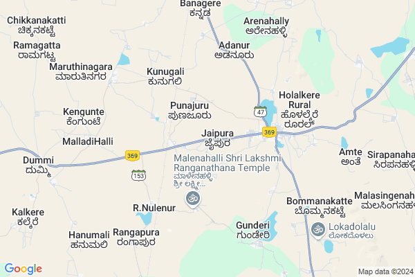
Pampapura is a small Village/hamlet in Holalkere Taluk in Chitradurga District of Karnataka State, India. It comes under Echaghatta Panchayath. It belongs to Bangalore Division . It is located 38 KM towards west from District head quarters Chitradurga. 229 KM from State capital Bangalore
Pampapura Pin code is 577557 and postal head office is H.D.Pura .
Pampapura is surrounded by Channagiri Taluk towards west , Chitradurga Taluk towards North , Hosdurga Taluk towards South , Davanagere Taluk towards North .
Chitradurga , Tarikere , Davanagere , Shimoga are the near by Cities to Pampapura.
Pampapura 2011 Census Details
Pampapura Local Language is Kannada. Pampapura Village Total population is 631 and number of houses are 127. Female Population is 49.0%. Village literacy rate is 54.4% and the Female Literacy rate is 21.1%.
Population
| Census Parameter | Census Data |
| Total Population | 631 |
| Total No of Houses | 127 |
| Female Population % | 49.0 % ( 309) |
| Total Literacy rate % | 54.4 % ( 343) |
| Female Literacy rate | 21.1 % ( 133) |
| Scheduled Tribes Population % | 99.8 % ( 630) |
| Scheduled Caste Population % | 0.0 % ( 0) |
| Working Population % | 79.2 % |
| Child(0 -6) Population by 2011 | 54 |
| Girl Child(0 -6) Population % by 2011 | 59.3 % ( 32) |
Pampapura Census More Deatils.
Politics in Pampapura
JD(U) , Bharatiya Janata Party , JD(S) , BJP , Bharatiya Janata Party (BJP) , INC are the major political parties in this area.Polling Stations /Booths near Pampapura
1)Govt Lower Primary School Issamudra Gollarahatty (h)2)Govt Lower Primary School Maddappanahatty(h)
3)Govt Higher Primary School Pampapura
4)Govt Higher Primary School Kamanahally
5)Govt Higher Primary School (left Side) Andanur-2
HOW TO REACH Pampapura
By Road
Holalkere is the Nearest Town to Pampapura. Road connectivity is there from Holalkere to Pampapura.By Rail
Holalkere Rail Way Station , Chikjajur Junction Rail Way Station are the very nearby railway stations to Pampapura. Also you can consider railway Stations from Near By town Holalkere. Holalkere Rail Way Station are the railway Stations near to Holalkere. You can reach from Holalkere to Pampapura by road after .Colleges near Pampapura
Ghps SchoolSchools in Pampapura
Ghps PampapuraGovt Health Centers near Pampapura
1) VENKATESHWARA BADAVANE , VENKATESHWARA BADAVANE , VENKATESHWARA BADAVANE , CHITRADURGA2) V.V.PURA (24X7) , PHC V.V.Pura , Hosadarga Road , Beside Grama panchayath office
3) Hallihal , Halihal SC , ,
Hospitals in Pampapura,Holalkere
Sajjan Hospital
Holakere; Chitradurga; NH-13; Mudenahalli Road; Chitradurga; Chitradurga; Karnataka 577526; India
4.1 KM distance Detail
TALUK HELATH OFFICE HOLALKERE
Behind Government Hospital; Holalkere; Karnataka 577526; India
4.2 KM distance Detail
more ..
Petrol Bunks in Pampapura,Holalkere
Indian Oil Petrol Pump
Holalkere; Chitradurga; NH-13; Muddenahalli Road; Chitradurga; Chitradurga; Karnataka 577526; India
3.8 KM distance Detail
HM PRABHUDEVA SALES AND SERVICE IOC DEALER
murugendraiah extention road holelkere; Davangere; Karnataka; India
3.8 KM distance Detail
Hindustan Petroleum
Holakere; Chitradurga; SH-47; Huliyar Hosadurga Holalkere Anagodu Road; Chitradurga; Chitradurga; Karnataka 577526; India
4.7 KM distance Detail
more ..
Colleges in Pampapura,Holalkere
Mmghs High School
Solapur-Mangalore Highway; Holalkere; Karnataka 577526; India
3.5 KM distance Detail
SRI SEVALAL ITI COLLEGE. HOLALKERE
iyangar extension; Holalkere; Karnataka 577526; India
3.6 KM distance Detail
more ..
Schools in Pampapura,Holalkere
VAGDEVI INTERNATIONAL RESIDENTIAL SCHOOL
Near Kukkawadeshwari Temple; NH-13;; Holalkere; Karnataka; India
1.9 KM distance Detail
Super Markets in Pampapura,Holalkere
Akash poultry farm
Dummi Gollarahatti Road; Doggnal; Karnataka 577531; India
11.0 KM distance Detail
Governement Offices near Pampapura,Holalkere
KSRTC
Makam Complex; Near PVT Bus Stand; Shimoga Road; Holalkere; DVG; Chitradurga; Karnataka 577526; India
4.2 KM distance Detail
How to reach Pampapura
Tourist Places Near By Pampapura
Schools in Pampapura
Colleges in Pampapura
Temperature & weather of Pampapura
places in Pampapura
Pampapura photos
More Information
Village Talk
Post News or Events about this Village
Chitradurga 37 KM near
Tarikere 57 KM near
Davanagere 58 KM near
Shimoga 71 KM near
Holalkere 0 KM near
Channagiri 27 KM near
Chitradurga 34 KM near
Hosdurga 39 KM near
Bajpe Airport 203 KM near
Hubli Airport 208 KM near
Bengaluru International Airport 215 KM near
Mysore Airport 225 KM near
Chitradurga 37 KM near
Shivgiri 66 KM near
Shimoga 72 KM near
Kemmanagundi 77 KM near
Kudremukh 83 KM near
Chitradurga 37 KM near
Davangere 59 KM near
Shimoga 71 KM near
Chikmagalur 99 KM near
Holalkere Rail Way Station 2.5 KM near
Chikjajur Junction Rail Way Station 10 KM near
Tarikere Rail Way Station 57 KM near