| Home | City Bus | Maps | Villages | Cities | Rail | Tourist Places | School | College | Pin Codes | Corona Cases Count |
| Distance Calculator Bus Services IFSC Codes Trace Mobile Number Weather Search Place Trace IP Available Cash ATM/Banks Locate Polling Booth Report an Error contact People |
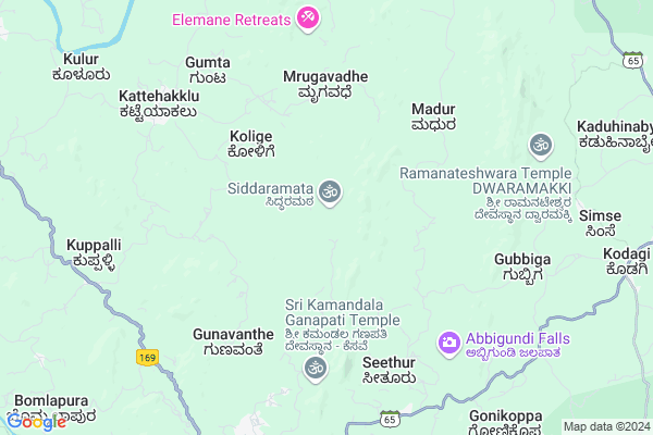
Siddaramata
Siddaramata Map
EDIT Map
Add Your House
 ..
..
Current Corona Virus Infected Patients Count in Chikmagalur District
| City Name | District Name | Total Covid cases |
|---|
Locality Name :
Siddaramata
( ಸಿದ್ಧರಮಠ )
Taluk Name : Koppa
District : Chikmagalur
State : Karnataka
Division : Mysore
Language : Kannada and Tulu, Konkani, Marathi, Urdu, Telugu And Gujarati
Current Time 10:58 AM
Date: Monday , Apr 28,2025 (IST)
Time zone: IST (UTC+5:30)
Elevation / Altitude: 570 meters. Above Seal level
Telephone Code / Std Code: 08265
Assembly constituency : Sringeri assembly constituency
Assembly MLA : T.D.Rajegowda
Lok Sabha constituency : Udupi Chikmagalur parliamentary constituency
Parliament MP : SHOBHA KARANDLAJE
Serpanch Name :
Pin Code : 577415
Post Office Name : Devangi
Main Village Name : Kelakuli
Commodities Prices : Koppa Market / Mandi
National Highways Reachable To Siddaramata
Nationa High Way :NH66
Nationa High Way :NH169A
Nationa High Way :NH66
Nationa High Way :NH169A
Rivers Near Siddaramata
Bhadra :ಭದ್ರಾ
Sita :ಸೀತಾ
Bhadra :ಭದ್ರಾ
Sita :ಸೀತಾ
About Siddaramata
Correct below Info and add more info about SiddaramataSiddaramata is a small Village/hamlet in Koppa Taluk in Chikmagalur District of Karnataka State, India. It comes under Kelakuli Panchayath. It belongs to Mysore Division . It is located 60 KM towards west from District head quarters Chikkamagaluru. 17 KM from Koppa (Rural). 291 KM from State capital Bangalore
Siddaramata Pin code is 577415 and postal head office is Devangi .
Koppa (rural) ( 9 KM ) , Hirekodige ( 9 KM ) , Harandur (koppa) ( 9 KM ) , Chavalmane ( 10 KM ) , Gubbiga ( 11 KM ) are the nearby Villages to Siddaramata. Siddaramata is surrounded by Koppa Taluk towards South , Tirthahalli Taluk towards west , Sringeri Taluk towards South , Shimoga Taluk towards North .
Shimoga , Tarikere , Chikmagalur , Karkala are the near by Cities to Siddaramata.
This Place is in the border of the Chikmagalur District and Shimoga District. Shimoga District Tirthahalli is west towards this place .
Demographics of Siddaramata
Kannada is the Local Language here. Total population of Siddaramata is 1136 .Males are 578 and Females are 558 living in 269 Houses. Total area of Siddaramata is 1535 hectares.Politics in Siddaramata
Bharatiya Janata Party , BJP , Indian National Congress (INC) , INC are the major political parties in this area.Polling Stations /Booths near Siddaramata
1)Government Higher Primary School Raghavendra Nagara Haranduru2)Government Lower Primary School
3)Government Higher Primary School
4)Government Higher Primary School Hokkalike Bommlapura
5)Government Lower Primary School
HOW TO REACH Siddaramata
By Road
Koppa is the Nearest Town to Siddaramata. Koppa is 16 km from Siddaramata. Road connectivity is there from Koppa to Siddaramata.By Rail
There is no railway station near to Siddaramata in less than 10 km.Colleges near Siddaramata
Gjc College
Address :
Governament Pre-university College
Address :
Skpu Callage
Address :
Malnad Education Society
Address :
Sri Maruthi Pre Univercity College
Address :
Schools in Siddaramata
Ghps Siddaramata
Address : kelakuli , koppa , chikkamangalore , Karnataka . PIN- 577126 , Post - Koppa
Govt Health Centers near Siddaramata
1) Katagar , MEDICAL OFFICER , PRAIMARY HEALTH CENTER KATAGARU ,2) Ashwathnagara , Health Sub Center Ashwathnagara A , , Ashwath Nagara
3) MALUR , MEDICAL OFFICER , PRAIMARY HEALTH CENTER MALUR ,
Petrol Bunks in Siddaramata,Koppa
HP Petrol Bunk
Balgadi Road; Melpal - Koppa Rd; Koppa; Karnataka 577126; India
10.3 KM distance Detail
HP PETROL PUMP - SRI GANESH SERVICE STATION
HPC Dealers Road Koppa; Mangalore; Karnataka 577126; India
10.4 KM distance Detail
more ..
Colleges in Siddaramata,Koppa
Government First Grade College; Koppa
Balagady; Koppa; Karnataka 577126; India
10.3 KM distance Detail
more ..
Schools in Siddaramata,Koppa
Government Higher Primary School; Kesave
Kesave; Siddaramata Rd; Kelakuli; Karnataka 577126; India
4.1 KM distance Detail
Government Higher Primary School; Chowki
Chowki; Siddaramata Rd; Gunavanthe; Karnataka 577126; India
7.8 KM distance Detail
Police Stations near Siddaramata,Koppa
N.R Pura Police Station
Opp. State Bank of Mysore; Narasimharajapura; Karnataka 577134; India
15.4 KM distance Detail
Thirthahalli Police Station
Soppugudde; Thirthahalli; Karnataka 577432; India
21.5 KM distance Detail
Governement Offices near Siddaramata,Koppa
DCF Office
Dcf office; Forest compound; Tirthahalli; Road; Koppa Rural; Karnataka 577126; India
10.3 KM distance Detail
About Siddaramata &
History
How to reach Siddaramata
Tourist Places Near By Siddaramata
Schools in Siddaramata
Colleges in Siddaramata
Temperature & weather of Siddaramata
places in Siddaramata
Siddaramata photos
More Information
How to reach Siddaramata
Tourist Places Near By Siddaramata
Schools in Siddaramata
Colleges in Siddaramata
Temperature & weather of Siddaramata
places in Siddaramata
Siddaramata photos
More Information
Village Talk
Post News or Events about this Village
Near Cities
Shimoga 44 KM near
Tarikere 53 KM near
Chikmagalur 58 KM near
Karkala 70 KM near
Shimoga 44 KM near
Tarikere 53 KM near
Chikmagalur 58 KM near
Karkala 70 KM near
Near By Taluks
Narasimharajapura 11 KM near
Koppa 16 KM near
Tirthahalli 21 KM near
Sringeri 29 KM near
Narasimharajapura 11 KM near
Koppa 16 KM near
Tirthahalli 21 KM near
Sringeri 29 KM near
Near By Air Ports
Bajpe Airport 100 KM near
Hubli Airport 220 KM near
Mysore Airport 223 KM near
Bengaluru International Airport 285 KM near
Bajpe Airport 100 KM near
Hubli Airport 220 KM near
Mysore Airport 223 KM near
Bengaluru International Airport 285 KM near
Near By Tourist Places
Sringeri 29 KM near
Kudremukh 35 KM near
Agumbe 37 KM near
Horanadu 43 KM near
Shimoga 43 KM near
Sringeri 29 KM near
Kudremukh 35 KM near
Agumbe 37 KM near
Horanadu 43 KM near
Shimoga 43 KM near
Near By Districts
Shimoga 46 KM near
Chikmagalur 58 KM near
Udupi 84 KM near
Dakshin Kannad 108 KM near
Shimoga 46 KM near
Chikmagalur 58 KM near
Udupi 84 KM near
Dakshin Kannad 108 KM near
Near By RailWay Station
Bhadravati Rail Way Station 47 KM near
Shivamogga Town Rail Way Station 47 KM near
Bhadravati Rail Way Station 47 KM near
Shivamogga Town Rail Way Station 47 KM near