| Home | City Bus | Maps | Villages | Cities | Rail | Tourist Places | School | College | Pin Codes | Corona Cases Count |
| Distance Calculator Bus Services IFSC Codes Trace Mobile Number Weather Search Place Trace IP Available Cash ATM/Banks Locate Polling Booth Report an Error contact People |
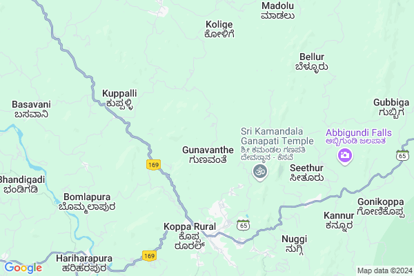
Kesave
Kesave Map
EDIT Map
Add Your House
 ..
..
Current Corona Virus Infected Patients Count in Chikmagalur District
| City Name | District Name | Total Covid cases |
|---|
Locality Name :
Kesave
( ಕೆಸವೆ )
Taluk Name : Koppa
District : Chikmagalur
State : Karnataka
Division : Mysore
Language : Kannada and Tulu, Konkani, Marathi, Urdu, Telugu And Gujarati
Current Time 05:59 AM
Date: Saturday , Apr 26,2025 (IST)
Time zone: IST (UTC+5:30)
Elevation / Altitude: 570 meters. Above Seal level
Telephone Code / Std Code: 08265
Assembly constituency : Sringeri assembly constituency
Assembly MLA : T.D.Rajegowda
Lok Sabha constituency : Udupi Chikmagalur parliamentary constituency
Parliament MP : SHOBHA KARANDLAJE
Serpanch Name :
Pin Code : 577126
Post Office Name : Koppa
Commodities Prices : Koppa Market / Mandi
Kesave Live Weather
Temperature: 21.7 °C
broken clouds
Humidity: 96%
Wind : 1.06 mt/sec towards SW
StationName : "Koppa"
observed on 1 Hours Back
Temperature: 21.7 °C
broken clouds
Humidity: 96%
Wind : 1.06 mt/sec towards SW
StationName : "Koppa"
observed on 1 Hours Back
Kesave Weather Forecast for Next 5 days
27-04-2025
21.4°C to 35.3°C
broken clouds, overcast clouds, light rain
21.4°C to 35.3°C
broken clouds, overcast clouds, light rain
28-04-2025
21.5°C to 35.0°C
overcast clouds, broken clouds, moderate rain, light rain
21.5°C to 35.0°C
overcast clouds, broken clouds, moderate rain, light rain
29-04-2025
20.7°C to 35.5°C
overcast clouds, clear sky, scattered clouds, light rain
20.7°C to 35.5°C
overcast clouds, clear sky, scattered clouds, light rain
30-04-2025
20.3°C to 33.7°C
scattered clouds, moderate rain, light rain, broken clouds
20.3°C to 33.7°C
scattered clouds, moderate rain, light rain, broken clouds
Edit below overview about Kesave
Edit below overview about Kesave
OverView of Kesave
There is Ganesh Temple called as Kamandala Ganapathi in front of Ganapathi the Water flow 365 days from Kamandala Ramesh Dixit from Brahma Temple Bangalore.Edit below overview about Kesave
National Highways Reachable To Kesave
Nationa High Way :NH66
Nationa High Way :NH169A
Nationa High Way :NH66
Nationa High Way :NH169A
Rivers Near Kesave
Bhadra :ಭದ್ರಾ
Sita :ಸೀತಾ
Bhadra :ಭದ್ರಾ
Sita :ಸೀತಾ
About Kesave
Kesave is a Village in Koppa Taluk in Chikmagalur District of Karnataka State, India. It belongs to Mysore Division . It is located 61 KM towards west from District head quarters Chikkamagaluru. 11 KM from Koppa (Rural). 293 KM from State capital Bangalore
Kesave Pin code is 577126 and postal head office is Koppa .
Harandur (koppa) ( 4 KM ) , Chavalmane ( 5 KM ) , Hirekodige ( 5 KM ) , Seethur ( 7 KM ) , Nuggi (bappunji) ( 10 KM ) are the nearby Villages to Kesave. Kesave is surrounded by Narasimharajapura Taluk towards East , Tirthahalli Taluk towards North , Sringeri Taluk towards South , Shimoga Taluk towards North .
Shimoga , Tarikere , Chikmagalur , Karkala are the near by Cities to Kesave.
This Place is in the border of the Chikmagalur District and Shimoga District. Shimoga District Tirthahalli is North towards this place .
Kesave 2011 Census Details
Kesave Local Language is Kannada. Kesave Village Total population is 844 and number of houses are 212. Female Population is 52.7%. Village literacy rate is 73.7% and the Female Literacy rate is 36.3%.
Population
| Census Parameter | Census Data |
| Total Population | 844 |
| Total No of Houses | 212 |
| Female Population % | 52.7 % ( 445) |
| Total Literacy rate % | 73.7 % ( 622) |
| Female Literacy rate | 36.3 % ( 306) |
| Scheduled Tribes Population % | 0.0 % ( 0) |
| Scheduled Caste Population % | 12.2 % ( 103) |
| Working Population % | 52.5 % |
| Child(0 -6) Population by 2011 | 70 |
| Girl Child(0 -6) Population % by 2011 | 41.4 % ( 29) |
Kesave Census More Deatils.
Politics in Kesave
Bharatiya Janata Party , BJP , Indian National Congress (INC) , INC are the major political parties in this area.Polling Stations /Booths near Kesave
1)Government Higher Primary School Gunavante Layout Haranduru-22)Government Higher Primary School Chowki
3)Government Higher Primary School Gunavante Layout Haranduru-1
4)Government Higher Primary School Hokkalike Bommlapura
5)Government Higher Primary School Siddaramata Dhakle Kelakuli
HOW TO REACH Kesave
By Road
Koppa is the Nearest Town to Kesave. Koppa is 6 km from Kesave. Road connectivity is there from Koppa to Kesave.By Rail
There is no railway station near to Kesave in less than 10 km.Colleges near Kesave
Gjc College
Address :
Governament Pre-university College
Address :
Skpu Callage
Address :
Malnad Education Society
Address :
Sri Maruthi Pre Univercity College
Address :
Schools in Kesave
Ghps Chowki
Address : kesave , koppa , chikkamangalore , Karnataka . PIN- 577126 , Post - Koppa
Ghps Kesave
Address : kesave , koppa , chikkamangalore , Karnataka . PIN- 577126 , Post - Koppa
Govt Health Centers near Kesave
1) Katagar , MEDICAL OFFICER , PRAIMARY HEALTH CENTER KATAGARU ,2) Ashwathnagara , Health Sub Center Ashwathnagara A , , Ashwath Nagara
3) B R Project Hospital (Govt Hospital) , Primary Health Centre, B R Project , Main Road , Opposite SBM Bank
Sub Villages in Kesave
Petrol Bunks in Kesave,Koppa
kalikamba fuel station
1; Thirthalli Road;upper; Solapur-Mangalore Hwy; Koppa; Karnataka 577126; India
5.8 KM distance Detail
HP PETROL PUMP - SRI GANESH SERVICE STATION
HPC Dealers Road Koppa; Mangalore; Karnataka 577126; India
6.1 KM distance Detail
more ..
Colleges in Kesave,Koppa
Government First Grade College; Koppa
Balagady; Koppa; Karnataka 577126; India
6.9 KM distance Detail
more ..
Schools in Kesave,Koppa
Government Higher Primary School; Kesave
Kesave; Siddaramata Rd; Kelakuli; Karnataka 577126; India
3.8 KM distance Detail
Government Higher Primary School; Suryadevasthana
Suryadevasthana; Karnataka 577126; India
3.8 KM distance Detail
Government Higher Primary School; Chowki
Chowki; Siddaramata Rd; Gunavanthe; Karnataka 577126; India
4.5 KM distance Detail
Sri Morarji Desai Residential School;Harandur; Koppa
Gunavanthe; Karnataka 577126; India
4.5 KM distance Detail
Electronic Shops in Kesave,Koppa
LG Enterprises
MMC Building;near Koppa Main bus stop; JMJ talkies Rd; Koppa; Karnataka 577126; India
5.6 KM distance Detail
Police Stations near Kesave,Koppa
N.R Pura Police Station
Opp. State Bank of Mysore; Narasimharajapura; Karnataka 577134; India
19.7 KM distance Detail
Thirthahalli Police Station
Soppugudde; Thirthahalli; Karnataka 577432; India
21.1 KM distance Detail
Governement Offices near Kesave,Koppa
DCF Office
Dcf office; Forest compound; Tirthahalli; Road; Koppa Rural; Karnataka 577126; India
5.2 KM distance Detail
About Kesave &
History
How to reach Kesave
Tourist Places Near By Kesave
Schools in Kesave
Colleges in Kesave
Temperature & weather of Kesave
places in Kesave
Kesave photos
More Information
How to reach Kesave
Tourist Places Near By Kesave
Schools in Kesave
Colleges in Kesave
Temperature & weather of Kesave
places in Kesave
Kesave photos
More Information
Village Talk
Post News or Events about this Village
Near Cities
Shimoga 49 KM near
Tarikere 57 KM near
Chikmagalur 59 KM near
Karkala 64 KM near
Shimoga 49 KM near
Tarikere 57 KM near
Chikmagalur 59 KM near
Karkala 64 KM near
Near By Taluks
Koppa 11 KM near
Narasimharajapura 14 KM near
Tirthahalli 21 KM near
Sringeri 24 KM near
Koppa 11 KM near
Narasimharajapura 14 KM near
Tirthahalli 21 KM near
Sringeri 24 KM near
Near By Air Ports
Bajpe Airport 95 KM near
Mysore Airport 223 KM near
Hubli Airport 223 KM near
Bengaluru International Airport 288 KM near
Bajpe Airport 95 KM near
Mysore Airport 223 KM near
Hubli Airport 223 KM near
Bengaluru International Airport 288 KM near
Near By Tourist Places
Sringeri 24 KM near
Agumbe 33 KM near
Kudremukh 38 KM near
Horanadu 38 KM near
Kemmanagundi 47 KM near
Sringeri 24 KM near
Agumbe 33 KM near
Kudremukh 38 KM near
Horanadu 38 KM near
Kemmanagundi 47 KM near
Near By Districts
Shimoga 51 KM near
Chikmagalur 59 KM near
Udupi 79 KM near
Dakshin Kannad 103 KM near
Shimoga 51 KM near
Chikmagalur 59 KM near
Udupi 79 KM near
Dakshin Kannad 103 KM near
Near By RailWay Station
Shivamogga Town Rail Way Station 52 KM near
Bhadravati Rail Way Station 52 KM near
Shivamogga Town Rail Way Station 52 KM near
Bhadravati Rail Way Station 52 KM near