| Home | City Bus | Maps | Villages | Cities | Rail | Tourist Places | School | College | Pin Codes | Corona Cases Count |
| Distance Calculator Bus Services IFSC Codes Trace Mobile Number Weather Search Place Trace IP Available Cash ATM/Banks Locate Polling Booth Report an Error contact People |
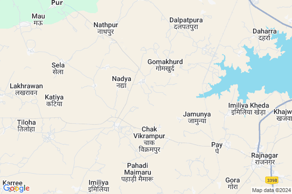
Pipat
Pipat Map
EDIT Map
Add Your House
 ..
..
Current Corona Virus Infected Patients Count in Chhatarpur District
| City Name | District Name | Total Covid cases |
|---|
Locality Name :
Pipat
( पिपात )
Tehsil Name : Rajnagar
District : Chhatarpur
State : Madhya Pradesh
Division : Sagar
Language : Hindi and Urdu, Bharia,devanagari
Current Time 05:31 AM
Date: Saturday , Apr 26,2025 (IST)
Time zone: IST (UTC+5:30)
Elevation / Altitude: 226 meters. Above Seal level
Telephone Code / Std Code: 07686
Assembly constituency : Rajnagar assembly constituency
Assembly MLA : Arvind Pateriya
Lok Sabha constituency : Khajuraho parliamentary constituency
Parliament MP : V.D. SHARMA (VISHNU DATT SHARMA)
Serpanch Name :
Pin Code : 471625
Post Office Name : Rajnager
Commodities Prices : Rajnagar Market / Mandi
Pipat Live Weather
Temperature: 29.1 °C
clear sky
Humidity: 13%
Wind : 3.2 mt/sec towards SW
StationName : "RÄ\u0081jnagar"
observed on Now
Temperature: 29.1 °C
clear sky
Humidity: 13%
Wind : 3.2 mt/sec towards SW
StationName : "RÄ\u0081jnagar"
observed on Now
Pipat Weather Forecast for Next 5 days
27-04-2025
29.7°C to 41.7°C
clear sky, scattered clouds, overcast clouds, broken clouds, few clouds
29.7°C to 41.7°C
clear sky, scattered clouds, overcast clouds, broken clouds, few clouds
28-04-2025
28.9°C to 41.3°C
clear sky, scattered clouds, broken clouds, overcast clouds
28.9°C to 41.3°C
clear sky, scattered clouds, broken clouds, overcast clouds
29-04-2025
28.6°C to 42.5°C
broken clouds, clear sky
28.6°C to 42.5°C
broken clouds, clear sky
30-04-2025
29.3°C to 44.6°C
clear sky, scattered clouds, overcast clouds, broken clouds
29.3°C to 44.6°C
clear sky, scattered clouds, overcast clouds, broken clouds
01-05-2025
28.0°C to 42.9°C
clear sky
28.0°C to 42.9°C
clear sky
Edit below overview about Pipat
Edit below overview about Pipat
OverView of Pipat
It is a very remote village with no internet connectivity. The people are very poor and illiterate as wellEdit below overview about Pipat
National Highways Reachable To Pipat
Nationa High Way :NH39
Nationa High Way :NH39
Rivers Near Pipat
Khudar River
Dhasan
Khudar River
Dhasan
About Pipat
Pipat is a Village in Rajnagar Tehsil in Chhatarpur District of Madhya Pradesh State, India. It belongs to Sagar Division . It is located 28 KM towards East from District head quarters Chhatarpur. 13 KM from Rajnagar. 360 KM from State capital Bhopal
Pipat Pin code is 471625 and postal head office is Rajnager .
Gomakala ( 3 KM ) , Dalpatpura ( 6 KM ) , Chaubar ( 6 KM ) , Pahadi Maimaru ( 6 KM ) , Pay ( 7 KM ) are the nearby Villages to Pipat. Pipat is surrounded by Chhatarpur Tehsil towards west , Laundi Tehsil towards East , Mahoba Tehsil towards North , Nowgong Tehsil towards west .
Chhatarpur , Mahoba , Panna , Nowgong are the near by Cities to Pipat.
Pipat 2011 Census Details
Pipat Local Language is Hindi. Pipat Village Total population is 2769 and number of houses are 531. Female Population is 47.9%. Village literacy rate is 50.1% and the Female Literacy rate is 20.0%.
Population
| Census Parameter | Census Data |
| Total Population | 2769 |
| Total No of Houses | 531 |
| Female Population % | 47.9 % ( 1327) |
| Total Literacy rate % | 50.1 % ( 1387) |
| Female Literacy rate | 20.0 % ( 553) |
| Scheduled Tribes Population % | 0.0 % ( 1) |
| Scheduled Caste Population % | 18.4 % ( 509) |
| Working Population % | 35.1 % |
| Child(0 -6) Population by 2011 | 442 |
| Girl Child(0 -6) Population % by 2011 | 47.3 % ( 209) |
Pipat Census More Deatils.
Politics in Pipat
Bharatiya Janata Party , BJP , INC are the major political parties in this area.Polling Stations /Booths near Pipat
1)Pipari2)Pipat
3)Gomakala
4)Gilounhan
5)Bhusaur
HOW TO REACH Pipat
By Rail
Rajnagar Rail Way Station is the very nearby railway stations to Pipat.Colleges near Pipat
Akanksha Institute Of Hotel Management
Address :
Schools in Pipat
Ms Pipat
Address : pipat , rajnagar , chhatarpur , Madhya Pradesh . PIN- 471625 , Post - Rajnager
Govt Health Centers near Pipat
1) SHC Imaliya , SHC Imaliya , NEAR SCHOOL ,2) SHC Purmau , SHC Purmau , Near By Aganwadi Pur , Near By Aganwadi Pur
3) PHC Rajnagar , PHC Rajnagar , NEAR BUS STAND ,
Sub Villages in Pipat
Colleges in Pipat,Rajnagar
raja balwant singh college
Near Narayan Bihar Colony; Khajuraho Road; Rajnagar; Chhatarpur; Madhya Pradesh 471606; India
13.1 KM distance Detail
College of Higher Education
Ganj; Chhatarpur; NH-75; Panna Khajuraho Road; Chhatarpur; Chhatarpur; Madhya Pradesh 471313; India
18.3 KM distance Detail
Pandit Dev Prabhakar Shastri College of Technology
NH-75; Panna Road; Gatheora; Chhatarpur; Madhya Pradesh 471001; India
23.4 KM distance Detail
more ..
Schools in Pipat,Rajnagar
Bright Future Public School Vikrampur Chhatarpur Madhya Pradesh
Chhatarpur; Madhya Pradesh 471001; India
2.9 KM distance Detail
Govt. Middle School Kaunda
Kaunda; Emaliya Road; Lakheri; Madhya Pradesh 471606; India
10.1 KM distance Detail
Electronic Shops in Pipat,Rajnagar
Bharat Computer
Lavkush Nagar - Rajapur - Rajnagar Rd; Bhole Colony; Rajnagar; Madhya Pradesh 471625; India
10.2 KM distance Detail
Super Markets in Pipat,Rajnagar
पुष्पेंद्र अहिरवार की अंडे की दुकान
Karela Rd; Maksudangarh; Madhya Pradesh 473287; India
18.0 KM distance Detail
Police Stations near Pipat,Rajnagar
BAMITHA police station-bamitha
Panna Road Bamitha 471105; National Highway 75; Bamitha; Madhya Pradesh 471105; India
21.6 KM distance Detail
Governement Offices near Pipat,Rajnagar
POLICE STATION RAJNAGAR
Soni Mohalla; Rajnagar; Madhya Pradesh 471625; India
10.3 KM distance Detail
About Pipat &
History
How to reach Pipat
Tourist Places Near By Pipat
Schools in Pipat
Colleges in Pipat
Temperature & weather of Pipat
places in Pipat
Pipat photos
More Information
How to reach Pipat
Tourist Places Near By Pipat
Schools in Pipat
Colleges in Pipat
Temperature & weather of Pipat
places in Pipat
Pipat photos
More Information
Village Talk
Post News or Events about this Village
Near Cities
Chhatarpur 28 KM near
Mahoba 43 KM near
Panna 44 KM near
Nowgong 46 KM near
Chhatarpur 28 KM near
Mahoba 43 KM near
Panna 44 KM near
Nowgong 46 KM near
Near By Taluks
Rajnagar 12 KM near
Chhatarpur 33 KM near
Laundi 35 KM near
Nowgong 44 KM near
Rajnagar 12 KM near
Chhatarpur 33 KM near
Laundi 35 KM near
Nowgong 44 KM near
Near By Air Ports
Khajuraho Airport 16 KM near
Kanpur Airport 194 KM near
Bamrauli Airport 223 KM near
Gwalior Airport 247 KM near
Khajuraho Airport 16 KM near
Kanpur Airport 194 KM near
Bamrauli Airport 223 KM near
Gwalior Airport 247 KM near
Near By Tourist Places
Khajuraho 15 KM near
Panna 48 KM near
Ajaigarh 48 KM near
Kalinjar 74 KM near
Satna 121 KM near
Khajuraho 15 KM near
Panna 48 KM near
Ajaigarh 48 KM near
Kalinjar 74 KM near
Satna 121 KM near
Near By Districts
Chhatarpur 27 KM near
Mahoba 45 KM near
Panna 48 KM near
Banda 88 KM near
Chhatarpur 27 KM near
Mahoba 45 KM near
Panna 48 KM near
Banda 88 KM near
Near By RailWay Station
Rajnagar Rail Way Station 7.0 KM near
Mahoba Junction Rail Way Station 46 KM near
Kulpahar Rail Way Station 50 KM near
Rajnagar Rail Way Station 7.0 KM near
Mahoba Junction Rail Way Station 46 KM near
Kulpahar Rail Way Station 50 KM near