| Home | City Bus | Maps | Villages | Cities | Rail | Tourist Places | School | College | Pin Codes | Corona Cases Count |
| Distance Calculator Bus Services IFSC Codes Trace Mobile Number Weather Search Place Trace IP Available Cash ATM/Banks Locate Polling Booth Report an Error contact People |
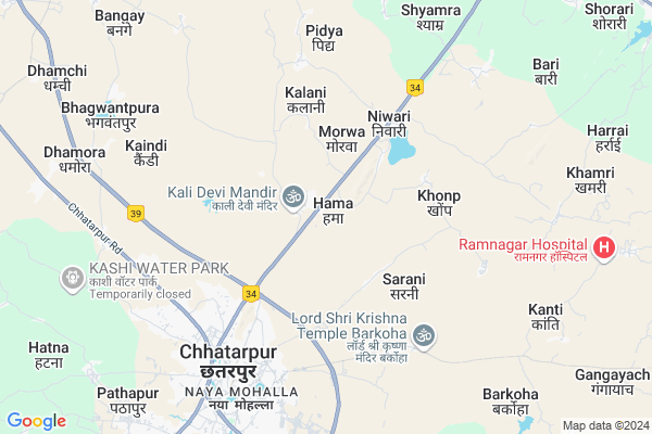
Hama
Hama Map
EDIT Map
Add Your House
 ..
..
Current Corona Virus Infected Patients Count in Chhatarpur District
| City Name | District Name | Total Covid cases |
|---|
Locality Name :
Hama
( हम )
Tehsil Name : Chhatarpur
District : Chhatarpur
State : Madhya Pradesh
Division : Sagar
Language : Hindi and Urdu, Bharia,devanagari
Current Time 04:18 AM
Date: Saturday , Apr 26,2025 (IST)
Time zone: IST (UTC+5:30)
Elevation / Altitude: 226 meters. Above Seal level
Telephone Code / Std Code: 07682
Assembly constituency : Chhatarpur assembly constituency
Assembly MLA : Lalita Yadav
Lok Sabha constituency : Tikamgarh parliamentary constituency
Parliament MP : Dr Virendra Kumar
Serpanch Name :
Pin Code : 471001
Post Office Name : Chhatarpur
Commodities Prices : Chhatarpur Market / Mandi
Hama Live Weather
Temperature: 29.1 °C
clear sky
Humidity: 13%
Wind : 3.88 mt/sec towards SW
StationName : "Chhatarpur"
observed on Now
Temperature: 29.1 °C
clear sky
Humidity: 13%
Wind : 3.88 mt/sec towards SW
StationName : "Chhatarpur"
observed on Now
Hama Weather Forecast for Next 5 days
27-04-2025
28.9°C to 41.1°C
clear sky, scattered clouds, overcast clouds, broken clouds, few clouds
28.9°C to 41.1°C
clear sky, scattered clouds, overcast clouds, broken clouds, few clouds
28-04-2025
28.8°C to 40.4°C
clear sky, broken clouds, overcast clouds
28.8°C to 40.4°C
clear sky, broken clouds, overcast clouds
29-04-2025
28.3°C to 42.3°C
broken clouds, few clouds, clear sky
28.3°C to 42.3°C
broken clouds, few clouds, clear sky
30-04-2025
29.1°C to 44.2°C
clear sky, few clouds, broken clouds, overcast clouds
29.1°C to 44.2°C
clear sky, few clouds, broken clouds, overcast clouds
National Highways Reachable To Hama
Nationa High Way :NH39
Nationa High Way :NH39
Rivers Near Hama
Khudar River
Dhasan
Khudar River
Dhasan
About Hama
Correct below Info and add more info about HamaHama is a Village in Chhatarpur Tehsil in Chhatarpur District of Madhya Pradesh State, India. It belongs to Sagar Division . It is located 7 KM towards North from District head quarters Chhatarpur. 13 KM from Chhatarpur. 343 KM from State capital Bhopal
Hama Pin code is 471001 and postal head office is Chhatarpur .
Niwari ( 3 KM ) , Sarani ( 3 KM ) , Khonp ( 3 KM ) , Kalani ( 4 KM ) , Saura ( 5 KM ) are the nearby Villages to Hama. Hama is surrounded by Nowgong Tehsil towards west , Rajnagar Tehsil towards East , Jaitpur Tehsil towards North , Bijawar Tehsil towards South .
Chhatarpur , Nowgong , Mahoba , Charkhari are the near by Cities to Hama.
Hama 2011 Census Details
Hama Local Language is Hindi. Hama Village Total population is 2310 and number of houses are 358. Female Population is 47.2%. Village literacy rate is 53.4% and the Female Literacy rate is 21.2%.
Population
| Census Parameter | Census Data |
| Total Population | 2310 |
| Total No of Houses | 358 |
| Female Population % | 47.2 % ( 1090) |
| Total Literacy rate % | 53.4 % ( 1234) |
| Female Literacy rate | 21.2 % ( 489) |
| Scheduled Tribes Population % | 0.0 % ( 0) |
| Scheduled Caste Population % | 34.3 % ( 792) |
| Working Population % | 48.2 % |
| Child(0 -6) Population by 2011 | 380 |
| Girl Child(0 -6) Population % by 2011 | 47.1 % ( 179) |
Hama Census More Deatils.
Politics in Hama
Bharatiya Janata Party , BJP , INC are the major political parties in this area.Polling Stations /Booths near Hama
1)Hama2)Guraiya
3)Kharka
4)Malpura
5)Rasuiyathakuran
HOW TO REACH Hama
By Rail
There is no railway station near to Hama in less than 10 km.Colleges near Hama
Jatayu Computer Center
Address :
Schools in Hama
Ms Hama
Address : hama , ishanagaar , chhatarpur , Madhya Pradesh . PIN- 471001 , Post - Chhatarpur
Govt Health Centers near Hama
1) SHC Niwari , SHC Niwari , MAHOBA ROAD, NIWARI ,2) SHC KENDI , SHC KENDI , KENDI , KENDI
3) UPHC-2 Tatoriya , Chansouriya Compounder KeMakan Me , Ayodhya Basti ,
Hospitals in Hama,Chhatarpur
Shree Ram Dental Clinic
NH86; Toria Mohalla; Chhatarpur; Madhya Pradesh 471001; India
5.5 KM distance Detail
MK MEMORIAL HOSPITAL
Vishwanath Colony; Chhatarpur; Madhya Pradesh 471001; India
5.9 KM distance Detail
smt M.K Memorial Hospital
Vishwanath Colony; Chhatarpur; Madhya Pradesh 471001; India
5.9 KM distance Detail
more ..
Petrol Bunks in Hama,Chhatarpur
Reliance Petrol Pump
Near Hotel Regency; National Highway 75; Vishwanath Colony; Chhatarpur; Madhya Pradesh 471001; India
6.3 KM distance Detail
Chhatarpur Filling Station
Road; Transport Nagar; Nowgong; Madhya Pradesh 471201; India
6.5 KM distance Detail
New Service Station
NH 75; Vishwanath Colony; Chhatarpur; Madhya Pradesh 471001; India
6.6 KM distance Detail
more ..
Colleges in Hama,Chhatarpur
Pt. Motilal Nehru Law College Campus
Chhatarpur; Madhya Pradesh 471001; India
3.3 KM distance Detail
JLS Computer College
NH -86; Mahoba road; Infront of Gurudwara; Toria Mohalla; Chhatarpur; Madhya Pradesh 471001; India
6.0 KM distance Detail
drjpcollegeofeducationresearchcentre
mahoba road; chhatarpur; NH86; Chhatarpur; Madhya Pradesh 471001; India
6.5 KM distance Detail
more ..
Schools in Hama,Chhatarpur
Dreamland English School
Mahoba Rd; Near kali devi Tiraha; Hama; Madhya Pradesh 471001; India
1.1 KM distance Detail
Electronic Shops in Hama,Chhatarpur
Anjana Car Decoration Chhatarpur
Vishwanath Colony; Chhatarpur; Madhya Pradesh 471001; India
5.3 KM distance Detail
LG Electronics
Ghanshyam DAS Tikariya Near Girls High School; Chattarpur Chattarpur; Madhya Pradesh 471001; India
5.8 KM distance Detail
Super Markets in Hama,Chhatarpur
JEEVAN. KIRANA..BAJARIYA
राम गली बजरिया; Naya Mohalla; Chhatarpur; Madhya Pradesh 471001; India
6.8 KM distance Detail
Local Parks in Hama,Chhatarpur
Pandit Deendayal Upadhyay Park Chhatarpur MP
Hanuman Toria; Chhatarpur; Madhya Pradesh 471001; India
7.7 KM distance Detail
Pandit Motilal Nehru Park
Shanti Nagar; Chhatarpur; Madhya Pradesh 471001; India
8.3 KM distance Detail
Police Stations near Hama,Chhatarpur
YATAYAAT THANA
bus stend no.1 chhatarpur 471001; Madhya Pradesh 471001; India
6.6 KM distance Detail
Kotwali Police Station
Mahal Road; Naya Mohalla; Chhatarpur; Madhya Pradesh 471001; India
6.9 KM distance Detail
CSP Office (Police)
NH86; Hanuman Toria; Chhatarpur; Madhya Pradesh 471001; India
7.2 KM distance Detail
Governement Offices near Hama,Chhatarpur
Chowk Bazar Square
Chowk Bazar Rd; Naya Mohalla; Chhatarpur; Madhya Pradesh 471001; India
6.6 KM distance Detail
vindrawan puram
Chetgiri Colony; Narayanpura; Chhatarpur; Madhya Pradesh 471001; India
6.8 KM distance Detail
About Hama &
History
How to reach Hama
Tourist Places Near By Hama
Schools in Hama
Colleges in Hama
Temperature & weather of Hama
places in Hama
Hama photos
More Information
How to reach Hama
Tourist Places Near By Hama
Schools in Hama
Colleges in Hama
Temperature & weather of Hama
places in Hama
Hama photos
More Information
Village Talk
Post News or Events about this Village
Near Cities
Chhatarpur 6 KM near
Nowgong 23 KM near
Mahoba 48 KM near
Charkhari 55 KM near
Chhatarpur 6 KM near
Nowgong 23 KM near
Mahoba 48 KM near
Charkhari 55 KM near
Near By Taluks
Chhatarpur 12 KM near
Nowgong 22 KM near
Rajnagar 32 KM near
Jaitpur 33 KM near
Chhatarpur 12 KM near
Nowgong 22 KM near
Rajnagar 32 KM near
Jaitpur 33 KM near
Near By Air Ports
Khajuraho Airport 37 KM near
Kanpur Airport 200 KM near
Gwalior Airport 227 KM near
Bamrauli Airport 245 KM near
Khajuraho Airport 37 KM near
Kanpur Airport 200 KM near
Gwalior Airport 227 KM near
Bamrauli Airport 245 KM near
Near By Tourist Places
Khajuraho 37 KM near
Panna 70 KM near
Ajaigarh 72 KM near
Kalinjar 97 KM near
Orchha 121 KM near
Khajuraho 37 KM near
Panna 70 KM near
Ajaigarh 72 KM near
Kalinjar 97 KM near
Orchha 121 KM near
Near By Districts
Chhatarpur 6 KM near
Mahoba 50 KM near
Panna 70 KM near
Tikamgarh 92 KM near
Chhatarpur 6 KM near
Mahoba 50 KM near
Panna 70 KM near
Tikamgarh 92 KM near
Near By RailWay Station
Kulpahar Rail Way Station 41 KM near
Mahoba Junction Rail Way Station 50 KM near
Kulpahar Rail Way Station 41 KM near
Mahoba Junction Rail Way Station 50 KM near