| Home | City Bus | Maps | Villages | Cities | Rail | Tourist Places | School | College | Pin Codes | Corona Cases Count |
| Distance Calculator Bus Services IFSC Codes Trace Mobile Number Weather Search Place Trace IP Available Cash ATM/Banks Locate Polling Booth Report an Error contact People |
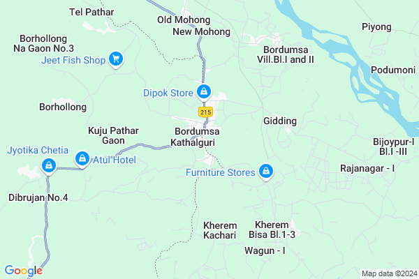
Dapkhu
Dapkhu Map
EDIT Map
Add Your House
 ..
..
Current Corona Virus Infected Patients Count in Changlang District
| City Name | District Name | Total Covid cases |
|---|
Locality Name :
Dapkhu
( दप्खु )
Tehsil Name : Bordumsa
District : Changlang
State : Arunachal Pradesh
Language : English and Hindi, Endangered
Current Time 12:51 PM
Date: Thursday , Apr 24,2025 (IST)
Time zone: IST (UTC+5:30)
Telephone Code / Std Code: 03800
Assembly constituency : Bordumsa Diyum assembly constituency
Assembly MLA : SOMLUNG MOSSANG
Lok Sabha constituency : parliamentary constituency
Parliament MP :
Serpanch Name :
Pin Code : 792056
Post Office Name : Bordumsa
Dapkhu Live Weather
Temperature: 26.0 °C
overcast clouds
Humidity: 66%
Wind : 2.14 mt/sec towards NW
StationName : "Digboi"
observed on Now
Temperature: 26.0 °C
overcast clouds
Humidity: 66%
Wind : 2.14 mt/sec towards NW
StationName : "Digboi"
observed on Now
Dapkhu Weather Forecast for Next 5 days
25-04-2025
17.7°C to 27.0°C
overcast clouds, broken clouds, light rain
17.7°C to 27.0°C
overcast clouds, broken clouds, light rain
26-04-2025
18.9°C to 32.5°C
light rain, broken clouds, few clouds
18.9°C to 32.5°C
light rain, broken clouds, few clouds
27-04-2025
19.0°C to 27.0°C
light rain, broken clouds
19.0°C to 27.0°C
light rain, broken clouds
28-04-2025
19.1°C to 24.1°C
light rain
19.1°C to 24.1°C
light rain
29-04-2025
19.2°C to 24.0°C
light rain, overcast clouds
19.2°C to 24.0°C
light rain, overcast clouds
National Highways Reachable To Dapkhu
Nationa High Way :NH315A
Nationa High Way :NH13
Nationa High Way :NH315A
Nationa High Way :NH13
Rivers Near Dapkhu
Emra river :Emra river :恩姆拉河 :ēnmǔlā hé
Treit River :Thvruit
Emra river :Emra river :恩姆拉河 :ēnmǔlā hé
Treit River :Thvruit
About Dapkhu
Correct below Info and add more info about DapkhuDapkhu is a Village in Bordumsa Tehsil in Changlang District of Arunachal Pradesh State, India. It is located 51 KM towards North from District head quarters Changlang. 258 KM from State capital Itanagar
Dapkhu Pin code is 792056 and postal head office is Bordumsa .
Dapkhu is surrounded by Upper Lekang Tehsil towards North , Ningroo Tehsil towards North , Namsai Tehsil towards North , Kakopathar Tehsil towards west .
Digboi , Margherita , Tinsukia , Duliajan Oil Town are the near by Cities to Dapkhu.
Dapkhu 2011 Census Details
Dapkhu Local Language is English. Dapkhu Village Total population is 505 and number of houses are 100. Female Population is 46.5%. Village literacy rate is 44.4% and the Female Literacy rate is 17.4%.
Population
| Census Parameter | Census Data |
| Total Population | 505 |
| Total No of Houses | 100 |
| Female Population % | 46.5 % ( 235) |
| Total Literacy rate % | 44.4 % ( 224) |
| Female Literacy rate | 17.4 % ( 88) |
| Scheduled Tribes Population % | 39.0 % ( 197) |
| Scheduled Caste Population % | 0.0 % ( 0) |
| Working Population % | 52.7 % |
| Child(0 -6) Population by 2011 | 86 |
| Girl Child(0 -6) Population % by 2011 | 39.5 % ( 34) |
Dapkhu Census More Deatils.
Politics in Dapkhu
N.A , Independent , NCP , INC are the major political parties in this area.Polling Stations /Booths near Dapkhu
1)Pry School Kherem Mura2)Middle School Balupathar
3)Pry.school Galenja
4)Temporary Structure U/mudoi Deep
5)Pry School Kherem Kachari
HOW TO REACH Dapkhu
By Rail
There is no railway station near to Dapkhu in less than 10 km.Colleges near Dapkhu
Government Higher Secondari School
Address :
Schools in Dapkhu
Dapkhu Pry.school
Address : dapkhu , bordumsa , changlang , Arunachal Pradesh . PIN- 792056 , Post - Bordumsa
Govt Health Centers near Dapkhu
1) SC Wamliang , SC Wamlaing , ,2) SC Blong , Blong , ,
3) PHC Kherang , Kherang , ,
Schools in Dapkhu,Bordumsa
GHSS Bordumsa
Bordumsa - Mahadevpur Rd; Bordumsa; Arunachal Pradesh 786160; India
2.6 KM distance Detail
JAWAHAR NAVODAYA VIDYALAYA
Goju Dist. Changlang;; Bordumsa; Arunachal Pradesh 792056; India
3.2 KM distance Detail
Local Parks in Dapkhu,Bordumsa
Governement Offices near Dapkhu,Bordumsa
P.H.E.D Kharsang
Jagun to Miao Rd; Kharsang; Arunachal Pradesh 792122; India
20.1 KM distance Detail
About Dapkhu &
History
How to reach Dapkhu
Tourist Places Near By Dapkhu
Schools in Dapkhu
Colleges in Dapkhu
Temperature & weather of Dapkhu
places in Dapkhu
Dapkhu photos
More Information
How to reach Dapkhu
Tourist Places Near By Dapkhu
Schools in Dapkhu
Colleges in Dapkhu
Temperature & weather of Dapkhu
places in Dapkhu
Dapkhu photos
More Information
Village Talk
Post News or Events about this Village
Near Cities
Digboi 33 KM near
Margherita 36 KM near
Tinsukia 57 KM near
Duliajan Oil Town 64 KM near
Digboi 33 KM near
Margherita 36 KM near
Tinsukia 57 KM near
Duliajan Oil Town 64 KM near
Near By Taluks
Bordumsa 0 KM near
Upper Lekang 11 KM near
Ningroo 15 KM near
Namsai 19 KM near
Bordumsa 0 KM near
Upper Lekang 11 KM near
Ningroo 15 KM near
Namsai 19 KM near
Near By Air Ports
Chabua Airport 94 KM near
Lilabari Airport 199 KM near
Rowriah Airport 211 KM near
Dimapur Airport 310 KM near
Chabua Airport 94 KM near
Lilabari Airport 199 KM near
Rowriah Airport 211 KM near
Dimapur Airport 310 KM near
Near By Tourist Places
Tirap 43 KM near
Changlang 49 KM near
Namdhapa 55 KM near
Tinsukia 57 KM near
Tezu(Parasuramkunda) 60 KM near
Tirap 43 KM near
Changlang 49 KM near
Namdhapa 55 KM near
Tinsukia 57 KM near
Tezu(Parasuramkunda) 60 KM near
Near By Districts
Changlang 49 KM near
Tinsukia 56 KM near
Lohit 60 KM near
Tirap 76 KM near
Changlang 49 KM near
Tinsukia 56 KM near
Lohit 60 KM near
Tirap 76 KM near
Near By RailWay Station
New Tinsukia Junction Rail Way Station 60 KM near
Naharkatiya Rail Way Station 66 KM near
New Tinsukia Junction Rail Way Station 60 KM near
Naharkatiya Rail Way Station 66 KM near