| Home | City Bus | Maps | Villages | Cities | Rail | Tourist Places | School | College | Pin Codes | Corona Cases Count |
| Distance Calculator Bus Services IFSC Codes Trace Mobile Number Weather Search Place Trace IP Available Cash ATM/Banks Locate Polling Booth Report an Error contact People |
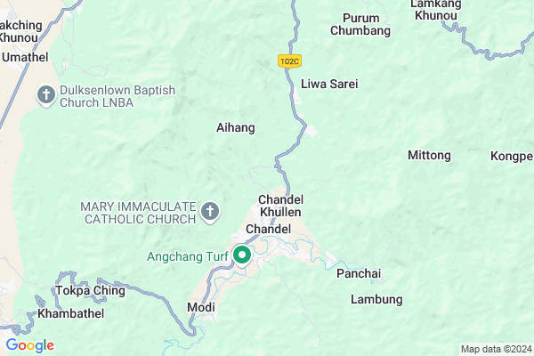
Kapaam (komlathabi) Map
EDIT Map
Add Your House
 ..
..
Current Corona Virus Infected Patients Count in Chandel District
| City Name | District Name | Total Covid cases |
|---|
Locality Name :
Kapaam (komlathabi)
( कपाम (komlathabi) )
Tehsil Name : Chandel
District : Chandel
State : Manipur
Language : Meiteilon (manipuri) and Thadou
Current Time 08:36 AM
Date: Wednesday , Apr 30,2025 (IST)
Time zone: IST (UTC+5:30)
Telephone Code / Std Code: 03872
Assembly constituency : Chandel assembly constituency
Assembly MLA : Ss. Olish
Lok Sabha constituency : Outer Manipur parliamentary constituency
Parliament MP : Lorho S. Pfoze
Serpanch Name :
Pin Code : 795135
Post Office Name : Pallel
Commodities Prices : Thoubal Market / Mandi
Kapaam (komlathabi) Live Weather
Temperature: 17.2 °C
overcast clouds
Humidity: 92%
Wind : 0.79 mt/sec towards W
StationName : "Kakching"
observed on 2 Hours Back
Temperature: 17.2 °C
overcast clouds
Humidity: 92%
Wind : 0.79 mt/sec towards W
StationName : "Kakching"
observed on 2 Hours Back
Kapaam (komlathabi) Weather Forecast for Next 5 days
01-05-2025
16.6°C to 29.6°C
broken clouds, light rain
16.6°C to 29.6°C
broken clouds, light rain
02-05-2025
15.5°C to 29.2°C
light rain, moderate rain, scattered clouds, broken clouds
15.5°C to 29.2°C
light rain, moderate rain, scattered clouds, broken clouds
03-05-2025
16.0°C to 29.8°C
broken clouds, overcast clouds, light rain, scattered clouds
16.0°C to 29.8°C
broken clouds, overcast clouds, light rain, scattered clouds
04-05-2025
17.0°C to 31.5°C
broken clouds, light rain, clear sky, scattered clouds, few clouds
17.0°C to 31.5°C
broken clouds, light rain, clear sky, scattered clouds, few clouds
05-05-2025
18.3°C to 32.4°C
few clouds, scattered clouds, overcast clouds, broken clouds, clear sky
18.3°C to 32.4°C
few clouds, scattered clouds, overcast clouds, broken clouds, clear sky
National Highways Reachable To Kapaam (komlathabi)
Nationa High Way :NH102B
Nationa High Way :NH2
Nationa High Way :NH102B
Nationa High Way :NH2
Rivers Near Kapaam (komlathabi)
Manipur River
Khuga River
Manipur River
Khuga River
About Kapaam (komlathabi)
Correct below Info and add more info about Kapaam (komlathabi)Kapaam (komlathabi) is a Village in Chandel Tehsil in Chandel District of Manipur State, India. It is located 2 KM towards North from District head quarters Chandel. 59 KM from State capital Imphal
Kapaam (komlathabi) Pin code is 795135 and postal head office is Pallel .
Kapaam (komlathabi) is surrounded by Kakching Tehsil towards North , Tengnoupal Tehsil towards East , Chakpikarong Tehsil towards South , Sangaikot Tehsil towards west .
Kakching , Mayang Imphal , Thoubal , Lilong are the near by Cities to Kapaam (komlathabi).
This Place is in the border of the Chandel District and Thoubal District. Thoubal District Kakching is North towards this place .
Demographics of Kapaam (komlathabi)
Meiteilon (manipuri) is the Local Language here.Politics in Kapaam (komlathabi)
NPF , Naga Peoples Front , BJP , PDA , INC are the major political parties in this area.Polling Stations /Booths near Kapaam (komlathabi)
1)Charangching Khunou2)K Savompa
3)Larong
4)Hengsi
5)Japhou Bazar Part-i(a)
HOW TO REACH Kapaam (komlathabi)
By Rail
There is no railway station near to Kapaam (komlathabi) in less than 10 km.Schools near Kapaam (komlathabi)
Jawahar Navodaya Vidyalaya
Address : liwa khullen sarei , chandel , chandel , Manipur . PIN- 795127 , Post - Chandel
Thani Memorial Training High School
Address : , chandel , chandel , Manipur . PIN- 795127 , Post - Chandel
Maha Union High School
Address : japhou , chandel , chandel , Manipur . PIN- 795127 , Post - Chandel
Mantak Jr. H S
Address : mantak village , chandel , chandel , Manipur . PIN- 795103 , Post - Kakching
Govt Health Centers near Kapaam (komlathabi)
1) Pallel PHC , , ,2) PHSC Thongam , , , Thongam L.P School
3) PHSC Waikhong , , ,
Hospitals in Kapaam (komlathabi),Chandel
Greenland Hospital & Research Centre;New Molbem;Khopijang Village;Serou Lamkhai;Chandel District;Manipur 79510
Sugnu - Chakpikarong Road; Nungpan; Manipur 795102; India
19.7 KM distance Detail
more ..
Local Parks in Kapaam (komlathabi),Chandel
Governement Offices near Kapaam (komlathabi),Chandel
DIO (District Immunization Officer)Chandel Family Welfare Service
Hnatham; Manipur 795127; India
2.8 KM distance Detail
About Kapaam (komlathabi) &
History
How to reach Kapaam (komlathabi)
Tourist Places Near By Kapaam (komlathabi)
Schools in Kapaam (komlathabi)
Colleges in Kapaam (komlathabi)
Temperature & weather of Kapaam (komlathabi)
places in Kapaam (komlathabi)
Kapaam (komlathabi) photos
More Information
How to reach Kapaam (komlathabi)
Tourist Places Near By Kapaam (komlathabi)
Schools in Kapaam (komlathabi)
Colleges in Kapaam (komlathabi)
Temperature & weather of Kapaam (komlathabi)
places in Kapaam (komlathabi)
Kapaam (komlathabi) photos
More Information
Village Talk
Post News or Events about this Village
Near Cities
Kakching 18 KM near
Mayang Imphal 33 KM near
Thoubal 35 KM near
Lilong 41 KM near
Kakching 18 KM near
Mayang Imphal 33 KM near
Thoubal 35 KM near
Lilong 41 KM near
Near By Taluks
Chandel 0 KM near
Kakching 16 KM near
Tengnoupal 22 KM near
Chakpikarong 24 KM near
Chandel 0 KM near
Kakching 16 KM near
Tengnoupal 22 KM near
Chakpikarong 24 KM near
Near By Air Ports
Imphal Municipal Airport 52 KM near
Kumbhirgram Airport 135 KM near
Aizawl Airport 168 KM near
Dimapur Airport 192 KM near
Imphal Municipal Airport 52 KM near
Kumbhirgram Airport 135 KM near
Aizawl Airport 168 KM near
Dimapur Airport 192 KM near
Near By Tourist Places
Chandel 3 KM near
Thoubal 37 KM near
Imphal 57 KM near
Tamenglong 97 KM near
Champhai 135 KM near
Chandel 3 KM near
Thoubal 37 KM near
Imphal 57 KM near
Tamenglong 97 KM near
Champhai 135 KM near
Near By Districts
Chandel 2 KM near
Churachandpur 33 KM near
Thoubal 35 KM near
Bishnupur 45 KM near
Chandel 2 KM near
Churachandpur 33 KM near
Thoubal 35 KM near
Bishnupur 45 KM near
Near By RailWay Station
Silchar Rail Way Station 149 KM near
Badarpur Junction Rail Way Station 175 KM near
Silchar Rail Way Station 149 KM near
Badarpur Junction Rail Way Station 175 KM near