| Home | City Bus | Maps | Villages | Cities | Rail | Tourist Places | School | College | Pin Codes | Corona Cases Count |
| Distance Calculator Bus Services IFSC Codes Trace Mobile Number Weather Search Place Trace IP Available Cash ATM/Banks Locate Polling Booth Report an Error contact People |
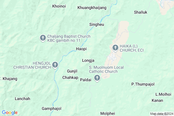
Longja
Longja Map
EDIT Map
Add Your House
 ..
..
Current Corona Virus Infected Patients Count in Chandel District
| City Name | District Name | Total Covid cases |
|---|
Locality Name :
Longja
( लांगजा )
Tehsil Name : Chakpikarong
District : Chandel
State : Manipur
Language : Meiteilon (manipuri) and Thadou
Current Time 08:55 AM
Date: Wednesday , Apr 30,2025 (IST)
Time zone: IST (UTC+5:30)
Telephone Code / Std Code: 03878
Assembly constituency : Chandel assembly constituency
Assembly MLA : Ss. Olish
Lok Sabha constituency : Outer Manipur parliamentary constituency
Parliament MP : Lorho S. Pfoze
Serpanch Name :
Pin Code : 795102
Post Office Name : Chakpikarong
Commodities Prices : Bishenpur Market / Mandi
National Highways Reachable To Longja
Nationa High Way :NH102B
Nationa High Way :NH102B
Rivers Near Longja
Manipur River
Lokchao River
Manipur River
Lokchao River
About Longja
Correct below Info and add more info about LongjaLongja is a Village in Chakpikarong Tehsil in Chandel District of Manipur State, India. It is located 33 KM towards South from District head quarters Chandel. 10 KM from Chakpikarong. 88 KM from State capital Imphal
Longja Pin code is 795102 and postal head office is Chakpikarong .
Gunjil ( 2 KM ) , Paldai ( 2 KM ) , Chahkap ( 3 KM ) , Songkong ( 4 KM ) , Mongjang ( 5 KM ) are the nearby Villages to Longja. Longja is surrounded by Sangaikot Tehsil towards North , Saikot Tehsil towards North , Singngat Tehsil towards west , Lamka Tehsil towards North .
Kakching , Mayang Imphal , Thoubal , Lilong are the near by Cities to Longja.
This Place is in the border of the Chandel District and Churachandpur District. Churachandpur District Samulamlan is North towards this place .
Longja 2011 Census Details
Longja Local Language is Meiteilon (manipuri). Longja Village Total population is 570 and number of houses are 112. Female Population is 54.4%. Village literacy rate is 49.6% and the Female Literacy rate is 25.8%.
Population
| Census Parameter | Census Data |
| Total Population | 570 |
| Total No of Houses | 112 |
| Female Population % | 54.4 % ( 310) |
| Total Literacy rate % | 49.6 % ( 283) |
| Female Literacy rate | 25.8 % ( 147) |
| Scheduled Tribes Population % | 98.8 % ( 563) |
| Scheduled Caste Population % | 0.0 % ( 0) |
| Working Population % | 61.6 % |
| Child(0 -6) Population by 2011 | 67 |
| Girl Child(0 -6) Population % by 2011 | 41.8 % ( 28) |
Longja Census More Deatils.
Politics in Longja
NPF , Naga Peoples Front , BJP , PDA , INC are the major political parties in this area.Polling Stations /Booths near Longja
1)Rungchang2)New Songjang
3)Liwa Sarei
4)Molngat
5)Aihang
HOW TO REACH Longja
By Rail
There is no railway station near to Longja in less than 10 km.Schools in Longja
Longja P S
Address : longja , chakpikarong , chandel , Manipur . PIN- 795102 , Post - Chakpikarong
Govt Health Centers near Longja
1) Sugnu CHC , , , Sugnu Bazar2) PHSC Thongam , , , Thongam L.P School
3) PHSC Waikhong , , ,
Hospitals in Longja,Chakpikarong
Greenland Hospital & Research Centre;New Molbem;Khopijang Village;Serou Lamkhai;Chandel District;Manipur 79510
Sugnu - Chakpikarong Road; Nungpan; Manipur 795102; India
15.8 KM distance Detail
more ..
Super Markets in Longja,Chakpikarong
Governement Offices near Longja,Chakpikarong
Sugnu Nagar Panchayat / Ward Development Committee Ward No. 2
Sugnu; Manipur 795101; India
21.8 KM distance Detail
About Longja &
History
How to reach Longja
Tourist Places Near By Longja
Schools in Longja
Colleges in Longja
Temperature & weather of Longja
places in Longja
Longja photos
More Information
How to reach Longja
Tourist Places Near By Longja
Schools in Longja
Colleges in Longja
Temperature & weather of Longja
places in Longja
Longja photos
More Information
Village Talk
Post News or Events about this Village
Near Cities
Kakching 49 KM near
Mayang Imphal 58 KM near
Thoubal 65 KM near
Lilong 69 KM near
Kakching 49 KM near
Mayang Imphal 58 KM near
Thoubal 65 KM near
Lilong 69 KM near
Near By Taluks
Chakpikarong 10 KM near
Sangaikot 11 KM near
Saikot 23 KM near
Lamka 27 KM near
Chakpikarong 10 KM near
Sangaikot 11 KM near
Saikot 23 KM near
Lamka 27 KM near
Near By Air Ports
Imphal Municipal Airport 78 KM near
Kumbhirgram Airport 134 KM near
Aizawl Airport 139 KM near
Dimapur Airport 216 KM near
Imphal Municipal Airport 78 KM near
Kumbhirgram Airport 134 KM near
Aizawl Airport 139 KM near
Dimapur Airport 216 KM near
Near By Tourist Places
Chandel 30 KM near
Thoubal 67 KM near
Imphal 84 KM near
Champhai 101 KM near
Tamenglong 111 KM near
Chandel 30 KM near
Thoubal 67 KM near
Imphal 84 KM near
Champhai 101 KM near
Tamenglong 111 KM near
Near By Districts
Churachandpur 28 KM near
Chandel 32 KM near
Bishnupur 61 KM near
Thoubal 65 KM near
Churachandpur 28 KM near
Chandel 32 KM near
Bishnupur 61 KM near
Thoubal 65 KM near
Near By RailWay Station
Silchar Rail Way Station 144 KM near
Badarpur Junction Rail Way Station 168 KM near
Silchar Rail Way Station 144 KM near
Badarpur Junction Rail Way Station 168 KM near