| Home | City Bus | Maps | Villages | Cities | Rail | Tourist Places | School | College | Pin Codes | Corona Cases Count |
| Distance Calculator Bus Services IFSC Codes Trace Mobile Number Weather Search Place Trace IP Available Cash ATM/Banks Locate Polling Booth Report an Error contact People |
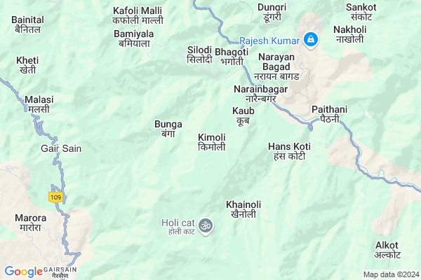
Kimoli
Kimoli Map
EDIT Map
Add Your House
 ..
..
Current Corona Virus Infected Patients Count in Chamoli District
| City Name | District Name | Total Covid cases |
|---|
Locality Name :
Kimoli
( किमोली )
Block Name : Narayanbagar
District : Chamoli
State : Uttarakhand
Language : Hindi and Urdu
Current Time 11:33 AM
Date: Tuesday , Apr 29,2025 (IST)
Time zone: IST (UTC+5:30)
Telephone Code / Std Code: 01372
Assembly constituency : Tharali assembly constituency
Assembly MLA : Bhupal Ram Tamta
Lok Sabha constituency : Garhwal parliamentary constituency
Parliament MP : Tirath Singh Rawat
Serpanch Name :
Pin Code : 246455
Post Office Name : Narainbagar
Commodities Prices : Ramnagar Market / Mandi
Kimoli Live Weather
Temperature: 24.6 °C
broken clouds
Humidity: 28%
Wind : 1.57 mt/sec towards SW
StationName : "Uttarakhand"
observed on 1 Hours Back
Temperature: 24.6 °C
broken clouds
Humidity: 28%
Wind : 1.57 mt/sec towards SW
StationName : "Uttarakhand"
observed on 1 Hours Back
Kimoli Weather Forecast for Next 5 days
30-04-2025
13.4°C to 27.3°C
broken clouds, light rain, overcast clouds
13.4°C to 27.3°C
broken clouds, light rain, overcast clouds
01-05-2025
12.7°C to 27.8°C
broken clouds, scattered clouds, few clouds, moderate rain
12.7°C to 27.8°C
broken clouds, scattered clouds, few clouds, moderate rain
02-05-2025
13.2°C to 24.8°C
broken clouds, overcast clouds, light rain, moderate rain
13.2°C to 24.8°C
broken clouds, overcast clouds, light rain, moderate rain
03-05-2025
13.1°C to 25.6°C
broken clouds, overcast clouds, light rain, moderate rain
13.1°C to 25.6°C
broken clouds, overcast clouds, light rain, moderate rain
04-05-2025
13.3°C to 24.5°C
overcast clouds, light rain
13.3°C to 24.5°C
overcast clouds, light rain
Edit below overview about Kimoli
Edit below overview about Kimoli
OverView of Kimoli
Kimoli is a lovely village surrounded by green hills with 3 sides.In front as east there is a massive hill ans known as KANPUR GARHI(it is said that the top of the hill was the capital of KANAKPAL from PARMAR DYNASTY of GARHWAL).The hill of Kanpur is also known as the crown of KIMOLI because it can be seen from far away fron its reach.The back side as the West of the village has also a big hill known as CHHITULA PAKH compete the Kanpur garhi because of its height.The orth side of the village has open area and connects village to its block NARAYANBAGAR and many more villages.The south side of the village has a dnse forest which supplies daily needs as wood,grass and many more. The cremation ghats are also situated at the south side of the village.Edit below overview about Kimoli
National Highways Reachable To Kimoli
Nationa High Way :NH534
Nationa High Way :NH309
Nationa High Way :NH534
Nationa High Way :NH309
Rivers Near Kimoli
Pindar :Pindar River
Ramganga
Pindar :Pindar River
Ramganga
About Kimoli
Kimoli is a Village in Narayanbagar Block in Chamoli District of Uttarakhand State, India. It is located 39 KM towards South from District head quarters Chamoli Gopeshwar. 3 KM from Narayan Bagar. 151 KM from State capital Dehradun
Kimoli Pin code is 246455 and postal head office is Narainbagar .
Maroda ( 2 KM ) , Meeng ( 3 KM ) , Angoth ( 3 KM ) , Bedula ( 3 KM ) , Kansola ( 3 KM ) are the nearby Villages to Kimoli. Kimoli is surrounded by Gairsain Block towards South , Tharali Block towards East , Karnaprayag Block towards North , Ghat Block towards North .
Pauri , Almora , Nainital , Ramnagar are the near by Cities to Kimoli.
Kimoli 2011 Census Details
Kimoli Local Language is Hindi. Kimoli Village Total population is 1079 and number of houses are 196. Female Population is 54.1%. Village literacy rate is 62.7% and the Female Literacy rate is 28.4%.
Population
| Census Parameter | Census Data |
| Total Population | 1079 |
| Total No of Houses | 196 |
| Female Population % | 54.1 % ( 584) |
| Total Literacy rate % | 62.7 % ( 677) |
| Female Literacy rate | 28.4 % ( 306) |
| Scheduled Tribes Population % | 0.0 % ( 0) |
| Scheduled Caste Population % | 36.0 % ( 388) |
| Working Population % | 27.6 % |
| Child(0 -6) Population by 2011 | 171 |
| Girl Child(0 -6) Population % by 2011 | 46.8 % ( 80) |
Kimoli Census More Deatils.
Politics in Kimoli
BJP , BJP , INC are the major political parties in this area.Polling Stations /Booths near Kimoli
1)Narayanbagar2)Narangi
3)Gwaldam State
4)Pali Malli
5)Kera
HOW TO REACH Kimoli
By Rail
There is no railway station near to Kimoli in less than 10 km.Colleges near Kimoli
Government Inter Collage
Address :
Gic Bhagawati
Address :
Schools in Kimoli
Ups Devidhar (kimoli)
Address : kimoli , narayanbagar , chamoli , Uttarakhand . PIN- 246455 , Post - Narainbagar
Govt Health Centers near Kimoli
1) Health Sub Center Wan , SC Wan , , Near Laatu Devta Temple2) Health Sub Center Mundoli , SC Mundoli , , Near Mundoli Market
3) Health Sub Center Dadarbagad , SC Dadarbagad , , Near Bunga Village
Hospitals in Kimoli,Narayanbagar
Primary Health Centre
Chamoli; SH-11; Bageswar Road; Narayan Bagar; Narayan Bagar; Uttarakhand 246455; India
5.0 KM distance Detail
Government Hospital Narayanbagar
Narayanbagar; Dungari; Uttarakhand 246455; India
5.0 KM distance Detail
Government Hospital
Almora-Bageshwar-Gopeshwar Road; Chopata; Uttarakhand 246453; India
9.3 KM distance Detail
दिनेश जोशी मेडीकोज थराली.
Tharali Dewal Rd; Tharali; Uttarakhand 246482; India
16.5 KM distance Detail
more ..
Petrol Bunks in Kimoli,Narayanbagar
Indian Oil Petrol Pump
Chamoli; SH-11; Bageswar Road; Narayan Bagar; Narayan Bagar; Uttarakhand 246455; India
15.0 KM distance Detail
more ..
Colleges in Kimoli,Narayanbagar
Government Inter College
Paintoli; Almora-Bageshwar-Gopeshwar Rd; Arkhanda; Uttarakhand 246455; India
8.7 KM distance Detail
Government Inter College
Tharali Dewal Rd; Tharali; Uttarakhand 246481; India
16.3 KM distance Detail
Government Girls Inter College
Tharali Dewal Rd; Tharali; Uttarakhand 246481; India
16.6 KM distance Detail
more ..
Schools in Kimoli,Narayanbagar
Shri Guru Ram Rai Public School
Panthi; Chamoli; SH-11; Bageswar Road; Narayan Bagar; Narayan Bagar; Uttarakhand 246455; India
4.1 KM distance Detail
Govt High School
HANSKOTI; Karanprayag Gwaldam Bageshwar Almora Nainital Rd; Hans Koti; Uttarakhand 246455; India
4.6 KM distance Detail
Government Primary School Narayanbagar
Almora-Bageshwar-Gopeshwar Rd; Dungari; Uttarakhand 246455; India
4.9 KM distance Detail
Electronic Shops in Kimoli,Narayanbagar
Bist Electronics
Almora-Bageshwar-Gopeshwar Rd; Dungari; Uttarakhand 246455; India
5.1 KM distance Detail
Best Electronics
Almora-Bageshwar-Gopeshwar Rd; Dungari; Uttarakhand 246455; India
5.1 KM distance Detail
Super Markets in Kimoli,Narayanbagar
About Kimoli &
History
How to reach Kimoli
Tourist Places Near By Kimoli
Schools in Kimoli
Colleges in Kimoli
Temperature & weather of Kimoli
places in Kimoli
Kimoli photos
More Information
How to reach Kimoli
Tourist Places Near By Kimoli
Schools in Kimoli
Colleges in Kimoli
Temperature & weather of Kimoli
places in Kimoli
Kimoli photos
More Information
Village Talk
Post News or Events about this Village
Near Cities
Pauri 63 KM near
Almora 70 KM near
Nainital 91 KM near
Ramnagar 92 KM near
Pauri 63 KM near
Almora 70 KM near
Nainital 91 KM near
Ramnagar 92 KM near
Near By Taluks
Narayanbagar 3 KM near
Gairsain 12 KM near
Tharali 16 KM near
Karnaprayag 17 KM near
Narayanbagar 3 KM near
Gairsain 12 KM near
Tharali 16 KM near
Karnaprayag 17 KM near
Near By Air Ports
Pantnagar Airport 134 KM near
Dehra Dun Airport 145 KM near
Muzaffarnagar Airport 201 KM near
Simla Airport 267 KM near
Pantnagar Airport 134 KM near
Dehra Dun Airport 145 KM near
Muzaffarnagar Airport 201 KM near
Simla Airport 267 KM near
Near By Tourist Places
Gairsain 9 KM near
Gauchar 31 KM near
Valley of Flowers 36 KM near
Gopeshwar 38 KM near
Dwarahat 41 KM near
Gairsain 9 KM near
Gauchar 31 KM near
Valley of Flowers 36 KM near
Gopeshwar 38 KM near
Dwarahat 41 KM near
Near By Districts
Chamoli 37 KM near
Rudra Prayag 46 KM near
Bageshwar 56 KM near
Pauri Garhwal 63 KM near
Chamoli 37 KM near
Rudra Prayag 46 KM near
Bageshwar 56 KM near
Pauri Garhwal 63 KM near
Near By RailWay Station
Ramnagar Rail Way Station 93 KM near
Kathgodam Rail Way Station 107 KM near
Ramnagar Rail Way Station 93 KM near
Kathgodam Rail Way Station 107 KM near