| Home | City Bus | Maps | Villages | Cities | Rail | Tourist Places | School | College | Pin Codes | Corona Cases Count |
| Distance Calculator Bus Services IFSC Codes Trace Mobile Number Weather Search Place Trace IP Available Cash ATM/Banks Locate Polling Booth Report an Error contact People |
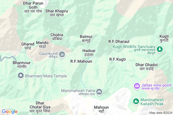
Hadsar
Hadsar Map
EDIT Map
Add Your House
 ..
..
Current Corona Virus Infected Patients Count in Chamba District
| City Name | District Name | Total Covid cases |
|---|---|---|
| Tissa | Chamba | 4 |
| Chamba District | Chamba | 2 |
Locality Name :
Hadsar
( हड़सर )
Tehsil Name : Bharmour
District : Chamba
State : Himachal Pradesh
Language : Hindi and Bhattiyali, Dogri-kangri, Pahari
Current Time 11:23 AM
Date: Friday , Apr 25,2025 (IST)
Time zone: IST (UTC+5:30)
Elevation / Altitude: 846 meters. Above Seal level
Telephone Code / Std Code: 01895
Assembly constituency : Bharmour assembly constituency
Assembly MLA : Dr. Janak Raj
Lok Sabha constituency : Mandi parliamentary constituency
Parliament MP : RAM SWAROOP SHARMA
Serpanch Name :
Pin Code : 176315
Post Office Name : Bharmour
Alternate Village Name : Harsar
Commodities Prices : Palampur Market / Mandi
Hadsar Live Weather
Temperature: 7.7 °C
scattered clouds
Humidity: 31%
Wind : 3.29 mt/sec towards W
StationName : "Dharamsala"
observed on Now
Temperature: 7.7 °C
scattered clouds
Humidity: 31%
Wind : 3.29 mt/sec towards W
StationName : "Dharamsala"
observed on Now
Hadsar Weather Forecast for Next 5 days
26-04-2025
8.9°C to 17.7°C
few clouds, light rain, scattered clouds, clear sky
8.9°C to 17.7°C
few clouds, light rain, scattered clouds, clear sky
27-04-2025
7.8°C to 19.7°C
clear sky, overcast clouds, light rain
7.8°C to 19.7°C
clear sky, overcast clouds, light rain
28-04-2025
7.3°C to 20.2°C
clear sky, broken clouds
7.3°C to 20.2°C
clear sky, broken clouds
29-04-2025
9.1°C to 22.8°C
clear sky, few clouds, scattered clouds
9.1°C to 22.8°C
clear sky, few clouds, scattered clouds
30-04-2025
10.8°C to 23.4°C
clear sky, scattered clouds
10.8°C to 23.4°C
clear sky, scattered clouds
Edit below overview about Hadsar
Edit below overview about Hadsar
OverView of Hadsar
Hadsar is a village where road from Chamba ends and two on foot treks to Manimahesh lake and Kugati Pass begins. It is also situated on the confluence of Budhil river and a stream flowing from Manimahes lake and is last village on road almost 17 kms from Bharmour. There is temple and some shrines for the stay of pilgrims and also few shops. There are also few houses of tribal Gaddi people But it is very important place to climb towards highest peaks of Chamba Kailalsh or Kugti Pass or for treaking in these remote high inner ranges and lake of Manimahsh. Pilgrims stay here for a night before starting climbing to 14 km on foot ascent to Manimahes Lake where like Amarnath yatra a 15 days long Manimahesh Yatra is orgnised from Janamashtmi to Radhashtmi and final holy bath into lake is happened on Radhashtmi. There are now human houses beyound Hadsar upto Manimahesh lake only tents are estblished for the stay of pilgrims temporarily during Yatra an also many free food tea lungars are made to help pilgrims while only few villages are found in Kugti area which is exactly opposite of Manimahes lake So Hadsar also impotant for resident of Kugti being last road head for them and also for treaking people too it is also last station to rest and get some important eatable before starting difficult mountanious treaking.Edit below overview about Hadsar
National Highways Reachable To Hadsar
Nationa High Way :NH154A
Nationa High Way :NH3
Nationa High Way :NH154A
Nationa High Way :NH3
Rivers Near Hadsar
Ravi
Sanauta Nala
Ravi
Sanauta Nala
About Hadsar
Hadsar is a Village in Bharmour Tehsil in Chamba District of Himachal Pradesh State, India. It is located 54 KM towards East from District head quarters Chamba. 10 KM from Bharmour. 186 KM from State capital Shimla
Hadsar Pin code is 176315 and postal head office is Bharmour .
Bharmour ( 8 KM ) , Greema ( 13 KM ) , Khani ( 15 KM ) , Garola ( 16 KM ) , Tundah ( 17 KM ) are the nearby Villages to Hadsar. Hadsar is surrounded by Gopalpur Tehsil towards South , Mehla Tehsil towards west , Dharamshala Tehsil towards west , Bhawarna Tehsil towards South .
Dharamsala , Keylong , Chamba , Dalhousie are the near by Cities to Hadsar.
Hadsar 2011 Census Details
Hadsar Local Language is Hindi. Hadsar Village Total population is 361 and number of houses are 66. Female Population is 52.4%. Village literacy rate is 64.8% and the Female Literacy rate is 31.3%.
Population
| Census Parameter | Census Data |
| Total Population | 361 |
| Total No of Houses | 66 |
| Female Population % | 52.4 % ( 189) |
| Total Literacy rate % | 64.8 % ( 234) |
| Female Literacy rate | 31.3 % ( 113) |
| Scheduled Tribes Population % | 0.0 % ( 0) |
| Scheduled Caste Population % | 0.3 % ( 1) |
| Working Population % | 60.9 % |
| Child(0 -6) Population by 2011 | 43 |
| Girl Child(0 -6) Population % by 2011 | 48.8 % ( 21) |
Hadsar Census More Deatils.
Politics in Hadsar
BJP , INC are the major political parties in this area.Polling Stations /Booths near Hadsar
1)Patwar Khana Sanchuin2)Gps. Groundi
3)Gps. Bhatiara
4)G.p.s.takwas
5)Gps. Luna
HOW TO REACH Hadsar
By Rail
There is no railway station near to Hadsar in less than 10 km.Colleges near Hadsar
Govt. Degree College Bharmour
Address :
Schools in Hadsar
Gms Hadsar
Address : hadsar , bharmour , chamba , Himachal Pradesh . PIN- 176315 , Post - Bharmour
Govt Health Centers near Hadsar
1) Utpur PHC , VPO Utpur Tehsil Tauni Devi Distt. Hamirpur H.P. , Utpur ,2) Chauri PHC , VPO Chauri Tehsil Sujanpur Distt. Hamirpur H.P. , Chauri ,
3) Phahal SC , V.P.O. Phahal Tehsil Nadaun Distt. Hamirpur H.P. , Phahal ,
Sub Villages in Hadsar
Petrol Bunks in Hadsar,Bharmour
HP PETROL PUMP - THAKUR HP CENTRE
Lahal Bharmour; Shimla; Himachal Pradesh 176315; India
14.6 KM distance Detail
H Das & Sons
31; Meerut Pauri National Highway; Holi; Himachal Pradesh 781; India
16.8 KM distance Detail
more ..
Schools in Hadsar,Bharmour
Shivalik Public School
Main Bazaar Bharmour; Bharmour; Himachal Pradesh 176315; India
7.9 KM distance Detail
DAV Public School
Main Bazaar Bharmour; Bharmour; Himachal Pradesh 176315; India
8.0 KM distance Detail
Hill Model Public School
Main Bazaar Bharmour; Bharmour; Himachal Pradesh 176315; India
8.0 KM distance Detail
Super Markets in Hadsar,Bharmour
Local Parks in Hadsar,Bharmour
WeMountaineers-The Pahari Trek/Camping
Village:Pranghala; PO:Pranghala; Bharmour; Himachal Pradesh 176315; India
8.5 KM distance Detail
About Hadsar &
History
How to reach Hadsar
Tourist Places Near By Hadsar
Schools in Hadsar
Colleges in Hadsar
Temperature & weather of Hadsar
places in Hadsar
Hadsar photos
More Information
How to reach Hadsar
Tourist Places Near By Hadsar
Schools in Hadsar
Colleges in Hadsar
Temperature & weather of Hadsar
places in Hadsar
Hadsar photos
More Information
Village Talk
Post News or Events about this Village
Near Cities
Dharamsala 42 KM near
Keylong 46 KM near
Chamba 52 KM near
Dalhousie 66 KM near
Dharamsala 42 KM near
Keylong 46 KM near
Chamba 52 KM near
Dalhousie 66 KM near
Near By Taluks
Bharmour 9 KM near
Gopalpur 41 KM near
Dharamshala 42 KM near
Mehla 42 KM near
Bharmour 9 KM near
Gopalpur 41 KM near
Dharamshala 42 KM near
Mehla 42 KM near
Near By Air Ports
Gaggal Airport 40 KM near
Bhuntar Airport 77 KM near
Pathankot Airport 106 KM near
Simla Airport 175 KM near
Gaggal Airport 40 KM near
Bhuntar Airport 77 KM near
Pathankot Airport 106 KM near
Simla Airport 175 KM near
Near By Tourist Places
Mcleodganj 39 KM near
Dharamsala 39 KM near
Palampur 43 KM near
Bir 49 KM near
Chamba 52 KM near
Mcleodganj 39 KM near
Dharamsala 39 KM near
Palampur 43 KM near
Bir 49 KM near
Chamba 52 KM near
Near By Districts
Kangra 42 KM near
Lahul And Spiti 46 KM near
Chamba 51 KM near
Kullu 80 KM near
Kangra 42 KM near
Lahul And Spiti 46 KM near
Chamba 51 KM near
Kullu 80 KM near
Near By RailWay Station
Pathankot Junction Rail Way Station 104 KM near
Kathua Rail Way Station 111 KM near
Pathankot Junction Rail Way Station 104 KM near
Kathua Rail Way Station 111 KM near