| Home | City Bus | Maps | Villages | Cities | Rail | Tourist Places | School | College | Pin Codes | Corona Cases Count |
| Distance Calculator Bus Services IFSC Codes Trace Mobile Number Weather Search Place Trace IP Available Cash ATM/Banks Locate Polling Booth Report an Error contact People |
Gopinatham
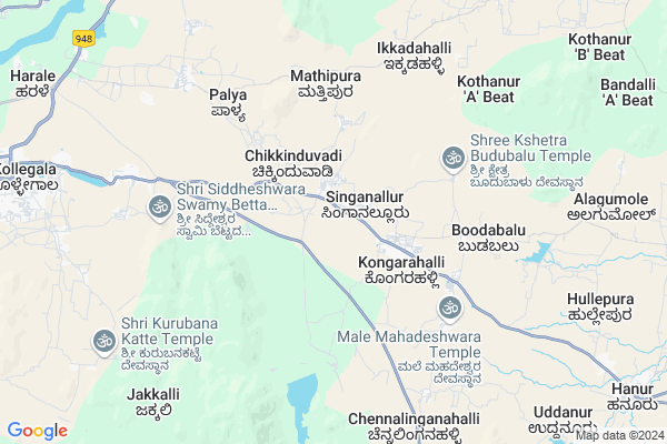
Gopinatham Map
EDIT Map
Add Your House
 ..
..
Current Corona Virus Infected Patients Count in Chamarajanagar District
| City Name | District Name | Total Covid cases |
|---|
Locality Name :
Gopinatham
( ಗೋಪಿನಾಥಮ್ )
Taluk Name : Kollegala
District : Chamarajanagar
State : Karnataka
Division : Mysore
Language : Kannada
Current Time 05:59 AM
Date: Saturday , Apr 26,2025 (IST)
Time zone: IST (UTC+5:30)
Elevation / Altitude: 736 meters. Above Seal level
Telephone Code / Std Code: 08224
Assembly constituency : Hanur assembly constituency
Assembly MLA : M.R. Manjunath
Lok Sabha constituency : Chamarajanagar parliamentary constituency
Parliament MP : V. SRINIVAS PRASAD
Serpanch Name :
Pin Code : 571490
Post Office Name : Mahadeshwara Malai
Alternate Village Name : Gopinatham
Commodities Prices : T. Narasipura Market / Mandi
Gopinatham Live Weather
Temperature: 24.0 °C
overcast clouds
Humidity: 62%
Wind : 1.46 mt/sec towards S
StationName : "KollegÄ\u0081l"
observed on 2 Hours Back
Temperature: 24.0 °C
overcast clouds
Humidity: 62%
Wind : 1.46 mt/sec towards S
StationName : "KollegÄ\u0081l"
observed on 2 Hours Back
Gopinatham Weather Forecast for Next 5 days
27-04-2025
24.0°C to 35.8°C
overcast clouds
24.0°C to 35.8°C
overcast clouds
28-04-2025
23.7°C to 35.3°C
overcast clouds, light rain
23.7°C to 35.3°C
overcast clouds, light rain
29-04-2025
23.6°C to 37.2°C
broken clouds, scattered clouds, few clouds, light rain, overcast clouds
23.6°C to 37.2°C
broken clouds, scattered clouds, few clouds, light rain, overcast clouds
30-04-2025
23.9°C to 36.4°C
overcast clouds, broken clouds, scattered clouds, light rain
23.9°C to 36.4°C
overcast clouds, broken clouds, scattered clouds, light rain
National Highways Reachable To Gopinatham
Nationa High Way :NH766;NH150A
Nationa High Way :NH150A;NH275
Nationa High Way :NH766;NH150A
Nationa High Way :NH150A;NH275
Rivers Near Gopinatham
Gundlu :ಗುಂಡ್ಲು
Kaveri :ಕಾವೇರಿ
Gundlu :ಗುಂಡ್ಲು
Kaveri :ಕಾವೇರಿ
About Gopinatham
Correct below Info and add more info about GopinathamGopinatham is a Village in Kollegala Taluk in Chamarajanagar District of Karnataka State, India. It belongs to Mysore Division . It is located 42 KM towards East from District head quarters Chamarajanagara. 118 KM from State capital Bangalore
Gopinatham Pin code is 571490 and postal head office is Mahadeshwara Malai .
Gopinatham is surrounded by Yelandur Taluk towards west , Malvalli Taluk towards North , Tirumakudal-Narsipur Taluk towards west , Chamarajanagar Taluk towards west .
Chamrajnagar , Malavalli , Maddur , Mandya are the near by Cities to Gopinatham.
Gopinatham 2011 Census Details
Gopinatham Local Language is Kannada. Gopinatham Village Total population is 4462 and number of houses are 1133. Female Population is 44.9%. Village literacy rate is 43.8% and the Female Literacy rate is 16.5%.
Population
| Census Parameter | Census Data |
| Total Population | 4462 |
| Total No of Houses | 1133 |
| Female Population % | 44.9 % ( 2005) |
| Total Literacy rate % | 43.8 % ( 1954) |
| Female Literacy rate | 16.5 % ( 734) |
| Scheduled Tribes Population % | 8.3 % ( 370) |
| Scheduled Caste Population % | 22.7 % ( 1011) |
| Working Population % | 57.9 % |
| Child(0 -6) Population by 2011 | 609 |
| Girl Child(0 -6) Population % by 2011 | 40.2 % ( 245) |
Gopinatham Census More Deatils.
Politics in Gopinatham
Indian National Congress (INC) is the major political party in this area.Polling Stations /Booths near Gopinatham
1)Govt Higher Primary School (north Wing)2)Govt Higher Primary School Left Side Hondarabalu
3)Govt Higher Primary School New Building Mangala
4)Govt. Lower Primary School Shivanasamudra
5)Anganavadi Center Poojaribhovidoddi
HOW TO REACH Gopinatham
By Rail
There is no railway station near to Gopinatham in less than 10 km. are the Rail way stations reachable from near by towns.By Road
Kollegal are the nearby by towns to Gopinatham having road connectivity to GopinathamColleges near Gopinatham
Sri Mahadeswara P U College
Address :
Govt Pu College
Address :
St. Antony P U College Cowdally
Address : St. Antony P U College Ramapura Main Road Cowdally (v&p) Kollegal (t) Ch. Nagara (dt)
Schools near Gopinatham
Kithururani Channama Vasathi Shale
Address : kollegala , kollegal , chamarajanagara , Karnataka . PIN- 571313 , Post - Zilla Adalitha Bhavan
Murarjidesai Residential Shcool
Address : kanchagalli , kollegal , chamarajanagara , Karnataka . PIN- 571443 , Post - Kamakerai
Morarji Desai Residence School
Address : hanur , hanur , chamarajanagara , Karnataka . PIN- 571439 , Post - Hanur
Adarsha Vidhyalya Ghps
Address : mudigundam , kollegal , chamarajanagara , Karnataka . PIN- 571440 , Post - Kollegal
Govt Health Centers near Gopinatham
1) AGARA-A , , nayakara beedi , near bus stand2) GOWDAHALLI , , Lingayathara beedi , near bus stand
3) Nettakal , , Nettakal , near temple
Schools in Gopinatham,Kollegala
Electronic Shops in Gopinatham,Kollegala
Super Markets in Gopinatham,Kollegala
Local Parks in Gopinatham,Kollegala
Police Stations near Gopinatham,Kollegala
Governement Offices near Gopinatham,Kollegala
About Gopinatham &
History
How to reach Gopinatham
Tourist Places Near By Gopinatham
Schools in Gopinatham
Colleges in Gopinatham
Temperature & weather of Gopinatham
places in Gopinatham
Gopinatham photos
More Information
How to reach Gopinatham
Tourist Places Near By Gopinatham
Schools in Gopinatham
Colleges in Gopinatham
Temperature & weather of Gopinatham
places in Gopinatham
Gopinatham photos
More Information
Village Talk
Post News or Events about this Village
Near Cities
Chamrajnagar 20 KM near
Malavalli 33 KM near
Maddur 58 KM near
Mandya 61 KM near
Chamrajnagar 20 KM near
Malavalli 33 KM near
Maddur 58 KM near
Mandya 61 KM near
Near By Taluks
Kollegala 0 KM near
Yelandur 21 KM near
Malvalli 34 KM near
Tirumakudal-Narsipur 38 KM near
Kollegala 0 KM near
Yelandur 21 KM near
Malvalli 34 KM near
Tirumakudal-Narsipur 38 KM near
Near By Air Ports
Mysore Airport 71 KM near
Salem Airport 131 KM near
Peelamedu Airport 139 KM near
Bengaluru International Airport 144 KM near
Mysore Airport 71 KM near
Salem Airport 131 KM near
Peelamedu Airport 139 KM near
Bengaluru International Airport 144 KM near
Near By Tourist Places
Shivanasamundram 18 KM near
Bheemeshwari 25 KM near
BR Hills 27 KM near
MM Hills 48 KM near
Nanjangud 64 KM near
Shivanasamundram 18 KM near
Bheemeshwari 25 KM near
BR Hills 27 KM near
MM Hills 48 KM near
Nanjangud 64 KM near
Near By Districts
Chamarajanagar 40 KM near
Mandya 61 KM near
Mysore 71 KM near
Ramanagara 73 KM near
Chamarajanagar 40 KM near
Mandya 61 KM near
Mysore 71 KM near
Ramanagara 73 KM near
Near By RailWay Station
Maddur Rail Way Station 61 KM near
Mandya Rail Way Station 61 KM near
Maddur Rail Way Station 61 KM near
Mandya Rail Way Station 61 KM near