| Home | City Bus | Maps | Villages | Cities | Rail | Tourist Places | School | College | Pin Codes | Corona Cases Count |
| Distance Calculator Bus Services IFSC Codes Trace Mobile Number Weather Search Place Trace IP Available Cash ATM/Banks Locate Polling Booth Report an Error contact People |
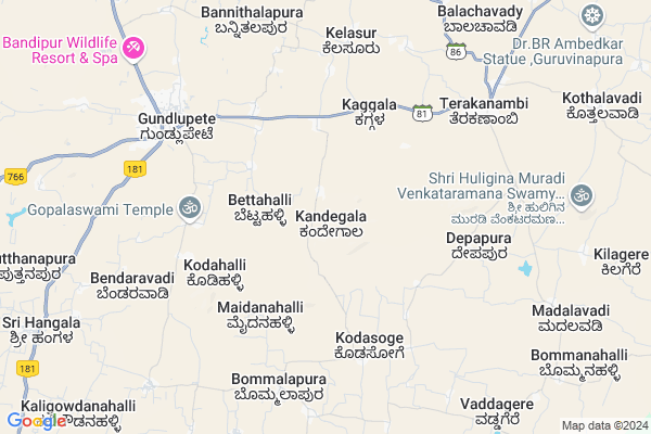
Kalanahundi
Kalanahundi Map
EDIT Map
Add Your House
 ..
..
Current Corona Virus Infected Patients Count in Chamarajanagar District
| City Name | District Name | Total Covid cases |
|---|
Locality Name :
Kalanahundi
( ಕಳನಹುಂಡಿ )
Taluk Name : Gundlupet
District : Chamarajanagar
State : Karnataka
Division : Mysore
Language : Kannada
Current Time 02:03 PM
Date: Tuesday , Apr 29,2025 (IST)
Time zone: IST (UTC+5:30)
Elevation / Altitude: 736 meters. Above Seal level
Telephone Code / Std Code: 08229
Assembly constituency : Gundlupet assembly constituency
Assembly MLA : H.M.Ganesh Prasad
Lok Sabha constituency : Chamarajanagar parliamentary constituency
Parliament MP : V. SRINIVAS PRASAD
Serpanch Name :
Pin Code : 571111
Post Office Name : Gundlupet
Main Village Name : Kandegala
Commodities Prices : Gundlupet Market / Mandi
Kalanahundi Live Weather
Temperature: 35.1 °C
scattered clouds
Humidity: 25%
Wind : 1.7 mt/sec towards E
StationName : "GundlupÄ\u0093t"
observed on 18 Mins Back
Temperature: 35.1 °C
scattered clouds
Humidity: 25%
Wind : 1.7 mt/sec towards E
StationName : "GundlupÄ\u0093t"
observed on 18 Mins Back
Kalanahundi Weather Forecast for Next 5 days
30-04-2025
23.9°C to 35.9°C
scattered clouds, broken clouds, light rain, overcast clouds
23.9°C to 35.9°C
scattered clouds, broken clouds, light rain, overcast clouds
01-05-2025
22.9°C to 34.6°C
overcast clouds, light rain
22.9°C to 34.6°C
overcast clouds, light rain
02-05-2025
22.4°C to 35.4°C
overcast clouds, broken clouds, scattered clouds, light rain
22.4°C to 35.4°C
overcast clouds, broken clouds, scattered clouds, light rain
03-05-2025
21.7°C to 35.0°C
overcast clouds, broken clouds, clear sky, light rain, moderate rain, scattered clouds
21.7°C to 35.0°C
overcast clouds, broken clouds, clear sky, light rain, moderate rain, scattered clouds
04-05-2025
21.1°C to 33.9°C
broken clouds, scattered clouds, clear sky, moderate rain, overcast clouds
21.1°C to 33.9°C
broken clouds, scattered clouds, clear sky, moderate rain, overcast clouds
National Highways Reachable To Kalanahundi
Nationa High Way :NH766
Nationa High Way :NH181
Nationa High Way :NH766
Nationa High Way :NH181
Rivers Near Kalanahundi
Kabini :ಕಬಿನಿ :കബിനി
Kabini River
Kabini :ಕಬಿನಿ :കബിനി
Kabini River
About Kalanahundi
Correct below Info and add more info about KalanahundiKalanahundi is a small Village/hamlet in Gundlupet Taluk in Chamarajanagar District of Karnataka State, India. It comes under Kandegala Panchayath. It belongs to Mysore Division . It is located 34 KM towards west from District head quarters Chamarajanagara. 6 KM from Gundlupet. 189 KM from State capital Bangalore
Kalanahundi Pin code is 571111 and postal head office is Gundlupet .
Kalanahundi is surrounded by Chamarajanagar Taluk towards East , Talavadi Taluk towards East , Nanjangud Taluk towards North , Udhagamandalam Taluk towards South .
Gundlupet , Nanjangud , Gudalur , Udhagamandalam are the near by Cities to Kalanahundi.
Demographics of Kalanahundi
Kannada is the Local Language here. Total population of Kalanahundi is 1062 .Males are 543 and Females are 519 living in 213 Houses. Total area of Kalanahundi is 1352 hectares.Politics in Kalanahundi
Bharatiya Janata Party (BJP) is the major political party in this area.Polling Stations /Booths near Kalanahundi
1)Govt.higher Primary School2)Govt.higher Primary School
3)Govt.higher Primary School
4)Govt.higher Primary School
5)Govt.higher Primary School
HOW TO REACH Kalanahundi
By Road
Gundlupet is the Nearest Town to Kalanahundi. Gundlupet is 10 km from Kalanahundi. Road connectivity is there from Gundlupet to Kalanahundi.By Rail
There is no railway station near to Kalanahundi in less than 10 km.Colleges near Kalanahundi
Sri Gangadareswra High School,pu College & Tch College
Address :
Gowtham Collage
Address :
Government Independent Junior College
Address :
Schools in Kalanahundi
Glps Kandegala
Address : kandegala , gundulpet , chamarajanagara , Karnataka . PIN- 571111 , Post - Gundlupet
Govt Health Centers near Kalanahundi
1) GUNDLUPET-B , SC Gundlupet B , Kalamndira Muslim Road , Anganavadi Center2) BOMMANAHALLI TRIBAL , SC Bommanahalli , Terakanambi Yeraganahalli Main Road , Hospetal Primises
3) UDIGALA-B , Sub Center Udigala B , ,
Schools in Kalanahundi,Gundlupet
Electronic Shops in Kalanahundi,Gundlupet
Super Markets in Kalanahundi,Gundlupet
Local Parks in Kalanahundi,Gundlupet
Police Stations near Kalanahundi,Gundlupet
Governement Offices near Kalanahundi,Gundlupet
About Kalanahundi &
History
How to reach Kalanahundi
Tourist Places Near By Kalanahundi
Schools in Kalanahundi
Colleges in Kalanahundi
Temperature & weather of Kalanahundi
places in Kalanahundi
Kalanahundi photos
More Information
How to reach Kalanahundi
Tourist Places Near By Kalanahundi
Schools in Kalanahundi
Colleges in Kalanahundi
Temperature & weather of Kalanahundi
places in Kalanahundi
Kalanahundi photos
More Information
Village Talk
Post News or Events about this Village
Near Cities
Gundlupet 6 KM near
Nanjangud 43 KM near
Gudalur 46 KM near
Udhagamandalam 46 KM near
Gundlupet 6 KM near
Nanjangud 43 KM near
Gudalur 46 KM near
Udhagamandalam 46 KM near
Near By Taluks
Gundlupet 6 KM near
Chamarajanagar 30 KM near
Talavadi 33 KM near
Nanjangud 37 KM near
Gundlupet 6 KM near
Chamarajanagar 30 KM near
Talavadi 33 KM near
Nanjangud 37 KM near
Near By Air Ports
Mysore Airport 65 KM near
Peelamedu Airport 100 KM near
Calicut Airport 125 KM near
Salem Airport 174 KM near
Mysore Airport 65 KM near
Peelamedu Airport 100 KM near
Calicut Airport 125 KM near
Salem Airport 174 KM near
Near By Tourist Places
Masinagudi 29 KM near
Mudumalai 31 KM near
Bellikkal 39 KM near
Bandipur National Park 39 KM near
Nanjangud 43 KM near
Masinagudi 29 KM near
Mudumalai 31 KM near
Bellikkal 39 KM near
Bandipur National Park 39 KM near
Nanjangud 43 KM near
Near By Districts
Chamarajanagar 32 KM near
The Nilgiris 46 KM near
Mysore 67 KM near
Wayanad 82 KM near
Chamarajanagar 32 KM near
The Nilgiris 46 KM near
Mysore 67 KM near
Wayanad 82 KM near
Near By RailWay Station
Mysuru Junction Rail Way Station 67 KM near
Shrirangapattana Rail Way Station 80 KM near
Mysuru Junction Rail Way Station 67 KM near
Shrirangapattana Rail Way Station 80 KM near