| Home | City Bus | Maps | Villages | Cities | Rail | Tourist Places | School | College | Pin Codes | Corona Cases Count |
| Distance Calculator Bus Services IFSC Codes Trace Mobile Number Weather Search Place Trace IP Available Cash ATM/Banks Locate Polling Booth Report an Error contact People |
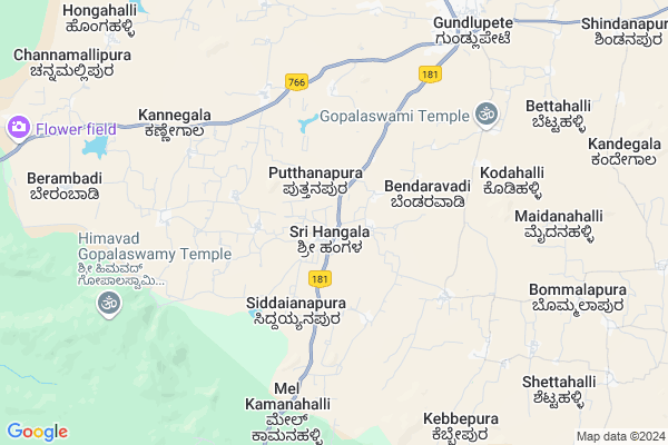
Hangala
Hangala Map
EDIT Map
Add Your House
 ..
..
Current Corona Virus Infected Patients Count in Chamarajanagar District
| City Name | District Name | Total Covid cases |
|---|
Locality Name :
Hangala
( ಹಣ್ಣುಗಳ )
Taluk Name : Gundlupet
District : Chamarajanagar
State : Karnataka
Division : Mysore
Language : Kannada
Current Time 01:47 PM
Date: Tuesday , Apr 29,2025 (IST)
Time zone: IST (UTC+5:30)
Elevation / Altitude: 736 meters. Above Seal level
Telephone Code / Std Code: 08229
Assembly constituency : Gundlupet assembly constituency
Assembly MLA : H.M.Ganesh Prasad
Lok Sabha constituency : Chamarajanagar parliamentary constituency
Parliament MP : V. SRINIVAS PRASAD
Serpanch Name :
Pin Code : 571126
Post Office Name : Hangala
Commodities Prices : Gundlupet Market / Mandi
Hangala Live Weather
Temperature: 33.6 °C
scattered clouds
Humidity: 27%
Wind : 3.39 mt/sec towards E
StationName : "GundlupÄ\u0093t"
observed on 1 Hours Back
Temperature: 33.6 °C
scattered clouds
Humidity: 27%
Wind : 3.39 mt/sec towards E
StationName : "GundlupÄ\u0093t"
observed on 1 Hours Back
Hangala Weather Forecast for Next 5 days
30-04-2025
23.2°C to 35.8°C
broken clouds, overcast clouds, light rain
23.2°C to 35.8°C
broken clouds, overcast clouds, light rain
01-05-2025
22.4°C to 33.5°C
overcast clouds, light rain
22.4°C to 33.5°C
overcast clouds, light rain
02-05-2025
22.1°C to 34.3°C
overcast clouds, broken clouds, scattered clouds, moderate rain, light rain
22.1°C to 34.3°C
overcast clouds, broken clouds, scattered clouds, moderate rain, light rain
03-05-2025
21.3°C to 34.5°C
overcast clouds, broken clouds, clear sky, light rain, moderate rain, scattered clouds
21.3°C to 34.5°C
overcast clouds, broken clouds, clear sky, light rain, moderate rain, scattered clouds
04-05-2025
20.7°C to 33.0°C
broken clouds, scattered clouds, clear sky, light rain, moderate rain, overcast clouds
20.7°C to 33.0°C
broken clouds, scattered clouds, clear sky, light rain, moderate rain, overcast clouds
Edit below overview about Hangala
Edit below overview about Hangala
OverView of Hangala
Hangla is beautiful village located, in the foot hills of Gopala swamy hills. It basically consists of 3 categories of people.1) Lingayat: Lingayat in Hangala village are basically educated fools. They contribute to 60% of the population. They may be called as white collared people. They are basically rude in nature. Around 90% of the community have same mind set. That is they behave like a dictator. Their main advantage is that, they support each of their community when he is in problem with other. They still support each other even if their group person is wrong. But they do not support each other for good things.
2) Pravars (Nayaks): They are really un educated peoples. They are not cultured people. They earn their living by doing labour jobs. Still they are un educated fools. They contribute for around 20% of population, still they are stronger and give equal fight to above category.
3) Rest: Next comes the general people, who struggle in between the above 2 categories. 4)In Chamarajanagara Region,Tamil nadu Kerala People are very Bad People and they will Always tell lies and they will always scold unnessesory will others and laugh others and they will dominate the innocent people and they will provoke you to make bad habits and they were Gossip mongers and if you help them they will do not help and they will let you for ourselves so please innocent please my kind is innocent people of india do not go to the this region because these please are very worst people and immaner i wish dont help to this people i will govt of india make this region to an seperate country or merge to an country so that innocent people of Karnataka live happily
Edit below overview about Hangala
National Highways Reachable To Hangala
Nationa High Way :NH766
Nationa High Way :NH181
Nationa High Way :NH766
Nationa High Way :NH181
Rivers Near Hangala
Kabini :ಕಬಿನಿ :കബിനി
Kabini River
Kabini :ಕಬಿನಿ :കബിനി
Kabini River
About Hangala
Hangala is a Village in Gundlupet Taluk in Chamarajanagar District of Karnataka State, India. It belongs to Mysore Division . It is located 45 KM towards west from District head quarters Chamarajanagara. 10 KM from Gundlupet. 199 KM from State capital Bangalore
Hangala Pin code is 571126 and postal head office is Hangala .
Hundipura ( 6 KM ) , Annur ( 8 KM ) , Bommalapura ( 9 KM ) , Gundlupet ( 9 KM ) , Berambadi ( 11 KM ) are the nearby Villages to Hangala. Hangala is surrounded by Gudalur Taluk towards west , Nanjangud Taluk towards North , Udhagamandalam Taluk towards South , Chamarajanagar Taluk towards East .
Gundlupet , Gudalur , Udhagamandalam , Nanjangud are the near by Cities to Hangala.
Hangala 2011 Census Details
Hangala Local Language is Kannada. Hangala Village Total population is 5704 and number of houses are 1440. Female Population is 50.6%. Village literacy rate is 53.0% and the Female Literacy rate is 22.9%.
Population
| Census Parameter | Census Data |
| Total Population | 5704 |
| Total No of Houses | 1440 |
| Female Population % | 50.6 % ( 2888) |
| Total Literacy rate % | 53.0 % ( 3021) |
| Female Literacy rate | 22.9 % ( 1307) |
| Scheduled Tribes Population % | 16.0 % ( 915) |
| Scheduled Caste Population % | 17.8 % ( 1014) |
| Working Population % | 45.9 % |
| Child(0 -6) Population by 2011 | 482 |
| Girl Child(0 -6) Population % by 2011 | 48.1 % ( 232) |
Hangala Census More Deatils.
Politics in Hangala
Bharatiya Janata Party (BJP) is the major political party in this area.Polling Stations /Booths near Hangala
1)Govt.lower Primary School Yelachatti2)Govt.higher Primary School
3)Govt.higher Primary School
4)Govt.pu College
5)Govt.lower Primary School Annuru
HOW TO REACH Hangala
By Road
Gundlupet is the Nearest Town to Hangala. Gundlupet is 8 km from Hangala. Road connectivity is there from Gundlupet to Hangala.By Rail
There is no railway station near to Hangala in less than 10 km.Colleges near Hangala
Government Independent Junior College
Address :
Schools in Hangala
Morarji Residential School Hangala
Address : hangala , gundulpet , chamarajanagara , Karnataka . PIN- 571126 , Post - Hangala
Niranjana Convent Hps Hangala
Address : hangala , gundulpet , chamarajanagara , Karnataka . PIN- 571126 , Post - Hangala
Ghps Hangala
Address : hangala , gundulpet , chamarajanagara , Karnataka . PIN- 571126 , Post - Hangala
Govt Junior Collage (high School)
Address : Hangala village and post, Gundlupet Tq, Chamarajangar Dist.
Govt Health Centers near Hangala
1) GUNDLUPET-B , SC Gundlupet B , Kalamndira Muslim Road , Anganavadi Center2) HOREYALA , SC Horeyala , Beguru Horeyla Main Road , PACC socitey
3) BOMMANAHALLI TRIBAL , SC Bommanahalli , Terakanambi Yeraganahalli Main Road , Hospetal Primises
Petrol Bunks in Hangala,Gundlupet
Sri sri Siddaganga Service Station - Indian Oil
NH766; Gundlupete; Karnataka 571111; India
7.9 KM distance Detail
indian oil yacoob&bros
Gundlupet RTO Checkpost;; Gundlupete; Karnataka; India
8.8 KM distance Detail
more ..
Colleges in Hangala,Gundlupet
JSS College Of Arts And Commerce
Baragi Road; Gundlupet-571111; Kozhikode-Mysore-Kollegal Hwy; Gundlupete; Karnataka 571111; India
9.0 KM distance Detail
Government Girls College
Chamarajanagar; NH-212; Kozhikode Kerala Highway; Gundlupete; Gundlupete; Karnataka 571111; India
9.0 KM distance Detail
K S N C College
Abdul Nazeer Sab Colony; State Highway 81; Gundlupete; Karnataka 571111; India
9.0 KM distance Detail
more ..
Electronic Shops in Hangala,Gundlupet
Aazam Macnic
Abdul Nazeer Sab Colony; SH81; Gundlupete; Karnataka 571111; India
8.8 KM distance Detail
Governement Offices near Hangala,Gundlupet
Assistant Director Office District Training Centre
Chamarajanagar; SH-81; Gundlupet Chamarajanagara Road; Gundlupete; Gundlupete; Karnataka 571111; India
8.6 KM distance Detail
About Hangala &
History
How to reach Hangala
Tourist Places Near By Hangala
Schools in Hangala
Colleges in Hangala
Temperature & weather of Hangala
places in Hangala
Hangala photos
More Information
How to reach Hangala
Tourist Places Near By Hangala
Schools in Hangala
Colleges in Hangala
Temperature & weather of Hangala
places in Hangala
Hangala photos
More Information
Village Talk
Post News or Events about this Village
Near Cities
Gundlupet 8 KM near
Gudalur 35 KM near
Udhagamandalam 43 KM near
Nanjangud 46 KM near
Gundlupet 8 KM near
Gudalur 35 KM near
Udhagamandalam 43 KM near
Nanjangud 46 KM near
Near By Taluks
Gundlupet 10 KM near
Nanjangud 40 KM near
Gudalur 40 KM near
Chamarajanagar 41 KM near
Gundlupet 10 KM near
Nanjangud 40 KM near
Gudalur 40 KM near
Chamarajanagar 41 KM near
Near By Air Ports
Mysore Airport 68 KM near
Peelamedu Airport 101 KM near
Calicut Airport 114 KM near
Salem Airport 185 KM near
Mysore Airport 68 KM near
Peelamedu Airport 101 KM near
Calicut Airport 114 KM near
Salem Airport 185 KM near
Near By Tourist Places
Masinagudi 22 KM near
Mudumalai 22 KM near
Bandipur National Park 28 KM near
Bellikkal 35 KM near
Ooty 42 KM near
Masinagudi 22 KM near
Mudumalai 22 KM near
Bandipur National Park 28 KM near
Bellikkal 35 KM near
Ooty 42 KM near
Near By Districts
The Nilgiris 42 KM near
Chamarajanagar 43 KM near
Mysore 70 KM near
Wayanad 71 KM near
The Nilgiris 42 KM near
Chamarajanagar 43 KM near
Mysore 70 KM near
Wayanad 71 KM near
Near By RailWay Station
Mysuru Junction Rail Way Station 70 KM near
Shrirangapattana Rail Way Station 84 KM near
Mysuru Junction Rail Way Station 70 KM near
Shrirangapattana Rail Way Station 84 KM near