| Home | City Bus | Maps | Villages | Cities | Rail | Tourist Places | School | College | Pin Codes | Corona Cases Count |
| Distance Calculator Bus Services IFSC Codes Trace Mobile Number Weather Search Place Trace IP Available Cash ATM/Banks Locate Polling Booth Report an Error contact People |
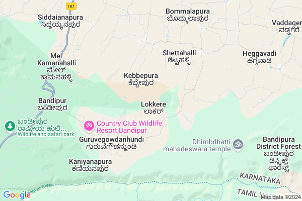
Booradahundi
Booradahundi Map
EDIT Map
Add Your House
 ..
..
Current Corona Virus Infected Patients Count in Chamarajanagar District
| City Name | District Name | Total Covid cases |
|---|
Locality Name :
Booradahundi
( ಬೋರ್ಡಾಹುಂಡಿ )
Taluk Name : Gundlupet
District : Chamarajanagar
State : Karnataka
Division : Mysore
Language : Kannada
Current Time 02:11 PM
Date: Tuesday , Apr 29,2025 (IST)
Time zone: IST (UTC+5:30)
Elevation / Altitude: 736 meters. Above Seal level
Telephone Code / Std Code: 08229
Assembly constituency : Gundlupet assembly constituency
Assembly MLA : H.M.Ganesh Prasad
Lok Sabha constituency : Chamarajanagar parliamentary constituency
Parliament MP : V. SRINIVAS PRASAD
Serpanch Name :
Pin Code : 571111
Post Office Name : Gundlupet
Main Village Name : Lokkere
Commodities Prices : Gundlupet Market / Mandi
Booradahundi Live Weather
Temperature: 33.6 °C
scattered clouds
Humidity: 27%
Wind : 3.39 mt/sec towards E
StationName : "GundlupÄ\u0093t"
observed on 2 Hours Back
Temperature: 33.6 °C
scattered clouds
Humidity: 27%
Wind : 3.39 mt/sec towards E
StationName : "GundlupÄ\u0093t"
observed on 2 Hours Back
Booradahundi Weather Forecast for Next 5 days
30-04-2025
23.2°C to 35.8°C
broken clouds, overcast clouds, light rain
23.2°C to 35.8°C
broken clouds, overcast clouds, light rain
01-05-2025
22.4°C to 33.5°C
overcast clouds, light rain
22.4°C to 33.5°C
overcast clouds, light rain
02-05-2025
22.1°C to 34.3°C
overcast clouds, broken clouds, scattered clouds, moderate rain, light rain
22.1°C to 34.3°C
overcast clouds, broken clouds, scattered clouds, moderate rain, light rain
03-05-2025
21.3°C to 34.5°C
overcast clouds, broken clouds, clear sky, light rain, moderate rain, scattered clouds
21.3°C to 34.5°C
overcast clouds, broken clouds, clear sky, light rain, moderate rain, scattered clouds
04-05-2025
20.7°C to 33.0°C
broken clouds, scattered clouds, clear sky, light rain, moderate rain, overcast clouds
20.7°C to 33.0°C
broken clouds, scattered clouds, clear sky, light rain, moderate rain, overcast clouds
National Highways Reachable To Booradahundi
Nationa High Way :NH766
Nationa High Way :NH181
Nationa High Way :NH766
Nationa High Way :NH181
Rivers Near Booradahundi
Kabini :ಕಬಿನಿ :കബിനി
Kabini River
Kabini :ಕಬಿನಿ :കബിനി
Kabini River
About Booradahundi
Correct below Info and add more info about BooradahundiBooradahundi is a small Village/hamlet in Gundlupet Taluk in Chamarajanagar District of Karnataka State, India. It comes under Lokkere Panchayath. It belongs to Mysore Division . It is located 47 KM towards South from District head quarters Chamarajanagara. 19 KM from Gundlupet. 204 KM from State capital Bangalore
Booradahundi Pin code is 571111 and postal head office is Gundlupet .
Booradahundi is surrounded by Udhagamandalam Taluk towards South , The Nilgiris Taluk towards South , Kotagiri Taluk towards South , Talavadi Taluk towards East .
Gundlupet , Udhagamandalam , Gudalur , Coonoor are the near by Cities to Booradahundi.
Demographics of Booradahundi
Kannada is the Local Language here. Total population of Booradahundi is 132 .Males are 67 and Females are 65 living in 30 Houses. Total area of Booradahundi is 674 hectares.Politics in Booradahundi
Bharatiya Janata Party (BJP) is the major political party in this area.Polling Stations /Booths near Booradahundi
1)Govt.composite High School2)Govt.higher Primary School
3)Govt.lower Primary School
4)Govt.lower Primary School
5)Govt.higher Primary School New Building Hunasetopu
HOW TO REACH Booradahundi
By Road
Gundlupet is the Nearest Town to Booradahundi. Gundlupet is 21 km from Booradahundi. Road connectivity is there from Gundlupet to Booradahundi.By Rail
There is no railway station near to Booradahundi in less than 10 km.Colleges near Booradahundi
Sri Gangadareswra High School,pu College & Tch College
Address :
Gowtham Collage
Address :
Government Independent Junior College
Address :
Schools near Booradahundi
Morarji Residential School Hangala
Address : hangala , gundulpet , chamarajanagara , Karnataka . PIN- 571126 , Post - Hangala
Morarji Minority Residensial School
Address : gundlupet , gundulpet , chamarajanagara , Karnataka . PIN- 571111 , Post - Gundlupet
Morarji Vasathi School Therakanmbi
Address : terakanambi hundi , gundulpet , chamarajanagara , Karnataka . PIN- 571123 , Post - Tirukanambi
Morarji School Yadavanahalli
Address : yaduvina halli , gundulpet , chamarajanagara , Karnataka . PIN- 571109 , Post - Begur
Govt Health Centers near Booradahundi
1) GUNDLUPET-B , SC Gundlupet B , Kalamndira Muslim Road , Anganavadi Center2) BOMMANAHALLI TRIBAL , SC Bommanahalli , Terakanambi Yeraganahalli Main Road , Hospetal Primises
3) UDIGALA-B , Sub Center Udigala B , ,
Petrol Bunks in Booradahundi,Gundlupet
SRI VENKATESHWARA SERVICE STATION
BOMMALAPURA VILLAGE; CHAMARAJNAGAR; Karnataka 571111; India
8.2 KM distance Detail
Sri sri Siddaganga Service Station - Indian Oil
NH766; Gundlupete; Karnataka 571111; India
17.6 KM distance Detail
more ..
Colleges in Booradahundi,Gundlupet
K S N C College
Abdul Nazeer Sab Colony; State Highway 81; Gundlupete; Karnataka 571111; India
17.8 KM distance Detail
Government Girls College
Chamarajanagar; NH-212; Kozhikode Kerala Highway; Gundlupete; Gundlupete; Karnataka 571111; India
18.0 KM distance Detail
Goutham PU College
Chamarajanagar; NH-212; Kozhikode Kerala Highway; Gundlupete; Gundlupete; Karnataka 571111; India
18.4 KM distance Detail
more ..
Schools in Booradahundi,Gundlupet
Higher Primary School Ashrama Shale
H.D.Kote; Mysore; Kebbepura; Karnataka 571121; India
2.1 KM distance Detail
Electronic Shops in Booradahundi,Gundlupet
Global plumbing&Electrical solution
moyar road; Msainagudi; Tamil Nadu 643223; India
15.2 KM distance Detail
Local Parks in Booradahundi,Gundlupet
Farmagram Resort
No 12D; Dharka Road; Masinagudi; Near Dharka Road; Masinagudi;; Mudumalai;; Ooty;; Masinagudi; Tamil Nadu 643223; India
14.8 KM distance Detail
Jungle Holidayz - Masinagudi - Masinagudi Trekking - Jeep Safari - Travels - Car Rentals - Ooty
Jungle Holidayz; Tours & Travels; Mavanalla ( P.O );; Masinagudi;; Nilgiris; Tamil Nadu 643223; India
15.4 KM distance Detail
Governement Offices near Booradahundi,Gundlupet
Assistant Director Office District Training Centre
Chamarajanagar; SH-81; Gundlupet Chamarajanagara Road; Gundlupete; Gundlupete; Karnataka 571111; India
17.6 KM distance Detail
About Booradahundi &
History
How to reach Booradahundi
Tourist Places Near By Booradahundi
Schools in Booradahundi
Colleges in Booradahundi
Temperature & weather of Booradahundi
places in Booradahundi
Booradahundi photos
More Information
How to reach Booradahundi
Tourist Places Near By Booradahundi
Schools in Booradahundi
Colleges in Booradahundi
Temperature & weather of Booradahundi
places in Booradahundi
Booradahundi photos
More Information
Village Talk
Post News or Events about this Village
Near Cities
Gundlupet 16 KM near
Udhagamandalam 32 KM near
Gudalur 33 KM near
Coonoor 40 KM near
Gundlupet 16 KM near
Udhagamandalam 32 KM near
Gudalur 33 KM near
Coonoor 40 KM near
Near By Taluks
Gundlupet 17 KM near
Udhagamandalam 31 KM near
The Nilgiris 32 KM near
Kotagiri 36 KM near
Gundlupet 17 KM near
Udhagamandalam 31 KM near
The Nilgiris 32 KM near
Kotagiri 36 KM near
Near By Air Ports
Mysore Airport 78 KM near
Peelamedu Airport 89 KM near
Calicut Airport 112 KM near
Salem Airport 178 KM near
Mysore Airport 78 KM near
Peelamedu Airport 89 KM near
Calicut Airport 112 KM near
Salem Airport 178 KM near
Near By Tourist Places
Masinagudi 14 KM near
Mudumalai 18 KM near
Bellikkal 25 KM near
Ooty 32 KM near
Kotagiri 36 KM near
Masinagudi 14 KM near
Mudumalai 18 KM near
Bellikkal 25 KM near
Ooty 32 KM near
Kotagiri 36 KM near
Near By Districts
The Nilgiris 32 KM near
Chamarajanagar 45 KM near
Wayanad 75 KM near
Mysore 80 KM near
The Nilgiris 32 KM near
Chamarajanagar 45 KM near
Wayanad 75 KM near
Mysore 80 KM near
Near By RailWay Station
Mysuru Junction Rail Way Station 80 KM near
Coimbatore Main Junction Rail Way Station 90 KM near
Mysuru Junction Rail Way Station 80 KM near
Coimbatore Main Junction Rail Way Station 90 KM near