| Home | City Bus | Maps | Villages | Cities | Rail | Tourist Places | School | College | Pin Codes | Corona Cases Count |
| Distance Calculator Bus Services IFSC Codes Trace Mobile Number Weather Search Place Trace IP Available Cash ATM/Banks Locate Polling Booth Report an Error contact People |
Anajihundi
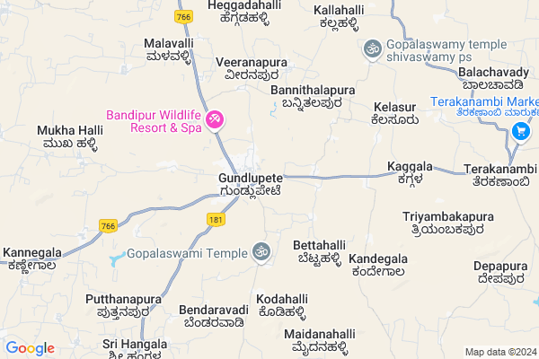
Anajihundi Map
EDIT Map
Add Your House
 ..
..
Current Corona Virus Infected Patients Count in Chamarajanagar District
| City Name | District Name | Total Covid cases |
|---|
Locality Name :
Anajihundi
( ಅನ್ಜಿಹುಂಡಿ )
Taluk Name : Gundlupet
District : Chamarajanagar
State : Karnataka
Division : Mysore
Language : Kannada
Current Time 02:05 PM
Date: Tuesday , Apr 29,2025 (IST)
Time zone: IST (UTC+5:30)
Elevation / Altitude: 736 meters. Above Seal level
Telephone Code / Std Code: 08229
Assembly constituency : Gundlupet assembly constituency
Assembly MLA : H.M.Ganesh Prasad
Lok Sabha constituency : Chamarajanagar parliamentary constituency
Parliament MP : V. SRINIVAS PRASAD
Serpanch Name :
Pin Code : 571126
Post Office Name : Hangala
Main Village Name : Mangala
Commodities Prices : Gundlupet Market / Mandi
Anajihundi Live Weather
Temperature: 35.1 °C
scattered clouds
Humidity: 25%
Wind : 1.7 mt/sec towards E
StationName : "GundlupÄ\u0093t"
observed on 20 Mins Back
Temperature: 35.1 °C
scattered clouds
Humidity: 25%
Wind : 1.7 mt/sec towards E
StationName : "GundlupÄ\u0093t"
observed on 20 Mins Back
Anajihundi Weather Forecast for Next 5 days
30-04-2025
23.9°C to 35.9°C
scattered clouds, broken clouds, light rain, overcast clouds
23.9°C to 35.9°C
scattered clouds, broken clouds, light rain, overcast clouds
01-05-2025
22.9°C to 34.6°C
overcast clouds, light rain
22.9°C to 34.6°C
overcast clouds, light rain
02-05-2025
22.4°C to 35.4°C
overcast clouds, broken clouds, scattered clouds, light rain
22.4°C to 35.4°C
overcast clouds, broken clouds, scattered clouds, light rain
03-05-2025
21.7°C to 35.0°C
overcast clouds, broken clouds, clear sky, light rain, moderate rain, scattered clouds
21.7°C to 35.0°C
overcast clouds, broken clouds, clear sky, light rain, moderate rain, scattered clouds
04-05-2025
21.1°C to 33.9°C
broken clouds, scattered clouds, clear sky, moderate rain, overcast clouds
21.1°C to 33.9°C
broken clouds, scattered clouds, clear sky, moderate rain, overcast clouds
National Highways Reachable To Anajihundi
Nationa High Way :NH766
Nationa High Way :NH181
Nationa High Way :NH766
Nationa High Way :NH181
Rivers Near Anajihundi
Kabini :ಕಬಿನಿ :കബിനി
Kabini River
Kabini :ಕಬಿನಿ :കബിനി
Kabini River
About Anajihundi
Correct below Info and add more info about AnajihundiAnajihundi is a small Village/hamlet in Gundlupet Taluk in Chamarajanagar District of Karnataka State, India. It comes under Mangala Panchayath. It belongs to Mysore Division . It is located 35 KM towards west from District head quarters Chamarajanagara. 188 KM from State capital Bangalore
Anajihundi Pin code is 571126 and postal head office is Hangala .
Anajihundi is surrounded by Chamarajanagar Taluk towards East , Nanjangud Taluk towards North , Talavadi Taluk towards East , Heggadadevankote Taluk towards west .
Gundlupet , Nanjangud , Gudalur , Udhagamandalam are the near by Cities to Anajihundi.
Demographics of Anajihundi
Kannada is the Local Language here. Total population of Anajihundi is 578 .Males are 304 and Females are 274 living in 135 Houses. Total area of Anajihundi is 956 hectares.Politics in Anajihundi
Bharatiya Janata Party (BJP) is the major political party in this area.Polling Stations /Booths near Anajihundi
1)Govt. Shree Maddaneshwara2)Govt.lower Primary School
3)Govt.higher Primary School
4)Govt.lower Primary School Channamallipura
5)Govt.junior College
HOW TO REACH Anajihundi
By Road
Gundlupet is the Nearest Town to Anajihundi. Road connectivity is there from Gundlupet to Anajihundi.By Rail
There is no railway station near to Anajihundi in less than 10 km.Colleges near Anajihundi
Sri Gangadareswra High School,pu College & Tch College
Address :
Gowtham Collage
Address :
Government Independent Junior College
Address :
Schools in Anajihundi
Ghps Mangala
Address : mangala , gundulpet , chamarajanagara , Karnataka . PIN- 571126 , Post - Hangala
Govt Health Centers near Anajihundi
1) GUNDLUPET-B , SC Gundlupet B , Kalamndira Muslim Road , Anganavadi Center2) UDIGALA-B , Sub Center Udigala B , ,
3) HOREYALA , SC Horeyala , Beguru Horeyla Main Road , PACC socitey
Schools in Anajihundi,Gundlupet
Electronic Shops in Anajihundi,Gundlupet
Super Markets in Anajihundi,Gundlupet
Local Parks in Anajihundi,Gundlupet
Police Stations near Anajihundi,Gundlupet
Governement Offices near Anajihundi,Gundlupet
About Anajihundi &
History
How to reach Anajihundi
Tourist Places Near By Anajihundi
Schools in Anajihundi
Colleges in Anajihundi
Temperature & weather of Anajihundi
places in Anajihundi
Anajihundi photos
More Information
How to reach Anajihundi
Tourist Places Near By Anajihundi
Schools in Anajihundi
Colleges in Anajihundi
Temperature & weather of Anajihundi
places in Anajihundi
Anajihundi photos
More Information
Village Talk
Post News or Events about this Village
Near Cities
Gundlupet 1 KM near
Nanjangud 38 KM near
Gudalur 45 KM near
Udhagamandalam 50 KM near
Gundlupet 1 KM near
Nanjangud 38 KM near
Gudalur 45 KM near
Udhagamandalam 50 KM near
Near By Taluks
Gundlupet 0 KM near
Chamarajanagar 32 KM near
Nanjangud 32 KM near
Talavadi 39 KM near
Gundlupet 0 KM near
Chamarajanagar 32 KM near
Nanjangud 32 KM near
Talavadi 39 KM near
Near By Air Ports
Mysore Airport 61 KM near
Peelamedu Airport 105 KM near
Calicut Airport 123 KM near
Salem Airport 179 KM near
Mysore Airport 61 KM near
Peelamedu Airport 105 KM near
Calicut Airport 123 KM near
Salem Airport 179 KM near
Near By Tourist Places
Masinagudi 30 KM near
Mudumalai 32 KM near
Bandipur National Park 35 KM near
Nanjangud 38 KM near
Bellikkal 42 KM near
Masinagudi 30 KM near
Mudumalai 32 KM near
Bandipur National Park 35 KM near
Nanjangud 38 KM near
Bellikkal 42 KM near
Near By Districts
Chamarajanagar 34 KM near
The Nilgiris 49 KM near
Mysore 62 KM near
Wayanad 78 KM near
Chamarajanagar 34 KM near
The Nilgiris 49 KM near
Mysore 62 KM near
Wayanad 78 KM near
Near By RailWay Station
Mysuru Junction Rail Way Station 63 KM near
Shrirangapattana Rail Way Station 76 KM near
Mysuru Junction Rail Way Station 63 KM near
Shrirangapattana Rail Way Station 76 KM near