| Home | City Bus | Maps | Villages | Cities | Rail | Tourist Places | School | College | Pin Codes | Corona Cases Count |
| Distance Calculator Bus Services IFSC Codes Trace Mobile Number Weather Search Place Trace IP Available Cash ATM/Banks Locate Polling Booth Report an Error contact People |
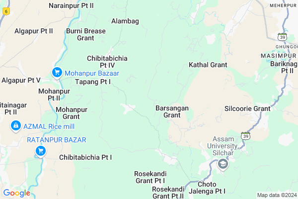
Barsangan Map
EDIT Map
Add Your House
 ..
..
Current Corona Virus Infected Patients Count in Cachar District
| City Name | District Name | Total Covid cases |
|---|---|---|
| Cachar District | Cachar | 1 |
| Silchar | Cachar | 1 |
Locality Name :
Barsangan
( बरसांगण )
Tehsil Name : Tapang
District : Cachar
State : Assam
Language : Assamese and Bengali, Bodo, Sylheti
Current Time 12:46 PM
Date: Monday , Apr 28,2025 (IST)
Time zone: IST (UTC+5:30)
Elevation / Altitude: 22 meters. Above Seal level
Telephone Code / Std Code: 03842
Assembly constituency : Algapur assembly constituency
Assembly MLA :
Lok Sabha constituency : Karimganj parliamentary constituency
Parliament MP :
Serpanch Name :
Pin Code : 788026
Post Office Name : Srikona
Commodities Prices : Kadamtala Market / Mandi
Barsangan Live Weather
Temperature: 25.4 °C
light rain
Humidity: 75%
Wind : 1.61 mt/sec towards N
Rain : null
StationName : "HailÄ\u0081kÄ\u0081ndi"
observed on 2 Hours Back
Temperature: 25.4 °C
light rain
Humidity: 75%
Wind : 1.61 mt/sec towards N
Rain : null
StationName : "HailÄ\u0081kÄ\u0081ndi"
observed on 2 Hours Back
Barsangan Weather Forecast for Next 5 days
29-04-2025
20.6°C to 33.9°C
overcast clouds, light rain
20.6°C to 33.9°C
overcast clouds, light rain
30-04-2025
21.1°C to 33.9°C
broken clouds, scattered clouds, moderate rain
21.1°C to 33.9°C
broken clouds, scattered clouds, moderate rain
01-05-2025
19.5°C to 29.1°C
overcast clouds, broken clouds, light rain
19.5°C to 29.1°C
overcast clouds, broken clouds, light rain
02-05-2025
20.4°C to 28.7°C
light rain, overcast clouds, broken clouds
20.4°C to 28.7°C
light rain, overcast clouds, broken clouds
03-05-2025
21.0°C to 34.0°C
light rain, overcast clouds, moderate rain
21.0°C to 34.0°C
light rain, overcast clouds, moderate rain
National Highways Reachable To Barsangan
Nationa High Way :NH306
Nationa High Way :NH8
Nationa High Way :NH306
Nationa High Way :NH8
Rivers Near Barsangan
Um Loti
Dalalma River
Um Loti
Dalalma River
About Barsangan
Correct below Info and add more info about BarsanganBarsangan is a Village in Tapang Tehsil in Cachar District of Assam State, India. It is located 15 KM towards South from District head quarters Silchar. 15 KM from Tapang. 216 KM from State capital Dispur
Barsangan Pin code is 788026 and postal head office is Srikona .
Silcoorie ( 7 KM ) , Ambicapur ( 9 KM ) , Ghungoor ( 11 KM ) , Borakhai ( 11 KM ) , Nayabill ( 12 KM ) are the nearby Villages to Barsangan. Barsangan is surrounded by Salchapra Tehsil towards North , Tapang Tehsil towards North , Hailakandi Tehsil towards west , Silchar Tehsil towards North .
Silchar , Hailakandi , Karimganj , Haflong are the near by Cities to Barsangan.
This Place is in the border of the Cachar District and Hailakandi District. Hailakandi District Algapur is North towards this place . Also it is in the Border of other district Karimganj .
Barsangan Grant 2011 Census Details
Barsangan Local Language is Assamese. Barsangan Grant Village Total population is 2858 and number of houses are 643. Female Population is 49.1%. Village literacy rate is 64.5% and the Female Literacy rate is 28.8%.
Population
| Census Parameter | Census Data |
| Total Population | 2858 |
| Total No of Houses | 643 |
| Female Population % | 49.1 % ( 1402) |
| Total Literacy rate % | 64.5 % ( 1843) |
| Female Literacy rate | 28.8 % ( 823) |
| Scheduled Tribes Population % | 0.0 % ( 1) |
| Scheduled Caste Population % | 73.6 % ( 2103) |
| Working Population % | 40.8 % |
| Child(0 -6) Population by 2011 | 511 |
| Girl Child(0 -6) Population % by 2011 | 51.1 % ( 261) |
Barsangan Grant Census More Deatils.
Politics in Barsangan
83.21% , Bharatiya Janata Party , 54457 , AUDF , AIUDF , BJP , INC are the major political parties in this area.Polling Stations /Booths near Barsangan
1)Kalinagar Part-6 Lp School2)Kaliprasad Roy High School
3)335 Tularthal Lp School
4)Mohonpur Ra Me School
5)606 Kunjanagar Lp School
HOW TO REACH Barsangan
By Rail
There is no railway station near to Barsangan in less than 10 km.Colleges near Barsangan
Jagannath Singh College, Udharbond
Address :
Lakshmi Narayan Junior College(lnjc)
Address : Near Silcoorie Gp Office,shiv Mandir,me School And Lp School
Janata College
Address : Po Kabuganj
Hills Degree College
Address : Convent Road
Aviator Senior Secondary School
Address : Kalain
Schools near Barsangan
Govt Health Centers near Barsangan
1) Chibitabichia MPHC , Chibitabichia MPHC , Chibitabichia , Near Chibitabichia HS School2) Natun Ramnagar SD , Natun Ramnagar SD , Lakhipur Road, Natun Ramnagar , 135 No Natun Ramnagar LP School
3) Promodnagar , , , Near Promodnagar TE
Hospitals in Barsangan,Tapang
SK Roy Civil Hospital
Hailakandi Road; Ghungoor; Masimpur; Silchar; Assam 788118; India
12.1 KM distance Detail
more ..
Petrol Bunks in Barsangan,Tapang
HP Petrol Pump - Goswami Filling Station
Silchar; Meherpur; Birbal Bazar; Gauhati; Assam 788015; India
13.5 KM distance Detail
Indian Oil Petrol Pump
Hailakandi Road; Meherpur; Birbal Bazar; Silchar; Assam 788012; India
13.6 KM distance Detail
more ..
Colleges in Barsangan,Tapang
Shyama Prasad Mukherjee College Of Education
Silcoorie Grant; Assam 788011; India
9.2 KM distance Detail
SPM COLLEGE OF EDUCATION; SILCOORIE; SILCHAR
Silchar-Hailakandi Rd; Silcoorie Grant; Assam 788011; India
10.1 KM distance Detail
more ..
Schools in Barsangan,Tapang
School Tilla Baghmara Chatla
Chatla Road; Silcoorie Grant; Assam 788011; India
5.9 KM distance Detail
Electronic Shops in Barsangan,Tapang
Studio Acoustics
Sharma's Home; Irongmara Bazar; Opposite of Blue-Chip Computer Education; Silchar; Assam 788011; India
7.6 KM distance Detail
Governement Offices near Barsangan,Tapang
Bhorakhai G.P Office
Andharighat Manipuri Basti Rd; Silcoorie Grant; Assam 788011; India
9.3 KM distance Detail
Office Of The All Assam Other Backward Classes Association
NIT Point; Fakirtilla; Silchar; Assam 788010; India
12.0 KM distance Detail
Office Of The Civil Security Guard Welfare Society
NIT Point; Fakirtilla; Silchar; Assam 788010; India
12.1 KM distance Detail
About Barsangan &
History
How to reach Barsangan
Tourist Places Near By Barsangan
Schools in Barsangan
Colleges in Barsangan
Temperature & weather of Barsangan
places in Barsangan
Barsangan photos
More Information
How to reach Barsangan
Tourist Places Near By Barsangan
Schools in Barsangan
Colleges in Barsangan
Temperature & weather of Barsangan
places in Barsangan
Barsangan photos
More Information
Village Talk
Post News or Events about this Village
Near Cities
Silchar 15 KM near
Hailakandi 17 KM near
Karimganj 43 KM near
Haflong 67 KM near
Silchar 15 KM near
Hailakandi 17 KM near
Karimganj 43 KM near
Haflong 67 KM near
Near By Taluks
Barjalenga 7 KM near
Salchapra 12 KM near
Hailakandi 14 KM near
Tapang 14 KM near
Barjalenga 7 KM near
Salchapra 12 KM near
Hailakandi 14 KM near
Tapang 14 KM near
Near By Air Ports
Kumbhirgram Airport 39 KM near
Aizawl Airport 111 KM near
Imphal Municipal Airport 135 KM near
Shillong Airport 139 KM near
Kumbhirgram Airport 39 KM near
Aizawl Airport 111 KM near
Imphal Municipal Airport 135 KM near
Shillong Airport 139 KM near
Near By Tourist Places
Silchar 15 KM near
Hailakandi 16 KM near
Karimganj 41 KM near
Kolasib 62 KM near
Unakoti 88 KM near
Silchar 15 KM near
Hailakandi 16 KM near
Karimganj 41 KM near
Kolasib 62 KM near
Unakoti 88 KM near
Near By Districts
Cachar 15 KM near
Hailakandi 16 KM near
Karimganj 42 KM near
Kolasib 60 KM near
Cachar 15 KM near
Hailakandi 16 KM near
Karimganj 42 KM near
Kolasib 60 KM near
Near By RailWay Station
Silchar Rail Way Station 15 KM near
Badarpur Junction Rail Way Station 23 KM near
Silchar Rail Way Station 15 KM near
Badarpur Junction Rail Way Station 23 KM near