| Home | City Bus | Maps | Villages | Cities | Rail | Tourist Places | School | College | Pin Codes | Corona Cases Count |
| Distance Calculator Bus Services IFSC Codes Trace Mobile Number Weather Search Place Trace IP Available Cash ATM/Banks Locate Polling Booth Report an Error contact People |
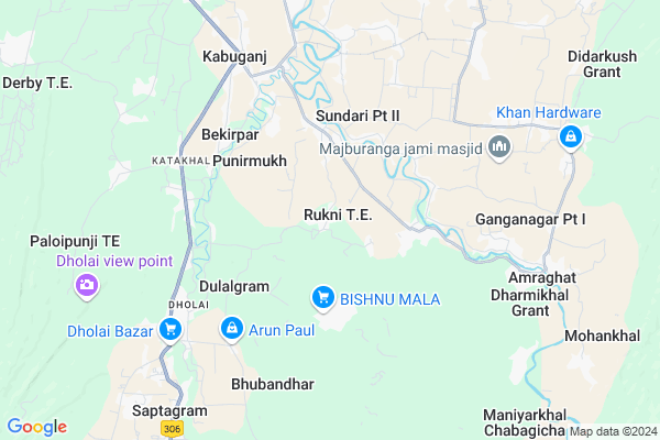
Rukni Map
EDIT Map
Add Your House
 ..
..
Current Corona Virus Infected Patients Count in Cachar District
| City Name | District Name | Total Covid cases |
|---|---|---|
| Cachar District | Cachar | 1 |
| Silchar | Cachar | 1 |
Locality Name :
Rukni
( रुकनी )
Tehsil Name : Palonghat
District : Cachar
State : Assam
Language : Assamese and Bengali, Bodo, Sylheti
Current Time 12:38 PM
Date: Tuesday , Apr 29,2025 (IST)
Time zone: IST (UTC+5:30)
Elevation / Altitude: 26 meters. Above Seal level
Telephone Code / Std Code: 03842
Assembly constituency : Sonai assembly constituency
Assembly MLA : Karim Uddin Barbhuiya
Lok Sabha constituency : Silchar parliamentary constituency
Parliament MP : RAJDEEP ROY
Serpanch Name :
Pin Code : 788116
Post Office Name : Palonghat
Commodities Prices : Kadamtala Market / Mandi
National Highways Reachable To Rukni
Nationa High Way :NH37
Nationa High Way :NH306
Nationa High Way :NH37
Nationa High Way :NH306
Rivers Near Rukni
Barak River
Serlui
Barak River
Serlui
About Rukni
Correct below Info and add more info about RukniRukni is a Village in Palonghat Tehsil in Cachar District of Assam State, India. It is located 28 KM towards South from District head quarters Silchar. 3 KM from Palonghat. 240 KM from State capital Dispur
Rukni Pin code is 788116 and postal head office is Palonghat .
Sundari ( 6 KM ) , Bhubandhar ( 6 KM ) , Nagdirgram ( 6 KM ) , Ganganagar ( 8 KM ) , Jibangram ( 9 KM ) are the nearby Villages to Rukni. Rukni is surrounded by Narsingpur Tehsil towards west , Sonai Tehsil towards North , Binnakandi Tehsil towards North , Barjalenga Tehsil towards west .
Silchar , Hailakandi , Karimganj , Haflong are the near by Cities to Rukni.
Rukni Pt I (Rukhi Pt I) 2011 Census Details
Rukni Local Language is Assamese. Rukni Pt I (Rukhi Pt I) Village Total population is 1117 and number of houses are 271. Female Population is 50.1%. Village literacy rate is 75.9% and the Female Literacy rate is 37.0%.
Population
| Census Parameter | Census Data |
| Total Population | 1117 |
| Total No of Houses | 271 |
| Female Population % | 50.1 % ( 560) |
| Total Literacy rate % | 75.9 % ( 848) |
| Female Literacy rate | 37.0 % ( 413) |
| Scheduled Tribes Population % | 0.1 % ( 1) |
| Scheduled Caste Population % | 48.9 % ( 546) |
| Working Population % | 32.1 % |
| Child(0 -6) Population by 2011 | 169 |
| Girl Child(0 -6) Population % by 2011 | 48.5 % ( 82) |
Rukni Pt I (Rukhi Pt I) Census More Deatils.
Politics in Rukni
Bharatiya Janata Party , AUDF , BJP , INC are the major political parties in this area.Polling Stations /Booths near Rukni
1)Bhrakhai Uccha Engrajee Bidyalaya (room No.2)2)145 No. Bekirpar Prathamik Bidyalaya (room No.2)
3)156 No. Tarapur Nimna Prathamik Bidyalaya (room No.1)
4)1556 No. Dhanehari Prathamik Vidyalaya
5)Bonraj Madhya Bongo Bidyalaya (room No. 2)
HOW TO REACH Rukni
By Rail
There is no railway station near to Rukni in less than 10 km.Colleges near Rukni
Jagannath Singh College, Udharbond
Address :
Lakshmi Narayan Junior College(lnjc)
Address : Near Silcoorie Gp Office,shiv Mandir,me School And Lp School
Janata College
Address : Po Kabuganj
Hills Degree College
Address : Convent Road
Aviator Senior Secondary School
Address : Kalain
Schools near Rukni
C.c.j.c Palonghat Hs School
Address : Palonghat bazar
Govt Health Centers near Rukni
1) Natun Ramnagar SD , Natun Ramnagar SD , Lakhipur Road, Natun Ramnagar , 135 No Natun Ramnagar LP School2) BERENGA-II SC , BERENGA-II SC , ,
3) Silchar Medical College and Hospital , Silchar Medical College, , Ghungoor, Silchar ,
Petrol Bunks in Rukni,Palonghat
Maa Lakshmi Refilling Station
Narsingpur Rd; Clever House Pt IV; Assam 788115; India
9.2 KM distance Detail
more ..
Colleges in Rukni,Palonghat
Madhab Chandra Das College
Kabuganj - Sonai Rd; Tulargram Pt II; Assam 788121; India
12.9 KM distance Detail
more ..
Schools in Rukni,Palonghat
HAZI MASKANDAR ALI ACADEMY
Hatikhal Bantarapur Rd; Sundari Pt I; Assam 788099; India
6.0 KM distance Detail
Hazi Abid Ali ME School
156; Kabuganj - Sonai Rd; Nagdirgram Pt III; Assam 788121; India
6.1 KM distance Detail
Governement Offices near Rukni,Palonghat
Chandpur GP Office
Kazidahar-Sonai-Amjur-Binnakandi-Lakhipur Rd; Berabak Pt III; Assam 788121; India
10.9 KM distance Detail
About Rukni &
History
How to reach Rukni
Tourist Places Near By Rukni
Schools in Rukni
Colleges in Rukni
Temperature & weather of Rukni
places in Rukni
Rukni photos
More Information
How to reach Rukni
Tourist Places Near By Rukni
Schools in Rukni
Colleges in Rukni
Temperature & weather of Rukni
places in Rukni
Rukni photos
More Information
Village Talk
Post News or Events about this Village
Near Cities
Silchar 29 KM near
Hailakandi 38 KM near
Karimganj 68 KM near
Haflong 71 KM near
Silchar 29 KM near
Hailakandi 38 KM near
Karimganj 68 KM near
Haflong 71 KM near
Near By Taluks
Palonghat 3 KM near
Narsingpur 5 KM near
Sonai 12 KM near
Binnakandi 16 KM near
Palonghat 3 KM near
Narsingpur 5 KM near
Sonai 12 KM near
Binnakandi 16 KM near
Near By Air Ports
Kumbhirgram Airport 38 KM near
Aizawl Airport 101 KM near
Imphal Municipal Airport 115 KM near
Shillong Airport 163 KM near
Kumbhirgram Airport 38 KM near
Aizawl Airport 101 KM near
Imphal Municipal Airport 115 KM near
Shillong Airport 163 KM near
Near By Tourist Places
Silchar 27 KM near
Hailakandi 37 KM near
Kolasib 54 KM near
Karimganj 66 KM near
Tamenglong 82 KM near
Silchar 27 KM near
Hailakandi 37 KM near
Kolasib 54 KM near
Karimganj 66 KM near
Tamenglong 82 KM near
Near By Districts
Cachar 27 KM near
Hailakandi 38 KM near
Kolasib 53 KM near
Karimganj 68 KM near
Cachar 27 KM near
Hailakandi 38 KM near
Kolasib 53 KM near
Karimganj 68 KM near
Near By RailWay Station
Silchar Rail Way Station 28 KM near
Badarpur Junction Rail Way Station 48 KM near
Silchar Rail Way Station 28 KM near
Badarpur Junction Rail Way Station 48 KM near