| Home | City Bus | Maps | Villages | Cities | Rail | Tourist Places | School | College | Pin Codes | Corona Cases Count |
| Distance Calculator Bus Services IFSC Codes Trace Mobile Number Weather Search Place Trace IP Available Cash ATM/Banks Locate Polling Booth Report an Error contact People |
Bamanda
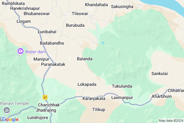
Bamanda Map
EDIT Map
Add Your House
 ..
..
Current Corona Virus Infected Patients Count in Boudh District
| City Name | District Name | Total Covid cases |
|---|
Locality Name :
Bamanda
( ବାମଣ୍ଡା )
Tehsil Name : Harabhanga
District : Boudh
State : Odisha
Language : Oriya and Hindi
Current Time 09:00 AM
Date: Thursday , Apr 24,2025 (IST)
Time zone: IST (UTC+5:30)
Elevation / Altitude: 292 meters. Above Seal level
Telephone Code / Std Code: 06763
Assembly constituency : Boudh assembly constituency
Assembly MLA : pradip kumar amat
Lok Sabha constituency : Kandhamal parliamentary constituency
Parliament MP : ACHYUTANANDA SAMANTA
Serpanch Name :
Pin Code : 762024
Post Office Name : Biranarasinghpur
Commodities Prices : Khunthabandha Market / Mandi
Bamanda Live Weather
Temperature: 34.8 °C
clear sky
Humidity: 23%
Wind : 0.48 mt/sec towards NW
StationName : "Kaintragarh"
observed on 1 Hours Back
Temperature: 34.8 °C
clear sky
Humidity: 23%
Wind : 0.48 mt/sec towards NW
StationName : "Kaintragarh"
observed on 1 Hours Back
Bamanda Weather Forecast for Next 5 days
25-04-2025
30.3°C to 44.8°C
clear sky, few clouds, broken clouds, scattered clouds
30.3°C to 44.8°C
clear sky, few clouds, broken clouds, scattered clouds
26-04-2025
28.2°C to 44.8°C
clear sky
28.2°C to 44.8°C
clear sky
27-04-2025
27.4°C to 45.8°C
clear sky, few clouds, scattered clouds
27.4°C to 45.8°C
clear sky, few clouds, scattered clouds
28-04-2025
27.7°C to 43.1°C
broken clouds, overcast clouds, scattered clouds
27.7°C to 43.1°C
broken clouds, overcast clouds, scattered clouds
29-04-2025
26.2°C to 42.3°C
scattered clouds, clear sky, few clouds, light rain
26.2°C to 42.3°C
scattered clouds, clear sky, few clouds, light rain
Rivers Near Bamanda
Mahanadi River :تهر مهاندي :دریائے مہاندی :مهاندي
Bagh
Mahanadi River :تهر مهاندي :دریائے مہاندی :مهاندي
Bagh
About Bamanda
Correct below Info and add more info about BamandaBamanda is a Village in Harabhanga Tehsil in Boudh District of Odisha State, India. It is located 33 KM towards South from District head quarters Boudh. 173 KM from State capital Bhubaneswar
Bamanda Pin code is 762024 and postal head office is Biranarasinghpur .
Bamanda is surrounded by Athmallik Tehsil towards North , Khajuripada Tehsil towards South , Boudh Tehsil towards west , Kishorenagar Tehsil towards North .
Phulabani , Anugul , Talcher , Balangir are the near by Cities to Bamanda.
This Place is in the border of the Boudh District and Anugul District. Anugul District Athmallik is North towards this place .
Bamanda 2011 Census Details
Bamanda Local Language is Oriya. Bamanda Village Total population is 863 and number of houses are 198. Female Population is 50.4%. Village literacy rate is 66.0% and the Female Literacy rate is 29.5%.
Population
| Census Parameter | Census Data |
| Total Population | 863 |
| Total No of Houses | 198 |
| Female Population % | 50.4 % ( 435) |
| Total Literacy rate % | 66.0 % ( 570) |
| Female Literacy rate | 29.5 % ( 255) |
| Scheduled Tribes Population % | 0.0 % ( 0) |
| Scheduled Caste Population % | 8.5 % ( 73) |
| Working Population % | 32.0 % |
| Child(0 -6) Population by 2011 | 98 |
| Girl Child(0 -6) Population % by 2011 | 49.0 % ( 48) |
Bamanda Census More Deatils.
Politics in Bamanda
BJD , is the major political party in this area.Polling Stations /Booths near Bamanda
1)Loigam Pry.school2)Pingalabeda D.pep School
3)Ramgad Pry School
4)Barupudug U.p. School
5)Janhapank Pry.school
HOW TO REACH Bamanda
By Rail
There is no railway station near to Bamanda in less than 10 km.Colleges near Bamanda
Anchalika Panchayat Jr.college Harbhanga
Address : At/po-harabhanga,dist-boudh
Bhairabi College
Address : Purunakatak, Boudh
Schools in Bamanda
Bamanda Hs
Address : bamanda , harbhanga , boudh , Sikkim . PIN- 762024 , Post - Biranarasinghpur
Ughs Bamanda
Address : bamanda , harbhanga , boudh , Sikkim . PIN- 762024 , Post - Biranarasinghpur
Landapadar Ps
Address : bamanda , harbhanga , boudh , Sikkim . PIN- 762023 , Post - Jhadrajing
Bamanda U G M E
Address : bamanda , harbhanga , boudh , Sikkim . PIN- 762024 , Post - Biranarasinghpur
Govt Health Centers near Bamanda
1) HINDOL , HINDOL , HINDOL , HINDOL HIGH SCHOOL2) Kalanga SC , Kalanga , , Near water Tank
3) Rutungia , Subcenter Rutungia , , Near Rutungia Seva Ashrama School
Hospitals in Bamanda,Harabhanga
Community Health Center
Old Cuttack; Baudh; NH-224; Boudh Banigucha Road; Boudh; Boudh; Odisha 762013; India
5.3 KM distance Detail
Government Hospital
Baudh; NH-224; Boudh Banigucha Road; Puranakatak; Puranakatak; Odisha 762013; India
5.4 KM distance Detail
more ..
Schools in Bamanda,Harabhanga
Old Cuttack High School
Old Cuttack; Baudh; NH-224; Boudh Banigucha Road; Boudh; Boudh; Odisha 762013; India
6.1 KM distance Detail
Local Parks in Bamanda,Harabhanga
Police Stations near Bamanda,Harabhanga
Governement Offices near Bamanda,Harabhanga
Government Irrigation Department
Baudh; NH-224; Boudh Banigucha Road; Puruna Katak; Puruna Katak; Odisha 762013; India
5.7 KM distance Detail
About Bamanda &
History
How to reach Bamanda
Tourist Places Near By Bamanda
Schools in Bamanda
Colleges in Bamanda
Temperature & weather of Bamanda
places in Bamanda
Bamanda photos
More Information
How to reach Bamanda
Tourist Places Near By Bamanda
Schools in Bamanda
Colleges in Bamanda
Temperature & weather of Bamanda
places in Bamanda
Bamanda photos
More Information
Village Talk
Post News or Events about this Village
Near Cities
Phulabani 34 KM near
Anugul 77 KM near
Talcher 96 KM near
Balangir 115 KM near
Phulabani 34 KM near
Anugul 77 KM near
Talcher 96 KM near
Balangir 115 KM near
Near By Taluks
Harabhanga 0 KM near
Athmallik 23 KM near
Khajuripada 28 KM near
Boudh 37 KM near
Harabhanga 0 KM near
Athmallik 23 KM near
Khajuripada 28 KM near
Boudh 37 KM near
Near By Air Ports
Bhubaneswar Airport 164 KM near
Raipur Airport 325 KM near
Ranchi Airport 348 KM near
Vishakhapatnam Airport 389 KM near
Bhubaneswar Airport 164 KM near
Raipur Airport 325 KM near
Ranchi Airport 348 KM near
Vishakhapatnam Airport 389 KM near
Near By Tourist Places
Phulbani 33 KM near
Sambalpur 118 KM near
Hirakud 131 KM near
Chilika 137 KM near
Nandan Kanan National Park 159 KM near
Phulbani 33 KM near
Sambalpur 118 KM near
Hirakud 131 KM near
Chilika 137 KM near
Nandan Kanan National Park 159 KM near
Near By Districts
Boudh 31 KM near
Kandhamal 33 KM near
Sonepur 72 KM near
Anugul 76 KM near
Boudh 31 KM near
Kandhamal 33 KM near
Sonepur 72 KM near
Anugul 76 KM near
Near By RailWay Station
Boinda Rail Way Station 48 KM near
Rairakhol Rail Way Station 54 KM near
Boinda Rail Way Station 48 KM near
Rairakhol Rail Way Station 54 KM near