| Home | City Bus | Maps | Villages | Cities | Rail | Tourist Places | School | College | Pin Codes | Corona Cases Count |
| Distance Calculator Bus Services IFSC Codes Trace Mobile Number Weather Search Place Trace IP Available Cash ATM/Banks Locate Polling Booth Report an Error contact People |
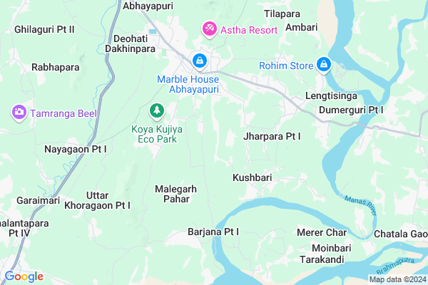
Pachania Khoragaon
Pachania Khoragaon Map
EDIT Map
Add Your House
 ..
..
Current Corona Virus Infected Patients Count in Bongaigaon District
| City Name | District Name | Total Covid cases |
|---|
Locality Name :
Pachania Khoragaon
( पछाणिआ खोरगाओं )
Tehsil Name : Tapattary
District : Bongaigaon
State : Assam
Language : Assamese and Bengali, Bodo
Current Time 07:27 AM
Date: Saturday , Apr 26,2025 (IST)
Time zone: IST (UTC+5:30)
Elevation / Altitude: 45 meters. Above Seal level
Telephone Code / Std Code: 03669
Assembly constituency : Abhayapuri South assembly constituency
Assembly MLA : Pradip Sarkar
Lok Sabha constituency : Barpeta parliamentary constituency
Parliament MP : Abdul Khaleque
Serpanch Name :
Pin Code : 783382
Post Office Name : Jogighopa
Commodities Prices : Dadengiri Market / Mandi
Pachania Khoragaon Live Weather
Temperature: 26.7 °C
clear sky
Humidity: 62%
Wind : 2.85 mt/sec towards E
StationName : "AbhayÄ\u0081puri"
observed on 12 Mins Back
Temperature: 26.7 °C
clear sky
Humidity: 62%
Wind : 2.85 mt/sec towards E
StationName : "AbhayÄ\u0081puri"
observed on 12 Mins Back
Pachania Khoragaon Weather Forecast for Next 5 days
27-04-2025
23.8°C to 37.2°C
light rain, clear sky
23.8°C to 37.2°C
light rain, clear sky
28-04-2025
21.8°C to 37.1°C
light rain, clear sky, few clouds, moderate rain, broken clouds
21.8°C to 37.1°C
light rain, clear sky, few clouds, moderate rain, broken clouds
29-04-2025
21.7°C to 32.3°C
broken clouds, light rain, moderate rain
21.7°C to 32.3°C
broken clouds, light rain, moderate rain
30-04-2025
22.1°C to 30.9°C
light rain, overcast clouds
22.1°C to 30.9°C
light rain, overcast clouds
01-05-2025
21.4°C to 28.1°C
light rain, overcast clouds, broken clouds
21.4°C to 28.1°C
light rain, overcast clouds, broken clouds
National Highways Reachable To Pachania Khoragaon
Nationa High Way :NH17
Nationa High Way :NH17
Rivers Near Pachania Khoragaon
Aai
Champamati
Aai
Champamati
About Pachania Khoragaon
Correct below Info and add more info about Pachania KhoragaonPachania Khoragaon is a Village in Tapattary Tehsil in Bongaigaon District of Assam State, India. It is located 26 KM towards South from District head quarters Bongaigaon. 124 KM from State capital Dispur
Pachania Khoragaon Pin code is 783382 and postal head office is Jogighopa .
Pachania Khoragaon is surrounded by Srijangram Tehsil towards North , Goalpara Tehsil towards South , Boitamari Tehsil towards west , Rupshi Tehsil towards East .
Goalpara , Bongaigaon , Barpeta , Barpeta Road are the near by Cities to Pachania Khoragaon.
This Place is in the border of the Bongaigaon District and Barpeta District. Barpeta District Rupshi is East towards this place . Also it is in the Border of other district Goalpara .
Kharagaon Pt I 2011 Census Details
Pachania Khoragaon Local Language is Assamese. Kharagaon Pt I Village Total population is 252 and number of houses are 61. Female Population is 52.0%. Village literacy rate is 58.3% and the Female Literacy rate is 30.2%.
Population
| Census Parameter | Census Data |
| Total Population | 252 |
| Total No of Houses | 61 |
| Female Population % | 52.0 % ( 131) |
| Total Literacy rate % | 58.3 % ( 147) |
| Female Literacy rate | 30.2 % ( 76) |
| Scheduled Tribes Population % | 0.0 % ( 0) |
| Scheduled Caste Population % | 0.0 % ( 0) |
| Working Population % | 27.0 % |
| Child(0 -6) Population by 2011 | 48 |
| Girl Child(0 -6) Population % by 2011 | 56.3 % ( 27) |
Kharagaon Pt I Census More Deatils.
Politics in Pachania Khoragaon
Indian National Congress , AUDF , AIUDF , 90.90% , BJP , AGP , 76097 , INC are the major political parties in this area.Polling Stations /Booths near Pachania Khoragaon
1)Lalmati L.p. School2)Latibari L.p. School ( Left )
3)Abhayeswari H.s& M.p. School(right)
4)Pararchar L.p. School
5)Piradhara L.p. School (left)
HOW TO REACH Pachania Khoragaon
By Rail
Abhayapuri Asam Rail Way Station is the very nearby railway stations to Pachania Khoragaon.Colleges near Pachania Khoragaon
Rajiv Gandhi Memorial College
Address : Lengtisinga(bongaigaon),assam.
Schools near Pachania Khoragaon
Dumerguri Sontoshpur Girls M.e.m
Address : Dumerguri, Lengtisinga, Tapattary, Abhayapuri, Bongaigaon, Assam
Lengtisinga M.e. School
Address : Vill. Lengtisinga. Po. Lentisinga. Dist. Bongaigaon. State. Assam
Sri Sri Ganbesh High School
Address : LALMATI
Govt Health Centers near Pachania Khoragaon
1) 200 Bedded Civil Hospital , Bhalukdubi , , Near Post Office, Bhalukdubi2) Bahalpur SC , Bahalpur SC , Bahalpur sector ,
3) Batardal SC , Batardal SC , Chapar Sector , NEAR CHAPAR TEA ESTATE ROAD
Petrol Bunks in Pachania Khoragaon,Tapattary
Petrol Pump
Abhayapuri - Srijangram Rd; Dharmapur; Abhayapuri; Assam 783384; India
6.2 KM distance Detail
more ..
Schools in Pachania Khoragaon,Tapattary
Tapattari MEM
Tapattary Block; Abhayapuri Kushabari Road; Abhayapuri; Assam 783384; India
2.8 KM distance Detail
tapatari l P school
Abhayapuri Kushabari Road; Abhayapuri; Assam 783384; India
2.8 KM distance Detail
Electronic Shops in Pachania Khoragaon,Tapattary
Das Computer And Electric
Lalbahadusr Shastri Path; Abhayapuri; Assam 783384; India
3.9 KM distance Detail
Local Parks in Pachania Khoragaon,Tapattary
Bamungaon Nursery
Rani Siddheswari Street; Bamungaon Pt-1; Assam 783384; India
5.3 KM distance Detail
About Pachania Khoragaon &
History
How to reach Pachania Khoragaon
Tourist Places Near By Pachania Khoragaon
Schools in Pachania Khoragaon
Colleges in Pachania Khoragaon
Temperature & weather of Pachania Khoragaon
places in Pachania Khoragaon
Pachania Khoragaon photos
More Information
How to reach Pachania Khoragaon
Tourist Places Near By Pachania Khoragaon
Schools in Pachania Khoragaon
Colleges in Pachania Khoragaon
Temperature & weather of Pachania Khoragaon
places in Pachania Khoragaon
Pachania Khoragaon photos
More Information
Village Talk
Post News or Events about this Village
Near Cities
Goalpara 16 KM near
Bongaigaon 26 KM near
Barpeta 36 KM near
Barpeta Road 40 KM near
Goalpara 16 KM near
Bongaigaon 26 KM near
Barpeta 36 KM near
Barpeta Road 40 KM near
Near By Taluks
Tapattary 0 KM near
Srijangram 10 KM near
Boitamari 16 KM near
Goalpara 16 KM near
Tapattary 0 KM near
Srijangram 10 KM near
Boitamari 16 KM near
Goalpara 16 KM near
Near By Air Ports
Rupsi Airport 87 KM near
Borjhar Airport 104 KM near
Shillong Airport 162 KM near
Salonibari Airport 241 KM near
Rupsi Airport 87 KM near
Borjhar Airport 104 KM near
Shillong Airport 162 KM near
Salonibari Airport 241 KM near
Near By Tourist Places
Goalpara 22 KM near
Bongaigaon 25 KM near
Barpeta 40 KM near
Manas National Park 67 KM near
Nalbari 86 KM near
Goalpara 22 KM near
Bongaigaon 25 KM near
Barpeta 40 KM near
Manas National Park 67 KM near
Nalbari 86 KM near
Near By Districts
Goalpara 16 KM near
Bongaigaon 25 KM near
Barpeta 36 KM near
Kokrajhar 47 KM near
Goalpara 16 KM near
Bongaigaon 25 KM near
Barpeta 36 KM near
Kokrajhar 47 KM near
Near By RailWay Station
Abhayapuri Asam Rail Way Station 8.6 KM near
Goalpara Town Rail Way Station 22 KM near
New Bongaigaon Junction Rail Way Station 27 KM near
Abhayapuri Asam Rail Way Station 8.6 KM near
Goalpara Town Rail Way Station 22 KM near
New Bongaigaon Junction Rail Way Station 27 KM near