| Home | City Bus | Maps | Villages | Cities | Rail | Tourist Places | School | College | Pin Codes | Corona Cases Count |
| Distance Calculator Bus Services IFSC Codes Trace Mobile Number Weather Search Place Trace IP Available Cash ATM/Banks Locate Polling Booth Report an Error contact People |
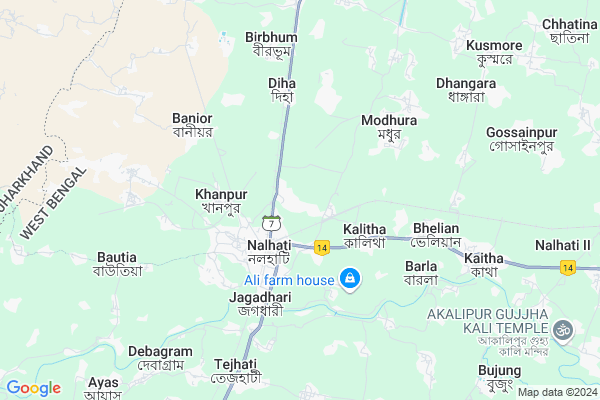
Paikpara
Paikpara Map
EDIT Map
Add Your House
 ..
..
Current Corona Virus Infected Patients Count in Birbhum District
| City Name | District Name | Total Covid cases |
|---|
Locality Name :
Paikpara
( পাইকপাড়া )
Block Name : Nalhati-i
District : Birbhum
State : West Bengal
Division : Burdwan
Language : Bengali and English
Current Time 12:37 PM
Date: Monday , Apr 28,2025 (IST)
Time zone: IST (UTC+5:30)
Elevation / Altitude: 40 meters. Above Seal level
Telephone Code / Std Code: 03465
Assembly constituency : Nalhati assembly constituency
Assembly MLA : Rajendra Prasad Singh (RAJU SINGH)
Lok Sabha constituency : Birbhum parliamentary constituency
Parliament MP : SATABDI ROY
Serpanch Name :
Pin Code : 731220
Post Office Name : Nalhati
Commodities Prices : Birbhum Market / Mandi
Paikpara Live Weather
Temperature: 34.4 °C
scattered clouds
Humidity: 28%
Wind : 2.59 mt/sec towards SE
StationName : "NalhÄ\u0081ti"
observed on 1 Hours Back
Temperature: 34.4 °C
scattered clouds
Humidity: 28%
Wind : 2.59 mt/sec towards SE
StationName : "NalhÄ\u0081ti"
observed on 1 Hours Back
Paikpara Weather Forecast for Next 5 days
29-04-2025
24.1°C to 36.9°C
scattered clouds, light rain, overcast clouds
24.1°C to 36.9°C
scattered clouds, light rain, overcast clouds
30-04-2025
20.7°C to 33.4°C
broken clouds, few clouds, heavy intensity rain, light rain, overcast clouds
20.7°C to 33.4°C
broken clouds, few clouds, heavy intensity rain, light rain, overcast clouds
01-05-2025
22.5°C to 34.9°C
broken clouds, scattered clouds, clear sky, light rain, overcast clouds
22.5°C to 34.9°C
broken clouds, scattered clouds, clear sky, light rain, overcast clouds
02-05-2025
23.6°C to 34.8°C
overcast clouds, few clouds, scattered clouds, light rain
23.6°C to 34.8°C
overcast clouds, few clouds, scattered clouds, light rain
03-05-2025
24.3°C to 34.3°C
overcast clouds, broken clouds, scattered clouds, clear sky
24.3°C to 34.3°C
overcast clouds, broken clouds, scattered clouds, clear sky
Rivers Near Paikpara
Brahmani
lal pokhra
Brahmani
lal pokhra
About Paikpara
Correct below Info and add more info about PaikparaPaikpara is a Village in Nalhati-i Block in Birbhum District of West Bengal State, India. It belongs to Burdwan Division . It is located 64 KM towards North from District head quarters Suri, Birbhum. 2 KM from Nalhati-I. 234 KM from State capital Kolkata
Paikpara Pin code is 731220 and postal head office is Nalhati .
Rampur ( 3 KM ) , Banior ( 5 KM ) , Barla ( 5 KM ) , Bautia ( 7 KM ) , Kaitha-i ( 7 KM ) are the nearby Villages to Paikpara. Paikpara is surrounded by Nalhati-Ii Block towards South , Rampurhat-Ii Block towards South , Murarai-Ii Block towards North , Rampurhat-I Block towards South .
Rampurhat , Pakaur , Paschim Punropara , Dhulian are the near by Cities to Paikpara.
This Place is in the border of the Birbhum District and Pakur District. Pakur District Maheshpur is North towards this place . It is near to the Jharkhand State Border.
Paikpara 2011 Census Details
Paikpara Local Language is Bengali. Paikpara Village Total population is 9993 and number of houses are 2282. Female Population is 48.7%. Village literacy rate is 63.1% and the Female Literacy rate is 28.3%.
Population
| Census Parameter | Census Data |
| Total Population | 9993 |
| Total No of Houses | 2282 |
| Female Population % | 48.7 % ( 4868) |
| Total Literacy rate % | 63.1 % ( 6310) |
| Female Literacy rate | 28.3 % ( 2826) |
| Scheduled Tribes Population % | 3.7 % ( 365) |
| Scheduled Caste Population % | 51.7 % ( 5162) |
| Working Population % | 34.3 % |
| Child(0 -6) Population by 2011 | 1335 |
| Girl Child(0 -6) Population % by 2011 | 49.2 % ( 657) |
Paikpara Census More Deatils.
Politics in Paikpara
FBL , AITC , AIFB , INC are the major political parties in this area.Polling Stations /Booths near Paikpara
1)Paikpara Jb School Room -i2)Otgram C B School Room -ii
3)Paikpara Mosulman Para S.s.k
4)Paikpara No.2 Prathamik Vidyalay Room -i
5)Paikpara Jb School Room-ii
HOW TO REACH Paikpara
By Rail
Nalhati Junction Rail Way Station , Takipur Rail Way Station are the very nearby railway stations to Paikpara.Colleges near Paikpara
Sailajananda Falguni Smriti Mahavidyalaya
Address :
Kabi Nazrul College
Address :
Turku Hansda Lapsa Hemrom Mahavidlaya
Address :
Basantika College Of Engeneering And Technology(polytechnic)
Address :
Suri Vidyasagar College
Address :
Schools near Paikpara
Amaipur Milani High Madrasha
Address : kalitha-i , nalhati-i , birbhum , West Bengal . PIN- 731220 , Post - Nalhati
Mustafadanga A.m.u. Sr.madrasa
Address : kaytha-i/vii , nalhati-i , birbhum , West Bengal . PIN- 731220 , Post - Nalhati
Tejhati Jasamanta High School
Address : kurumgram-viii , nalhati-i , birbhum , West Bengal . PIN- 731220 , Post - Nalhati
Kaytha High School
Address : kaytha-i/iii , nalhati-i , birbhum , West Bengal . PIN- 731220 , Post - Nalhati
Govt Health Centers near Paikpara
1) Paikpara SC , Paikpara SC , ,2) Gopalpur SC , Sub Centre , Gopalpur Nalhati Word No 1 , Near High Road
3) Nalhati East SC , , ,
Petrol Bunks in Paikpara,Nalhati-i
Nalhati Filling Station(Bharat Petroleum)
Gopalpur; West Bengal 731220; India
2.2 KM distance Detail
more ..
Colleges in Paikpara,Nalhati-i
Sofia Girls College
731243; Patharkalpara; Nalhati; West Bengal 731220; India
2.4 KM distance Detail
more ..
Electronic Shops in Paikpara,Nalhati-i
New Bus Stand
Morgram - Panagarh State Hwy; Nalhati; West Bengal 731220; India
1.9 KM distance Detail
About Paikpara &
History
How to reach Paikpara
Tourist Places Near By Paikpara
Schools in Paikpara
Colleges in Paikpara
Temperature & weather of Paikpara
places in Paikpara
Paikpara photos
More Information
How to reach Paikpara
Tourist Places Near By Paikpara
Schools in Paikpara
Colleges in Paikpara
Temperature & weather of Paikpara
places in Paikpara
Paikpara photos
More Information
Village Talk
Post News or Events about this Village
Near Cities
Rampurhat 19 KM near
Pakaur 39 KM near
Paschim Punropara 45 KM near
Dhulian 48 KM near
Rampurhat 19 KM near
Pakaur 39 KM near
Paschim Punropara 45 KM near
Dhulian 48 KM near
Near By Taluks
Nalhati-I 2 KM near
Nalhati-Ii 3 KM near
Murarai-Ii 17 KM near
Rampurhat-Ii 17 KM near
Nalhati-I 2 KM near
Nalhati-Ii 3 KM near
Murarai-Ii 17 KM near
Rampurhat-Ii 17 KM near
Near By Air Ports
Netaji Subhas Chandra Bose Airport 217 KM near
Bagdogra Airport 300 KM near
Ranchi Airport 313 KM near
Rupsi Airport 326 KM near
Netaji Subhas Chandra Bose Airport 217 KM near
Bagdogra Airport 300 KM near
Ranchi Airport 313 KM near
Rupsi Airport 326 KM near
Near By Tourist Places
Pakur 40 KM near
Murshidabad 50 KM near
Suri 60 KM near
Dumka 68 KM near
Santiniketan 80 KM near
Pakur 40 KM near
Murshidabad 50 KM near
Suri 60 KM near
Dumka 68 KM near
Santiniketan 80 KM near
Near By Districts
Pakur 40 KM near
Murshidabad 54 KM near
Birbhum 62 KM near
Dumka 68 KM near
Pakur 40 KM near
Murshidabad 54 KM near
Birbhum 62 KM near
Dumka 68 KM near
Near By RailWay Station
Nalhati Junction Rail Way Station 2.6 KM near
Takipur Rail Way Station 8.4 KM near
Murarai Rail Way Station 16 KM near
Nalhati Junction Rail Way Station 2.6 KM near
Takipur Rail Way Station 8.4 KM near
Murarai Rail Way Station 16 KM near