| Home | City Bus | Maps | Villages | Cities | Rail | Tourist Places | School | College | Pin Codes | Corona Cases Count |
| Distance Calculator Bus Services IFSC Codes Trace Mobile Number Weather Search Place Trace IP Available Cash ATM/Banks Locate Polling Booth Report an Error contact People |
Nandigram
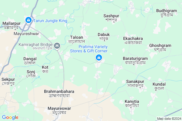
Nandigram Map
EDIT Map
Add Your House
 ..
..
Current Corona Virus Infected Patients Count in Birbhum District
| City Name | District Name | Total Covid cases |
|---|
Locality Name :
Nandigram
( নন্দীগ্রাম )
Block Name : Murarai-ii
District : Birbhum
State : West Bengal
Division : Burdwan
Language : Bengali and English
Current Time 08:58 AM
Date: Saturday , Apr 12,2025 (IST)
Time zone: IST (UTC+5:30)
Elevation / Altitude: 33 meters. Above Seal level
Telephone Code / Std Code: 03465
Assembly constituency : Mayureswar assembly constituency
Assembly MLA : Abhijit Roy
Lok Sabha constituency : Bolpur parliamentary constituency
Parliament MP : ASIT KUMAR MAL
Serpanch Name :
Pin Code : 731219
Post Office Name : Murarai
Commodities Prices : Rampurhat Market / Mandi
Nandigram Live Weather
Temperature: 30.0 °C
few clouds
Humidity: 56%
Wind : 2.46 mt/sec towards SE
StationName : "Sainthia"
observed on 48 Mins Back
Temperature: 30.0 °C
few clouds
Humidity: 56%
Wind : 2.46 mt/sec towards SE
StationName : "Sainthia"
observed on 48 Mins Back
Nandigram Weather Forecast for Next 5 days
13-04-2025
27.1°C to 38.7°C
few clouds, clear sky, light rain, broken clouds
27.1°C to 38.7°C
few clouds, clear sky, light rain, broken clouds
14-04-2025
25.6°C to 39.9°C
scattered clouds, clear sky, broken clouds, light rain, overcast clouds
25.6°C to 39.9°C
scattered clouds, clear sky, broken clouds, light rain, overcast clouds
15-04-2025
23.8°C to 38.6°C
overcast clouds, broken clouds, scattered clouds, light rain, heavy intensity rain
23.8°C to 38.6°C
overcast clouds, broken clouds, scattered clouds, light rain, heavy intensity rain
16-04-2025
24.7°C to 36.2°C
overcast clouds, light rain
24.7°C to 36.2°C
overcast clouds, light rain
17-04-2025
24.9°C to 36.4°C
overcast clouds, clear sky, light rain, broken clouds
24.9°C to 36.4°C
overcast clouds, clear sky, light rain, broken clouds
Rivers Near Nandigram
Bansloi
Hooghly :হুগলী :Hugli :Hooghly :Hugli
Bansloi
Hooghly :হুগলী :Hugli :Hooghly :Hugli
About Nandigram
Correct below Info and add more info about NandigramNandigram is a Village in Murarai-ii Block in Birbhum District of West Bengal State, India. It belongs to Burdwan Division . It is located 36 KM towards East from District head quarters Suri, Birbhum. 52 KM from Murarai-Ii. 202 KM from State capital Kolkata
Nandigram Pin code is 731219 and postal head office is Murarai .
Talowan ( 3 KM ) , Dabuk ( 3 KM ) , Kanachi ( 5 KM ) , Baraturigram ( 5 KM ) , Mayureswar ( 8 KM ) are the nearby Villages to Nandigram. Nandigram is surrounded by Mayureswar-Ii Block towards South , Rampurhat-Ii Block towards North , Rampurhat-I Block towards North , Sainthia Block towards South .
Rampurhat , Sainthia , Suri , Baharampur are the near by Cities to Nandigram.
This Place is in the border of the Birbhum District and Pakur District. Pakur District Maheshpur is North towards this place . It is near to the Jharkhand State Border.
Demographics of Nandigram
Bengali is the Local Language here.Politics in Nandigram
CPM , CPI(M) , AITC , BJP , All India Trinamool Congress , INC are the major political parties in this area.Polling Stations /Booths near Nandigram
1)Nandhihat Pry.school.2)Dadpur Pry. School
3)Dakshingram Jagattarini Vidyayatan (room No- 1)
4)Kharasinpur Primary School (room No - 2)
5)Daspalsa High Schol Room No.-2
HOW TO REACH Nandigram
By Rail
Mallarpur Rail Way Station , Tarapith Road Rail Way Station are the very nearby railway stations to Nandigram.Colleges near Nandigram
Sailajananda Falguni Smriti Mahavidyalaya
Address :
Kabi Nazrul College
Address :
Turku Hansda Lapsa Hemrom Mahavidlaya
Address :
Basantika College Of Engeneering And Technology(polytechnic)
Address :
Suri Vidyasagar College
Address :
Schools near Nandigram
Kalahapur Hazi Md. Kh High Mad
Address : amdole-viii , murarai-ii , birbhum , West Bengal . PIN- 731219 , Post - Murarai
Chaiti Bhadista High School
Address : kushmore-ii/ii , murarai-ii , birbhum , West Bengal . PIN- 731238 , Post - Chatra (Birbhum)
Mitrapur Anchal High School
Address : mitrapur-i , murarai-ii , birbhum , West Bengal . PIN- 731221 , Post - Paikar
Nandigram High School
Address : nandigram-viii , murarai-ii , birbhum , West Bengal . PIN- 731219 , Post - Murarai
Govt Health Centers near Nandigram
1) Dakshingram SC , Dakhingram , Vill+P.o-Dakshingram,P.S-Mayuresawr,Dist-Birbhum , BESIDE PACCA ROAD2) Ratma PHC , Ratma PHC , RATMA, BIRBHUM , HOSPITAL (PHC)
3) Ratma SC , Ratma , ,
Hospitals in Nandigram,Murarai-ii
Kharasinpur Play Ground
Mallarpur - Mayureswar Road; Kharasinpur; West Bengal 731216; India
7.8 KM distance Detail
more ..
Colleges in Nandigram,Murarai-ii
Mahula Sriramkrishnan Teachers Training Institute
Malancha; West Bengal 731216; India
6.4 KM distance Detail
more ..
Schools in Nandigram,Murarai-ii
কলিতাড়া প্রাথমিক বিদ্যালয়
Dakshingram Rd; Kalitara; West Bengal 731245; India
1.8 KM distance Detail
Local Parks in Nandigram,Murarai-ii
Hotel Swagatam International (Tarapith)
Kabi Chandrapur; Tarapith Temple Road; District Birbhum; Tarapith; 731233; India
10.3 KM distance Detail
About Nandigram &
History
How to reach Nandigram
Tourist Places Near By Nandigram
Schools in Nandigram
Colleges in Nandigram
Temperature & weather of Nandigram
places in Nandigram
Nandigram photos
More Information
How to reach Nandigram
Tourist Places Near By Nandigram
Schools in Nandigram
Colleges in Nandigram
Temperature & weather of Nandigram
places in Nandigram
Nandigram photos
More Information
Village Talk
Post News or Events about this Village
Near Cities
Rampurhat 16 KM near
Sainthia 25 KM near
Suri 32 KM near
Baharampur 51 KM near
Rampurhat 16 KM near
Sainthia 25 KM near
Suri 32 KM near
Baharampur 51 KM near
Near By Taluks
Mayureswar-I 3 KM near
Mayureswar-Ii 10 KM near
Rampurhat-Ii 16 KM near
Rampurhat-I 17 KM near
Mayureswar-I 3 KM near
Mayureswar-Ii 10 KM near
Rampurhat-Ii 16 KM near
Rampurhat-I 17 KM near
Near By Air Ports
Netaji Subhas Chandra Bose Airport 188 KM near
Ranchi Airport 296 KM near
Bagdogra Airport 334 KM near
Gaya Airport 335 KM near
Netaji Subhas Chandra Bose Airport 188 KM near
Ranchi Airport 296 KM near
Bagdogra Airport 334 KM near
Gaya Airport 335 KM near
Near By Tourist Places
Suri 34 KM near
Santiniketan 46 KM near
Murshidabad 55 KM near
Dumka 68 KM near
Pakur 74 KM near
Suri 34 KM near
Santiniketan 46 KM near
Murshidabad 55 KM near
Dumka 68 KM near
Pakur 74 KM near
Near By Districts
Birbhum 34 KM near
Murshidabad 53 KM near
Dumka 68 KM near
Pakur 74 KM near
Birbhum 34 KM near
Murshidabad 53 KM near
Dumka 68 KM near
Pakur 74 KM near
Near By RailWay Station
Rampurhat Junction Rail Way Station 17 KM near
Sainthia Junction Rail Way Station 17 KM near
Rampurhat Junction Rail Way Station 17 KM near
Sainthia Junction Rail Way Station 17 KM near