| Home | City Bus | Maps | Villages | Cities | Rail | Tourist Places | School | College | Pin Codes | Corona Cases Count |
| Distance Calculator Bus Services IFSC Codes Trace Mobile Number Weather Search Place Trace IP Available Cash ATM/Banks Locate Polling Booth Report an Error contact People |
 ..
..
Current Corona Virus Infected Patients Count in Birbhum District
| City Name | District Name | Total Covid cases |
|---|
Block Name : Murarai-i
District : Birbhum
State : West Bengal
Division : Burdwan
Language : Bengali and English
Current Time 09:51 AM
Date: Thursday , Apr 24,2025 (IST)
Time zone: IST (UTC+5:30)
Elevation / Altitude: 36 meters. Above Seal level
Telephone Code / Std Code: 03465
Assembly constituency : Murarai assembly constituency
Assembly MLA : Dr Mosarraf Hossain
Lok Sabha constituency : Birbhum parliamentary constituency
Parliament MP : SATABDI ROY
Serpanch Name :
Pin Code : 731219
Post Office Name : Murarai
Commodities Prices : Birbhum Market / Mandi
Temperature: 28.7 °C
clear sky
Humidity: 58%
Wind : 3.54 mt/sec towards S
StationName : "Pakur"
observed on 2 Hours Back
27.7°C to 43.1°C
clear sky
26.4°C to 44.1°C
clear sky
26.6°C to 43.2°C
clear sky, few clouds, light rain
23.9°C to 39.4°C
scattered clouds, clear sky, few clouds, overcast clouds, moderate rain, light rain
21.0°C to 37.2°C
overcast clouds, broken clouds, clear sky, heavy intensity rain, light rain
OverView of Mahurapur
An authentic history of the village is yet to be traced. However, the name "Mahurapur" is very close to two or three words in terms of pronunciation: Mohr, Mohra and Mahua. If the first word, Mohr, is its etymological source, the land was a ‘gift’ or prize given to a person by the landlord. The second word, Mohra, simply means ‘pawn’, and as a place name, be it a town or a village, it has wide acceptance: for example, ‘Mohra Sharif’ (holy place) in Rawalpindi District, Pakistan, and Mohra, one of the towns in Gaya District of Bihar. The possibility of the third word, Mahua, cannot be ruled out: "Mahua" has a real topographical context. The village is very close to the Santhal Parganas, and the north-western side of the village is dominated by tribal (the Santhal) settlement. The entire area is rich in the plantation of Mahua trees. Maybe, originally it was "Mohuapur" and later in popular conversation a consonant sound 'r' was inserted between two vowels - 'u' and 'a'. After prolonged deforestation a settlement took place during the pre-moghul eras. However, all these are hypothetical positions and cannot be substantiated with authentic facts.
Under the Police Station, Murari, Mahurapur is one of the old villages in the extreme northern part of Birbhum District where once renowned British ICS officer Sir William Wilson Hunter (1840-1900) worked as District Magistrate. At present Mahurapur is a medium-sized village. Population is balanced between mainly Hindus and Muslims. There are some 2500 people living in the village. Most of them depend on agriculture and stone quarry at a nearby place called Gopalpur. Of them about one dozen families are from outside settled in the village. Educated people are engaged in different profession like teaching, office clerks, business, and so on. Some have shifted to towns and cities. Agricultural productions are mainly paddy and some vegetables and the land owners depend mostly on natural rains. The area was once famous for cattle rearing and milk products. Even during the 1960s there were many families who had substantial landed properties and cattle population. Even in the 1970s one could see a huge cattle population in the village and in the evening a long procession of the cattle returning home was a regular scenario. One had to wait for long before the cattle traffic made the roads clear for him.
The village is relatively peaceful. As with other villages, it feels the pressure of new cultural waves and accordingly televisions at homes and makeshift video parlours seem to have affected the outlook of the young generation. The Rathajatra Fair, once popular, is no longer to be found in its old spirit. The Football tournament too is gone. Nature too seems to have turned it face from the village. A huge number of an Australian bird species which visited the place and dominated a special pond of the village in the winter season, no longer find it a suitable site for winter habitat. The village, once infested with no less than 3000 hanumans, has now not even a single soul. In the 1960s government agencies came to shoot them one after another and since then they too have never turned back to the village.
Two pathetic scenarios of the village are its electricity and roads. Some ten years ago electrification was initiated and till now the apathy of the concerned department is evident each moment of a year: either there is no power supply at all, or if it is there, one can see only the filament of the electric bulbs dimly shining but without light thrown on the objects around them. Hooking of electricity is rampant and domestic lines are often used for running mills. The only road to the Rajgram Railway Station, some seven km away, will test the orthopaedic stamina on one’s way to and fro the village.to be completed gradually
Edit below overview about Mahurapur
Hooghly :হুগলী :Hugli :Hooghly :Hugli
গঙ্গা নদী :Ganges :ጋንጅስ :Río Gangas :نهر الغانج :গঙ্গা নদী :Qanq :Рака Ганг :Ганг :গঙ্গা নদী :གླང་ཆེན་ཁ་བབས། :Ganga :Ganges :Ganges :Ganga :Afon Ganga :Ganges :Ganges :ގަންގާ ކޯރު :Γάγγης :Ganges :Gango :Ganges :Ganges :Ganges :گنگ (رود) :Ganges :Gange :An Ghainséis :Río Ganxes :ગંગા :גנגס :गंगा :Ganges :Gangesz :Գանգես :Fluvio Ganges :Sungai Gangga :Ganges :Gange :ガンジス川 :Kali Gangga :განგი :Ганг :ಗಂಗಾ :갠지스 강 :Ganges :Ganges :Ganges :Ganga :Ganga :Ганг :ഗംഗാനദി :गंगा :Sungai Ganges :ဂင်္ဂါမြစ် :गंगा नदी :Ganges :Ganges :Ganges :Ganges :ଗଙ୍ଗା ନଦୀ :ਗੰਗਾ ਦਰਿਆ :Ganges :Rio Ganges :Gange :Ганг :गङ्गा :Ganga :Ganges :Ганг :Ganges :Ganga :கங்கை :గంగా నది :Дарёи Гангес :แม่น้ำคงคา :Gang :Ilog Ganges :Ganj Nehri :Ганг :دریائے گنگا :Sông Hằng :גאנגעס :恒河
About Mahurapur
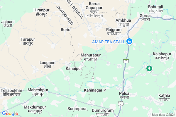
Mahurapur is a Village in Murarai-i Block in Birbhum District of West Bengal State, India. It belongs to Burdwan Division . It is located 86 KM towards North from District head quarters Suri, Birbhum. 6 KM from Murarai. 260 KM from State capital Kolkata
Mahurapur Pin code is 731219 and postal head office is Murarai .
Palsa ( 6 KM ) , Gorsha ( 7 KM ) , Dumurgram ( 8 KM ) , Murarai ( 10 KM ) , Amdole ( 10 KM ) are the nearby Villages to Mahurapur. Mahurapur is surrounded by Maheshpur Block towards west , Murarai-Ii Block towards East , Pakur Block towards North , Hiranpur Block towards North .
Pakaur , Dhulian , Paschim Punropara , Rampurhat are the near by Cities to Mahurapur.
This Place is in the border of the Birbhum District and Pakur District. Pakur District Maheshpur is west towards this place . It is near to the Jharkhand State Border.
Mahurapur 2011 Census Details
Mahurapur Local Language is Bengali. Mahurapur Village Total population is 5348 and number of houses are 1156. Female Population is 49.0%. Village literacy rate is 46.7% and the Female Literacy rate is 21.5%.
Population
| Census Parameter | Census Data |
| Total Population | 5348 |
| Total No of Houses | 1156 |
| Female Population % | 49.0 % ( 2622) |
| Total Literacy rate % | 46.7 % ( 2500) |
| Female Literacy rate | 21.5 % ( 1152) |
| Scheduled Tribes Population % | 2.8 % ( 150) |
| Scheduled Caste Population % | 38.9 % ( 2081) |
| Working Population % | 33.2 % |
| Child(0 -6) Population by 2011 | 803 |
| Girl Child(0 -6) Population % by 2011 | 48.4 % ( 389) |
Mahurapur Census More Deatils.
Politics in Mahurapur
CPM , CPI(M) , AITC , INC are the major political parties in this area.Polling Stations /Booths near Mahurapur
1)Mahurapur High School Room No. 22)Mahurapur Malpara I.c.d.s
3)Mahurapur High School Room No. 1
4)Madanapuri S.s.k
5)Chandanpara Pry. School
HOW TO REACH Mahurapur
By Rail
Banshlai Bridge Rail Way Station , Rajgram Rail Way Station are the very nearby railway stations to Mahurapur.Colleges near Mahurapur
Kabi Nazrul CollegeSchools near Mahurapur
Murarai Gourangini Balika Vi(hGovt Health Centers near Mahurapur
1) Dalimba GP HQ SC , DALIMBA SC , DALIMBA , G.P. OFFICE2) Murarai RH , MURARAI RURAL HOSPITAL , HOSPITAL ROAD, MURARAI , NEAR WEBEL COMPUTER CENTRE
3) Murarai GP HQ SC , Murarai GP HQ SC , Vill, PO & PS - Murarai, Dist Birbhum , Murarai RH
Hospitals in Mahurapur,Murarai-i
sarkar Automobuiles
Rajgram-Kasilla-Bahutali Rd; Ambhua; West Bengal 731222; India
6.2 KM distance Detail
more ..
Colleges in Mahurapur,Murarai-i
Ursuline Primary Teachers' Education College; Chandrapura
Chandrapura; Maheshpur; Jharkhand; India
6.7 KM distance Detail
CSC ACADEMY; NDLM; MAHESHPUR
MAHESHPUR; HATPARA ROAD; Amrapara - Maheshpur - Murarai Rd; Maheshpur; Jharkhand 816106; India
7.6 KM distance Detail
more ..
Super Markets in Mahurapur,Murarai-i
Annapurna Super Market
Rajgram-Kasilla-Bahutali Rd; Ambhua; West Bengal 731222; India
7.4 KM distance Detail
Police Stations near Mahurapur,Murarai-i
Murarai Police Station
Murarai;; Murarai I Community Development Block; Murarai; West Bengal 731219; India
10.1 KM distance Detail
How to reach Mahurapur
Tourist Places Near By Mahurapur
Schools in Mahurapur
Colleges in Mahurapur
Temperature & weather of Mahurapur
places in Mahurapur
Mahurapur photos
More Information
Village Talk
Post News or Events about this Village
Pakaur 15 KM near
Dhulian 27 KM near
Paschim Punropara 29 KM near
Rampurhat 42 KM near
Murarai-I 5 KM near
Maheshpur 8 KM near
Murarai-Ii 13 KM near
Pakur 15 KM near
Netaji Subhas Chandra Bose Airport 242 KM near
Bagdogra Airport 276 KM near
Rupsi Airport 312 KM near
Ranchi Airport 320 KM near
Pakur 15 KM near
Murshidabad 66 KM near
English-Bazar 71 KM near
Dumka 71 KM near
Malda 72 KM near
Pakur 16 KM near
Dumka 71 KM near
Maldah 72 KM near
Murshidabad 72 KM near
Banshlai Bridge Rail Way Station 5.8 KM near
Rajgram Rail Way Station 7.3 KM near
Murarai Rail Way Station 9 KM near
Pakur Rail Way Station 16 KM near