| Home | City Bus | Maps | Villages | Cities | Rail | Tourist Places | School | College | Pin Codes | Corona Cases Count |
| Distance Calculator Bus Services IFSC Codes Trace Mobile Number Weather Search Place Trace IP Available Cash ATM/Banks Locate Polling Booth Report an Error contact People |
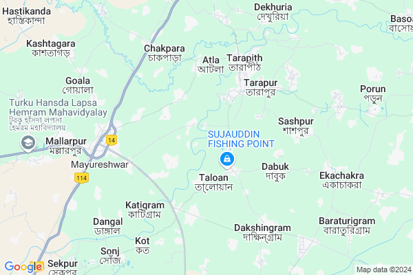
Kanachi
Kanachi Map
EDIT Map
Add Your House
 ..
..
Current Corona Virus Infected Patients Count in Birbhum District
| City Name | District Name | Total Covid cases |
|---|
Locality Name :
Kanachi
( কানাচি )
Block Name : Mayureswar-i
District : Birbhum
State : West Bengal
Division : Burdwan
Language : Bengali and English
Current Time 11:28 PM
Date: Wednesday , Feb 05,2025 (IST)
Time zone: IST (UTC+5:30)
Telephone Code / Std Code: 03461
Assembly constituency : Mayureswar assembly constituency
Assembly MLA : Abhijit Roy
Lok Sabha constituency : Bolpur parliamentary constituency
Parliament MP : ASIT KUMAR MAL
Serpanch Name :
Pin Code : 731216
Post Office Name : Mallarpur
Commodities Prices : Rampurhat Market / Mandi
Edit below overview about Kanachi
Edit below overview about Kanachi
OverView of Kanachi
Kanachi H.S School in Kanachi Address:-Kanachi,Mayureswar-1,Birbhum,West Bengal. Pin-7312162 Nos. Primary School in this village.B-Ed College near 1 K.M of Kanachi.Edit below overview about Kanachi
National Highways Reachable To Kanachi
Nationa High Way :NH114
Nationa High Way :NH114
Rivers Near Kanachi
Hooghly :হুগলী :Hugli :Hooghly :Hugli
Mayurakshi
Hooghly :হুগলী :Hugli :Hooghly :Hugli
Mayurakshi
About Kanachi
Kanachi is a Village in Mayureswar-i Block in Birbhum District of West Bengal State, India. It belongs to Burdwan Division . It is located 36 KM towards East from District head quarters Suri, Birbhum. 2 KM from Mayureswar-I. 207 KM from State capital Kolkata
Kanachi Pin code is 731216 and postal head office is Mallarpur .
Dabuk ( 4 KM ) , Nandigram ( 5 KM ) , Bharkata ( 5 KM ) , Dakshingram ( 6 KM ) , Kharun ( 7 KM ) are the nearby Villages to Kanachi. Kanachi is surrounded by Rampurhat-I Block towards North , Rampurhat-Ii Block towards North , Mayureswar-Ii Block towards South , Sainthia Block towards South .
Rampurhat , Sainthia , Suri , Baharampur are the near by Cities to Kanachi.
Kanachi 2011 Census Details
Kanachi Local Language is Bengali. Kanachi Village Total population is 2108 and number of houses are 540. Female Population is 48.6%. Village literacy rate is 65.9% and the Female Literacy rate is 31.4%.
Population
| Census Parameter | Census Data |
| Total Population | 2108 |
| Total No of Houses | 540 |
| Female Population % | 48.6 % ( 1025) |
| Total Literacy rate % | 65.9 % ( 1390) |
| Female Literacy rate | 31.4 % ( 662) |
| Scheduled Tribes Population % | 1.8 % ( 37) |
| Scheduled Caste Population % | 8.6 % ( 182) |
| Working Population % | 32.1 % |
| Child(0 -6) Population by 2011 | 271 |
| Girl Child(0 -6) Population % by 2011 | 42.8 % ( 116) |
Kanachi Census More Deatils.
Politics in Kanachi
CPM , CPI(M) , AITC , BJP , All India Trinamool Congress , INC are the major political parties in this area.Polling Stations /Booths near Kanachi
1)Nabagram Pry. School2)Hatin Pry. School
3)Nakora Katigram Siddhikali High School
4)Pukurpara Pry.school Room-2
5)Sabek Haruki Pry. School
HOW TO REACH Kanachi
By Rail
Mallarpur Rail Way Station , Tarapith Road Rail Way Station are the very nearby railway stations to Kanachi.Colleges near Kanachi
Turku Hansda Lapsa Hemrom Mahavidlaya
Address :
Schools in Kanachi
Kanachi H.s School
Address :
Govt Health Centers near Kanachi
1) Sandhigora Bazar SC , Near Nitai Temple , ,2) Majurhati SC , Majurhati , Vill-Majurhati,P.O-Dabuk, Dist-Birbhum ,
3) Fullidanga SC , Fullidanga SC , SAHAPUR GP , FULLIDANGA HIGH SCHOOL
Hospitals in Kanachi,Mayureswar-i
Kharasinpur Play Ground
Mallarpur - Mayureswar Road; Kharasinpur; West Bengal 731216; India
4.6 KM distance Detail
more ..
Colleges in Kanachi,Mayureswar-i
Mahula Sriramkrishnan Teachers Training Institute
Malancha; West Bengal 731216; India
3.8 KM distance Detail
more ..
Schools in Kanachi,Mayureswar-i
MAJHARIPARA PRYMARI SCHOOL
Neem Tala Rd; Majharipara; West Bengal 731216; India
1.6 KM distance Detail
Sandhigora Bazar Primary School Basudev
Sandhigara; West Bengal 731216; India
1.9 KM distance Detail
Local Parks in Kanachi,Mayureswar-i
Hotel Swagatam International (Tarapith)
Kabi Chandrapur; Tarapith Temple Road; District Birbhum; Tarapith; 731233; India
5.4 KM distance Detail
Governement Offices near Kanachi,Mayureswar-i
Mallarpur Gram Panchayat
Fatehpur;; Bharkata; Fatehpur; West Bengal 731216; India
6.3 KM distance Detail
About Kanachi &
History
How to reach Kanachi
Tourist Places Near By Kanachi
Schools in Kanachi
Colleges in Kanachi
Temperature & weather of Kanachi
places in Kanachi
Kanachi photos
More Information
How to reach Kanachi
Tourist Places Near By Kanachi
Schools in Kanachi
Colleges in Kanachi
Temperature & weather of Kanachi
places in Kanachi
Kanachi photos
More Information
Village Talk
Post News or Events about this Village
Near Cities
Rampurhat 11 KM near
Sainthia 28 KM near
Suri 32 KM near
Baharampur 53 KM near
Rampurhat 11 KM near
Sainthia 28 KM near
Suri 32 KM near
Baharampur 53 KM near
Near By Taluks
Mayureswar-I 2 KM near
Rampurhat-I 12 KM near
Rampurhat-Ii 12 KM near
Mayureswar-Ii 15 KM near
Mayureswar-I 2 KM near
Rampurhat-I 12 KM near
Rampurhat-Ii 12 KM near
Mayureswar-Ii 15 KM near
Near By Air Ports
Netaji Subhas Chandra Bose Airport 193 KM near
Ranchi Airport 295 KM near
Bagdogra Airport 330 KM near
Gaya Airport 331 KM near
Netaji Subhas Chandra Bose Airport 193 KM near
Ranchi Airport 295 KM near
Bagdogra Airport 330 KM near
Gaya Airport 331 KM near
Near By Tourist Places
Suri 34 KM near
Santiniketan 51 KM near
Murshidabad 56 KM near
Dumka 64 KM near
Pakur 69 KM near
Suri 34 KM near
Santiniketan 51 KM near
Murshidabad 56 KM near
Dumka 64 KM near
Pakur 69 KM near
Near By Districts
Birbhum 35 KM near
Murshidabad 55 KM near
Dumka 64 KM near
Pakur 70 KM near
Birbhum 35 KM near
Murshidabad 55 KM near
Dumka 64 KM near
Pakur 70 KM near
Near By RailWay Station
Mallarpur Rail Way Station 6.3 KM near
Tarapith Road Rail Way Station 6.3 KM near
Rampurhat Junction Rail Way Station 12 KM near
Sainthia Junction Rail Way Station 19 KM near
Mallarpur Rail Way Station 6.3 KM near
Tarapith Road Rail Way Station 6.3 KM near
Rampurhat Junction Rail Way Station 12 KM near
Sainthia Junction Rail Way Station 19 KM near