| Home | City Bus | Maps | Villages | Cities | Rail | Tourist Places | School | College | Pin Codes | Corona Cases Count |
| Distance Calculator Bus Services IFSC Codes Trace Mobile Number Weather Search Place Trace IP Available Cash ATM/Banks Locate Polling Booth Report an Error contact People |
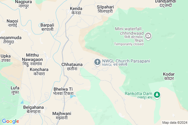
Parsa Pani
Parsa Pani Map
EDIT Map
Add Your House
 ..
..
Current Corona Virus Infected Patients Count in Bilaspur District
| City Name | District Name | Total Covid cases |
|---|---|---|
| Bilaspur | Bilaspur | 1 |
Locality Name :
Parsa Pani
( परसा पानी )
Tehsil Name : Kota
District : Bilaspur
State : Chattisgarh
Language : Chhattisgarhi and Hindi, Agariya, Bagheli
Current Time 05:32 PM
Date: Friday , Apr 25,2025 (IST)
Time zone: IST (UTC+5:30)
Elevation / Altitude: 325 meters. Above Seal level
Telephone Code / Std Code: 07753
Assembly constituency : Kota assembly constituency
Assembly MLA : Atal Shrivastava
Lok Sabha constituency : Bilaspur parliamentary constituency
Parliament MP : ARUN SAO
Serpanch Name :
Pin Code : 495116
Post Office Name : Belgahana
Alternate Village Name : PARSAPANI C , Parsapani-C
Commodities Prices : Kota Market / Mandi
Parsa Pani Live Weather
Temperature: 40.9 °C
clear sky
Humidity: 8%
Wind : 2.95 mt/sec towards W
StationName : "KotÄ\u0081"
observed on 2 Mins Back
Temperature: 40.9 °C
clear sky
Humidity: 8%
Wind : 2.95 mt/sec towards W
StationName : "KotÄ\u0081"
observed on 2 Mins Back
Parsa Pani Weather Forecast for Next 5 days
26-04-2025
27.5°C to 37.2°C
clear sky
27.5°C to 37.2°C
clear sky
27-04-2025
26.2°C to 44.1°C
clear sky, few clouds, broken clouds, overcast clouds
26.2°C to 44.1°C
clear sky, few clouds, broken clouds, overcast clouds
28-04-2025
22.8°C to 37.6°C
overcast clouds, light rain, broken clouds, scattered clouds
22.8°C to 37.6°C
overcast clouds, light rain, broken clouds, scattered clouds
29-04-2025
22.3°C to 39.3°C
scattered clouds, few clouds, light rain, broken clouds, clear sky
22.3°C to 39.3°C
scattered clouds, few clouds, light rain, broken clouds, clear sky
30-04-2025
23.0°C to 39.6°C
clear sky, scattered clouds, broken clouds
23.0°C to 39.6°C
clear sky, scattered clouds, broken clouds
Rivers Near Parsa Pani
Arharan
Arpa
Arharan
Arpa
About Parsa Pani
Correct below Info and add more info about Parsa PaniParsa Pani is a Village in Kota Tehsil in Bilaspur District of Chattisgarh State, India. It is located 53 KM towards North from District head quarters Bilaspur. 20 KM from Kota. 169 KM from State capital Raipur
Parsa Pani Pin code is 495116 and postal head office is Belgahana .
Chureli ( 5 KM ) , Pahanda ( 6 KM ) , Konchara ( 7 KM ) , Banabel ( 8 KM ) , Kenda ( 8 KM ) are the nearby Villages to Parsa Pani. Parsa Pani is surrounded by Pali Tehsil towards East , Gaurella-1 Tehsil towards North , Gaurella-2 Tehsil towards North , Takhatpur Tehsil towards South .
Bilaspur , Bilaspur , Dipka , Akaltara are the near by Cities to Parsa Pani.
Parsapani 2011 Census Details
Parsa Pani Local Language is Chhattisgarhi. Parsapani Village Total population is 1328 and number of houses are 288. Female Population is 50.2%. Village literacy rate is 54.8% and the Female Literacy rate is 22.3%.
Population
| Census Parameter | Census Data |
| Total Population | 1328 |
| Total No of Houses | 288 |
| Female Population % | 50.2 % ( 667) |
| Total Literacy rate % | 54.8 % ( 728) |
| Female Literacy rate | 22.3 % ( 296) |
| Scheduled Tribes Population % | 95.5 % ( 1268) |
| Scheduled Caste Population % | 1.5 % ( 20) |
| Working Population % | 62.8 % |
| Child(0 -6) Population by 2011 | 227 |
| Girl Child(0 -6) Population % by 2011 | 49.3 % ( 112) |
Parsapani Census More Deatils.
Politics in Parsa Pani
Bharatiya Janata Party , BJP , INC are the major political parties in this area.Polling Stations /Booths near Parsa Pani
1)Parasda2)Chapora
3)Sodhakala
4)Jamunahi
5)Umriyadadar
HOW TO REACH Parsa Pani
By Rail
Belgahna Rail Way Station is the very nearby railway stations to Parsa Pani.Colleges near Parsa Pani
Niranjan Kesharwani Collage
Address :
Schools in Parsa Pani
Up Ms, Parsapani
Address : parsa pani , kota , bilaspur (chhattisgarh) , Chattisgarh . PIN- 495116 , Post - Belgahana
Govt Health Centers near Parsa Pani
1) SHC Chhatauna , , ,2) SHC Pudu , , ,
3) SHC Konchara , , ,
Hospitals in Parsa Pani,Kota
Shree Shivam Hospital Belgahna
near bus stand ratanpur road; Chhattisgarh 495116; India
10.3 KM distance Detail
more ..
Super Markets in Parsa Pani,Kota
Santosh Mobile Point
Teacher SKY Sir HN-112 Silli; Parsada; Ratanpur; Chhattisgarh 495442; India
20.1 KM distance Detail
About Parsa Pani &
History
How to reach Parsa Pani
Tourist Places Near By Parsa Pani
Schools in Parsa Pani
Colleges in Parsa Pani
Temperature & weather of Parsa Pani
places in Parsa Pani
Parsa Pani photos
More Information
How to reach Parsa Pani
Tourist Places Near By Parsa Pani
Schools in Parsa Pani
Colleges in Parsa Pani
Temperature & weather of Parsa Pani
places in Parsa Pani
Parsa Pani photos
More Information
Village Talk
Post News or Events about this Village
Near Cities
Bilaspur 48 KM near
Bilaspur 50 KM near
Dipka 54 KM near
Akaltara 66 KM near
Bilaspur 48 KM near
Bilaspur 50 KM near
Dipka 54 KM near
Akaltara 66 KM near
Near By Taluks
Kota 20 KM near
Pali 34 KM near
Gaurella-1 34 KM near
Gaurella-2 39 KM near
Kota 20 KM near
Pali 34 KM near
Gaurella-1 34 KM near
Gaurella-2 39 KM near
Near By Air Ports
Raipur Airport 166 KM near
Jabalpur Airport 251 KM near
Bamrauli Airport 370 KM near
Varanasi Airport 379 KM near
Raipur Airport 166 KM near
Jabalpur Airport 251 KM near
Bamrauli Airport 370 KM near
Varanasi Airport 379 KM near
Near By Tourist Places
Amarkantak 45 KM near
Bilaspur 50 KM near
Janjgir-Champa 61 KM near
Korba 68 KM near
Janjgir 80 KM near
Amarkantak 45 KM near
Bilaspur 50 KM near
Janjgir-Champa 61 KM near
Korba 68 KM near
Janjgir 80 KM near
Near By Districts
Bilaspur 52 KM near
Korba 70 KM near
Anuppur 91 KM near
Janjgir-Champa 103 KM near
Bilaspur 52 KM near
Korba 70 KM near
Anuppur 91 KM near
Janjgir-Champa 103 KM near
Near By RailWay Station
Belgahna Rail Way Station 9 KM near
Kargi Road Rail Way Station 24 KM near
Belgahna Rail Way Station 9 KM near
Kargi Road Rail Way Station 24 KM near