| Home | City Bus | Maps | Villages | Cities | Rail | Tourist Places | School | College | Pin Codes | Corona Cases Count |
| Distance Calculator Bus Services IFSC Codes Trace Mobile Number Weather Search Place Trace IP Available Cash ATM/Banks Locate Polling Booth Report an Error contact People |
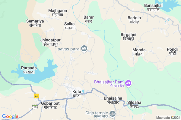
Kupabandha
Kupabandha Map
EDIT Map
Add Your House
 ..
..
Current Corona Virus Infected Patients Count in Bilaspur District
| City Name | District Name | Total Covid cases |
|---|---|---|
| Bilaspur | Bilaspur | 1 |
Locality Name :
Kupabandha
( कुपबंधा )
Tehsil Name : Kota
District : Bilaspur
State : Chattisgarh
Language : Chhattisgarhi and Hindi, Agariya, Bagheli
Current Time 11:31 AM
Date: Wednesday , Feb 05,2025 (IST)
Time zone: IST (UTC+5:30)
Elevation / Altitude: 325 meters. Above Seal level
Telephone Code / Std Code: 07753
Assembly constituency : Kota assembly constituency
Assembly MLA : Atal Shrivastava
Lok Sabha constituency : Bilaspur parliamentary constituency
Parliament MP : ARUN SAO
Serpanch Name :
Main Village Name : Darsagar
Commodities Prices : Kota Market / Mandi
Kupabandha Live Weather
Temperature: 28.2 °C
overcast clouds
Humidity: 29%
Wind : 0.95 mt/sec towards SE
StationName : "KotÄ\u0081"
observed on 2 Hours Back
Temperature: 28.2 °C
overcast clouds
Humidity: 29%
Wind : 0.95 mt/sec towards SE
StationName : "KotÄ\u0081"
observed on 2 Hours Back
Kupabandha Weather Forecast for Next 5 days
06-02-2025
21.3°C to 35.5°C
overcast clouds, scattered clouds, clear sky, few clouds
21.3°C to 35.5°C
overcast clouds, scattered clouds, clear sky, few clouds
07-02-2025
16.0°C to 33.1°C
clear sky
16.0°C to 33.1°C
clear sky
08-02-2025
14.5°C to 33.2°C
clear sky
14.5°C to 33.2°C
clear sky
09-02-2025
12.6°C to 33.5°C
clear sky, scattered clouds
12.6°C to 33.5°C
clear sky, scattered clouds
10-02-2025
14.4°C to 35.1°C
few clouds, clear sky
14.4°C to 35.1°C
few clouds, clear sky
Rivers Near Kupabandha
Arharan
Arpa
Arharan
Arpa
About Kupabandha
Correct below Info and add more info about KupabandhaKupabandha is a small Village/hamlet in Kota Tehsil in Bilaspur District of Chattisgarh State, India. It comes under Darsagar Panchayath. It is located 37 KM towards North from District head quarters Bilaspur. 148 KM from State capital Raipur
Kupabandha is surrounded by Takhatpur Tehsil towards South , Bilaspur Tehsil towards South , Pali Tehsil towards East , Lormi Tehsil towards west .
Bilaspur , Bilaspur , Mungeli , Akaltara are the near by Cities to Kupabandha.
Demographics of Kupabandha
Chhattisgarhi is the Local Language here.Politics in Kupabandha
Bharatiya Janata Party , BJP , INC are the major political parties in this area.Polling Stations /Booths near Kupabandha
1)Bhelvatikra2)Amali
3)Navagaon (salka Shreepara)
4)Amagohan
5)Navagaon (salka)
HOW TO REACH Kupabandha
By Rail
Kargi Road Rail Way Station , Salkaroad Rail Way Station are the very nearby railway stations to Kupabandha.Pincodes near Kupabandha
495009 ( Koni ) , 495330 ( Takhatpur ) , 495001 ( Bilaspur (Bilaspur-CGH) )Colleges near Kupabandha
Niranjan Kesharwani Collage
Address :
Schools near Kupabandha
Mahamaya Pub Sch Ratanpur
Address : ratanpur , kota , bilaspur (chhattisgarh) , Chattisgarh . PIN- 495442 , Post - Ratanpur (Bilaspur)
Mahamaya Sanskrity Vid Ratanpur
Address : ratanpur , kota , bilaspur (chhattisgarh) , Chattisgarh . PIN- 495442 , Post - Ratanpur (Bilaspur)
Netaji Shu.chand. Bose Ratanpu
Address : karaiha para , kota , bilaspur (chhattisgarh) , Chattisgarh . PIN- 495442 , Post - Ratanpur (Bilaspur)
Ps Ms, Adarsh Vaidik Vidya Pee
Address : kota , kota , bilaspur (chhattisgarh) , Chattisgarh . PIN- 495113 , Post - Kargi Road
Govt Health Centers near Kupabandha
1) SHC Amali , , ,2) PHC Navagoan (Salka) , , ,
3) SHC Kota , , ,
Petrol Bunks in Kupabandha,Kota
HP PETROL PUMP - SHRI PUSHKAR PETROLEUM
HP Petrol Pump Village- Changori; Kota Kota Amarkantak Road; Raipur; Chhattisgarh 495113; India
6.8 KM distance Detail
more ..
Colleges in Kupabandha,Kota
Govt.niranjan Kesharwani College Kota
Kota-Lormi Rd; Kargi Kalan; Chhattisgarh 495113; India
3.9 KM distance Detail
Govt. Niranjan Kesharwani Arts & Comm. College Kota
Kargi Road; Kota; Bilaspur; Chhattisgarh 495113; India
3.9 KM distance Detail
more ..
Electronic Shops in Kupabandha,Kota
Kaushik Electrikcal
Padavpara Rd; Padavpara; Dewariha Para; Kota; Chhattisgarh 495113; India
4.7 KM distance Detail
mahamaya stationery
Padavpara Rd; Dewariha Para; Kota; Chhattisgarh 495113; India
4.8 KM distance Detail
Local Parks in Kupabandha,Kota
Lakhani Devi Naxtra Vatika
Near Lakhani devi temple; Kota Road; Ratanpur; Chhattisgarh 495442; India
14.2 KM distance Detail
About Kupabandha &
History
How to reach Kupabandha
Tourist Places Near By Kupabandha
Schools in Kupabandha
Colleges in Kupabandha
Temperature & weather of Kupabandha
places in Kupabandha
Kupabandha photos
More Information
How to reach Kupabandha
Tourist Places Near By Kupabandha
Schools in Kupabandha
Colleges in Kupabandha
Temperature & weather of Kupabandha
places in Kupabandha
Kupabandha photos
More Information
Village Talk
Post News or Events about this Village
Near Cities
Bilaspur 32 KM near
Bilaspur 32 KM near
Mungeli 52 KM near
Akaltara 57 KM near
Bilaspur 32 KM near
Bilaspur 32 KM near
Mungeli 52 KM near
Akaltara 57 KM near
Near By Taluks
Kota 0 KM near
Takhatpur 21 KM near
Bilaspur 33 KM near
Pali 38 KM near
Kota 0 KM near
Takhatpur 21 KM near
Bilaspur 33 KM near
Pali 38 KM near
Near By Air Ports
Raipur Airport 146 KM near
Jabalpur Airport 246 KM near
Sonegaon Airport 378 KM near
Bamrauli Airport 388 KM near
Raipur Airport 146 KM near
Jabalpur Airport 246 KM near
Sonegaon Airport 378 KM near
Bamrauli Airport 388 KM near
Near By Tourist Places
Bilaspur 33 KM near
Amarkantak 53 KM near
Janjgir-Champa 56 KM near
Korba 73 KM near
Janjgir 74 KM near
Bilaspur 33 KM near
Amarkantak 53 KM near
Janjgir-Champa 56 KM near
Korba 73 KM near
Janjgir 74 KM near
Near By Districts
Bilaspur 35 KM near
Korba 75 KM near
Janjgir-Champa 98 KM near
Kabirdham 101 KM near
Bilaspur 35 KM near
Korba 75 KM near
Janjgir-Champa 98 KM near
Kabirdham 101 KM near
Near By RailWay Station
Kargi Road Rail Way Station 4.6 KM near
Salkaroad Rail Way Station 5.9 KM near
Belgahna Rail Way Station 12 KM near
Kargi Road Rail Way Station 4.6 KM near
Salkaroad Rail Way Station 5.9 KM near
Belgahna Rail Way Station 12 KM near