| Home | City Bus | Maps | Villages | Cities | Rail | Tourist Places | School | College | Pin Codes | Corona Cases Count |
| Distance Calculator Bus Services IFSC Codes Trace Mobile Number Weather Search Place Trace IP Available Cash ATM/Banks Locate Polling Booth Report an Error contact People |
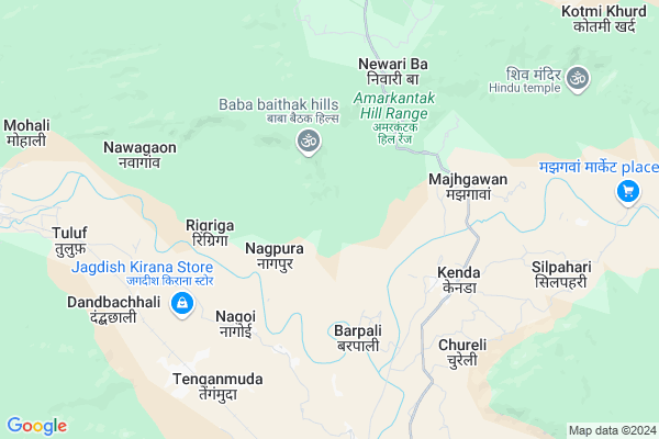
Kasaibahara
Kasaibahara Map
EDIT Map
Add Your House
 ..
..
Current Corona Virus Infected Patients Count in Bilaspur District
| City Name | District Name | Total Covid cases |
|---|---|---|
| Bilaspur | Bilaspur | 1 |
Locality Name :
Kasaibahara
( कसेबहरा )
Tehsil Name : Kota
District : Bilaspur
State : Chattisgarh
Language : Chhattisgarhi and Hindi, Agariya, Bagheli
Current Time 01:50 AM
Date: Saturday , Apr 26,2025 (IST)
Time zone: IST (UTC+5:30)
Elevation / Altitude: 325 meters. Above Seal level
Telephone Code / Std Code: 07753
Assembly constituency : Kota assembly constituency
Assembly MLA : Atal Shrivastava
Lok Sabha constituency : Bilaspur parliamentary constituency
Parliament MP : ARUN SAO
Serpanch Name :
Pin Code : 495116
Post Office Name : Belgahana
Main Village Name : Kasaibahra
Commodities Prices : Kota Market / Mandi
Kasaibahara Live Weather
Temperature: 26.4 °C
clear sky
Humidity: 12%
Wind : 1.26 mt/sec towards W
StationName : "KotÄ\u0081"
observed on Now
Temperature: 26.4 °C
clear sky
Humidity: 12%
Wind : 1.26 mt/sec towards W
StationName : "KotÄ\u0081"
observed on Now
Kasaibahara Weather Forecast for Next 5 days
26-04-2025
25.9°C to 25.9°C
clear sky
25.9°C to 25.9°C
clear sky
27-04-2025
25.4°C to 43.4°C
clear sky, broken clouds, light rain
25.4°C to 43.4°C
clear sky, broken clouds, light rain
28-04-2025
23.5°C to 38.8°C
overcast clouds, scattered clouds, light rain, broken clouds, few clouds
23.5°C to 38.8°C
overcast clouds, scattered clouds, light rain, broken clouds, few clouds
29-04-2025
22.2°C to 38.8°C
clear sky, light rain, broken clouds
22.2°C to 38.8°C
clear sky, light rain, broken clouds
30-04-2025
22.1°C to 39.4°C
scattered clouds, clear sky, few clouds, broken clouds, overcast clouds
22.1°C to 39.4°C
scattered clouds, clear sky, few clouds, broken clouds, overcast clouds
Rivers Near Kasaibahara
Arharan
Arpa
Arharan
Arpa
About Kasaibahara
Correct below Info and add more info about KasaibaharaKasaibahara is a small Village/hamlet in Kota Tehsil in Bilaspur District of Chattisgarh State, India. It comes under Kasaibahra Panchayath. It is located 64 KM towards North from District head quarters Bilaspur. 28 KM from Kota. 175 KM from State capital Raipur
Kasaibahara Pin code is 495116 and postal head office is Belgahana .
Kasaibahara is surrounded by Kota Tehsil towards South , Gaurella-2 Tehsil towards North , Pali Tehsil towards East , Takhatpur Tehsil towards South .
Bilaspur , Bilaspur , Dipka , Mungeli are the near by Cities to Kasaibahara.
Demographics of Kasaibahara
Chhattisgarhi is the Local Language here.Politics in Kasaibahara
Bharatiya Janata Party , BJP , INC are the major political parties in this area.Polling Stations /Booths near Kasaibahara
1)Karwan2)Baridih
3)Nagchuva
4)Lamkena
5)Sodhakhurd
HOW TO REACH Kasaibahara
By Rail
Tenganmada Rail Way Station is the very nearby railway stations to Kasaibahara.Colleges near Kasaibahara
Niranjan Kesharwani Collage
Address :
Schools near Kasaibahara
Mahamaya Pub Sch Ratanpur
Address : ratanpur , kota , bilaspur (chhattisgarh) , Chattisgarh . PIN- 495442 , Post - Ratanpur (Bilaspur)
Mahamaya Sanskrity Vid Ratanpur
Address : ratanpur , kota , bilaspur (chhattisgarh) , Chattisgarh . PIN- 495442 , Post - Ratanpur (Bilaspur)
Netaji Shu.chand. Bose Ratanpu
Address : karaiha para , kota , bilaspur (chhattisgarh) , Chattisgarh . PIN- 495442 , Post - Ratanpur (Bilaspur)
Ps Ms, Adarsh Vaidik Vidya Pee
Address : kota , kota , bilaspur (chhattisgarh) , Chattisgarh . PIN- 495113 , Post - Kargi Road
Govt Health Centers near Kasaibahara
1) SHC Barpali , , ,2) SHC Ringaringa , , ,
3) SHC Bitkuli , , ,
Schools in Kasaibahara,Kota
उच्चतर माध्यमिक विद्यालय नगोई बिलासपुर छ. ग.
Tenganmada; Nagoi; Chhattisgarh 495116; India
5.3 KM distance Detail
About Kasaibahara &
History
How to reach Kasaibahara
Tourist Places Near By Kasaibahara
Schools in Kasaibahara
Colleges in Kasaibahara
Temperature & weather of Kasaibahara
places in Kasaibahara
Kasaibahara photos
More Information
How to reach Kasaibahara
Tourist Places Near By Kasaibahara
Schools in Kasaibahara
Colleges in Kasaibahara
Temperature & weather of Kasaibahara
places in Kasaibahara
Kasaibahara photos
More Information
Village Talk
Post News or Events about this Village
Near Cities
Bilaspur 58 KM near
Bilaspur 59 KM near
Dipka 64 KM near
Mungeli 72 KM near
Bilaspur 58 KM near
Bilaspur 59 KM near
Dipka 64 KM near
Mungeli 72 KM near
Near By Taluks
Gaurella-1 24 KM near
Kota 27 KM near
Gaurella-2 28 KM near
Pali 44 KM near
Gaurella-1 24 KM near
Kota 27 KM near
Gaurella-2 28 KM near
Pali 44 KM near
Near By Air Ports
Raipur Airport 173 KM near
Jabalpur Airport 243 KM near
Bamrauli Airport 361 KM near
Khajuraho Airport 372 KM near
Raipur Airport 173 KM near
Jabalpur Airport 243 KM near
Bamrauli Airport 361 KM near
Khajuraho Airport 372 KM near
Near By Tourist Places
Amarkantak 35 KM near
Bilaspur 59 KM near
Janjgir-Champa 72 KM near
Korba 77 KM near
Janjgir 91 KM near
Amarkantak 35 KM near
Bilaspur 59 KM near
Janjgir-Champa 72 KM near
Korba 77 KM near
Janjgir 91 KM near
Near By Districts
Bilaspur 61 KM near
Korba 80 KM near
Anuppur 80 KM near
Korea 106 KM near
Bilaspur 61 KM near
Korba 80 KM near
Anuppur 80 KM near
Korea 106 KM near
Near By RailWay Station
Tenganmada Rail Way Station 7.7 KM near
Belgahna Rail Way Station 14 KM near
Pendra Road Rail Way Station 30 KM near
Tenganmada Rail Way Station 7.7 KM near
Belgahna Rail Way Station 14 KM near
Pendra Road Rail Way Station 30 KM near